Just over a week ago I completed my longest day of the trip, 91.75 mi / 147.63 km.
Waking up early to leave Erldunda this morning I see a sign: Alice Springs 199 km (for those wondering, because I know some of you are, 199 km is 123.65 miles). Alice Springs – aka Outback Mecca – is the largest town on the Stuart Highway (bar the termini, Adelaide and Darwin) with a population of over 28,000.
Getting to Alice is something I’ve been looking forward to for a while now (because supermarkets), and 199 km, a whole 31.6 mi / 51 km further than my longest day, appears outside the realm of possibility.
But the best way for a person to motive me to do something is to tell me I can’t do it (even if that person is me).

Riding on a road still wet from last night’s rain, I gradually and repeatedly climb and descend for the first 62 mi / 100 km; a month ago, this distance would have marked the end of my day’s ride.
Another eight miles (13 km) and I reach Stuarts Well Roadhouse. Time for a break.
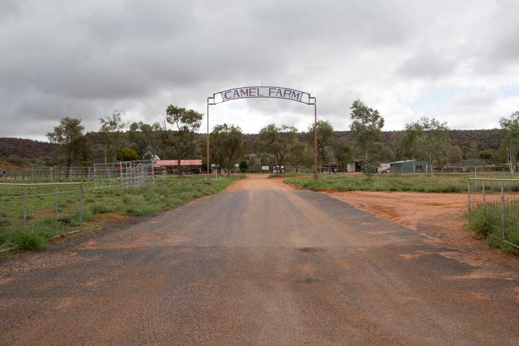
In addition to having an interesting soup selection (see photo below), they also have a camel farm. Turns out Australia has the largest feral camel population in the world and is the only place (again, in the world) with feral camel herds (don’t say I never taught you anything). This also speaks to Australia’s size because I have yet to see a single feral camel (I’m lacking in the animal-spotting department).
I consider a visit to the farm, but it’s already two in the afternoon and I usually stop riding around four (the sun begins to set around five). Time is limited if I plan to make it to the other side of the rainbow today (that’s what we’re calling Alice now).
Just as I am finishing what may be my only chilled beverage for the day, my cyclist friends from Coober Pedy wander out from the back of the roadhouse.

They camped thirty miles (48 km) north of Erldunda last night, but because of my early start and their being distracted by the makeshift zoo next door to the roadhouse (yes, there’s a camel farm and a zoo), I managed to catch them.
“Alice Springs?” I ask.
They’re not sold on the idea, but they also aren’t done for the day. We resolve to ride north together and see how we go.
Now as much as I love the voices in my head, having someone to talk to while riding beats the hell out of riding alone – especially in this landscape (there are now small mesas and slightly larger plants, but still not much to look at). We end up making fantastic time and I quickly hit my first hundred-mile (160 km) day.
By the time we’re within 15 mi / 24 km of Alice Springs we’ve reached a silent agreement that, in spite of the sinking sun, we’re making it there tonight – there’s no debate. But there’s one more bit of excitement before we reach our destination, and at six miles (10 km) out, the Stuart Highway turns left. WOW! I know this might not sound exciting, but this road has literally been going straight for the past 948 mi / 1525 km.
With the sun disappeared behind the horizon we turn on our lights and roll into town.
Mission accomplished.

- START: Erldunda, Northern Territory
- END: Alice Springs, Northern Territory
- DAY’S DISTANCE: 123.87 mi / 199.35 km
- TOTAL DISTANCE: 1,521.08 mi / 2,447.84 km