
Hiiker is an app designed by members of the outdoor community to help users discover, plan, and navigate their outdoor adventures. The app has a growing database with thousands of trails from across the globe (including over 600 in the United States). The app has everything from day hikes and
Guide to Hiking Mount Rishiri (利尻山) in Japan
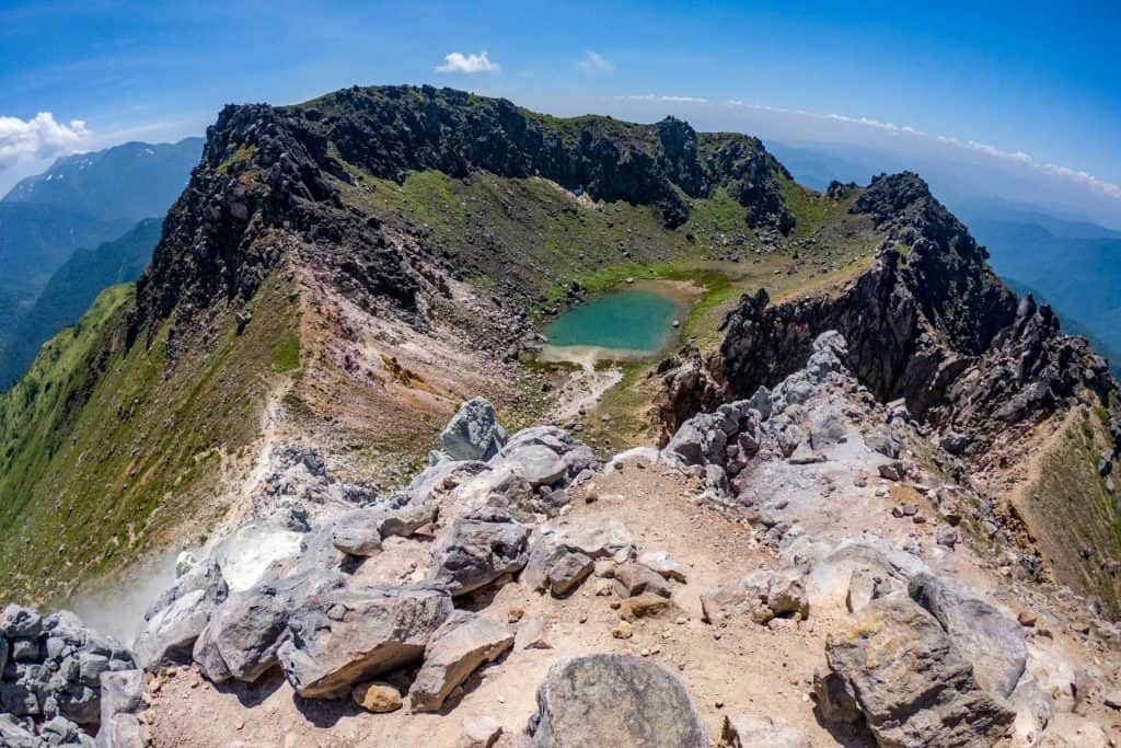
Mount Rishiri (利尻山, Rishiri-zan) is a 5,646 ft / 1,721 m stratovolcano on Rishiri Island (利尻島) off the northwest coast of Hokkaido (北海道). The entirety of Rishiri Island is essentially Mount Rishiri and the peak is near the island's center. It is one of Japan's hyaku-meizan, but it is not
Guide to Hiking Yakedake (焼岳) in Japan
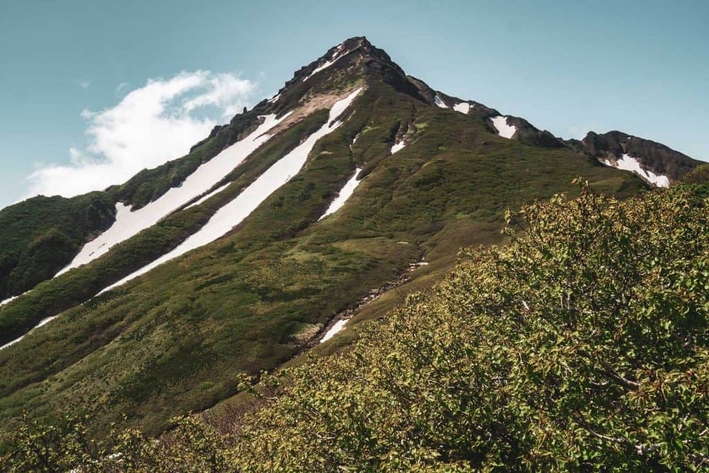
Yakedake (焼岳) is an 8,054 ft / 2,455 m peak at the southern end of Japan's Northern/Kita Alps (北アルプス). It's also an active volcano. You can also hike to the top of it. One of Japan's hyaku-meizan, it's a fairly well-known peak but is not nearly as popular a hike as some of the more prominent

Japan Traverse in Photos: The Chuo Alps (中アルプス)
The second stage of my Japan Alps Traverse covered the Chuo Alps (中アルプス) - aka the Central Alps. Our trek through the Chuo Alps Lasted only about 24 hours as this is the shortest of the three ranges comprising the Japanese Alps. We entered the Chuo Alps via the Fukushima A Course (福島Aコース) in the

Guide to Hiking the Mount Anne Circuit in Tasmania
The Mount Anne Circuit is named for the 4,669 ft / 1,423 m Mount Anne - the highest peak in Tasmania's Southwest National Park. I would expect the Mount Anne Circuit to circumnavigate Mount Anne (hence the circuit bit), but this track does no such thing. A more appropriate name may be the "Mount

Japan Traverse in Photos: The Kita Alps (北アルプス)
My traverse of the Japanese Alps began at the eastern edge of Toyama Bay (富山湾) in Niigata Prefecture (新潟県). From the coast, my hiking party of two Kiwis and I headed up the northernmost ridgeline in the Kita Alps (北アルプス) - aka the Northern Alps. The trip began with nearly a week of nonstop rain as

Japan Alps Spreadsheet: Peaks, Huts, & Distances
I don't know that I would say I love data, but I do love being organized and data is one of those things that can be organized nicely. Maybe it's because of that that I spent way too long creating a spreadsheet listing all of the peaks, passes, huts, and trailheads of my Japan Alps Traverse (this

Japan Alps Traverse Map, Itinerary, and GPS Track
The route I would take through across the Japanese Alps was unsure at best before starting this traverse, but I managed to stick to my original plan (if you could call it that) fairly closely. Having now completed the traverse, I am sharing my day-by-day itinerary, statistics, and maps to help those