
The Southern Sierra High Route (SoSHR) is a 100 mi / 160 km route through California's Sierra Nevada that runs parallel to (and sometimes overlaps with) the John Muir Trail (JMT) and the Pacific Crest Trail (PCT). It is commonly referred to as a more rugged JMT since a large part of the SoSHR is

Forester Pass Guide: Approaches, Crossing, and Snow
Forester Pass, the 13,153 ft / 4,009 m pass named for the United States Forest Service workers who "discovered" it, is the highest point on the Pacific Crest Trail and is the first Sierra pass encountered by northbound Pacific Crest Trail (PCT) thru-hikers (and the final pass crossed by southbound

Glen Pass Guide: Approaches, Crossing, and Snow
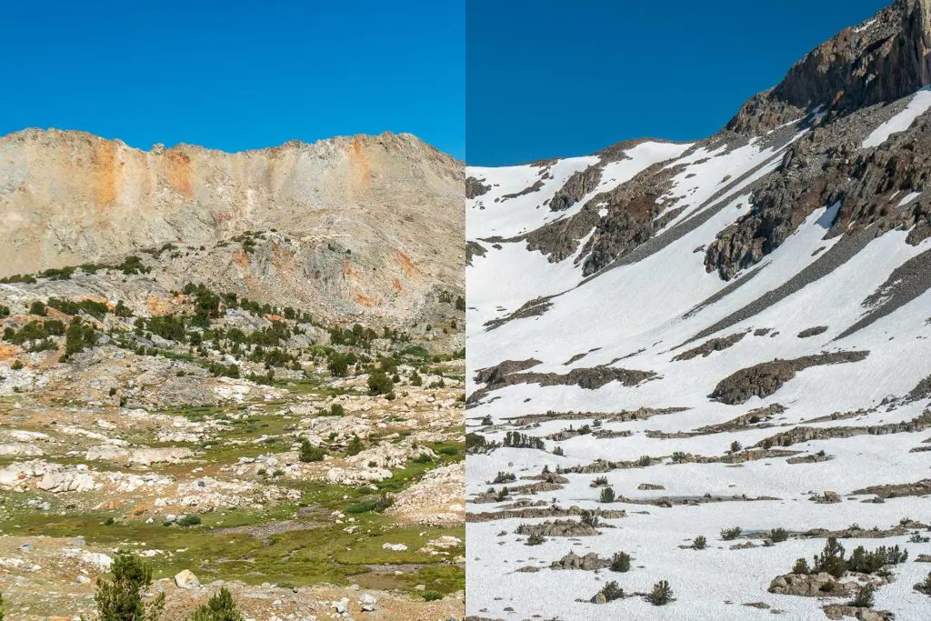
Glen Pass, the 11,969 ft / 3,648 m pass named for Forest Service ranger Glen H. Crow, is the second Sierra pass encountered by northbound Pacific Crest Trail (PCT) thru-hikers and the eighth encountered by southbound John Muir Trail (JMT) hikers. It's located 11.6 mi / 18.67 km north of Forester

Muir Pass Guide: Approaches, Crossing, and Snow
Muir Pass, the 11,969 ft / 3,648 m pass named for John Muir, a Scottish-American naturalist, botanist, zoologist, glaciologist, and nature-enthusiast, is the fifth Sierra pass encountered by northbound Pacific Crest Trail thru-hikers (and the fifth encountered by southbound John Muir Trail
Pinchot Pass Guide: Approaches, Crossing, and Snow
Pinchot Pass, the 12,093 ft / 3,686 m pass named for Gifford Pinchot, the 1st head of the United States Forest Service, is the third Sierra pass encountered by northbound Pacific Crest Trail thru-hikers (and the fourth encountered by southbound John Muir Trail hikers). It's located just 9.8 mi

Mather Pass Guide: Approaches, Crossing, and Snow
Mather Pass, the 12,093 ft / 3,686 m pass named for Stephen Mather, the 1st Director of the National Park Service, is the fourth Sierra pass encountered by northbound Pacific Crest Trail thru-hikers (and the third encountered by southbound John Muir Trail hikers). Despite it not being as high

Guide to Hiking the Lowest to Highest Route
The Lowest to Highest Route is a 135 mi / 217 km hike beginning at Badwater Basin in California's Death Valley National Park and ending at the summit of Mount Whitney - the highest point in the Continental United States (but technically you'll end back down at the trailhead since you'll need to get

Fall Hiking In California’s Sierra Nevada Mountains
Some of my favorite places in the world can be found in California's Sierra Nevada Mountains and I've recently discovered my favorite time of the year to be there: the fall (or autumn as some readers know it). Why? Over the course of four days my group and I saw zero bugs and crossed paths