• Skip to primary navigation
  • Skip to main content
  • Skip to primary sidebar
  • Skip to footer
Halfway Anywhere

Halfway Anywhere

  • About
  • Blog
  • PCT
  • CDT
  • Hikes
    • Arizona
      • Arizona Trail
      • Buckskin Gulch/Paria Canyon
      • Royal Arch Loop
    • Australia
      • Outback Bicycle Tour
      • New South Wales
        • The Coast Track
      • Tasmania
        • Federation Peak
        • Frenchmans Cap
        • Mount Anne Circuit
        • Overland Track
        • Western Arthurs Traverse
    • California
      • Cactus to Clouds
      • Kings Canyon High Basin Route
      • Southern Sierra High Route
      • Trans-Catalina Trail
    • Brazil
    • Japan
      • Alps Traverse
      • Fuji Area
      • Hokkaido
      • Hokuriku
      • Kansai
      • Kita Alps
      • Kyushu
    • Nepal
      • Everest Base Camp
      • Three Passes Trek
    • New Zealand
      • Ball Pass Route
    • Oregon
      • Timberline Trail
    • Washington
      • Wonderland Trail
  • Gear
    • Current Gear List
    • Gear Reviews
    • Gear Lists
    • PCT Gear
    • Best Backpacking Quilts
    • Best Satellite Messengers
    • Best Sun Hoodies
    • Best Thru-Hiking Shoes
    • Best Thru-Hiking Socks
    • Deals & Discounts
  • Surveys
    • PCT Survey
      • PCT Survey Results
      • PCT Gear Guide
      • PCT Resupply Guide
      • Women’s Gear Guide
      • Couples’ Gear Guide
      • Demographic Breakdown
      • PCT Horror Stories
      • PCT Hiker Advice
      • PCT Social Issues
      • All PCT Survey Articles
      • PCT Survey Sign-Up
    • CDT Survey
      • CDT Survey Results
      • CDT Gear Guide
      • CDT Resupply Guide
      • CDT Horror Stories
      • CDT Hiker Advice
      • All CDT Survey Articles
      • CDT Survey Sign-Up
    • JMT Survey
      • JMT Survey Results
      • JMT Gear Guide
      • All JMT Survey Articles
      • JMT Survey Sign-Up
  • Contact
    • Say Hello!
    • Support

Fall Hiking In California’s Sierra Nevada Mountains

By Mac Leave a Comment

Some of my favorite places in the world can be found in California’s Sierra Nevada Mountains and I’ve recently discovered my favorite time of the year to be there: the fall (or autumn as some readers know it).

Why?

Over the course of four days my group and I saw zero bugs and crossed paths with only three other hikers (once inside Kings Canyon).

And the downside? Things were a bit brown, the lakes were a bit low, the temperatures were often below freezing, and we got snowed on one night, but these were small inconveniences to accept in exchange for having the Sierra to ourselves.

Our itinerary ended up being the following:

  • DAY 1: Onion Valley Campground to Kearsarge Lakes (5.3 mi / 8.5 km)
  • DAY 2: Kearsarge Lakes to PCT Mile 784.3 (5.6 mi / 9 km)
  • DAY 3: PCT Mile 784.3 to Tyndall Creek Campsite (9.6 mi / 15.5 km)
  • DAY 4: Tyndall Creek Campsite to Shepherd Pass Trailhead (14 mi / 22.5 km)

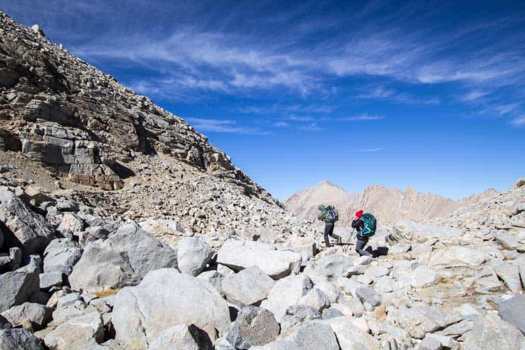
Three of the four of us had already been over Kearsarge Pass, 11,709 ft / 3,569 m, and Forester Pass, 13,153 ft / 4,009 m (except we had all hiked north over Forester the first time), but Shepherd Pass was a mystery to all of us (and we didn’t do much research into what it entailed).

Turns out that although the approach from the west to Shepherd Pass is relatively mild, once you begin descending the eastern side you’re in for nearly 6,000 feet (1,829 m) of downhill hiking to the trailhead/carpark.

We left our vehicle at Onion Valley – 13.5 mi / 21.7 km away from the Shepherd Pass trailhead, and despite our best efforts, were unable to secure a ride when we made it down to the road and were forced to camp one more night at the trailhead.

If you want some punishment (and switchbacking), then I suggest hiking up to Shepherd Pass from the east (and probably go climb Mount Williamson, 14,380 ft / 4,383 m, while you’re at it). The trail is seriously impressive.

Sierra-Fall-1-Packing
The final preparations and a cold night at the Onion Valley Campground.
Sierra-Fall-2-Kearsarge-Ascent
A beautiful start to the day as we head up towards Kearsarge Pass from Onion Valley.
Sierra-Fall-4-Appa-Stretching
Appa says, “Don’t forget to stretch.”
Sierra-Fall-5-Backpacks
Taking a break in an off-trail enclave.
Sierra-Fall-3-Appa-Moist-Tree
Appa, Moist, and the circle of life.
Sierra-Fall-6-Appa-Kearsarge-Pass
Looking west from Kearsarge Pass (11,709 ft / 3,569 m).
Sierra-Fall-7-Mac-Kearsarge
Getting a bit higher than the pass – right before the storm hits.
Sierra-Fall-8-Snow-Tents
The aftermath of a snowy fall night.
Sierra-Fall-9-Mac-Lake
Thankfully, the day after the storm ended up being beautiful.
Sierra-Fall-10-Descent
Descending into Kings Canyon.
Sierra-Fall-12-Fire
No fires above 10,000 ft (3,048 m) – this one went for hours.
Sierra-Fall-11-Trail
Day three – another beautiful day as we head up towards Forester Pass.
Sierra-Fall-12-Valley
Not much water this time of year (but still plenty to drink).
Sierra-Fall-13-Appa-Valley
Appa pondering the meaning of life as we stare back into Kings Canyon.
Sierra-Fall-14-Appa-Water
Jumping into an alpine lake just below Forester Pass – not a great idea.
Sierra-Fall-15-Climbing
Above the treeline. Beautiful and treacherous.
Sierra-Fall-16-Mac-Selfie
Selfies can help pass the time on a long ascent. Just keep moving.
Sierra-Fall-17-Forester-Group
The gang atop Forester Pass (13,153 ft / 4,009 m).
Sierra-Fall-18-Appa-Forester
Looking south from Forester Pass.
Sierra-Fall-19-Trail-Building
Some spectacular trail work has been done to create the trails crisscrossing the Sierra.
Sierra-Fall-18-Trail
Beating the sun down the pass.
Sierra-Fall-18-Sundown
Fall sunsets. Night hiking to the bear box it is.
Sierra-Fall-19-Shephard-Approach
Branching off to head northeast towards Shepherd Pass.
Sierra-Fall-20-Shephard-Approach-Map
“Uh guys, are we going the right way?” -Moist
Sierra-Fall-20-Shephard-Approach
Turns out Shepherd Pass is on the moon.
Sierra-Fall-21-Shephard-Pass
Another impressive trail.
Sierra-Fall-22-Shephard-Trail
Only 6,000 feet (1,829 m) to the bottom.
Sierra-Fall-21-Switchbacks
Switchbacks for days.
Sierra-Fall-21-Shephard-Sundown
Early fall sunsets in the Sierra.
Sierra-Fall-Shepherd-Pass-Trailhead-Totoro
The Shepherd Pass trailhead (and bonus Totoro).

You'll Like These Too:

Share this post:

Share on Facebook Share on Twitter Share on Pinterest Share on Reddit Share on WhatsApp Share on Email

California,  Photo Gallery Sierra Nevada,  Weather

Subscribe
Notify of
guest
guest
0 Comments
Inline Feedbacks
View all comments

Primary Sidebar

Most Recent Posts

  • Women’s Gear Guide for the Pacific Crest Trail (2022 Survey)
  • The Best Thru-Hiking Shelters for Couples (2022 PCT Survey)
  • Hayduke Trail Gear List: Everything You Need to Hike Across Utah
  • Continental Divide Trail Hiking Advice for 2023 (& Beyond)
  • Continental Divide Trail Horror Stories (Class of 2022)
Backpacking Gear Pacific Crest Trail Continental Divide Trail Mac's Backpack

Footer

STAY IN TOUCH

You've made it this far, you're either into this site or you're still looking for something. Either way, best to sign up for my newsletter, yeah?

NAVIGATION

  • Recent Posts
  • Backpacking Gear
  • Continental Divide Trail
  • Pacific Crest Trail
  • Brazil Trekking
  • Japan Trekking
  • Nepal Trekking
  • New Zealand Trekking
  • Tasmania Trekking

LEGALESE

  • Privacy Policy
  • Cookie Policy
  • Terms and Conditions

Copyright © 2023 · Halfway Anywhere