
Guide To Hiking The Overland Track In Tasmania
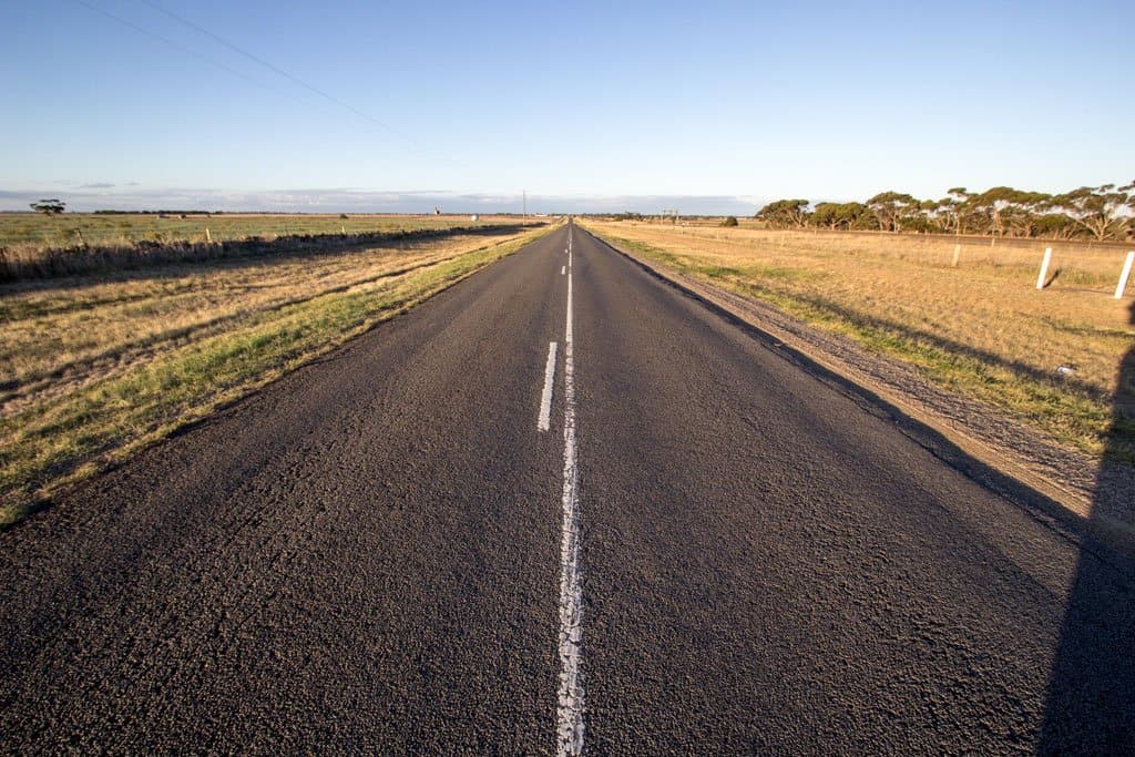
The Overland Track is a well-maintained 49.7 mi / 80 km track through Cradle Mountain-Lake St Clair National Park connecting Ronny Creek (map) to Lake St Clair (map).
From October 1 to May 31 (inclusive) you are required to make a booking to hike the track. During this time, you are also required to walk this track southbound (aka you must begin at Ronny Creek).
The daily quota for hikers beginning during the booking season (which includes the Tasmanian summer in case you haven’t registered that Australia is in the Southern Hemisphere) is 60 trekkers per day (34 of which are for individual trekkers).
Bookings on the Overland Track do fill up, so if you’re interested in hiking it during the booking season, then you should try to make your reservation a month or two in advance (I’m writing this in late November and there are only two spots in all of December/January).
Overland Track Basics
- Location: Cradle Mountain-Lake St Clair National Park
- Length: 49.7 mi / 80 km
- Type: One-way hiking track
- Booking Required: October 1 to May 31, inclusive (buy)
- Permit Cost: A$12-$60
- Northern Terminus: Ronny Creek (map)
- Southern Terminus: Lake St Clair (map)
- Elevation Gain: +4,793 ft / 1,461 m
- Elevation Loss: -5,160 ft / 1,573 m
- Highest point: Plateau between Marions Lookout and Kitchen Hut, 4,100 ft / 1,250 m
- Lowest point: Forth River crossing, 2,360 ft / 720 m
- Difficulty: Easy-Moderate
- Notes: From October 1 to May 31, the track must be hiked southbound


How much does the Overland Track cost?
Short answer? A$230. Long answer follows.
Regardless of what time of year you hike the Overland Track, you are required to purchase a National Parks Pass. This can be done when you arrive at the Overland Track or ahead of time online (here). This is separate from the Overland Track booking/permit and can be done at any time.
For a single trekker (traveling via foot, motorcycle, or public transportation), a Parks Pass is A$30. This covers you for eight weeks. If you have a vehicle, the cost of the pass is A$60.
If you’re hiking between October 1 to May 31 (inclusive), the booking for the Overland Track is A$200 per person. So, if you’re going to be hiking during the high season and intend on spending more than 24 hours on the track, then the Overland Track costs A$230 (or A$260 if you have a car).
If you’re trying to do the Overland Track as cheaply as possible and don’t mind hiking it in a single day, then you could pay A$16.50 for a 24 hour Cradle Mountain Parks Pass. However, I wouldn’t recommend this since you will probably miss the highlights; but it’s an option if you want it. And in case you’re wondering (I was), if you want to hike the Overland Track in one day during the peak season you are still required to have a booking.

Best Hike in the World?
Short answer? No. Long answer follows.
The Overland Track is often ticketed as one of the “Best Hikes In The World” and has itself become a destination for visitors to Tasmania (which, by the way, is an Australian state, not its own country).
Let me get it out of the way now and say that I would not consider this one of the best hikes in the world. Yes, it’s a world-class hiking track (with boatloads of infrastructure), but it definitely would not be worth making a trip down to Tasmania if the Overland Track was your only objective. In fact, it’s not even my favorite hike in Tasmania (that honor goes to the Western Arthurs Traverse).
That being said, if your “Past Hikes” list isn’t very extensive or you really like sleeping in huts, then the Overland Track just might make it onto your “Best Hikes” list.
Okay, rant over.

Overland Track Itinerary
The suggested Overland Track itinerary takes six or seven days. Why six or seven? Because the last leg of the track (day seven), from Narcissus to Cynthia Bay (via Lakeside Track), is skipped by most trekkers. Instead of hiking the final 10.9 mi / 17.5 km, you can pay to take a ferry across Lake St Clair and to the end of the track.
Here’s what’s suggested:
- Day 1: Ronny Creek to Waterfall Valley 6.65 mi / 10.7 km
- Day 2: Waterfall Valley to Lake Windermere 4.85 mi / 7.8 km
- Day 3: Lake Windermere to Pelion 10.44 mi / 16.8 km
- Day 4: Pelion to Kia Ora 5.34 / 8.6 km
- Day 5: Kia Ora to Windy Ridge (Bert Nichols Hut) 5.97 mi / 9.6 km
- Day 6: Windy Ridge to Narcissus 5.59 mi / 9 km
- Day 7: Narcissus to Cynthia Bay (via Lakeside Track) 10.88 mi / 17.5 km
Now if you’re thinking that perhaps you can do a bit better than (aka more than double) a 7 mi / 11 km per day pace, then here’s what I would suggest as an alternative:
- Day 1: Ronny Creek to Lake Windermere + Cradle Mountain & Barn Bluff 17.09 mi / 27.5 km
- Day 2: Lake Windermere to Kia Ora + Mount Ossa 19 mi / 30.6 km
- Day 3: Kia Ora to Pine Valley Hut + Hartnett Falls & the Acropolis 16.59 mi / 26.7 km
- Day 4: Pine Valley Hut to Cynthia Bay 16.59 mi / 26.7 km
The good thing about your Overland Track booking is that you can take as many days as you want. You do not have to have your campsites/huts booked ahead of time. If you’re hiking in the high season, all that matters is that you start on your registered start date. If you’ve allowed yourself flexibility, you can adjust your itinerary after you’re already out on the trail.
So, for example, if you really want a great view on top of Mount Ossa (Tasmania’s highest peak at 5,305 ft / 1,617 m), then you can just hang out and wait for a good weather window.

Overland Track Side Trips
There are a number of side trips you can do from the Overland Track. I have listed them here from north to south and put the ones you should seriously consider doing in bold.
- Cradle Mountain, 1.25 mi / 2km round trip, it’s what the park is named for
- Barn Bluff, 4.35 mi / 7 km round trip, fourth-tallest mountain in Tasmania (5,114 ft / 1,559 m)
- Lake Will, 1.86 mi / 3 km round trip
- Old Pelion Hut, 0.62 mi / 1 km round trip
- Mt Ossa, 3.23 mi / 5.2 km round trip, Tasmania’s tallest mountain (5,305 ft / 1,617 m)
- Mt Pelion East, 1.49 mi / 2.4 km round trip
- D’Alton and Fergusson Falls, 0.62 mi / 1 km round trip
- Hartnett Falls 0.93 mi / 1.5 km round trip, make sure you go down to the bottom
- Pine Valley Hut 2.92 mi /4.7 km one-way
- The Acropolis, 3.98 mi / 6.4 km round trip from Pine Valley Hut (east)
- The Labyrinth, 3.73 mi / 6 km round trip from Pine Valley Hut (west)
- Narcissus Hut to Cynthia Bay, 10.87 mi / 17.5 km one-way, this is the final leg of the Overland Track that you can (and should) hike instead of taking the ferry across Lake St Clair. Echo Point Hut (sleeps four) is located about 4.66 mi / 7.5 km from Narcissus Hut.


Getting to the Overland Track
If you’re hiking between October 1 to May 31, then you will need to start the Overland Track at Ronny Creek (map) in Cradle Mountain-Lake St Clair National Park. You have to pick up your Overland Track permit from the Parks & Wildlife Service at Cradle Mountain (map).
The closest major cities to the Cradle Mountain are Devenport (where you will arrive in Tasmania if you take the ferry from Melbourne) and Launceston (you can easily fly here for less than the price of the ferry).
I arrived in Launceston and then hitchhiked to Cradle Mountain (it’s not difficult to hitchhike from the Launceston airport). I got my resupply from the Woolworths in Deloraine (there isn’t much at Cradle Mountain, so I suggest getting your resupply before if hitchhiking to the park).
The Tasmania Parks and Wildlife Service has put together this document with lots of helpful information for getting to the start of the track.


You cannot pick up your pass early. That is, not unless you do the following:
You can start your hike at Dove Lake instead of Ronny Creek (however, you can/should still stop at Ronny Creek to take a photo with the Overland Track sign) and then hike and stay at the Scott Kilvert Memorial Hut your first night on the trail.
None of this trail overlaps with the Overland Track, but the Scott Kilvert Memorial Hut is just north of a junction with the Overland Track.
The only drawback to this plan is that if you want to hike Cradle Mountain as well (and if the weather is nice, you should), then it
Hopefully, this map helps:

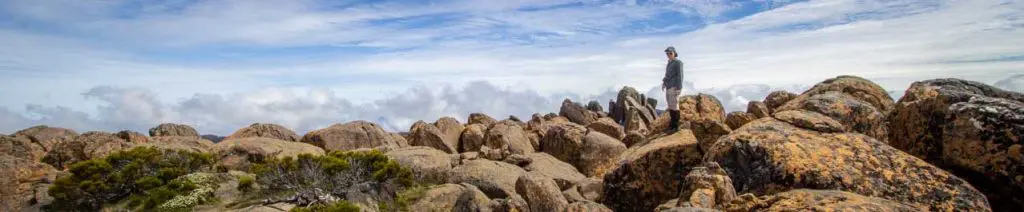
Overland Track Description
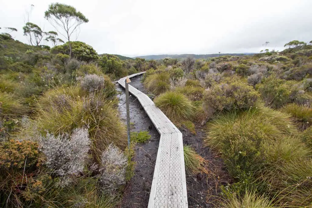
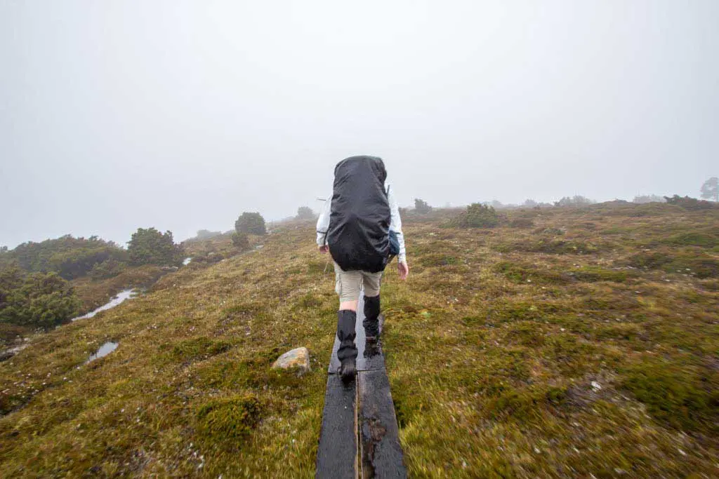
The Overland Track is not a grueling test of strength and endurance, it’s a fairly easy track that is very well maintained by Tasmania Parks and Wildlife Service.
A surprising amount of the track is boardwalks, and when you get into the forested sections, there are always orange arrows (which you can find on most of the track in Tasmania) to guide you in the right direction.
There are seven primary huts where trekkers can stay along the Overland Track. They are, from north to south:
- Waterfall Valley Hut – sleeps 24
- Windermere Hut – sleeps 16 (no tent sites)
- Pelion Hut – sleeps 36
- Kia Ora Hut – sleeps 20
- Bert Nichols Hut – sleeps 24
- Narcissus Hut– sleeps 18
- Echo Point Hut – sleeps 8
There are also a couple of emergency shelters on the track.

However, once you get off the official Overland Track to explore some of the side trips (like Cradle Mountain and Mount Ossa), the difficulty of the track does take a step up (still entirely manageable, but will probably require a bit of scrambling).
There are also four emergency shelters located on the Overland Track (overnight stays not permitted except in case of an emergency):
- Kitchen Hut
- Rangers Hut
- Du Cane Hut
- Old Pelion Hut
Overland Track Southern Terminus
The southern terminus of the Overland Track is at Lake St Clair.
Besides the visitor center and lodge, the southern end of Lake St Clair is 3.6 mi / 5.8 km from the closest sign of civilization, Derwent Bridge (which is really nothing more than a gas station, cafe, and a couple of lodges – map).
We had a package shipped to one of the lodges in Derwent Bridge and the owner kindly offered to pick us up from the end of the track. Otherwise, we would have walked into “town”. There are no public transportation options available from either Lake St Clair or from Derwent Bridge. That being said, it didn’t take us long to get a hitch all the way to Hobart.

Overland Track Map
Overland Track Resources
- Tasmania Parks and Wildlife: Daily walk notes
- Overland Track booking
- Parks Pass purchase
- Australia Bureau of Meteorology
- TASMAP Overland Track Map
- Lake St Clair Ferry: +61 03 6289 1137

Hiya – thanks for the information on your site. Does the National Park allow camping inside the Park?
You are allowed to camp inside the park but you must register beforehand and you are only permitted to camp at designated sites.
Does the track to the east of dove lake link with the overland track or is there no option but go up over Marion’s look out?
You can connect the track to the east (or the west) of Dove Lake to the Overland Track.
Gonna be hitching from Launceston Airport as well, though making that turn off onto the Bass Highway seems like it would be difficult given you’d be heading north from the airport towards Launceston and with nowhere to safely pull over beforehand. What was your experience if you don’t mind sharing in a bit more detail?
I don’t quite understand your question – care to clarify?
Sorry. Hitching from the airport it would seem that the vast majority of people would be heading directly to Launceston as opposed to turning off towards Deloraine, and it doesn’t look like there is any spot really for a driver to drop you off safely or legally around the turn-off. You said in this post you found it pretty easy hitching there directly from the airport, so I was just wondering how you managed this turn-off section of the journey if you can remember.
I understand now – my wording above is a little ambiguous. I arrived at the Launceston Airport, hitchhiked to Launceston, and then hitchhiked to Cradle Mountain from there.
Hiking Overland in December. Do I need to book either passes prior to or can I do them both when I arrive? But do I risk getting turned away if I don’t book in advance?
You need to have made a reservation for a permit to hike the trail. The other passes you can get when you arrive.
Thanks. The one thats $200 is the one I need to get prior to correct? And would you say I need to get it this early or is mid fall ok?
Yes, the expensive one. You need to get this well in advance as there is a daily quota and the permits go fast.
Perfect. Thats what I thought but wanted to make sure. Appreciate the feedback and the way detailed blog on your trip. Happy trails.
Sorry for all the questions. I’m a planner and just want to make sure my things are in order. I am planning on walking the length of the lake and finishing at the Lake St Clair Visitor center. Whats the best way for me to try and get to Devonport from there? The park site offers a list of bus options? That the best way? Is it somewhat easy to reserve a seat? Appreciate the feedback and help.
Personally, I would hitchhike.
Is there ever any parties in the huts?
Relevant username.
There’s a typo for the height of Mt Ossa, it’s 1,617 meters.
And Dewent Bridge should be Derwent Bridge. Sorry to be picky!
Fixed!
Thank you! Fixed!