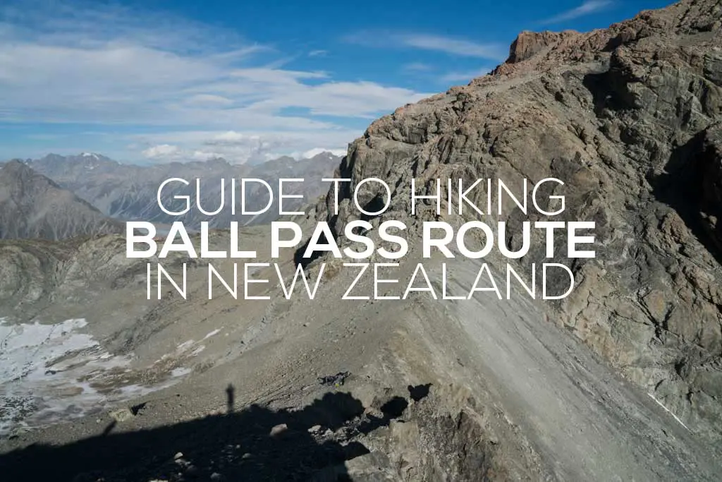
Guide to Hiking Ball Pass Route in New Zealand
The Basics
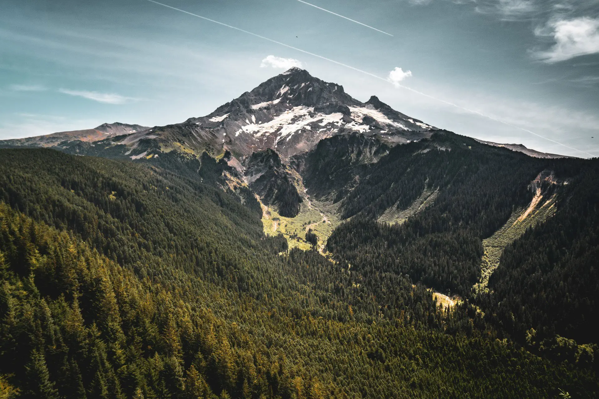
The Ball Pass Route (or Ball Pass Crossing) is a challenging hike in Aoraki/Mount Cook National Park in the Canterbury Region of New Zealand’s South Island. If you’re a dedicated machine, you could smash this hike out in a single day, but a two (or, for some, a three) day itinerary is best.
Technically, Ball Pass is a one-way hike with trailheads at the White Horse Hill Campsite (where the popular Hooker Valley Track begins) and the Tasman Glacier Car Park. These two trailheads are only 6.2 mi / 10 km apart via a paved (and well-trafficked) road. Walking or hitchhiking this section is not difficult.


Ball Pass can be hiked in either direction, but I would suggest hiking this route clockwise (beginning by following the Hooker Valley Track from the White Horse Hill Campsite) for the following reasons:
- The camping options are better on the west side of the pass (although there are no shelters).
- The climb on the west side is steeper and shorter than the east side (which I would rather go up than down).
- If, for some reason, you cannot make it past the Ball Glacier on the west side, the route back to the trailhead via the Hooker Valley is shorter.
That being said, do whatever makes you happy.
At a Glance
- Location: Aoraki/Mount Cook National Park, Canterbury, South Island
- Length: 18.44 mi / 29.68 km
- Type: One-way (can road walk 6.2 mi / 10 km to make it a loop)
- Booking Required: No
- Permit Required: No
- Trailhead Location: White Horse Hill Campsite (-43.718630, 170.093276)
- Trailhead Location: Tasman Glacier Car Park (-43.697792, 170.163054)
- Elevation Gain (clockwise): 5,775 ft / 1,760 m
- Highest point: 7,139 ft / 2,176 m
- Difficulty: Strenuous
- Notes: Crampons and ice axe suggested
How to Get to Ball Pass
To reach the Ball Pass trailhead, you must first reach Aoraki/Mount Cook National Park, which is located at the end of Mount Cook Road (State Highway 80), which heads north along the western shore of Lake Pukaki from State Highway 8.
The easiest way to reach the Aoraki/Mount Cook National Park is the same way you reach anywhere in New Zealand, with a car. That being said, you have alternatives if you aren’t a fan of having your private vehicle (or you’re legally barred from driving).
- Accessible via public transportation: Yes
- Trailhead parking: Yes (free, unmetered)
- Trailhead coordinates (White Horse Hill Campsite): -43.718630, 170.093276
- Trailhead coordinates (Tasman Glacier Car Park): -43.697792, 170.163054
By Car
Via car, the Aoraki/Mount Cook National Park can be reached north on the 35.2 mi / 56.65 km Mount Cook Road (State Highway 80) from State Highway 8. Twizel (41 mi / 65 km) and Tekapo (67 mi / 107 km) are the nearest towns. There’s plenty of free, unmetered parking at the trailheads.
By Train
Sorry, no trains.
By Bus
InterCity has daily bus service to Aoraki/Mount Cook National Park from various locations across the South Island, including Queenstown (4.75 hours), Christchurch (5.5 hours), and Tekapo (2.5 hours). For more information, visit the InterCity website.
Hitchhiking
Hitchhiking to Aoraki/Mount Cook National Park is possible and not too difficult. It doesn’t matter what time you get to the trailhead because you can start this hike in the afternoon and easily find camping or you can stay at the White Horse Hill Campsite at the trailhead.
Notes on Ball Pass Route
- New Zealand’s Department of Conservation (DOC) classifies this as an “Expert: Route” track. According to them, this means it is for “People with high-level backcountry (remote areas) skills and experience, navigation, and survival skills required. Complete self-sufficiency required.” and “Track unformed and natural, may be rough, muddy or very steep. The track has markers, poles, or rock cairns. Expect unbridged stream and river crossings.”
- Starting from the Hooker Valley (heading clockwise), the route over Ball Pass first follows the Hooker Valley Track, which is a very well-defined and maintained trail leading up to Hooker Lake.
- In the Hooker Valley (past the Hooker Valley Track), the route is not well-defined, but it’s not difficult to see where you need to go.
- I would not suggest this route in poor weather as it is very exposed and has some steep sections that (probably) would not be very fun when wet.
- There are two shelters along the Ball Pass Route: Ball Hut and Caroline Hut (both on the east side of the pass). Ball Hut is a standard 3-bunk DOC hut available on a first-come, first-served basis ($5/night). Caroline Hut is private and is not available for overnight stays without making prior arrangements (and it will probably be locked); however, there is an emergency shelter on the side of Caroline Hut in case you get caught out in a storm.
- Camping is permitted along the route (except within 150 m of Caroline Hut), and numerous spots are suitable for pitching a tent (the most notable of which is the Playing Field on the west side of the pass).
- There are spots available for camping at the top of the pass (but there is no water).


Gear Required
One of the big questions I had before attempting Ball Pass Route was whether or not I would need gear (crampons and an ice axe) to get past Ball Glacier on the west side of the pass. The short answer to this question is (or at least was) no; it is possible (although probably not advisable) to complete Ball Pass Route without any snow gear.
I did this hike in February and completed it (along with one other person) without snow gear. However, traction for the snow/ice and an ice axe would definitely not have hurt as our crossing/climbing of the glacier certainly had some sketchy moments. If I were to do this hike again (especially if I was attempting it earlier in the season, I would probably bring microspikes at the very least (and likely an ice axe). It would not be a bad idea to also bring a helmet – the Playing Field Gully and the section just below the pass have a lot of loose rock.
If you don’t have your own gear, you can rent crampons and an ice axe (and/or a helmet) in Aoraki/Mount Cook Village from Alpine Guides.


Ball Pass Route Itinerary
As mentioned above, if you really wanted to crush Ball Pass and you got an early start, you could do it in a single day. That being said, I would recommend two days with a night spent camping at the top of the pass (weather permitting).
Two Days
- Day 1: White Horse Hill Campground to Ball Pass 8.83 mi / 14.21 km
- Day 2: Ball Pass to Tasman Glacier Car Park 9.61 mi / 15.47 km
Three Days
- Day 1: White Horse Hill Campground to Playing Field 7 mi / 11.27 km
- Day 2: Playing Field to Ball Hut 5.74 mi / 9.24 km
- Day 3: Ball Hut to Tasman Glacier Car Park 5.7 mi / 9.17 km


What to Expect on the Ball Pass Route
Note: the following describes the route in a clockwise direction.
Ball Pass Route begins by following the 3.1 mi / 5 km Hooker Valley Track up to Hooker Lake There’s a sign marking Ball Pass Route before you reach Hooker Lake, but I found it easier to ignore this and instead head to the end of the Hooker Valley Track.
At the end of the Hooker Valley Track is a large picnic table and day hiker crowds taking pictures (depending on the weather and time of year). Say peace out to everyone not going on your adventure and follow the valley up along the east side of the lake. A number of the trails I found and followed through here petered out into bushwhacking (or bush bashing as the locals say) and it was typically easier to simply stay along the glacial ridge just above the lake.
You might find an occasional trail marker in this section, but there doesn’t look to be much of an established trail. A few streams and waterfalls provide opportunities for water through here. And speaking of streams, as you get closer to the north side of the lake, you’ll have to go up and around two massive washouts (I was told by a volunteer at Mueller Hut that each of these would take an hour to get past – this information was far from accurate).


After the washouts, the route breaks away from the lake/glacier and heads toward the base of the Playing Field Gully (you can find camping in this area).
There may still be snow in this gully in the early season, and I found plenty of water available. There’s a faint trail up through the gully, but many times, especially toward the top, it just turns into boulder hopping in the upward direction. It’s here where I felt that a helmet may be appropriate.


The Playing Field (named after Ball Pass? Because you play with balls on a playing field?) awaits you at the top of the chute and there’s plenty of awesome camping up here.
Continuing past the Playing Field, the trail can be a bit tricky. All of the copy/paste trip reports I read before heading up here described the route forming “a large Z between bluffs”. It became apparent what this meant once I was up here (and it was here that I decided this would be a terrible trail to attempt in shitty weather).


A few random cairns mark the way up as the trail follows the ‘Z’ everyone loves talking about, heads around a ridge and opens up to give you your first good look at Ball Pass (and how much snow you may or may not have to navigate).
Don’t be tempted to climb higher along the scree slope as you make your way to the pass. The trail drops down to pass underneath a rocky outcrop (we first tried to go over this and had to backtrack).
There were a few places along this section where we could get water, but I’m not sure how reliable these sources are (it might be best to carry all your water from the Playing Field Gully if you’re planning on camping on top of the pass or Ball Ridge before Caroline Hut.


Navigating the snow/ice on Ball Glacier will depend largely on what time of year you hike and what the weather has been like recently.
We took a risk by not bringing any equipment for this part of the trail (and were told by two different groups coming down the Hooker Valley from the pass that we would not make it over) and fortunately, we were able to make it past the glacier. That said, we would have had an easier time with some traction for our feet and some ice axes for our hands.
At the top of the pass, you will find camping just below on the east side.


From Ball Pass, the trail descends steeply to a flat snowfield on the north side. You’re not going down this. Instead, gain Ball Ridge and brgin to follow it down (there’s camping up here if you’re not keen on caping on the pass).
Some of the ridge has a more defined trail but it’s not hard to simply follow the ridge down. Follow it all the way down to Caroline Hut (a private hut that’s not available to stay in without making prior arrangements) where you can refill on water from a rainwater tank and hand out on the balcony in front of the emergency shelter (attached to the side of the hut). There’s no camping within 150 m of Caroline Hut.
There’s also a very nice privy here (with an excellent view – keep the door open).


Below Caroline Hut the trail becomes a bit more defined, but you’re still just following the ridge down. The New Zealand Department of Conservation website reports “two difficult sections” through here, but I do not know what they are talking about.
Just follow the ridge down.
The trail levels out a bit as you get further down and you’ll find a trail marker telling you to turn right. Do this. Apparently, the old trail (ahead of you) has been made impassable by slips.


Eventually, you will make it down off the ridge. Head south (basically back the way you came from) along the flats (there is an actual trail now) until reaching Ball Hut.
Ball Hut is a standard 3-bunk DOC hut available on a first come, first served basis ($5/night). It is free to camp outside Ball Hut. Water is available from two different rainwater tanks – one attached to the hut and one just south.


From Ball Hut to the Tasman Glacier Car Park the trail is mostly flat and easy to follow, but there are a few (very small uphill bits).
You will likely begin to see a lot more people during this section (although not as many as you probably saw on the Hooker Valley Track) since a day trip to Ball Hut is (for some strange reason) a hike that people do.
When you reach the Tasman Glacier Car Park you can either pick up your car that you intelligently left there beforehand, hitchhike back to the White Horse Hill Campground where you left your car, or walk the 6.2 mi / 10 km paved road back to White Horse Hill Campground. Or you can do whatever you want because you’re done with the hike and you’re your own boss.


Ball Pass Route Campsites
Camping is permitted along Ball Pass Route, with the exception of within 150 m of Caroline Hut. That being said, the number of “good campsites” are limited. Here’s where you can find decent camping (heading clockwise on the route).
- Before reaching the base of the Playing Field Gully (the scree chute leading up the the Playing Field).
- The Playing Field is a large, flat, grassy area with plenty of room for tents and some larger boulders that can be used for shelter.
- Just below Ball Pass on the east side there is a flat area with room for tents/camping.
- After gaining Ball Ridge, there are some flat and (semi) sheltered sites where you could pitch a tent.
- After Caroline Hut on Ball Ridge there are some flat but exposed areas where you could camp.
- Around Ball Hut there is plenty of space for camping.


Map of Ball Pass Route
Resources
- New Zealand Department of Conservation (DOC)
- Ball Pass Route Description (DOC)
- Aoraki/Mount Cook National Park (DOC)
- Ball Hut (DOC)
- Hooker Valley Track (DOC)
- Caroline Hut Photo Gallery (Alpine Recreation)
- Gear Rental in Aoraki/Mount Cook Village (Alpine Guides)
- Aoraki/Mount Cook National Park Weather (NZ MetService)
- Ball Pass Weather (YR.no)
- InterCity Bus Service


Hey, I’m planning on doing this route when I visit new zealand this month. The doc website and other pages describe this as a mountaineering route. I don’t see how this is mountaineering other than crossing an ice field. I plan on bringing micro spikes. Unless kiwis consider any off trail alpine hike with boulders fields and scrambling to be mountaineering. Thanks for the trip report!
No worries! The DOC website had me questioning the route as well, but as long as the weather and conditions are good, there’s nothing mountaineering about it.