Buckskin Gulch and Paria Canyon – The Ultimate Backpacking Guide
Buckskin Gulch and Paria Canyon are located in the Paria Canyon-Vermilion Cliffs Wilderness spanning the border of Southern Utah and Northern Arizona.
Both Buckskin Gulch and Paria Canyon can be accessed from numerous trailheads and they can be explored either as day hikes or as a multiday backpacking trip. Backpackers most commonly depart the Wire Pass Trailhead and then hike Buckskin Gulch to the confluence with the Paria River before continuing out Paria Canyon to Lees Ferry.
The full hike of Buckskin Gulch and Paria Canyon takes hikers from Buckskin Gulch Trailhead to Lees Ferry. However, the more common route (and the one I’ll cover here) begins at Wire Pass Trailhead instead of further north at Buckskin Gulch Trailhead. From what the rangers tell me, you’re basically walking in a sandy wash for about 5 mi / 8 km if you want to start at Buckskin Gulch Trailhead instead.

Buckskin Gulch and Paria Canyon Overview
- Location: Paria Canyon-Vermilion Cliffs Wilderness (Arizona/Utah, USA)
- Length: 46 mi / 74 km from Wire Pass Trailhead | 50 mi / 80 km from Buckskin Gulch Trailhead
- Type: One-way
- Recommended Time: 3-4 days
- Most Popular Months: March/April, October/November
- Max Group Size: 10
- Permit Required: Yes
- Permit Cost: $9 + $5 per person per day (not night)
- Dogs Allowed: Yes
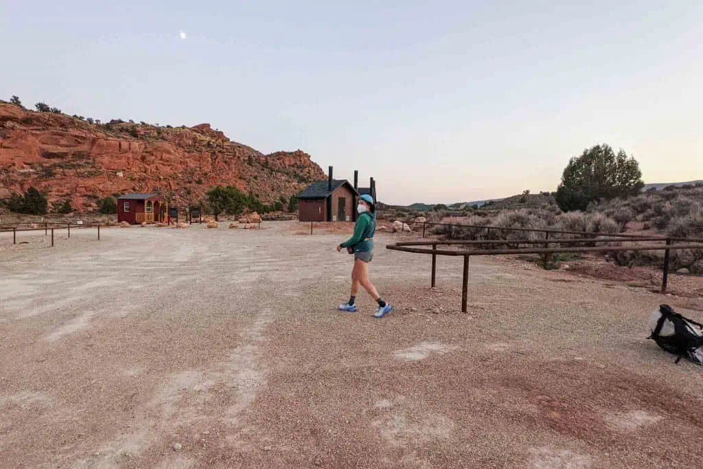
- Trailhead: Wire Pass Trailhead (36.183833, -112.376747) | Buckskin Gulch Trailhead (37.066754, -112.000331)
- Low Point: Lees Ferry
- High Point: Wire Pass Trailhead or Buckskin Gulch Trailhead
- Elevation Gain: 1,794 ft / 547 m
- Elevation Loss: ~2,500 ft / 762 m
- Difficulty: Moderate to Strenuous

Buckskin Trailhead vs. Wire Pass Trailhead
There are two places you can begin this hike via Buckskin Gulch – one is Buckskin Gulch Trailhead and one is Wire Pass Trailhead.
So what’s the difference?
- Both Buckskin Gulch Trailhead and Wire Pass Trailhead are accessed via House Rock Valley Road, south of Highway 89.
- Starting at Buckskin Gulch Trailhead adds approximately 4 mi / 6.4 km to the hike.
- Wire Pass Trailhead is located on House Rock Valley Road, Buckskin Gulch Trailhead is located just southeast of House Rock Valley Road (easily walkable).
- Wire Pass Trailhead is a more popular trailhead (it’s also the trailhead for The Wave).
- Wire Pass Trailhead requires you drive 4 mi / 6.4 km further on a dirt road (it’s not a terrible road, but if it’s rained recently or you’re on foot/bicycle, this could make a difference).
- Apparently (I haven’t done it) the hike from Buckskin Gulch Trailhead to where the Wire Pass slot canyon meets Buckskin Gulch is mostly in a sandy wash and is not that interesting.
You’re not really missing anything if you start at Wire Pass Trailhead. But do what your heart desires, they’re fairly close to one another and they both have pit toilets (although the pit toilets at Wire Pass Trailhead are newer).
Here, I’ll be covering the hike from Wire Pass Trailhead.

Getting to Wire Pass Trailhead
By Car
The best way to reach the trailhead, a private vehicle is recommended for this hike.
Wire Pass Trailhead is located on House Rock Valley Road – south of Highway 89. It’s a dirt road in relatively good shape. You do not need a high-clearance or 4WD vehicle to make it to the trailhead, but if you’re in an average 2WD sedan or coupe, you’ll have to take it slow. If your car is lowered or has little clearance, you will want to proceed with extreme caution. Note that after heavy (or even moderate) rains, House Rock Valley Road may be impassible.
The closest population centers are Kanab, Utah (47 mi / 75 km away – west on Highway 89) and Page, Arizona (44 mi / 71 km away – east on Highway 89). From both Kanab and Page, you’ll access House Rock Valley Road from the north. Be careful turning onto House Rock Valley Road – especially if you’re coming from the east (Page). It’s on a highway, around a corner, has no dedicated turning lane, and immediately drops. It’s 8.4 mi / 13.5 km south on House Rock Valley Road from Highway 89 to Wire Pass Trailhead.
If you want to come up House Rock Valley Road from the south – from Highway 89A in Arizona – you’ll drive 21 mi / 34 km on the unpaved House Rock Valley Road to reach Wire Pass Trailhead. The road south of the trailhead is in better shape than the road north of it, but there’s a chance it may be impassible after heavy rains.
By Public Transportation
There are no public transportation options available for reaching Wire Pass Trailhead.
By Private Transportation
There are several private shuttle operators who provide transportation to/from Wire Pass Trailhead and/or Buckskin Gulch Trailhead from Lees Ferry. Many of these companies can also provide you with transportation to Wire Pass Trailhead from Kanab, Utah, or Page, Arizona (the two closest cities).
I would not suggest you get a shuttle with anyone who only accepts cash as they are likely operating an unlicensed business and likely do not have insurance to cover you should something happen during your drive.
- $193 – Backcountry Found (this is who I used, was happy with service and could pay via credit card)
$225 – Trails End Shuttle & Tours- $225 – Grand Staircase Discovery Tours
- $250 – Seeking Treasure Adventures
- $250 – Paria Outpost
- $300 – Grand Circle Tours
- $300 – Arizona Canyon Aces
Note that this is not an exhaustive list and that the prices reflected may change. If you have any additions, changes, or potential deletions for this list, please leave a comment at the end of this post or get in touch.
By Hitchhiking
Hitchhiking to/from the Wire Pass Trailhead would be tricky, but not impossible. There’s not much between Page and Kanab so if you get a ride heading out of either town, chances are the person will be passing House Rock Valley Road. If you could get someone to (safely) drop you at the junction for House Rock Valley Road, it shouldn’t be too difficult to get a ride (or walk) the rest of the way to the trailhead.
Getting to/from Lees Ferry
By Car
Lees Ferry is where you’ll exit Paria Canyon at the end of your hike (or start the hike if you’re doing it in reverse).
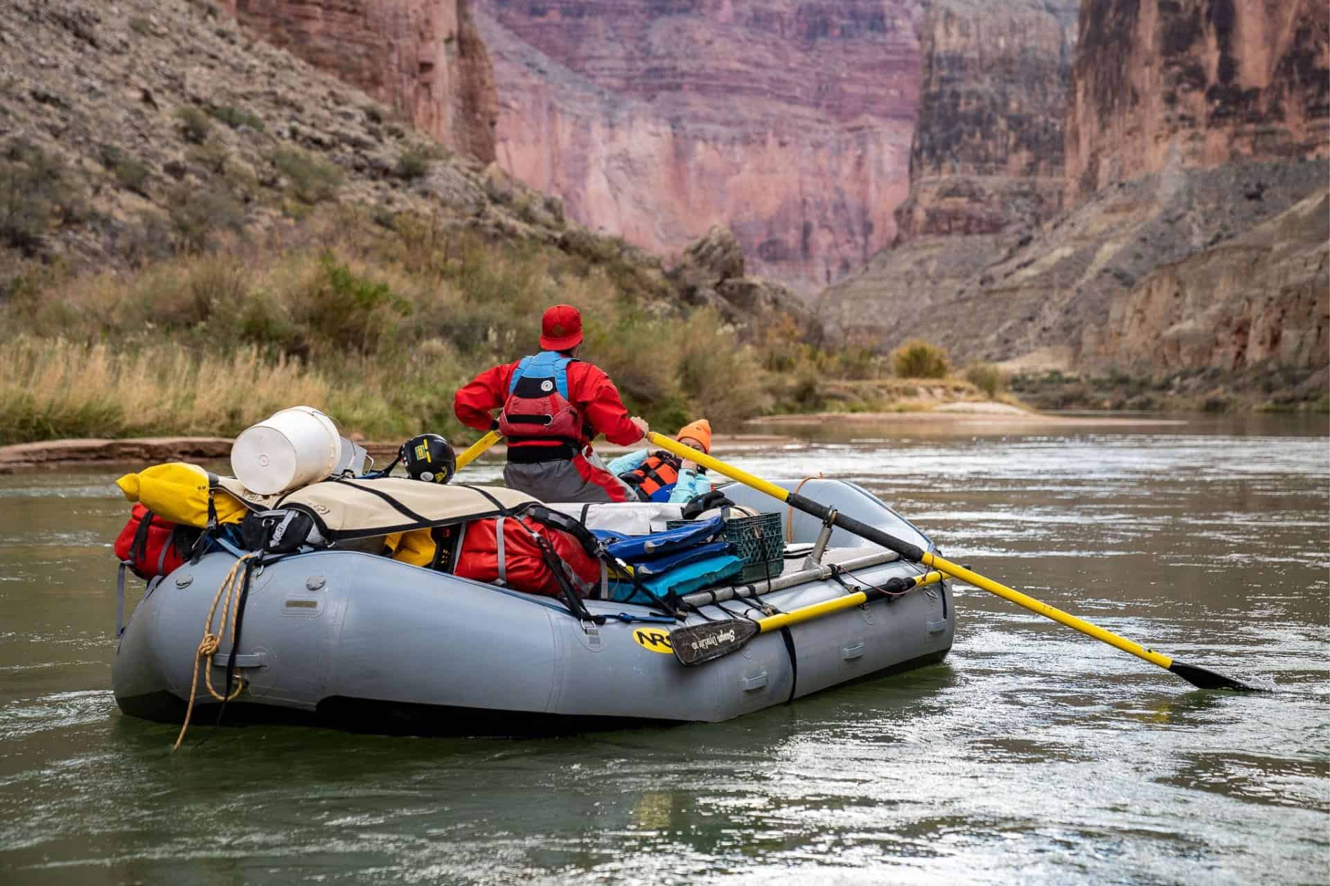
There is a paved road to Lees Ferry. It’s a popular spot since in addition to being the start of a few day hikes, it’s where river runners begin Grand Canyon rafting trips. You’ll have to put your car’s license plate information on your permit application and your permit will have a parking pass you can use to park at Lees Ferry for the duration of your trip.
As with Wire Pass Trailhead, a private vehicle is the easiest way to reach Lees Ferry. If you only have one car, I would recommend leaving it here and getting a private shuttle to Wire Pass to begin your trip. This way, if you go faster or take longer than expected, you don’t have to worry about shuttle logistics and you already have a car waiting.
However, if you don’t have access to a vehicle and are starting this hike from Flagstaff, there are numerous outfitters (mostly river-related) that offer shuttles from Flagstaff to Lees Ferry. That said, I would not recommend this route since you need to pick up your permit in person and will have to do so either in St. George, Utah or at the Paria Contact Station off Highway 89. More on this below.
By Public Transportation
There are no public transportation options available for reaching Lees Ferry.
By Hitchhiking
It’s not unreasonable to think you could manage a hitch out of Lees Ferry to either Page or possibly to Flagstaff. However, it would be risky to rely on hitchhiking to get you all the way from Lees Ferry to Wire Pass Trailhead. It wouldn’t be impossible, but it might take a while.
Things to Know
- You are required to carry out all solid human waste (that means poop) from Buckskin Gulch and the Paria Canyon narrows. You are provided wag bags as part of your permit (which you must pick up in person).
- Reliable water sources are scarce – the first 7 mi / 11 km of the Paria River can be dry in summer – expect big carries and be ready to clog up your filter with silty water if you can’t locate springs (or they aren’t running).
- Flash flooding can occur at any time, but floods occur most often in July and August.
- Campfires are prohibited.
- Camping is prohibited in Wrather Canyon.
- There are extremely few safe exits/campsites/locations within Buckskin Gulch in the case of a flash flood. Do not enter Buckskin Gulch if there is a chance of flooding.
- There are no marked trails or routes. Granted, most of the time you’ll be in a slot canyon or following the Paria River, but there are many times, especially when the canyon widens as you get closer to Lees Ferry, where navigation and routefinding will be required.
- There is a large boulder jam a bit before Buckskin Gulch reaches its confluence with the Paria River. There’s a short, 15-20 ft / 5-7 m downclimb here. There’s a rope affixed to a boulder with shallow moqui steps (divots for your feet) cut into it, but it is a little challenging and insecure – especially if this is not something you’re comfortable with (or you’re a dog).
- Campsites must be a minimum 200 ft / 61 m from springs and archaeological sites.
- Overnight trips are limited to 14 days.
- The quota for overnight use in the canyon is 20 people per day.
- Paria is pronounced pah-ree-ah (/pəˈriːə/, rhymes with “Maria”)
- Buckskin is pronounced buck-skin (/ˈbəkˌskin/, rhymes with “Buckskin”)


When to Hike: Weather and Conditions
Buckskin Gulch and Paria Canyon can be hiked for most of the year – so long as the road isn’t impassable due to rain and there is no flooding on the horizon. That said, the most popular months are April, May, and June with things picking up again in September and October.
Peak Season Hiking (April-June): These months are the most popular for hiking Buckskin Gulch and Paria Canyon (and visiting the Wave). It’s before the peak of the summer heat and flash flood season (but remember, floods can occur at any point during the year). The earlier you go, the colder it will be (especially at night), the later you go, the warmer.
Summer Hiking (July/August): I would never suggest that anyone do this hike during these months. Not only are July and August the months when the canyons most commonly flood, but they’re also the hottest months – hot to the point where you’ll probably be uncomfortable even at night with no sleeping bag and no clothes. Temperatures can frequently exceed and remain above 100°F / 38°C. Avoid hiking during July and August unless you have a specific reason for doing so.
Fall Hiking (September-November): This is when I hiked and when I would recommend hiking (I would also maybe go a bit later in the year). This is the second-most-popular time for visitors to the area, but it still falls well short of the peak in spring and early summer. There’s a bit more chance of precipitation than in the spring, but there’s a drop-off from the peak of summer.
Winter Hiking (December-February): There’s nothing wrong with hiking during the winter – but it will be cold. I’ve been in this area in February (for a pre-dawn arrival at the nearby Wave) and can confirm that it’s freezing. Historical temperatures have reached below 0°F / -18°C in the dead of winter. If you’re planning on hiking during this time, prepare to be cold. Especially since you’ll also spend a lot of time being wet – waders or a dry bottom might be a good idea (or even necessary).

Paria Canyon Permits
Permits for trips in Paria Canyon-Vermilion Cliffs Wilderness can be reserved at Recreation.gov. You’ll want to make your reservation in advance – as soon as permitting opens.
Paria Canyon permit reservations open at noon (Mountain Time) on the first of each month for three months in advance. So, for example, if you want to reserve a permit for sometime in October, you can reserve it beginning July first at noon.
Permits are issued for the number of days your trip will be (not the number of nights). The permit fee is $9 plus $5 per person per day. So if two of you are going on a four-day, three-night trip, the permit cost will be $49.
You are required to pick up your permit in person. This can be done at the Paria Contact Station (March 15 to November 15, 8:00 am – 4:30 pm), at the BLM Information Center in St. George, Utah (Monday to Friday 7:45 am – 5:00 pm), or (sometimes?) at the Grand Staircase-Escalante National Monument Visitor Center in Kanab, Utah (I’ve received conflicting information on this, so call to confirm).
Your permit includes a parking pass for your car (or cars) that will allow parking at Lees Ferry and/or Wire Pass/Buckskin Gulch Trailhead. You will also receive wag bags with your permit (I received one per day for two people).
Camping
There are no established campgrounds in Buckskin Gulch or Paria Canyon, but you will find impacted campsites along the route. Please observe Leave No Trace practices at these locations and use a wag bag if you’re camped in an area where you cannot dig a cat hole more than 200 ft / 61 m from the high-water mark.
Dispersed or “at large” camping is permitted along the route. You do not need to denote ahead of time where you’re going to be camping.
There are no safe campsites (safe from flooding) in Buckskin Gulch until just before reaching the Paria River confluence (~13.5 mi / 21.7 km from Wire Pass Trailhead and ~17 mi / 27.4 km from Buckskin Gulch Trailhead). Once you reach Paria Canyon, you’ll occasionally find an elevated campsite (the canyon will be much wider than Buckskin Gulch), and suitable camping opportunities will increase as you get closer to Lees Ferry.
Note: Camping in Wrather Canyon is prohibited; campfires are also prohibited.
Itinerary
How many days does it take to hike Buckskin Gulch and Paria Canyon? It might be possible in a day if you really wanted to, but I would not recommend attempting this. With all the feet-wetting and occasional route finding, it will not be an enjoyable single-day effort if you’re looking for a huge day. in the area, I would suggest the (logistically easier) Rim to Rim to Rim at the Grand Canyon Instead.
I would suggest three or four days for the Buckskin Gulch and Paria Canyon. Maybe five days if you’re moving at a more leisurely pace, but I can’t imagine taking any longer. I completed it in three days with plenty of time for filtering water, taking breaks, and making camp while the sun was still up.
Dispersed or “at-large” camping is permitted in Paria Canyon. In Buckskin Gulch, I couldn’t find anywhere that prohibits camping, but there aren’t any suitable campsites that would put you in a safe spot should a flash flood occur. Also, it would be impossible to camp a sufficient distance from the “trail” in Buckskin Gulch.
It’s recommended (or even required) that you complete Buckskin Gulch in a single day; the first campsite you reach is just before the Paria River confluence. That means either a 13.5 mi / 21.7 km day from Wire Pass Trailhead or a 17 mi / 27.4 km day from Buckskin Gulch Trailhead.
Gear & Packing List
You can choose to go lightweight in Buckskin Gulch and Paria Canyon, but there are a few things you should not be without if you are looking to have a successful trip (like a water filter and extra socks). I brought my normal backpacking kit.
- EXTRA SOCKS: Your feet are going to be wet a lot (if not 100% of the time) during your time in the canyon, and in addition to water, your shoes will be filled with sand as well. This is the kind of sand that gets stuck in your clothing for many washes to come. I would suggest bringing an extra pair of socks for each day – and maybe another pair for camp and/or to sleep in as well. There are a few times I thought having waterproof socks would be handy, but the water levels were oftentimes too high to justify them (water can’t go over the tops of these socks).
- TREKKING POLES: One thing I wish I had with me on this hike was a trekking pole (or trekking poles) to help with navigating the higher river crossings and knowing where to step when passing through muck-filled sections of Buckskin Gulch. If I were to do this again, I would bring at least one trekking pole.
- ELECTROLYTES: Bring electrolytes! Buckskin Gulch and Paria Canyon can be blistering hot (especially during the summer months), and there is a lot of exposure. Make sure you’re bringing electrolytes to rehydrate and that you’ll have enough for the entirety of your hike.
- CAMP SHOES: I know not everyone is a fan of bringing camp shoes on backpacking trips, but your feet are going to be wet, and your shoes are going to be sand-filled. It’s nice to have some dry footwear to use around camp, not to have to live in your wet shoes. I haven’t gotten a pair yet, but I’ve been eyeing the Xero Shoes Z-Trail EV Sandals as a durable pair of camp shoes to bring when weight isn’t as much of a concern to replace my current Batman sandals from 2017.
- SUNSCREEN: Bring plenty of sunscreen. Yes, you’ll be in a slot canyon with little direct sunlight for this hike, but once you get closer to Lees Ferry in Paria Canyon, the landscape opens up significantly, and it’s exposed. There are plenty of opportunities to take cover under trees for shade, but the majority of your time hiking will be spent without the luxury of tree cover.
- WATER: Bring water capacity – and lots of it (especially if you’re hiking in the summer). Not so much because there isn’t any water, but because it’s a pain to filter (unless you find a spring), and you’re probably not going to want to be filtering water at multiple points during the day (or maybe you are, don’t let me tell you what to do). If you’re looking for a collapsible bladder that’s durable and packs down small, I suggest the HydraPak Seeker; it comes in 2L, 3L, and 4L versions.
- WATER FILTER: In addition to a small water filter, like the Platypus QuickDraw, I would recommend bringing a large-capacity water filter as well, like the Platypus GravityWorks. If you can’t locate the springs (I could only find one) or you need to filter water from the Paria River, it may take a while, and having a gravity filter to do the work for you will make life easier (especially if you’re going to be filtering for two or more people). I filtered silt and sediment-heavy water from the Paria with a GravityWorks filter multiple times, and it was not fun.
For more recommendations on backpacking gear, check out my current gear list or gear reviews.
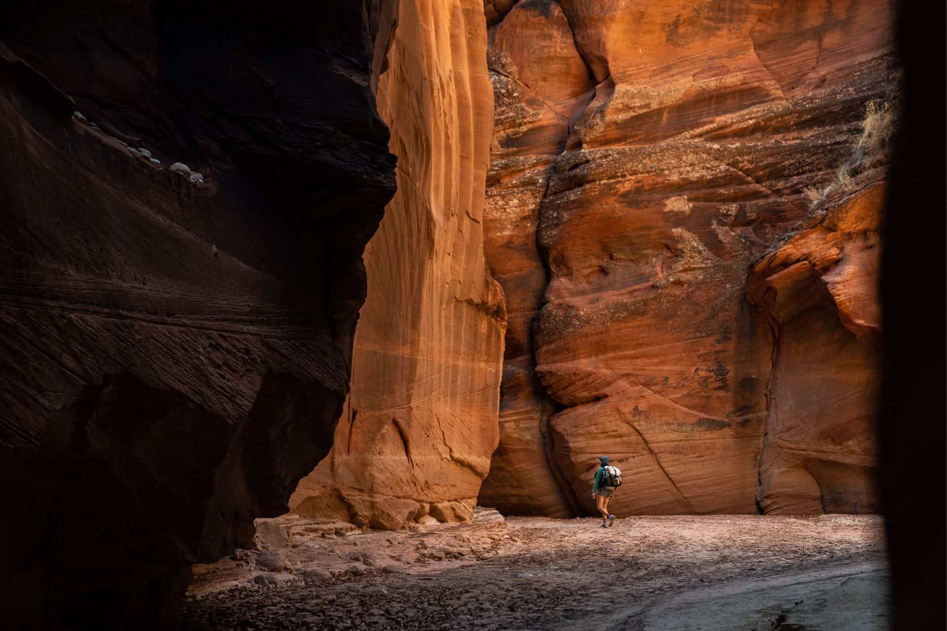
Route Description
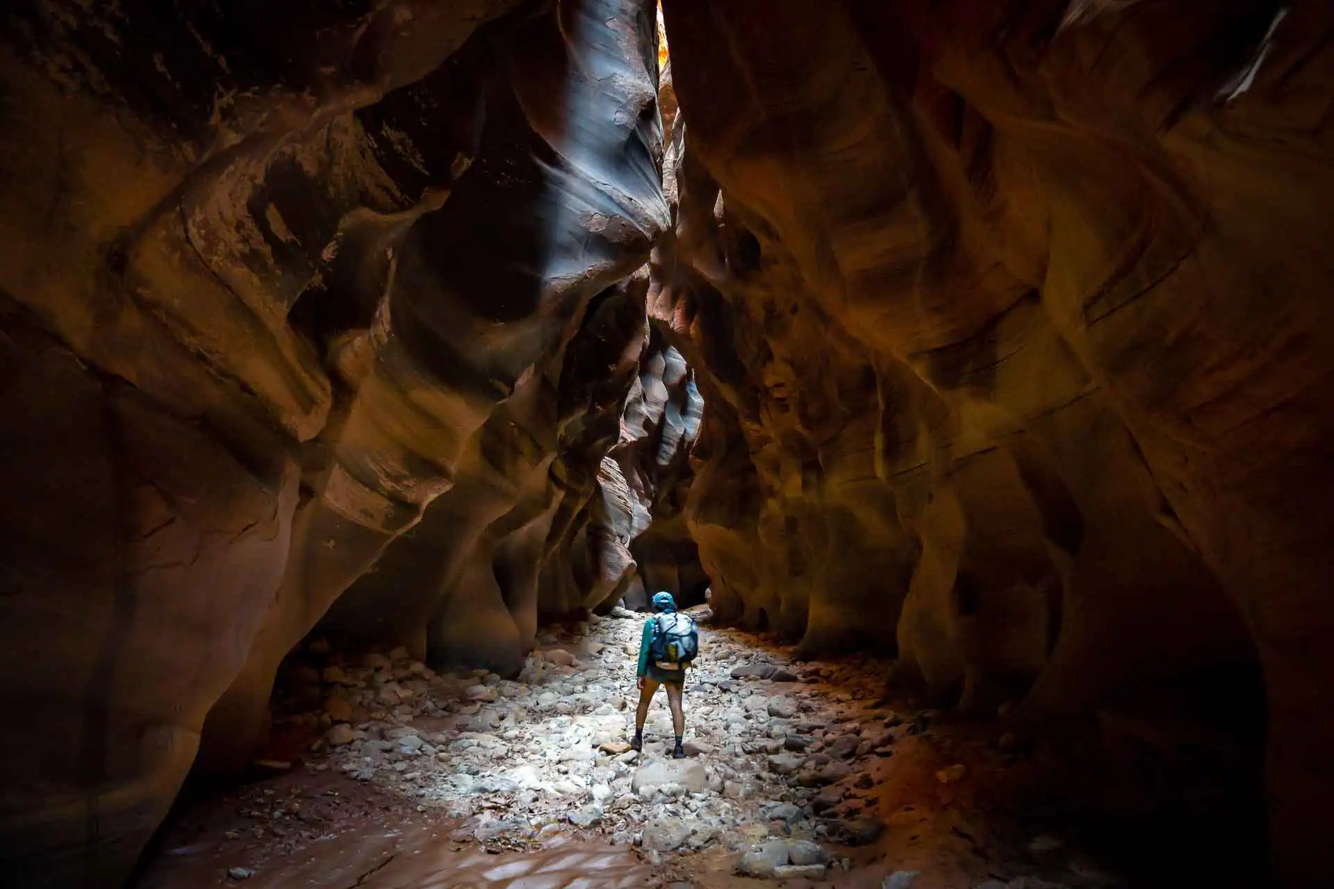
Beginning at Wire Pass Trailhead, the route follows a well-traveled wash (that nearly resembles a dirt road) until it slowly begins to dip as canyon walls rise on either side of it as you enter the Wire Pass Slot.
Following the slot (there’s only one way to go), you’ll eventually make it to the intersection of Buckskin Gulch after around 1.7 mi / 2.74 km. Just before turning south (making a right) and continuing to follow Buckskin Gulch, you’ll find a petroglyph panel on the southern (right) wall. If you would like to do a loop hike, you could turn north (left) here and hike out to Buckskin Gulch Trailhead.
Depending on the time of year and recent weather, you may or may not have gotten your feet wet yet. Don’t get too excited if you still have dry feet because I can guarantee you that if you’re planning on hiking out to Lees Ferry, your feet will absolutely be wet and covered in muck and mud at some point (probably soon).
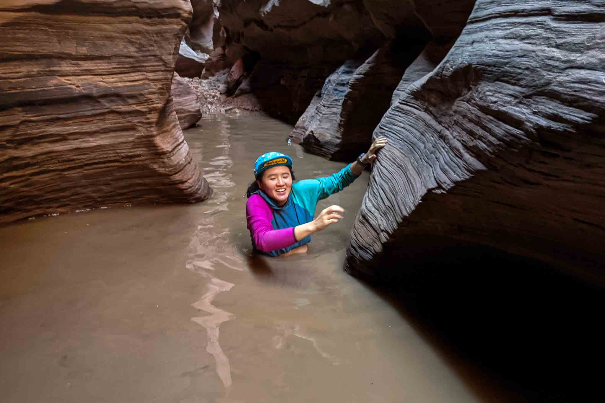

The route follows Buckskin Gulch, passing through sometimes chest-deep water (I encountered pools that came above my waist, I’m 5’10” / 179 cm) which may require you to take off your pack and carry it. Note there are very few (if any) safe places to camp in Buckskin Gulch (I didn’t see anywhere stating camping here is prohibited, but it’s not a good idea given the risk of flash floods).
That said, water levels will depend on when you’re hiking and the recent precipitation; if you’re lucky, you might hardly encounter any water at all in Buckskin Gulch (but I would still prepare for wet feet).
The Middle Route is a way into/out of Buckskin Gulch just over halfway to the Paria River confluence from the Wire Pass slot intersects Buckskin Gulch. This route (which I have not personally taken) is described as difficult and as requiring some climbing proficiency (or at least comfort with exposure) to navigate. I would not expect that you can casually enter/exit the Middle Route, and it should likely only be used as an emergency option (unless you are experienced with this route).
There are some petroglyph panels just up the start of the Middle Route and more a couple of hundred feet above the canyon floor on a west-facing wall. You will likely have to climb up on the ledges on the canyon’s right to see these petroglyphs.

After the Middle Trail junction, the route continues through Buckskin Gulch – alternating between easy walking through the slot and wading through the muck – until reaching your next major obstacle, the boulder jam.
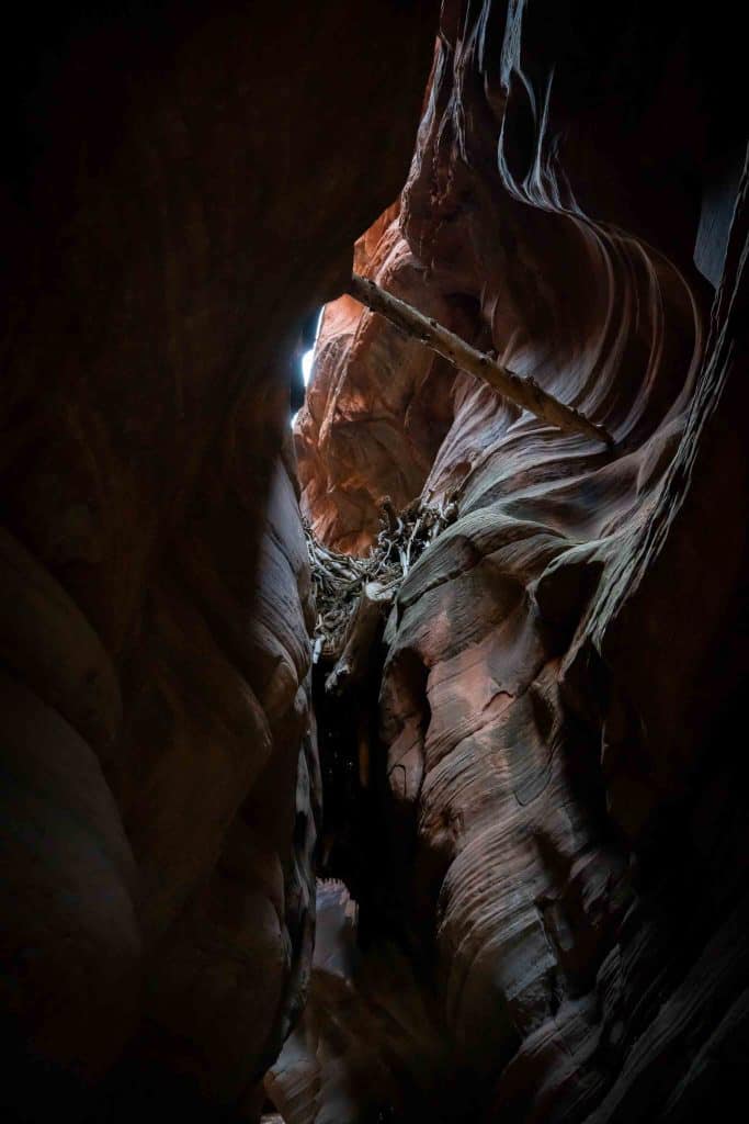
You’ll come to an area that opens up a bit, and that can almost be described as looking somewhat akin to a cavern. It’s unique as far as this route goes because it’s one of the few times you can’t see the trail directly in front of you. On the north side of the slot (the left if you’re heading toward the Paria River), you’ll need to make your way up to the top of a large boulder with a rope affixed above it.
Using this rope and the Moqui steps cut into the boulder, you’ll need to lower yourself down to the ground below. It’s a max 20 ft / 6 m drop. The rope isn’t anchored directly above where the Moqui steps are, so it can be a bit awkward getting down this section. It would not be good if you fell here, so you’ll need to be comfortable with a small amount of exposure as you make your way down.
Others who have completed this hike have told me that the boulder is not always oriented properly for you to easily climb down (or up) the Moqui steps and that there is an additional route through the boulders known as the Rabbit Hole. This is an opening whereby it’s possible to squeeze through the boulder jam, but it may not always be accessible due to water levels, debris, or difficulty locating it.


From here, it’s more of the same until just before reaching the Paria River Confluence.
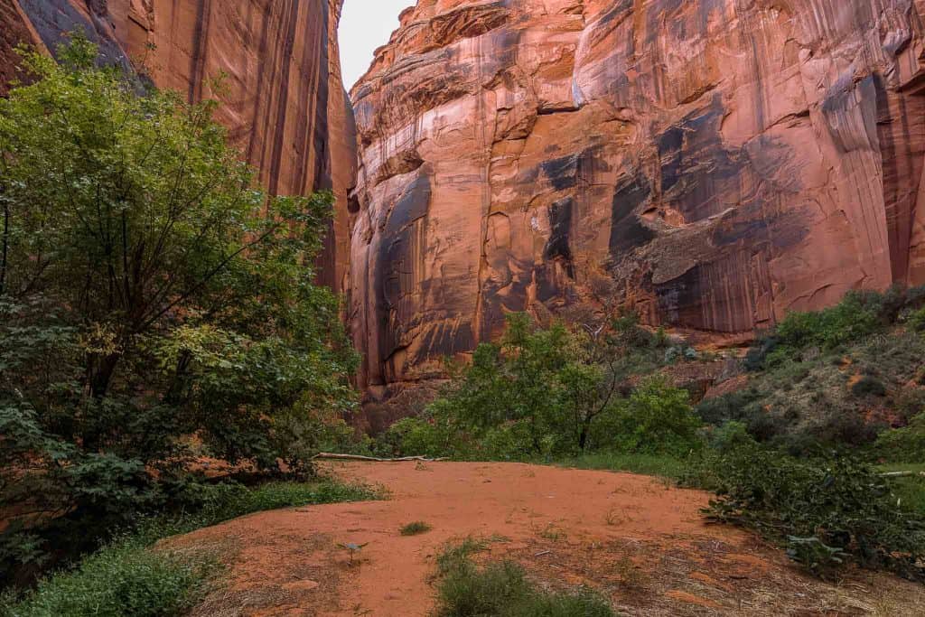
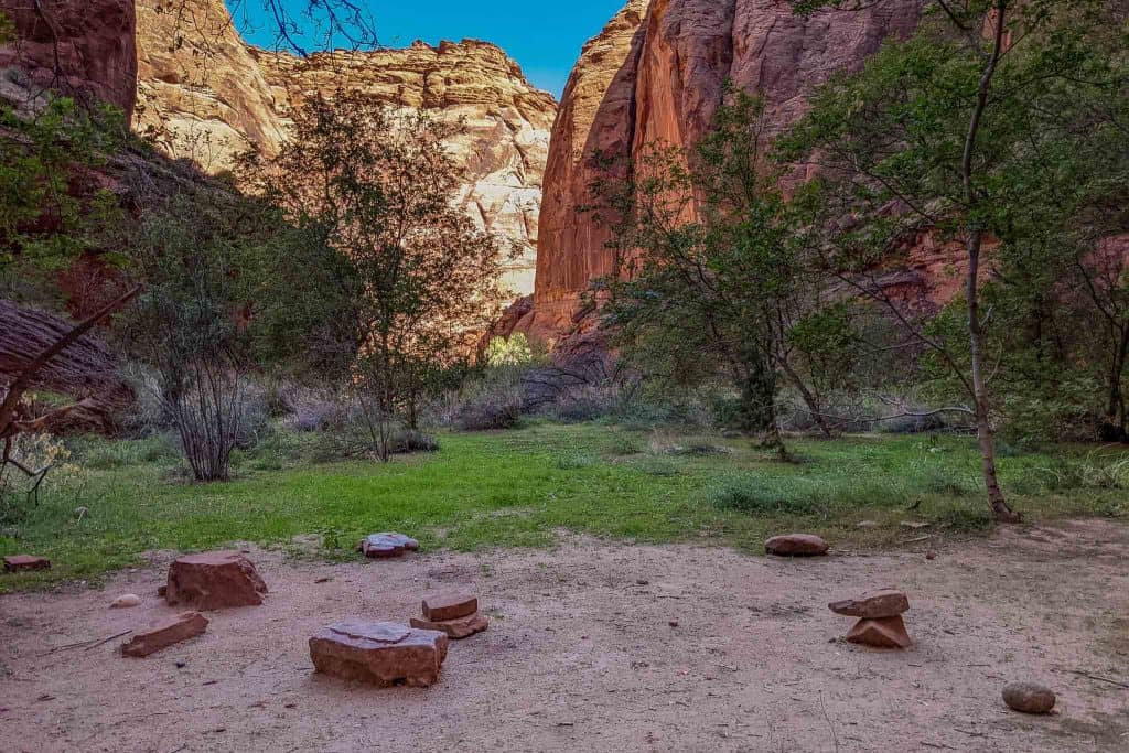
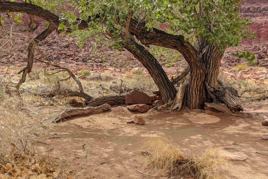
The canyon will open up significantly, and there will be a large amount of vegetation on the left with a sandy hill/ramp/elevated spot you can hike to the top of. This is the first safe campsite encountered when hiking through Buckskin Gulch. There is space for camping up top and a few more spots lower down. I believe there are also a few more camping opportunities just past this on the other side of the stream, but I didn’t go up to investigate.
When you reach the Paria River Confluence, you can either turn left and head out to White House Campground via White House Trail, or you can continue following the Paria River through Paria Canyon toward Lees Ferry.


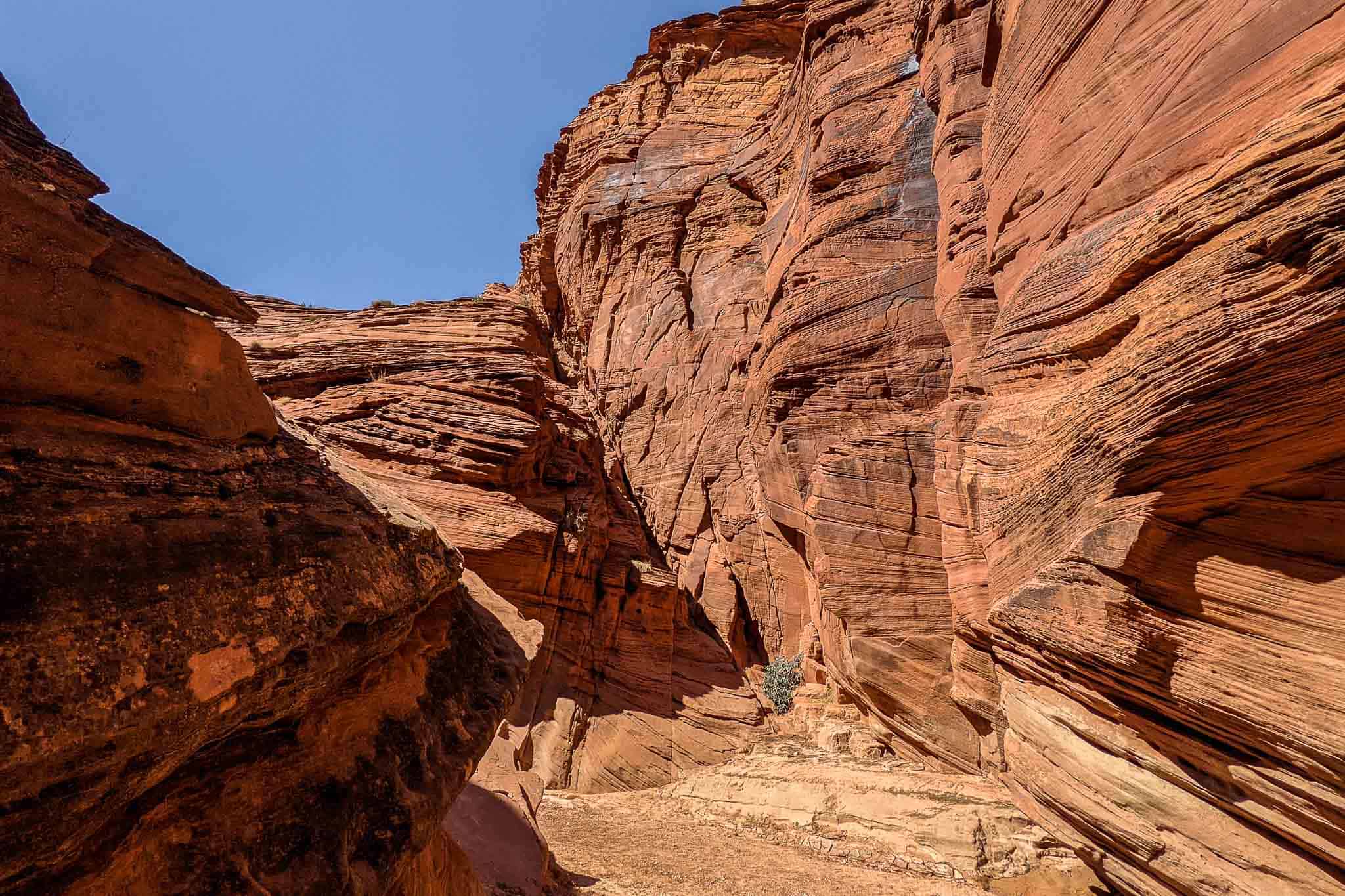
Once you enter Paria Canyon, the canyon walls slowly begin to spread farther apart.
You’ll follow the river at first (the river may be dry for the first several miles), but soon you’ll have the option of cutting up onto sediment deposits around bends as well. You’ll still be crossing the river constantly, so don’t have any expectation of making it out with dry feet, but you will leave behind the chest-deep slot canyon pools of muck.
If you look in the areas on the inside of the river bends, you’ll usually be able to find campsites.
If you’re planning to filter from the springs, pay attention to where they’re marked on the map (the map below shows approximate locations only). The springs are not obvious, marked, or necessarily easy to find; I could only find one.


Eventually, you’ll find yourself hiking up and away from the river (on river right).
The trail stays high for a bit, but not always for long. You’ll alternate between walking in/next to the river or above it. There are typically use trails on the banks if you take the time to look for them, but they’re not always obvious from river level.
The camping opportunities are more plentiful here, but you’ll need to fill up on water at the river if you decide to go this (camping) route. You’ll be crossing the river plenty, so despite potentially walking for long enough for your feet to dry, don’t get too excited.


We never had to walk in the middle of the river instead of being able to follow a trail once we made it this far into the (out of the?) canyon.
Eventually, the canyon walls will have fallen so far away that you’ll forget they’re even there. There’s lots of exposure here, so be ready for the heat if you’re hiking in summer in the middle of the day.
As you grow closer to Lees Ferry, there will be more colonizer trash (this time with informational signs!) on your left (and once on your right!) for you to stop and gaze at. You exit the canyon just above the parking lot where I indicated you leave a car above. You’ll have to walk the road across a bridge before turning to continue on the road up to the lot.
Water Sources
Water is tricky in Buckskin Gulch and Paria Canyon. In Buckskin Gulch, you’ll have plenty of water, but it will mostly be filled with muck and heavy with sediment – not anything you would want to put through a water filter unless you had to. Bringing enough water for the entirety of Buckskin Gulch to the Paria River confluence is recommended.
That said, it is possible that the Paria River will be dry at the confluence and for a few miles beyond (towards Lees Ferry), depending on the year and time of year. I suggest checking for the latest conditions when you pick up your permit.
The springs marked on the map by the Bureau of Land Management are:
- Wall Spring: Approximately 2.2 mi / 3.5 km from the Paria River Confluence on the right side of the canyon. It’s likely better to continue to the easier-to-find (and likely better-flowing) Big Spring
- Big Spring: Approximately 4.9 mi / 7.9 km from the Paria River Confluence on the right side of the canyon. This was the only spring I was able to locate during my hike.
- The Hole: Approximately 11.7 mi / 18.8 km from the Paria River Confluence on the right side of the canyon in a rock alcove.
- Shower Spring: Approximately 14.5 mi / 23.3 km from the Paria River confluence – difficult to find. I’ve been told there is a large camping area on the opposite side of the Paria from Shower Spring. Another hint from a reader is that you’ll walk up the bank into the reeds to a shallow pool with water coming off rocks at the back.
- Last Reliable Spring: Approximately 18.2 mi / 29.3 km from the Paria River confluence
These springs are all marked with an approximate location on the map below.
Moral of the story? Fill up on (a lot of) water whenever you have the chance – especially if you’re hiking in warmer temperatures.

Map
The following is an overview of Buckskin Gulch and Paria Canyon with landmarks. Note that this should be used as a guide and is not necessarily 100% representative of what’s on the ground (i.e., you shouldn’t just blindly try to follow this track).
Conclusion
Hiking Buckskin Gulch and Paria Canyon lived up to all my expectations (except for the part where we got hit with an unexpected thunderstorm).
This hike is remote, prone to flash flooding, has no defined trail (for the most part), and requires that you manage your water (and temperature). It should not be underestimated just because there are no big elevation changes or mountains standing in your way. If you get yourself into trouble out here, there are very few options as far as getting out.
That said, except for the muck pools and the winding river getting old after a dozen miles of each, it’s an awesome area and certainly an adventure worth looking into if you have the proper expectations, weather window, permit, and logistical ability.
I’m always looking to improve upon the information and resources provided in these guides so if you have any questions, suggestions, or updates, please leave a comment below or get in touch.
Resources
- Recreation.gov (Permits)
- Paria Contact Station
- Arizona Strip Field Office (St. George, UT)
- Kanab Field Office (Kanab, UT)
- BLM Paria Canyon
- Paria Canyon-Vermilion Cliffs Wilderness Area (BLM)

Affiliate Disclosure: This page may contain affiliate links, which means I may receive small commissions for purchases made via these links at no additional cost to you. This helps pay the bills and keep the site up and running. Thank you for your support!

I hitchhiked from Lee’s Ferry to the House Rock Valley Road. It took me 6 separate hitches and the better part of 2 days (although it could likely be done in 1 — I spent some time hiking around). Additionally, this was mid-week; I imagine hitching is slightly easier on a weekend. Here were the hitches (estimated time before I got a ride in parenthesis):
– Lee’s Ferry to Marble Canyon/ Hwy 89A (1 hour of road walking & thumbing)
– Marble Canyon to Bitter Springs/ Hwy89A-89 junction (1 hour highway walking – probably should have waited at junction)
– Bitter Springs to Page (20 minutes waiting at junction)
– Page to Wahweap Blvd turnoff to Wahweap Marina (20 minutes waiting at random intersection)
– I ended up highway walking & thumbing to Stateline canyon (45 min), then hiking down the canyon and over to Lone Rock. I camped a bit farther upstream and the next morning I walked up Wiregrass canyon to Wiregrass Canyon Trailhead. This hiking section ended up being quite scenic.
– Walk/ hitchhike from Wiregrass Canyon Trailhead to Big Water (1.5 hour road walking & thumbing)
– Big Water to House Rock Valley Junction (~3 hours waiting across from Big Water Visitor Center)
I probably could have cut out a lot of the time by holding out in Page for someone headed all the way to Kanab. Finding a ride out of Page was easy; but finding a ride from e.g. Big Water, where most cars aren’t slowing down, was quite difficult. I’d be interested to hear from other people who hitched, and if they had an easier time than I did.
All of this is to confirm what Mac said: hitchhiking is definitely possible, but if you’re going to do it you should take it seriously, have plenty of food/ water/ sun protection, and plan on at least a full day of hitching.
What an adventure! Nice job making it all the way!
Thank you for the caltopo link with spring sources. I’ve added them to my map!
Just remember they aren’t exact and that the springs may be dry! Always check with local management beforehand. That said, I hope the map helps!
Everything I’ve read has specifically stated that camping is not allowed in Buckskin until the confluence so you have to do the entirety of Buckskin the first day.
Can you point me to any official source stating that camping is not allowed in Buckskin until the confluence? I am happy to update the information, but cannot find this stated anywhere on Recreation.gov or BLM websites.
The drop at the Boulder Area in Buckskin changes every year. Because of the nature of the flooding, and damage to whatever rope/aid is rigged, one should not expect it to look like what you have pictured. You did a great job describing the conditions. I’ve hiked the area multiple times/years, and the pour-off has been different every time. (The Moqui Steps are always there though!)
Does this mean I just got lucky that the rope/Moqui steps were perfectly in line?
Yup. Sometimes (rarely) there is no rope. For several years, there was a ‘manhole’ opening with a log to scramble down. There was an overhanging pour-off to the right (looking down canyon) with a rope that was the route for several years. To be safe, I’ve always brought a length of line to use if nothing is there. The BLM has been pretty good in recent years in rigging something, but flashfloods can change what they rig.