Wonderland Trail Backpacking Guide
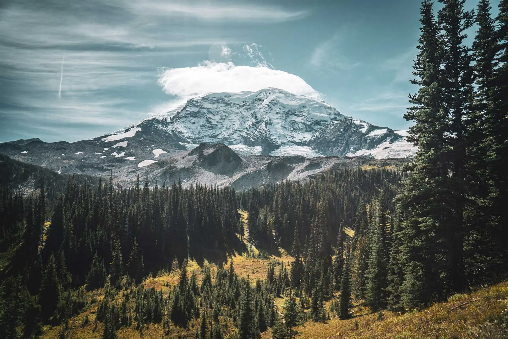
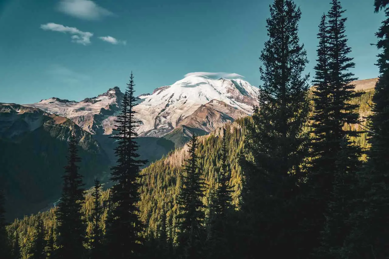
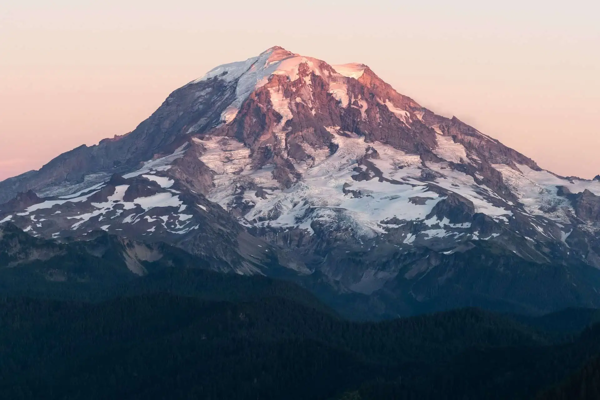
The Wonderland Trail is a 93-mile (150 km) circuit located in Washington’s Mount Rainier National Park with over 23,000 ft / 7,090 m of elevation gain. The trail circumnavigates (goes in a circle around) Mount Rainier, the highest peak in Washington at 14,411 ft / 4,392 m.
It’s a popular trail and requires hikers to apply for a permit ($20 application fee per group of up to 12 people) in advance – more on Wonderland Trail permits, including walk-up permits, below. There are a number of different starting points for the Wonderland Trail and it can be hiked clockwise or counterclockwise.
If you’re feeling ambitious, the hike can be done in three days (or fewer if you’re truly a beast), but most hikers choose itineraries calling for six to eight days.
Wonderland Trail Basics
- Location: Mount Rainier National Park, Washington, USA
- Length: 93 mi / 150 km
- Type: Circuit
- Officially Recommended Time: 6 to 8 days?
- My Suggested Time: 5 days
- Possible Time: 2 or 3 days
- Most Popular Months: July/August
- Booking Required: Yes*
- Application Cost: $20 (per group)
- Max Group Size: 5 for an individual permit, 12 for group permit (min 6)
- Permit Required: Yes
- Permit Cost: $0 (covered by application cost)
- Mount Rainier Summit Location: 46.852326, -121.760328
- Trailhead Locations (with camping/parking):
- Elevation Gain: 25,293 ft / 7,709 m (although it’s officially reported as 23,000 ft / 7,010 m – the larger number was recorded by my GPS)
- High Point: Panhandle Gap (6,750 ft / 2,060 m)
- Low Point: Ipsut Creek Campground (2,300 ft / 701 m)
- Difficulty: Moderate-Strenuous
*More on permits (including how to hike the Wonderland Trail without a permit) below.


How to get to the Wonderland Trail
The only way to reach the Wonderland Trail is by car. There are no public transportation options for getting to Mount Rainier National Park. The closest major cities are Seattle, Tacoma, and Yakima in Washington or Portland, Oregon.
- Accessible via public transportation: No
- Trailhead parking: Yes
- Trailhead coordinates (with parking): Longmire (map), Cougar Rock Campground (map), Reflection Lake (map), Box Canyon (map), White River Campground (map), Sunrise Visitor Center (map), Mowich Lake Campground (map)
BY CAR: To get to Mount Rainier National Park via car, you must pay an entry fee of $30 (per vehicle, not per person). If you’ve got your own car and frequent the national parks, you should probably get an America the Beautiful National Parks Pass if you don’t already have one (unlimited entry to all national parks for a year). All of the trailheads listed above have nicely paved roads leading to them, except Mowich Lake Campground, which requires you to drive 16 mi / 26 km down an unpaved road (it’s not that rough – no 4WD or high-clearance vehicle is needed). You can check the status of the park’s roads here.
BY PUBLIC TRANSPORTATION: Unfortunately, this is not an option. This is America; people here don’t believe in public transportation.
BY PRIVATE TRANSPORT: If you poke around the internet, I am sure you can find (actually, not so sure) various companies offering rides to/from various trailheads within Mount Rainier National Park. If you can get to Tacoma, Washington, it’s about $100 for an Uber to Longmire (or $150 from Seattle) – not terrible if you’re a group of four.
HITCHHIKING: If you can make it out of the city and past the major freeways/highways, I am sure hitchhiking in would be possible. The closer you get to the park, the easier (presumably) it will be to score a ride. Hitchhiking in Washington is illegal on freeways but not on the on-ramps (but don’t quote me on this). If you walk into the park (past a checkpoint), there is a “per person” fee of $15 (this applies to bicycles as well). It’s best to get a hitch that’s driving into the park (you won’t cost them anything extra for being in the car). That said, hitchhiking is technically illegal within Mount Rainier National Park, but I would be surprised if a ranger gave you trouble for hitchhiking somewhere safe and out of the road.
Notes on the trail
- The Wonderland Trail can be hiked clockwise or counterclockwise. I hiked it counterclockwise, but the most popular route is clockwise. Which way should you hike it? Honestly, I don’t think it matters.
- Clockwise is the more popular way to hike the Wonderland Trail (but as I said, it doesn’t matter which way you go).
- Longmire is the most popular starting point on the Wonderland Trail. Here, you will find a ranger station, a small store (with mostly souvenirs), and a hotel.
- I began my hike at Mowich Lake Campground which features a 16 mi / 26 km drive down an unpaved road, pit toilets, picnic tables, and trash cans.
- The most popular time for hiking the Wonderland Trail is from mid-July through mid-September. The earlier you go, the more potential there is for snow there is; the later you go, the more potential for cold.
- July and August are Mount Rainier National Park’s driest and warmest months.


Wonderland Trail Weather
Washington and the Pacific Northwest are notorious for rain. The permanent glaciers surrounding Mount Rainier (which, hopefully, you will see plenty of during your time on the Wonderland Trail) are a testament to this.
July and August are the driest months of the year at Mount Rainier and are therefore also the most popular months to hike the Wonderland Trail. June and September are also relatively dry, at least compared to the rest of the year, but you can also expect slightly lower temperatures during these months.
I hiked the Wonderland Trail over three days in September and had one day of rain, one day of clouds, and one beautiful day of the most glorious sun.


Wonderland Trail Permits
“How do I get a Wonderland Trail permit?” The first hurdle to a Wonderland Trail hike.
There are four ranger stations where Wonderland Trail permits may be picked up or applied for as a walk-up. They are:
- Longmire Wilderness Information Center (map)
- Paradise Wilderness Information Center (map)
- White River Wilderness Information Center (map)
- Carbon River Ranger Station (map)
NOTE: After September 28, permits are only available at Longmire (daily) or the Jackson Visitor Center at Paradise (weekends only).
Applying Online
You can apply online for the Wonderland Trail advance-reservation lottery beginning in late February each year on Recreation.gov. Two-thirds of permits are distributed via the advance-registration lottery and subsequent online general sale.
Spots on the Wonderland Trail fill up quickly, and by April, the park generally stops accepting permit applications (for the Wonderland Trail). Applications are processed in random order. The cost for entering the lottery is $6, and the cost for a permit (if you’re awarded one) is an additional $20.
Walk-Up Permits
One-third of the wilderness permits for Mount Rainier National Park are reserved for in-person walk-ups.
These permits can be issued the same day as your trip’s start date or one day before – no earlier. Wonderland Trail walk-up permits are available on a first-come, first-served basis at each of the four ranger stations.
Also, if you plan on hiking the Wonderland Trail beginning after September 28, you must get a walk-up permit (first come, first served).
Tips for Getting a Permit
You can do a few things to increase your chances of getting a Wonderland Trail permit.
- Check the number of sites you plan to stay at for each backcountry campsite. Some campsites only have two or three individual sites, which can hurt your chances.
- If possible, incorporate the three frontcountry campgrounds (Mowich Lake, Cougar Rock, and White River) into your itinerary. These campgrounds have space allotted for backpackers, and, in the worst case, you can always pay for a site at Cougar Rock or White River.
- The shorter your Wonderland Trail itinerary, the better your odds are of getting a permit (fewer nights competing for spots at a campsite).
- Remember that there are a handful of campsites you can stay at located off the Wonderland Trail as well (under 2 mi / 3.2 km). Getting to/from one of these nearby campsites may be worth the extra legwork if it means getting a permit for the start/end day you want.
- For walk-up permits, be flexible with your itinerary – if just one campsite you’re hoping to stay at is full your entire itinerary will be rejected. Have multiple plans ready when attempting to get a walk-up permit.
- If you’re hoping for a walk-up permit, start your trip mid-week to avoid competing with weekend backpackers also hoping for a walk-up permit.
- For walk-up permits, remember that unclaimed Wonderland Trail permits are canceled at 10 am the day they’re scheduled to start, so don’t give up hope if there were no permits available when the ranger station opened.
Hiking Without a Permit
Lastly, know it’s possible to hike the Wonderland Trail without a permit – you just have to complete the 93-mi / 150-km loop in three days.
The permit people get for the Wonderland Trail allows for camping in the backcountry; there’s no permit needed for hiking during the day. Luckily, there are three frontcountry campsites spaced fairly evenly around the Wonderland Trail: Mowich Lake Campground, Cougar Rock Campground, and White River Campground. Mowich Lake is a free, primitive campground (pit toilets) with a self-registration booth in the parking lot. Cougar Rock and White River Campgrounds are full-service campgrounds (flushing toilets) with campsite fees of $20 each. Here are the distances between the tree frontcountry campgrounds:
- Cougar Rock Campground clockwise to Mowich Lake Campground: ~36 mi / 58 km
- Mowich Lake Campground clockwise to White River Campground: ~26 mi / 42 km
- White River Campground clockwise to Cougar Rock Campground: ~33 mi / 53 km
All three campgrounds are accessible via car (Mowich Lake Campground requires 16 mi / 26 km of travel down an unpaved road).
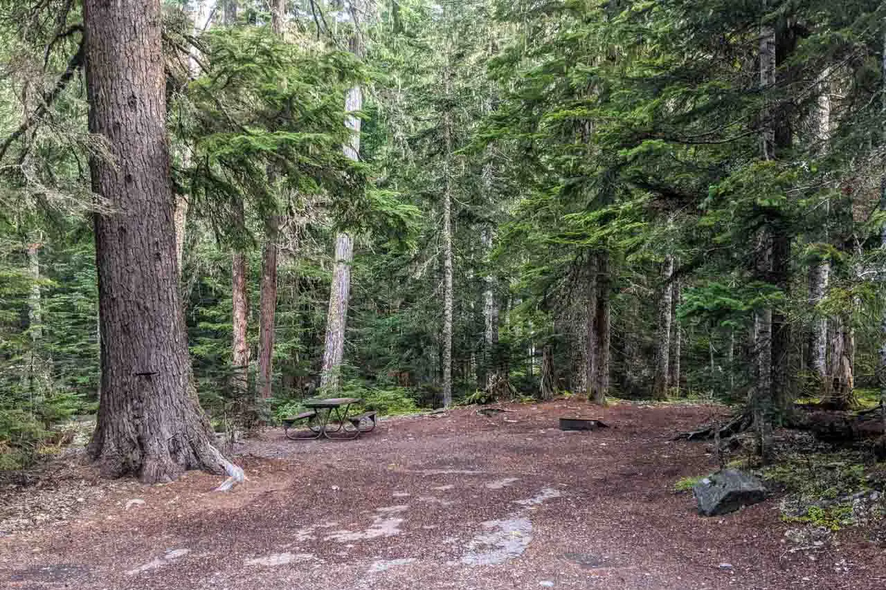


Wonderland Trail Campsites
Camping along the Wonderland Trail is only allowed in one of the 21 designated campsites (18 backcountry and three frontcountry). Individual sites can accommodate up to five people, and group sites can accommodate up to twelve.
Here is a list of all the campsites along the Wonderland Trail with distances to the next campsite (in each direction). Remember, there are a handful of campsites within 2 mi / 3.2 km of the Wonderland Trail that you can also stay at (if you want to be flexible with your itinerary to increase your chances of getting a permit). If you’re going to follow along, you can find the Mount Rainier National Park wilderness planner (including a map with distances) here.
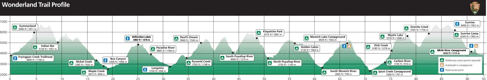
| CAMPSITE | ELEVATION | INDIVIDUAL SITES | GROUP SITE | SHELTER | PATROL CABIN | LOCATION | DISTANCE TO NEXT (CLOCKWISE) | DISTANCE TO NEXT (COUNTERCLOCKWISE) |
|---|---|---|---|---|---|---|---|---|
| Pyramid Creek | 3,765 ft / 1,148 m | 3 | No | No | No | Backcountry | 2 mi / 3.2 km | 4.75 mi / 7.64 km |
| Devil’s Dream | 5,060 ft / 1,542 m | 7 | Yes | No | No | Backcountry | 6.1 mi / 9.82 km | 2 mi / 3.2 km |
| South Puyallup River | 4,000 ft / 1,219 m | 4 | Yes | No | No | Backcountry | 3.7 mi / 5.95 km | 6.1 mi / 9.82 km |
| Klapatche Park | 5,515 ft / 1,681 m | 4 | No | No | No | Backcountry | 2.8 mi / 4.51 km | 3.7 mi / 5.95 km |
| North Puyallup River | 3,750 ft / 1,143 m | 3 | Yes | No | No | Backcountry | 5 mi / 8.05 km | 2.8 mi / 4.51 km |
| Golden Lakes | 5,130 ft / 1,564 m | 5 | Yes | No | Yes | Backcountry | 6.8 mi / 10.94 km | 5 mi / 8.05 km |
| South Mowich River | 2,605 ft / 794 m | 3 | Yes | Yes | No | Backcountry | 3.4 mi / 5.47 km | 6.8 mi / 10.94 km |
| Mowich Lake Campground | 4,929 ft / 1,502 m | — | Yes | No | Yes | Frontcountry | 5.6 mi / 9.01 km | 3.4 mi / 5.47 km |
| Ipsut Creek Campground | 2,330 ft / 710 m | 12 | Yes | No | No | Backcountry | 3.1 mi / 4.99 km | 5.6 mi / 9.01 km |
| Carbon River | 3,195 ft / 974 m | 4 | Yes | No | No | Backcountry | 1.1 mi / 1.77 km | 3.1 mi / 4.99 km |
| Dick Creek | 4,185 ft / 1,276 m | 2 | No | No | No | Backcountry | 3.8 mi / 6.12 km | 1.1 mi / 1.77 km |
| Mystic Camp | 5,570 ft / 1,698 m | 7 | Yes | No | Yes | Backcountry | 5.5 mi / 8.85 km | 3.8 mi / 6.12 km |
| Granite Creek | 5,765 ft / 1,757 m | 3 | Yes | No | No | Backcountry | 5.1 mi / 8.21 km | 5.5 mi / 8.85 km |
| Sunrise Camp | 6,245 ft / 1,903 m | 8 | Yes (2) | No | No | Backcountry | 2.2 mi / 3.54 km | 5.1 mi / 8.21 km |
| White River Campground | 4,280 ft / 1,305 m | — | Yes | No | No | Frontcountry | 6.7 mi / 10.78 km | 2.2 mi / 3.54 km |
| Summerland | 5,940 ft / 1,811 m | 5 | Yes | Yes | No | Backcountry | 4.5 mi / 7.24 km | 6.7 mi / 10.78 km |
| Indian Bar | 5,120 ft / 1,561 m | 4 | Yes | Yes | No | Backcountry | 6.4 mi / 10.3 km | 4.5 mi / 7.24 km |
| Nickel Creek | 3,385 ft / 1,032 m | 3 | Yes | No | No | Backcountry | 3.6 mi / 5.79 km | 6.4 mi / 10.3 km |
| Maple Creek | 2,815 ft / 858 m | 4 | Yes | No | No | Backcountry | 7.4 mi / 11.91 km | 3.6 mi / 5.79 km |
| Paradise River | 3,805 ft / 1,160 m | 3 | Yes | No | No | Backcountry | 1.75 mi / 2.82 km | 7.4 mi / 11.91 km |
| Cougar Rock Campground | 3,180 ft / 969 m | — | Yes | No | No | Frontcountry | 4.75 mi / 7.64 | 1.75 mi / 2.82 km |
Camping in undesignated sites is permitted within cross-country and alpine zones is possible by permit only.


Wonderland Trail Itinerary
How many days does it take to hike the Wonderland Trail? A backcountry permit for Mount Rainier National Park allows for a maximum stay of 14 nights, which means that if you want to complete the Wonderland Trail on a single permit, you will need to average at least 6.64 mi / 10.69 mi per day.
You may choose to hike either clockwise or counterclockwise and you may begin your hike from wherever you would like. Remember, your permit governs where you camp, not where you start/end.
Here are some example itineraries (all going clockwise):
5-Day Itinerary
- Day 1: Cougar Rock Campground to Golden Lakes (21.35 mi / 34.36 km)
- Day 2: Golden Lakes to Ipsut Creek Campground (15.8 mi / 25.43 km)
- Day 3: Ipsut Creek Campground to Sunrise Camp (18.6 mi / 29.93 km)
- Day 4: Sunrise Camp to Nickel Creek (19.8 mi / 31.87 km)
- Day 5: Nickel Creek to Cougar Rock Campground (12.75 mi / 20.52 km)
7-Day Itinerary
- Day 1: Cougar Rock Campground to South Puyallup River (12.85 mi / 20.68 km)
- Day 2: South Puyallup River to Golden Lakes (11.5 mi / 18.51 km)
- Day 3: Golden Lakes to Ipsut Creek (15.8 mi / 25.43 km)
- Day 4: Ipsut Creek to Granite Creek (13.5 mi / 21.73 km)
- Day 5: Granite Creek to Summerland (14 mi / 22.53 km)
- Day 6: Summerland to Nickel Creek (10.9 mi / 17.54 km)
- Day 7: Nickel Creek to Cougar Rock Campground (12.75 mi / 20.52 km)
10-Day Itinerary
- Day 1: Cougar Rock Campground to Devil’s Dream (6.75 mi / 10.86 km)
- Day 2: Devil’s Dream to Klapatche Park (9.8 mi / 15.77 km)
- Day 3: Klapatche Park to Golden Lakes (7.8 mi / 12.55 km)
- Day 4: Golden Lakes to Mowich Lake Campground (10.2 mi / 16.42 km)
- Day 5: Mowich Lake Campground to Dick Creek (9.8 mi / 15.77 km)
- Day 6: Dick Creek to Granite Creek (9.3 mi / 14.97 km)
- Day 7: Granite Creek to White River Campground (7.3 mi / 11.75 km)
- Day 8: White River Campground to Indian Bar (11.2 mi / 18.02 km)
- Day 9: Indian Bar to Maple Creek (10 mi / 16.09 km)
- Day 10: Maple Creek to Cougar Rock Campground (9.15 mi / 14.73 km)
As discussed in the permit section above, you can also hike the Wonderland Trail without in permit if it’s done as a three-day trip:
- Day 1: Cougar Rock Campground to Mowich Lake Campground (~36 mi / 58 km)
- Day 2: Mowich Lake Campground to White River Campground (~26 mi / 42 km)
- Day 3: White River Campground to Cougar Rock Campground (~33 mi / 53 km)
Wonderland Trail Gear & Packing List
Most people would probably consider the Wonderland Trail a long-distance backpacking trip, and so it’s generally recommended that you pack appropriately for what could be an adventure of up to 15 days (if you’re really taking advantage of those 14 nights allowed by the permit).
If you don’t know what you should be packing for a trip like this, you probably shouldn’t be hitting the Wonderland Trail, but there are a few things worth highlighting/pointing out, just in case.
- Do you know what is awesome? Maps. You should probably invest in the National Geographic Mount Rainier National Park Trail Map if you want to be really cool.
- You need a shelter (tent) to hike the Wonderland Trail (at least you should have one if you don’t like sleeping in the rain). Although shelters are available at some campsites, most are primitive sites with nothing more than a cleared patch of ground for you to sleep on. I used a Big Agnes Copper Spur 2 Platinum on my hike, and it was the best.
- The chance of rain is high, so you should probably bring appropriate gear for the conditions (for most people, this probably means at least a rain jacket). Check out the Arc’teryx Beta SL for something ultralight (but effective) or the Arc’teryx Beta SL for something more bombproof.
- If you’re hiking in the middle of the summer (i.e., warmer temperatures), you probably want to invest in some repellant as mosquitoes can be bad (I am a big fan of Sawyer Picaridin Spray).
- Carrying a phone? Worried about getting lost? Want to know how far you are from the next campsite or water source? Get the Wonderland Trail App from FarOut Guides, and you (probably) won’t regret it.
If you want more recommendations on backpacking gear, check out my current gear list or gear reviews.


Resupply and Food Caches
Because of the Wonderland Trail’s length (93 mi / 150 km), many hikers elect to resupply at some point during their hikes instead of carrying an ungodly amount of food from the start.
There are four locations where Wonderland Trail hikers can cache food:
- Longmire Wilderness Information Center (map)
- White River Campground food cache container near ranger station (map)
- Sunrise Old Gas Station food cache container (map)
- Mowich Lake Patrol Cabin food cache container (map)
Food caches can be dropped off in-person prior to the beginning of your hike or mailed ahead to the park. Because of rodents (the threat is real, one got into my car at Mowich Lake Campground), all food caches are required to be in a plastic/clearly labeled container.
Cache labels must contain:
- Your name
- The location the cache is being picked up at
- The approximate date the cache is being picked up (if known)
- Your permit number (if known)
Food on the Trail
I’m constantly trying to evolve my backcountry food game (i.e. make healthier decisions) and I think I did a solid job fueling my three-day circuit of the Wonderland Trail. Here are some of my favorite snacks/meals from the trail:
- Fishpeople Wild Alaskan Salmon Jerky
- Joe Chocolates (Coffee + Chocolate)
- Mountain House Fusilli Pasta with Italian Sausage
I’m always looking for new (and especially healthier) backpacking meals and snacks. I’ve found that not eating only chocolate on the trail can really improve my performance (and mood). If you have any suggestions for new foods to try, let me know in the comments!

If you are mailing food ahead to yourself, here are the addresses for each of the locations (NOTE: not all locations accept USPS, UPS, and FedEx – confirm the address and shipping method before sending out your resupply).
Longmire Wilderness Information Center
UPS or FedEx
Mount Rainier National Park
1 NPS Warehouse
Longmire, WA 98397
ATTN: Longmire WIC
White River Campground OR Sunrise Visitor Center
USPS, UPS, or FedEx
Mount Rainier National Park
White River WIC
70002 SR 410 East
Enumclaw, WA 98022
Mowich Lake Patrol Cabin
via UPS or FedEx (PREFERRED)
Mount Rainier National Park
Carbon River Ranger Station
35415 Fairfax Forest Reserve Road East
Carbonado, WA 98323
Mowich Lake Patrol Cabin
via USPS
Mount Rainier National Park
Carbon River Ranger Station
P.O. Box 423
Wilkeson, WA 98396
Notes on Food Caches
- Fuel (gas cans, HEET, white gas, etc.) cannot be sent in your cache (you aren’t allowed to mail it). Additionally, fuel must be stored separately from (outside of) your cache’s plastic container. You may hand-deliver fuel to one of the four cache locations at the beginning of the section.
- You must mail or hand-deliver your food caches to the locations where you intend to pick them up. The park will not distribute your food caches for you.
- The park suggests mailing your cache so it arrives at least two weeks before you expect to pick it up.


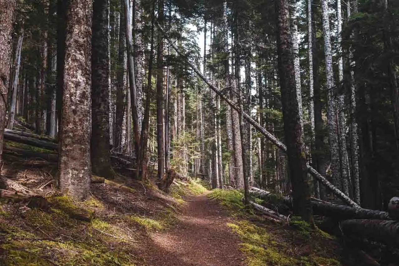
Trail Description
The Wonderland Trail is quite literally, a walk in a park. The Wonderland Trail is not, figuratively a walk in the park.
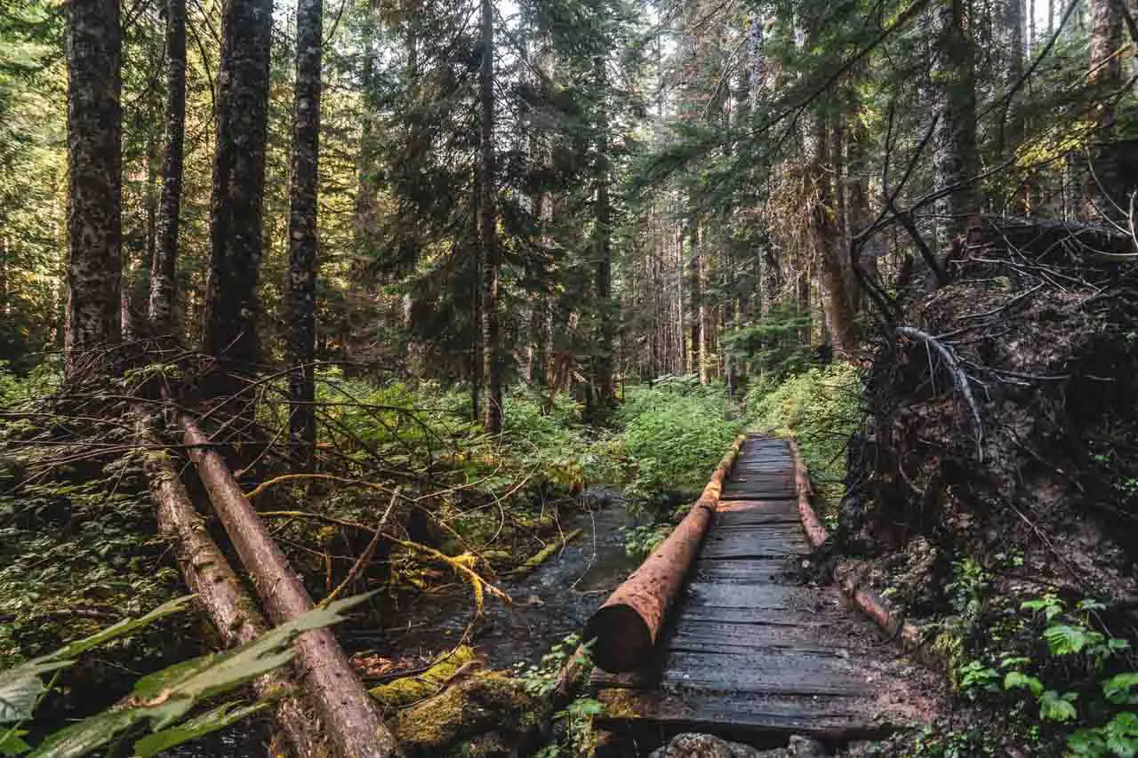
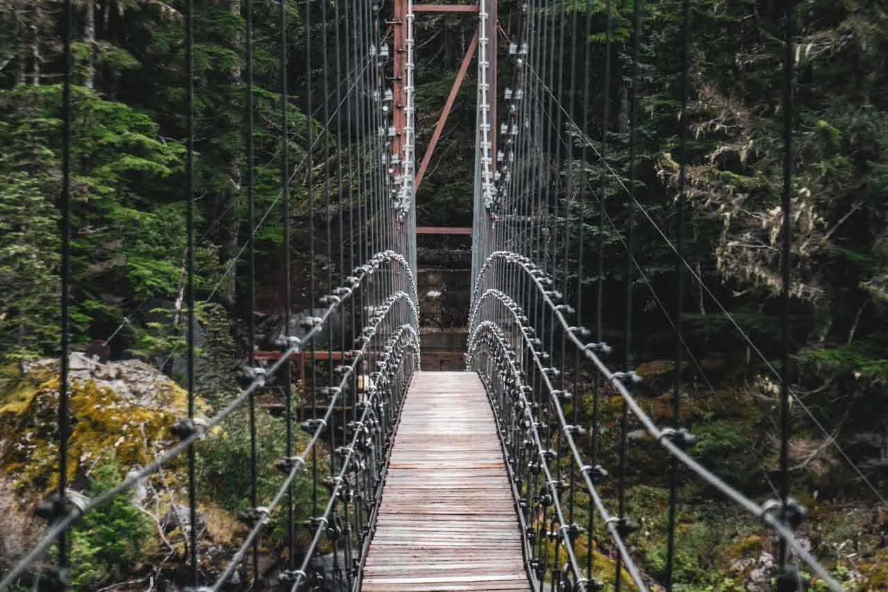
As you would expect from a national park, the physical trail is brilliantly maintained and there is infrastructure for every water crossing. In addition to log crossings (with railings), you’ll find the Tahoma Creek Suspension Bridge between Devil’s Dream and South Puyallup River.
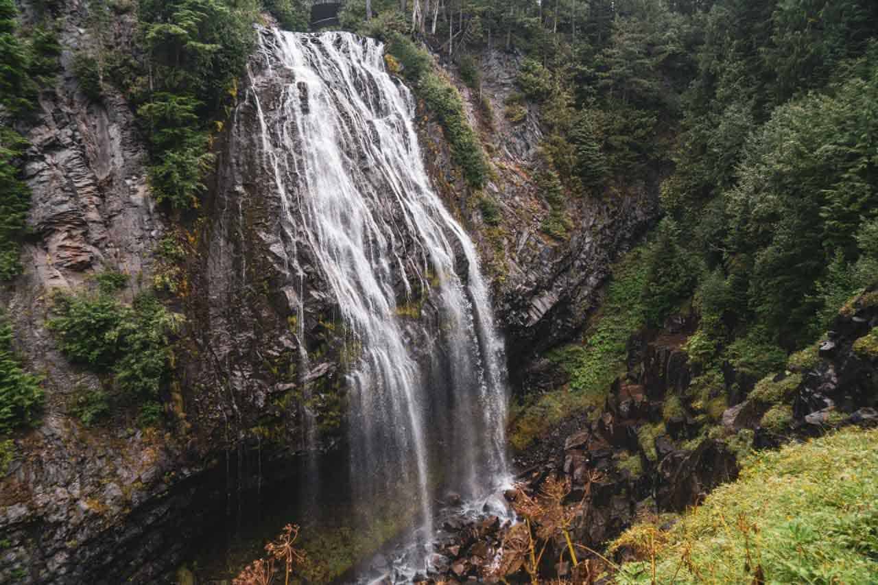
On the southern side of Mount Rainier (between Longmire and Nickel Creek), there are a fair number of waterfalls, the most impressive of which is Narada Falls, a quick 0.1 mi / 160 m detour off the Wonderland Trail (worth the detour).
There is also a cool box canyon next to the road between Snow Creek and Nickel Creek (there are also bathrooms and trash cans here).

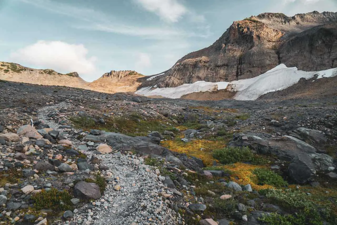
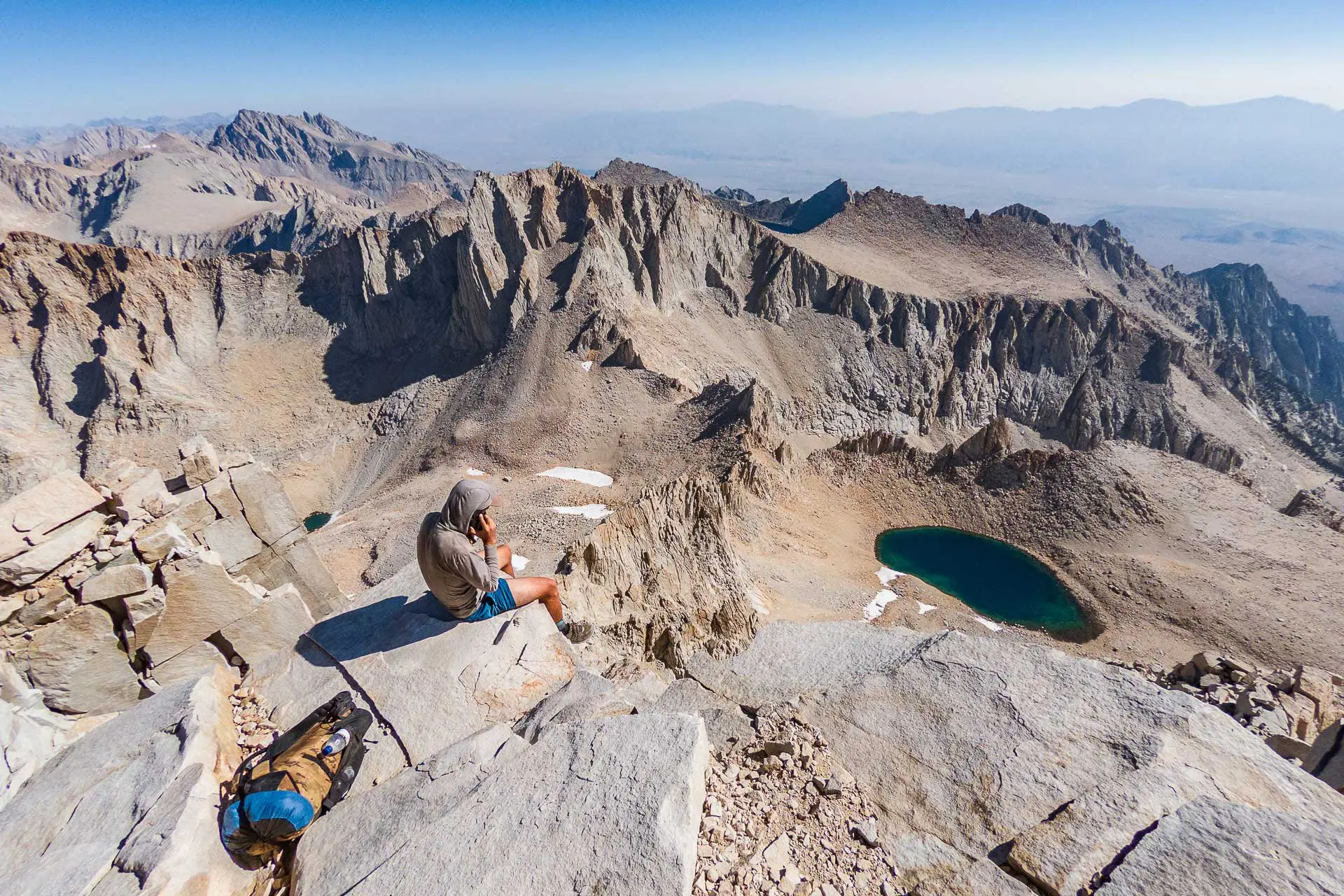
Your time on the Wonderland Trail will be split above and below the tree line – which is 6,500 to 7,500 ft (1,980 to 2,286 m) in Mount Rainier National Park. However, most of the Wonderland Trail lies below 6,000 ft / 1,829 m. The only sections of the trail above this altitude are those between Summerland and Indian Bar and between Granite Creek and Sunrise.
With over 23,000 ft / 7,010 m of elevation gain (although my GPS recorded 25,293 ft / 7,709 m), that works out to just under 250 ft of elevation gain per mile (48 m per km) – assuming you’re climbing for all 93 mi / 150 km. When you cut that distance in half (because you’re going down half the time), the elevation gain per mile averages out to 500 ft per mile (94 m per km). All that math works out, right?
Basically, you just have to know that there are some serious climbs.
Heading clockwise, the Wonderland Trail has five sustained climbs over 2,000 ft / 610 m. Heading counterclockwise, there are six. Maybe this is why people tend to go clockwise? Regardless of which way you decide to hike, you will be doing a lot of climbing (and descending).
The highest point on the Wonderland Trail is Panhandle Gap (6,750 ft / 2,060 m); the lowest point on the Wonderland Trail is Ipsut Creek Campground (2,300 ft / 701 m).
The Spray Park Alternate
Between Mowich Lake Campground and Carbon River Camp there is a popular alternative to the Wonderland Trail via the Spray Park Trail.
The Spray Park Trail is 7.8 mi / 12.6 km long and bypasses 8.5 mi / 13.7 km of the Wonderland Trail – making it 0.7 mi / 1.1 km shorter. Hikers opting to take Spray Park will miss the climb up and over Ipsut Pass (5,118 ft / 1,560 m), and will instead climb to 6,400 ft / 1,951 m on the western slope of Mount Rainier.
Basically, the Spray Park alternate is slightly shorter, adds a fair amount of climbing, and is more scenic than the official Wonderland Trail.
There are also two backcountry campsites located along the Spray Park Trail, Eagle’s Roost and Cataract Valley.
| CAMPSITE | ELEVATION | INDIVIDUAL SITES | GROUP SITE | SHELTER | PATROL CABIN | LOCATION | DISTANCE TO NEXT (CLOCKWISE) | DISTANCE TO NEXT (COUNTERCLOCKWISE) |
|---|---|---|---|---|---|---|---|---|
| Eagle’s Roost | 4,885 ft / 1,489 m | 7 | No | No | No | Backcountry | 4.7 mi / 7.6 km (Cataract Valley) | 1.7 mi / 2.74 km (Mowich Lake CG) |
| Cataract Valley | 4,620 ft / 1,408 m | 6 | Yes | No | No | Backcountry | 1.4 mi / 2.3 km (Carbon River) | 4.7 mi / 7.6 km (Eagle’s Roost) |
Spray Falls (via the Spray Park Trail) is also a popular day hike from Mowich Lake Campground. More on this hike here.
Wonderland Trail Map
This is a GPS track for the Wonderland Trail. This track should be used for illustrative purposes only and should NOT be used for navigation. I’ve marked the ranger stations, trailheads, and points of interest.
Conclusion
The Wonderland Trail is popular for a reason – it’s a beautifully maintained trail around an impressive and imposing mountain (that’s Mount Rainier, in case you’re somehow reading this and don’t already know this). However, getting a permit for a Wonderland Trail hike can be a pain (if you don’t get one via the lottery).
Is the Wonderland Trail worth it? Probably, yeah. Is it the greatest thing ever and should you be crushed if you don’t end up getting a permit? No, it’s certainly not that. And if you are really dead set on hiking it, just head to the park with plenty of time to spare and try for a walk-up permit.
If you don’t end up getting a permit for the Wonderland Trail and hanging out in the park waiting to score a walk-up permit isn’t your idea of a good time, you try for a permit for the Enchantments or opt to hike in North Cascades National Park instead. There’s no shortage of mountains to be explored in Washington (or of Sasquatch to be found).
Hopefully, you found this post useful. I’m always looking to improve my hiking guides (and, more specifically, Wonderland Trail-specific information), if you have any suggestions to improve or update this guide, please leave a comment below or get in touch.


Resources
- Wonderland Trail Permits (Recreation.gov)
- The Wonderland Trail (Mount Rainier National Park)
- Elevation Profile
- Trip Planner (distances between campsites)
- Mount Rainier National Park Map (with distances)
- Mount Rainier National Park Home
- Mount Rainier National Park Map (overview)
- Mount Rainier National Park Permits
- Mount Rainier Road Status
- Mount Rainier Weather
- Cougar Rock Campground Map
- White River Campground Map


Are wag bags required on the Wonderland trail or can you just dig a cat hole?
Wag bags aren’t required for the Wonderland Trail. You’re required to NOT dispose “of human waste within 100 feet of water or within sight of a trail.”
Thank you for sharing. You’ve included a lot of valuable information. My friends and I hope to hike this trail next year. With respect to food, I’ve been taking a new package of baby carrots (first started doing that on the Arizona Trail). Yeah they’re a little heavy but I really looked forward to eating them after lunch and dinner, and sometimes breakfast.
Heavy and not very calorie-dense, but if they make you happy then go for it!
Great information, very well put together! Thanks. I did the Wonderland last year (2019) in September. I didn’t get a permit by lottery, so I did a walk-up. I was very excited to get my permit, and didn’t pay as close attention as I should have. I had two food caches, which I deposited around the park. As I was doing this, I took a better look at my permit. It really wasn’t an optimal itinerary for me, so I decided to try again. I took a cache to the White River ranger station and asked about adjusting my permit. Got a much more appropriate itinerary for me. Yay! My suggestion is to really understand your options and to remain calm (it is hard when you know you want to get started!) and work with the ranger to get what’s right for you. I loved my hike and am planning to go again this year. I live in Washington, so that’s a reasonable possibility. Side note: while the mice were everywhere in camp – seriously – I never had an issue with them getting up the food pole into my bag. Again, thanks so much for your wonderful site. I keep coming back to it for a variety of information (I’ve done half the PCT so far…)
Thanks, Barbara! Hopefully, you get back out this year (and that COVID-19 becomes a thing of the past soon so that we can responsibly get back out into those trailside communities).
DUDE! I’m about to start experimenting with Packit Gourmet for meals, as I’m hearing they are the jam. Also a fan of dried mango, Chomps turkey sticks, and lemon Luna Bars.
Let me know what your favorites are!
Another home-run Mac! These things represent a pile of hours getting to the final production. You covered every detail one needs to plan a trip and set out. It’s always refreshing to see trails, campgrounds, and other infrastructure well-maintained in some of our parks. Unfortunately, I had some sour experiences recently in Crater Lake National Park with rotting, crumbling structures — mostly in campgrounds. Part of that was incumbent upon the mega-contractor Xanterra. Politics aside, there are lots of private companies lobbying and pushing current administration to sub-contract parks trail maintenance (including bridges) and other important infrastructure used by we public. Hmmm, oh well.
Most important, the snacks. Personally, I’ll choose my smoked Copper River sockeye packets over most sports or nutrition bars. The salmon protein re-fuels, and keeps the tank full longer than most sports bar recipes. At least that’s my experience. In places like the Olympics or others with spawning salmon, I take extra care to seal the empty packets inside ziplock bags. The black bears in those locations seem hard-wired to the smell of fish. I’m sure that applies anywhere for that matter. I never had a single issue with bears competing for my salmon by simply keeping things clean, tidy, and out of reach. And that was before canister requirements.
Thank you, @lacorota:disqus! Worked hard on this one. Will be continuing to build on this for the guides to come. Bear canisters in Mount Rainier NP aren’t required, but they are “highly recommended”. The backcountry campsites have poles for hanging food, but I heard reports of mice being able to get up these poles and into food.