Cactus to Clouds (C2C) Hiking Guide
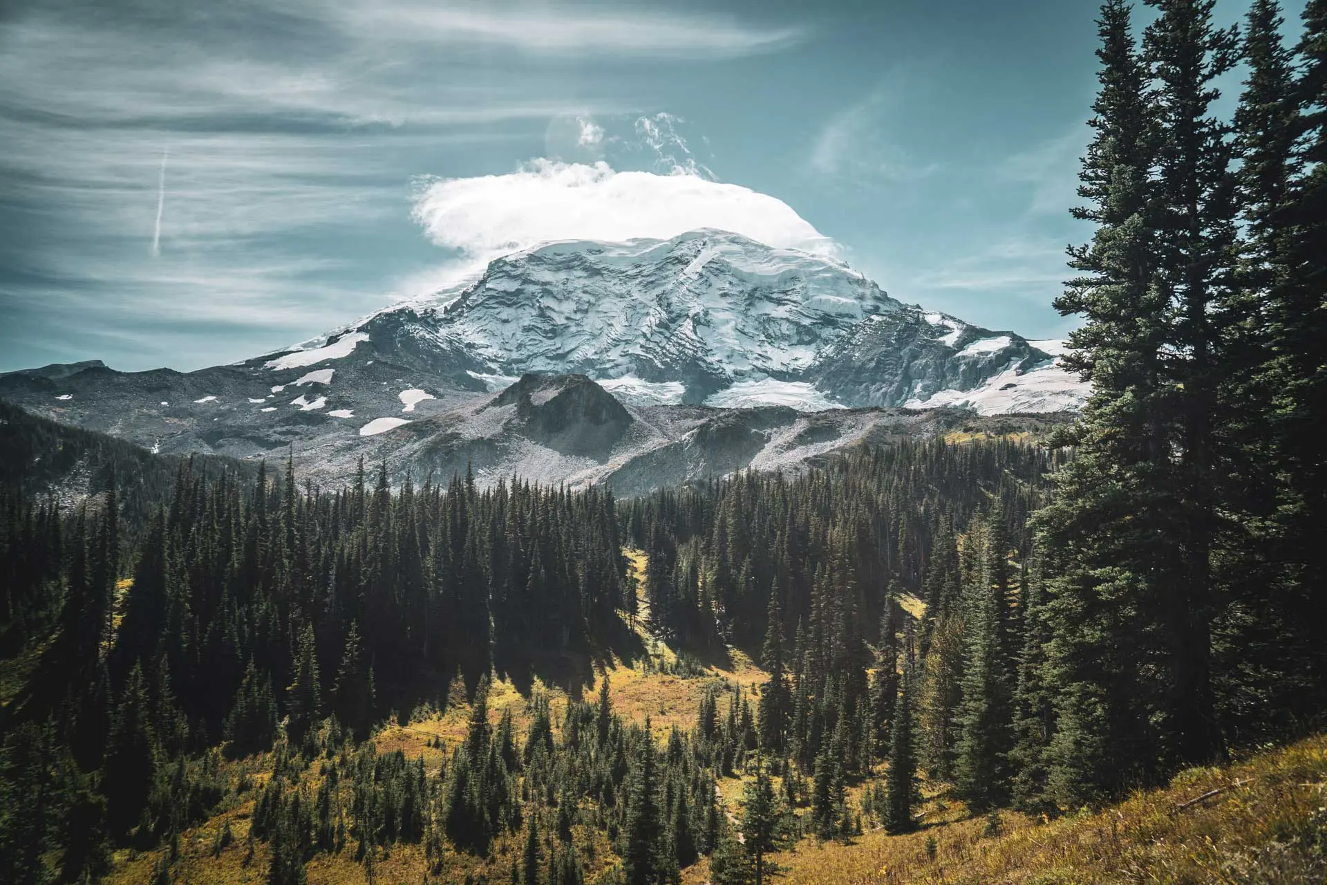
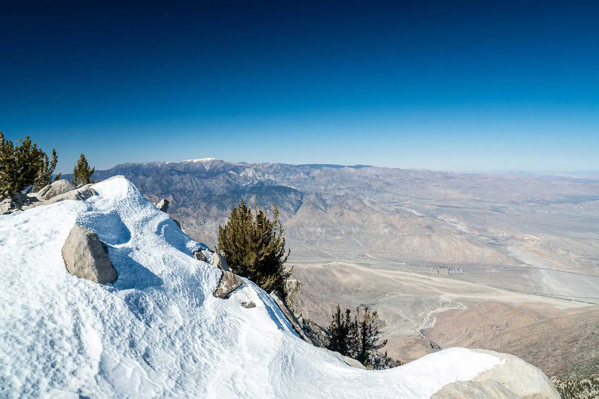
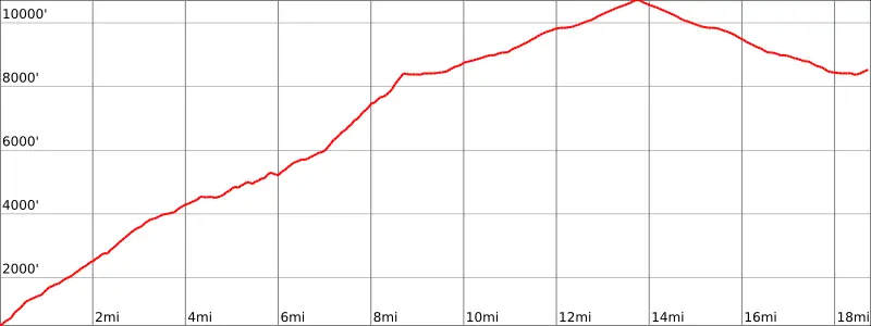
Cactus to Clouds (C2C) is an 18.78 mi / 30.23 km hike from the Palm Springs Art Museum at just 481 ft / 147 m above sea level, up to the 10,833 ft / 3,302 m summit of Mount San Jacinto, and then back down from the summit to the Palm Springs Aerial Tramway.
The hike begins in Santa Rosa and San Jacinto Mountains National Monument and then crosses the boundary into Mount San Jacinto State Park after approximately 6.7 mi / 10.8 km. Cactus to Clouds begins following the Skyline Trail from the trailhead until reaching the Long Valley Ranger Station.
From the ranger station, C2C continues to Wellman Divide (map), intersecting a trail leading up to the peak from Idyllwild. Following this junction, it’s another 2 mi / 3.2 km to the summit of Mount San Jacinto. After reaching the summit, it’s another 5 mi / 8 km back down to the tramway.

C2C Overview
- Location: Mount San Jacinto State Park / Santa Rosa and San Jacinto Mountains National Monument (California, USA)
- Length: 18.78 mi / 30.23 km
- Type: One-way
- Recommended Time: 1-2 days
- Possible Time: 1 day
- Most Popular Months: March/April, October/November
- Max Group Size: 15
- Permit Required: Yes
- Permit Cost: Free
- Dogs Allowed: No
- Trailhead: Palm Springs Art Museum | 33.82528013931493, -116.55055341822606
- End Location: Palm Springs Aerial Tramway | 33.81310878496551, -116.63863280719218
- Low Point: Palm Springs Art Museum (481 ft / 147 m)
- High Point: Mount San Jacinto (10,833 ft / 3,302 m)
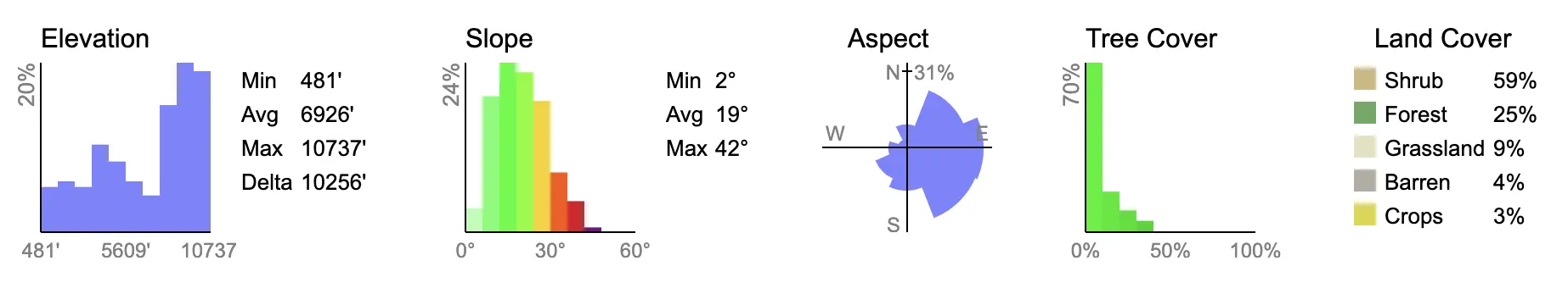
- Elevation Gain: 10,704 ft / 3,263 m
- Elevation Loss: 2,657 ft / 810 m
- Difficulty: Strenuous

How to Get to the Trailhead
The Cactus to Clouds trailhead is located at the Palm Springs Art Museum. There is free street parking at the museum (parking in the museum lot is not allowed). It’s also accessible via public transportation. The other end of C2C will put you at the bottom of the Palm Springs Aerial Tramway, located 6.6 mi / 10.6 km away. If you only have one car, I would recommend leaving it at the museum and then taking a cab or rideshare back to your car from the tramway. More on both locations below.
Palm Springs Art Museum
- Location: Palm Springs Art Museum (map)
- Accessible via public transportation: Yes
- Closest population center: Palm Springs, CA
- Trailhead parking: Yes
- Trailhead facilities: Nearby shops, restaurants, hotels, etc.
- Cost to park: Free
- Parking time limit: None
By Car
It’s easy to get to the start of Cactus to Clouds with a car. Simply drive to the Palm Springs Art Museum, located at 101 N Museum Dr, Palm Springs, CA 92262 (map), and park on either North Museum Drive or North Belardo Road (check the signs to make sure you’re not parking illegally).
Do not park in the parking garage across North Museum Drive from the museum and trailhead; this garage has a 4-hour limit. Also, do not park in the Palm Springs Art Museum parking lot (where the trailhead is); it’s expressly prohibited. Park on the street.
Note the Museum Trailhead (where you begin C2C) is the start of the Skyline Trail (which comprises the first stage of C2C up to Long Valley).
By Public Transportation
The Sunline bus system connects the trailhead to the greater Palm Springs area. Routes 1, 2, and 4 all have stops near the trailhead.
Cities with access to the Sunline Bus System include Desert Hot Springs, Desert Edge, Cathedral City, Thousand Palms, Rancho Mirage, Palm Desert, Bermuda Dunes, Indian Wells, La Quinta, Indio, Coachella, Thermal, Mecca, Oasis, and North Shore. Additionally, Route 10, the commuter link, serves an area that stretches as far as Beaumont and San Bernardino.
An adult fare is $1 ($6 if taking the commuter link), the youth fare (5-17 years) is $0.85 ($6 for a commuter fare), and a senior fare (60+) is $0.50 ($4 for a commuter fare).
By Hitchhiking
Because the trailhead is located in an urban area (Downtown Palm Springs), you’re unlikely to be able to get a ride here hitchhiking. I would look into the bus if you don’t have a vehicle or anyone willing to drop you off.
Palm Springs Aerial Tramway
- Location: Palm Springs Aerial Tramway (map)
- Accessible via public transportation: No
- Closest population center: Palm Springs, CA
- Trailhead parking: Yes
- Trailhead facilities:
- Cost to park: $10
- Parking time limit: None
By Car
Definitely, the most practical way to reach the tramway, getting there with a vehicle is simple. The paved Tramway Road leads up to the tramway from N Palm Canyon Drive at the Palm Springs Visitors Center.
Parking at the tramway costs $10. However, parking is free if you’re a resident of the Coachella Valley from Mecca, Thermal, Coachella, Indio, La Quinta, Indian Wells, Palm Desert, Rancho Mirage, Cathedral City, Palm Springs, Thousand Palms, or Desert Hot Springs. Proof of address is required.
By Public Transportation
The Palm Springs Aerial Tramway is not accessible via public transportation. However, you can get close.
The Palm Springs Visitor Center (map) is located along Line 4 of the SunLine bus system and is 3.8 mi / 6.1 km from the Palm Springs Aerial Tramway via Tramway Road.
The Palm Springs Art Museum (the start of Cactus to Clouds) is another 2.8 mi / 4.5 km south of the Palm Springs Visitors Center, making the total distance from the bottom of the tramway to the museum 6.6 mi / 10.6 km.
A cab or a rideshare is probably your best bet if you’re looking to get back to the trailhead from the tramway.
By Hitchhiking
I would guess that you could probably get a ride down the 3.8 mi / 6.1 km to the Visitors Center, but getting back to the museum might be more difficult (if you’re expecting to hitch). That said, you could always walk or catch the bus the remaining 2.8 mi / 4.5 km from the Visitors Center to the museum.
Notes on the hike
- The length of Cactus to Clouds, 18.78 mi / 30.23 km, includes the trip back down to the tramway from Mount San Jacinto. The distance from the Palm Springs Art Museum (the trailhead) to the summit of Mount San Jacinto is 13.8 mi / 22.2 km.
- You can park for free for an indefinite amount of time on the streets adjacent to the Palm Springs Art Museum. You cannot park in the museum parking lot.
- The Palm Springs Aerial Tramway does not take you down to the Palm Springs Art Museum (the start of C2C). The distance from the bottom of the tramway to the start of C2C is 6.7 mi / 10.78 km.
- I would not recommend this hike in the summer without a very early start. Daytime summer temperatures in Palm Springs can reach upward of 122°F / 50°C.
- Fires are prohibited on Cactus to Clouds.
- There are flushing toilets at both the Long Valley Ranger Station and the tramway.
- During winter, the only reliable water is in the bathrooms at Long Valley Ranger Station (be advised that the water here exceeds the Maximum Contaminant Level (MCL) for the disinfection by-product Haloacetic Acid (HAA5) and some people who drink water counting HAA5 in excess of the MCL over many years may have an increased risk of cancer).
- Dispersed camping is not allowed within Mount San Jacinto State Park.
- I’ve seen reports that Cactus to Clouds has the most elevation gain of any trail in the United States. Clearly, there are qualifications to this statement (e.g. the elevation must be in a single push without any significant loss), but I would be interested to know if this is true (if you know for certain, let me know in the comments).


When to Hike: Weather and Conditions
The Cactus to Clouds can be hiked for a large part of the year – as early as May and as late as November depending on snowfall and when the roads to/from the trailheads open. More broadly, the season for the route is probably considered to be July through September.
Shoulder Season Hiking (March/April, October/November): This is when I would suggest (and when I did) a Cactus to Clouds hike. Later in the year might be preferable to earlier in the year to some since snow shouldn’t be an issue (unless there’s been an early snowfall). Remember that the weather at the peak is in an entirely different climate than the start of the hike – nearly vertical miles (~3.2 km) above the desert below.
Summer Hiking (May-September): Summer can begin early in the desert and can last well into what’s officially the fall. Temperatures can reach 122°F / 50°C in Palm Springs at the trailhead, so if you’re planning on completing Cactus to Clouds in the summer, it would behoove you to start very early and to bring a lot of water. There’s no water available on the trail until you reach Long Valley – after the majority of the distance and elevation is behind you. I would avoid Cactus to Clouds during the summer months.
Winter Hiking (December-February): Despite favorable temperatures in the desert during winter, the summit of and slopes below Mount San Jacinto can receive significant snowfall. Depending on the year, this could mean that you will need traction and/or an ice axe, or that you will need serious winter experience to complete the hike from the desert below. There are steep and potentially icy sections of the trail where a fall could be fatal.

Permits
Mount San Jacinto State Park requires permits for both day and overnight users.
Day-use permits are free and can be obtained at Long Valley Ranger Station – near the top of the Palm Springs Aerial Tramway. Permits are also available at Park Headquarters in Idyllwild, but if you are hiking Cactus to Clouds, there’s really no reason for you to go to Idyllwild for your permit.
Camping and Campgrounds
If you are planning on camping, overnight permits for Mount San Jacinto State Park cost $5 and are available at the Long Valley Ranger Station, Park Headquarters in Idyllwild, or by mail (you must print and mail in this form).
Wilderness Camping Permit applications are accepted up to 56 days (8 weeks) in advance and, if mailing your permit request, must be sent at least 14 days before your planned dates. In the summer, campgrounds sometimes fill four or more weeks in advance.
- Round Valley Campground, located on C2C, is open year-round and has 19 primitive sites with a water spigot (can run dry) and vault toilets.
- Tamarack Valley Campground is 0.5 mi / 800 m north of the trail (directly north of Round Valley Campground), is open year-round, and has 8 primitive sites with vault toilets.
- Little Round Valley Campground is 1 mi / 1.6 km west of the summit of Mount San Jacinto (C2C comes up from the east, so you will not pass this campground unless you’re specifically going to it), is open year-round, and has 6 primitive sites with vault toilets.
Dispersed camping is not permitted within Mount San Jacinto State Park.
Itinerary
How many days does it take to hike the Cactus to Clouds? It’s certainly manageable in a day, but you’ll want to start early enough to catch the last tram down or you’ll be stuck up at Long Valley for the night. Or you could hike back down to the museum to complete a Cactus to Clouds to Cactus (C2C2C). Find the hours for the tramway here.
Remember, you pass the tramway on the way up to the summit of San Jacinto, so if it takes you longer than expected to make it up to Long Valley, you can always cut your hike early and head to the tramway instead of the summit.
Alternatively, you can split it into two days by spending the night at one of the campgrounds in Mount San Jacinto State Park. More on camping above. There is no dispersed camping permitted within the State Park.
Gear & Packing List
You can choose to go lightweight with Cactus to Clouds or you can bring an overnight backpacking kit if you’re looking to camp, but there are some essentials that you’ll want regardless of your plan or pace.
- WATER: It should be obvious, but it needs to be said. Bring water – and lots of it. I used an Osprey Raptor 14 Hydration Pack which holds 2.5 liters of water in a bladder and has both side and interior pockets that allow for additional water storage. I brought five liters of water total up the Skyline Trail to Long Valley; I also did this hike in late February (it was by no means hot) and started at three in the morning (that said, I was also hiking C2C2C, but you may want to start early, I encourage you to do so).
- HEADLAMP: It’s very much advised you begin this hike in the dark (and if you’re hiking C2C2C, you’ll probably finish in the dark as well). I carry the BioLite 200 Headlamp because it’s lightweight, compact (can stash it pretty much anywhere), bright, and rechargeable. Carry what you like, but just make sure you’ve got something. The start of the trail can be difficult to follow in the dark.
- TRACTION: There’s a good chance that you’ll encounter some ice or snow on C2C. This is not true for the entire year, but it’s definitely true for some (possibly most) of the year. I was relieved to have had my MICROspikes with me and I would recommend bringing a pair if you’re unsure of conditions when you’re hiking up. Depending on the coverage, you might even want an ice axe or even snowshoes.
- SUNGLASSES: Having started at three in the morning, I forgot my sunglasses – big mistake. I use a pair of polarized Ray-Bans since they make large-frame glasses capable of looking normal on my large head. I also use one of these to make sure I don’t lose or drop my sunglasses. I encourage you to get one for yourself.
- INSULATED JACKET: No matter what time of year you’re hiking the Cactus to Clouds, there’s a good chance that you’re going to want an insulated jacket. Even when it’s blazing hot in the desert below – it can still be chilly at the summit of San Jacinto. My go-to lightweight jacket is the Arc’teryx Cerium LT – lightweight, warm, and not so puffy that I need to take it off immediately after I start hiking.
- WATER FILTER: When you reach Long Valley, there are water sources available to you (in the winter, the only water may be from the taps inside the bathrooms at the ranger station), but you’ll still want to filter your water before drinking it. Bringing a lightweight filter like a Sawyer Squeeze is highly recommended. It might even be a great hike for the Sawyer MINI since you won’t have to filter very often (due to the lack of water sources).
If you want more recommendations on backpacking gear, check out my current gear list or gear reviews.
Route Description
Cactus to Clouds is not in itself an official trail. Instead, it is comprised of a number of trails, beginning with the Skyline Trail leaving the Palm Springs Art Museum. At the start, the trail is relatively well defined, but there are plenty of use trails that have developed over time and the route can seem a bit like a web of trails instead of a single, defined track.
If you’re beginning in the dark, there’s a good chance you’ll get turned around a few times and an even better chance that you don’t stick to what would be considered the “official trail” (if such a thing actually exists). Generally, so long as you’re moving up and aren’t stomping through the bushes, you’re probably going the right way.
The trail is marked (at some points) with white dots and blazes. If you follow these, you’ll do well to keep yourself on the right track. Essentially, if you begin a long and unexpected downhill section all of a sudden, you’re probably going the wrong way. Take it slow and try to avoid simply bushwhacking up – there is a trail to follow.
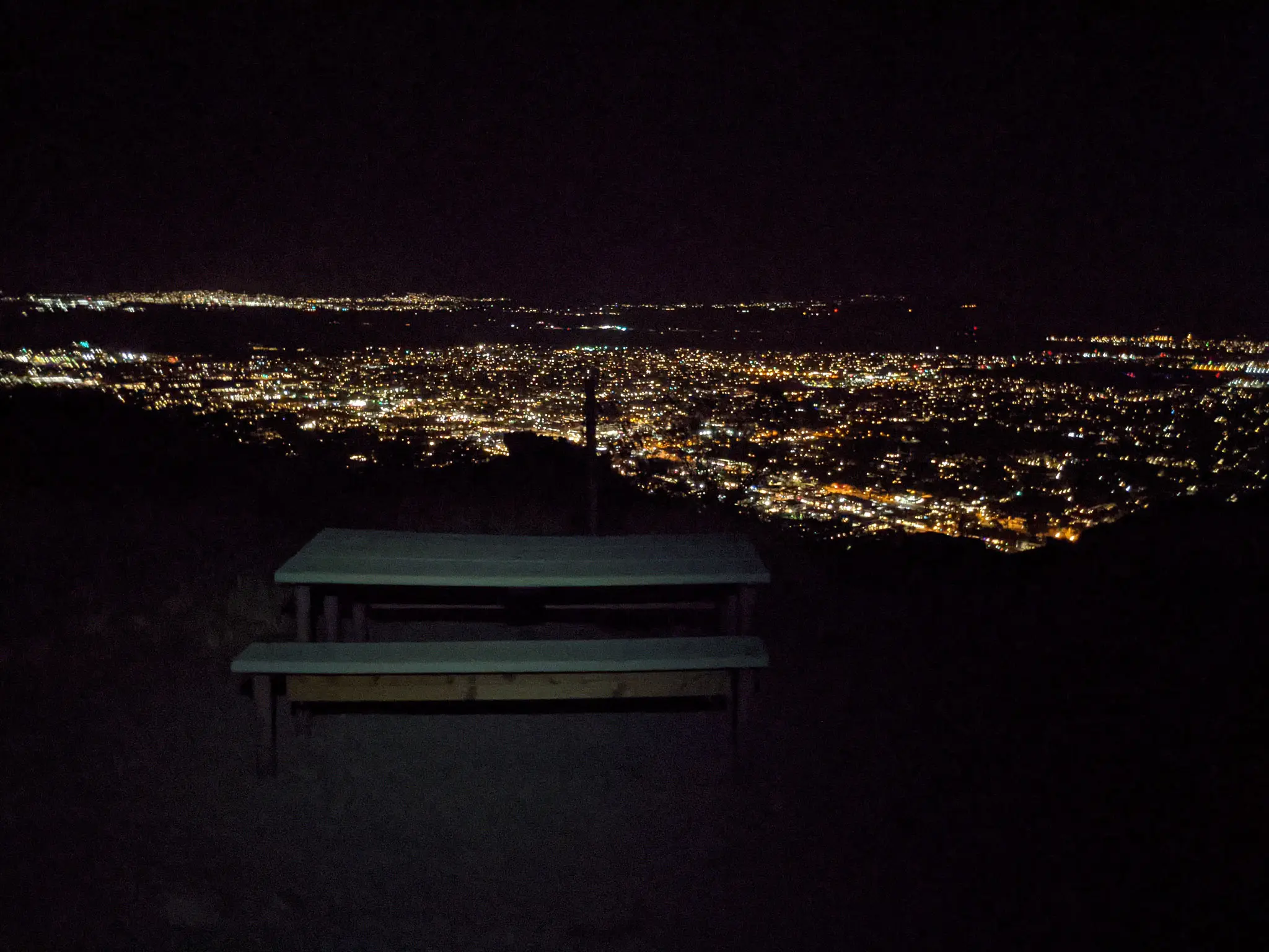
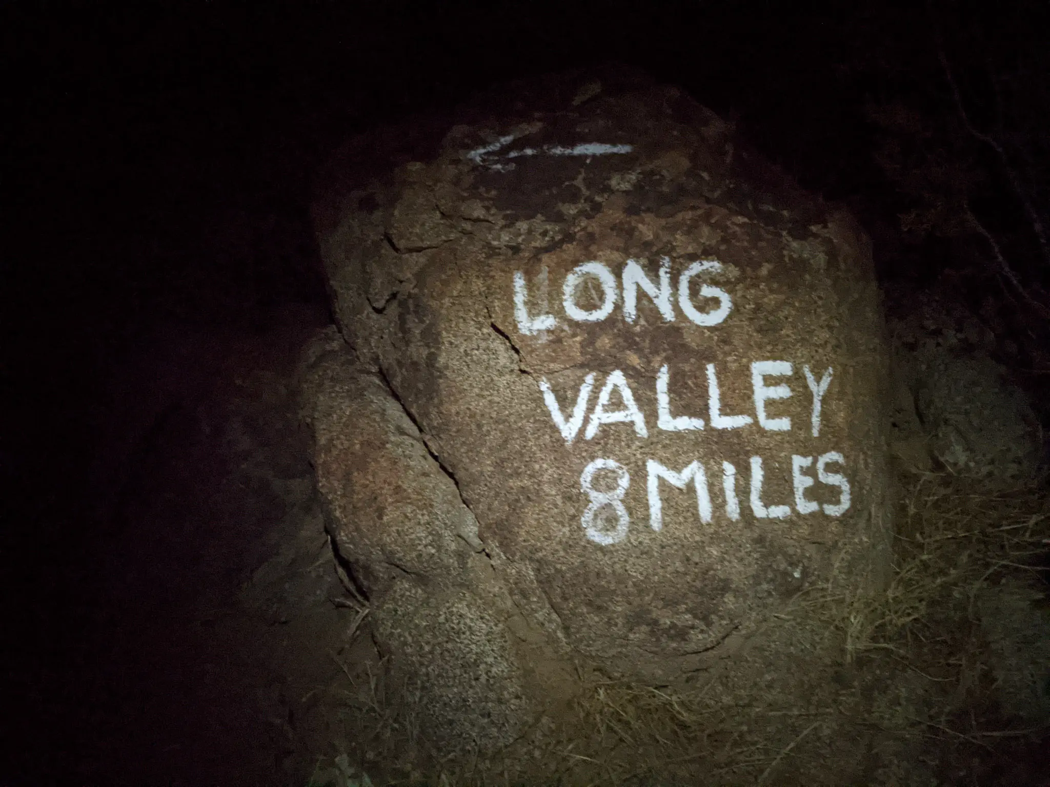
At around the 1 mi / 1.6 km mark, you’ll have climbed nearly 900 ft / 274 m and you’ll pass some picnic tables. Now’s the time to start thinking about how committed you are to the hike. You’ll pass a couple of rocks with messages scrawled across them like “LONG VALLEY 8 MILES” and “NO WATER ON TRAIL UNTIL ROUND VALLEY RANGER STATION 8 MILES 10 HOURS”.

An actual sign (not just paint on rocks) warns of temperatures ranging from -12 to 120°F / -24 to 50°C, rattlesnakes, ticks, scorpions, no water, a disappearing route, and brush (because brush is scary). Basically, if this sign makes you feel like you might be out of your element, then you might be out of your element.
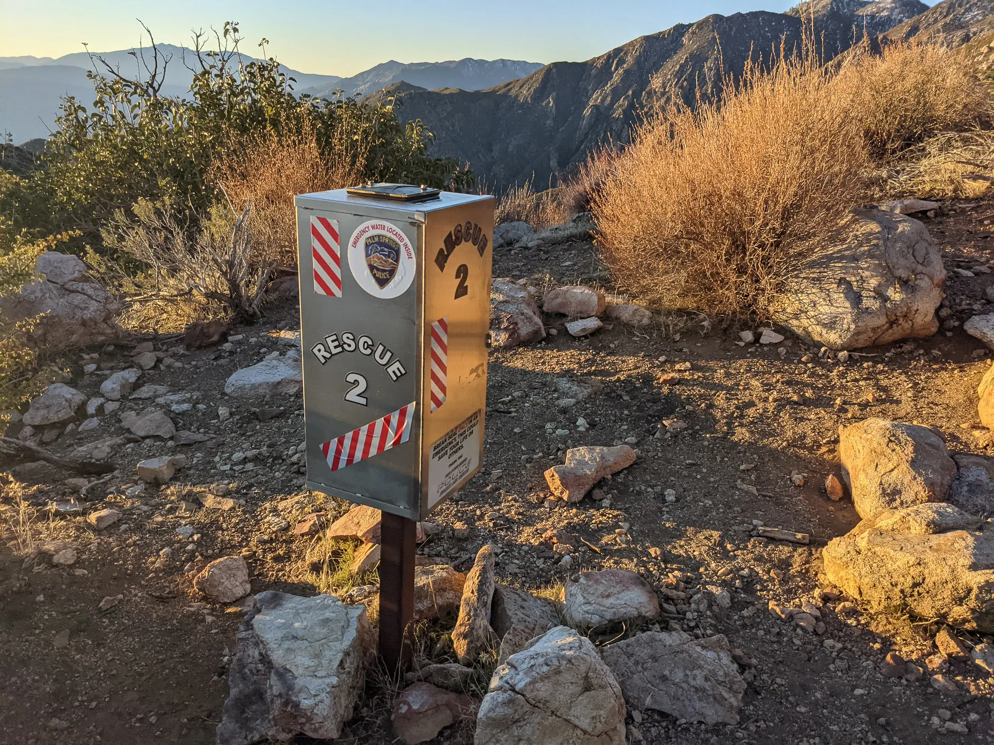
There are two Rescue Boxes located along the trail which are meant to have emergency water, supplies, and a way to contact emergency services in them. However, when I examined the second box (I didn’t look too closely at the first), the seal was broken and there was nothing but trash inside. Essentially don’t rely on these to save you. Yes, you will have cell reception for some of this hike. No, you won’t have reception the entire hike.
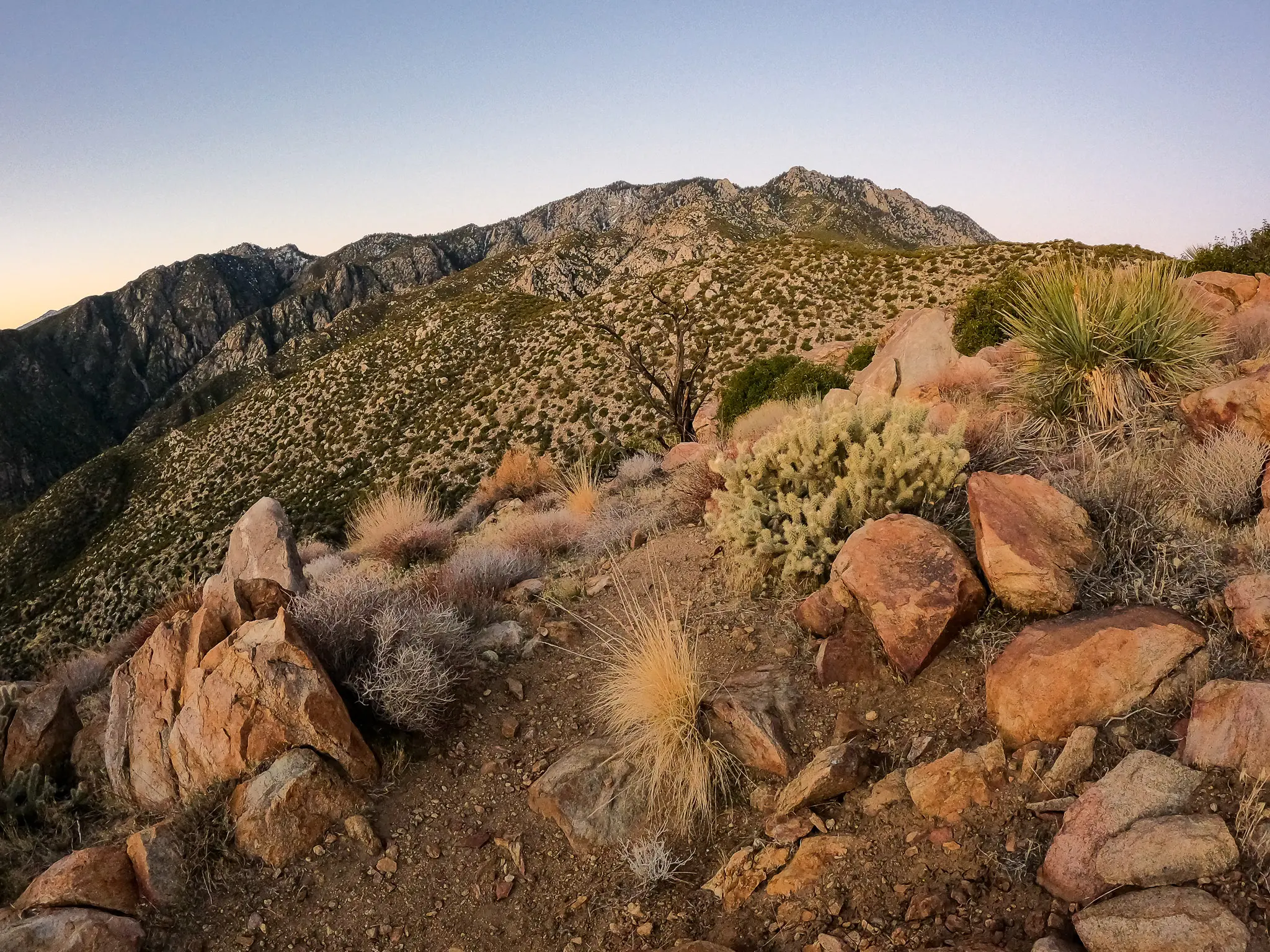
In the daylight, I didn’t find the trail difficult to follow. Continuing up the ridge, the trail passes a marked junction where you can turn left to (apparently) follow an alternate trail back down to the desert below, but other than this, there’s no real way to “make a wrong turn”.
There are a few small sections where the brush to the sides of the trail is encroaching on it a little bit, but the trail is not what I would call overgrown.
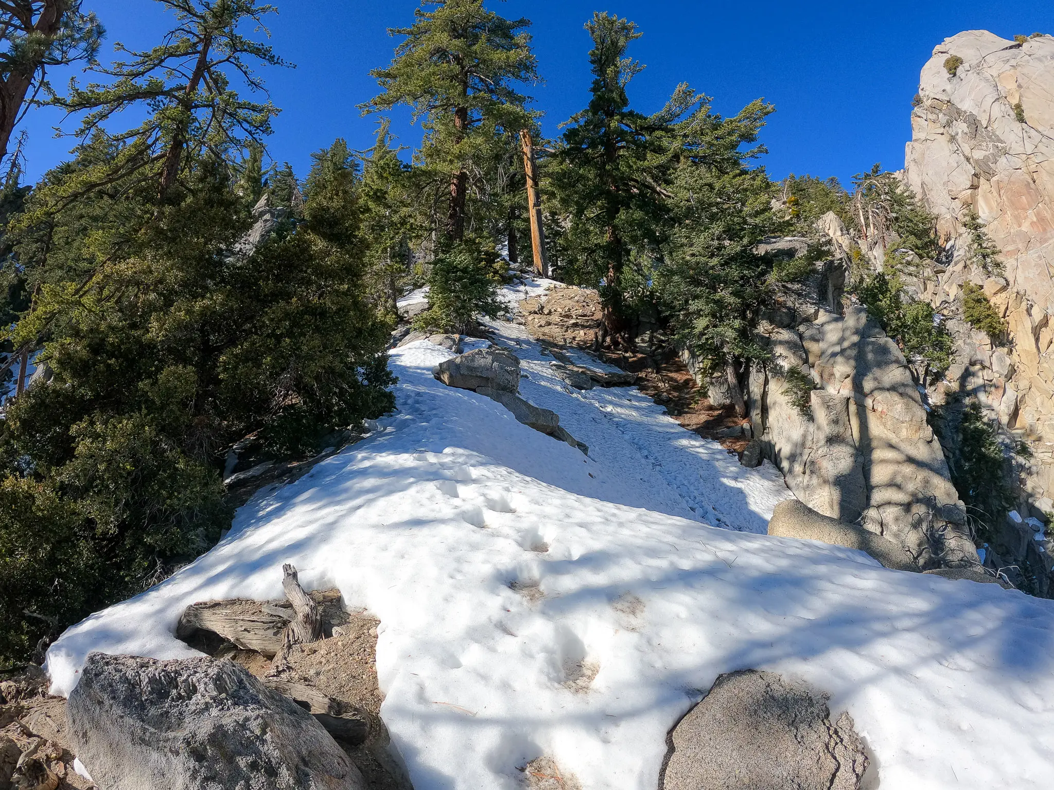
At around 7,500 ft / 2,286 m the trail begins a northwesterly traverse before the final climb (not that the climbing is really broken up at all – you’re pretty much always climbing) up to Long Valley. According to my GPS, the mile leading up to this traverse gained over 1,200 ft / 366 m in elevation. This is where I put on (and was happy I had) my MICROspikes. In photos, this section doesn’t look too intimidating, but a fall on the ice here could result in a long a potentially disastrous fall.
For me, the trail here was snow-covered from here up to Long Valley (where there was a brief dry patch followed by more snow to the summit). I stuck to where I thought the trail was and switchbacked my way up the steeper sections through the snow without much difficulty. That said, if you have little or no experience hiking without a clear trail in front of you and/or you’re uncomfortable hiking through snow/ice without a defined trail, I would avoid hiking C2C when snow is present.

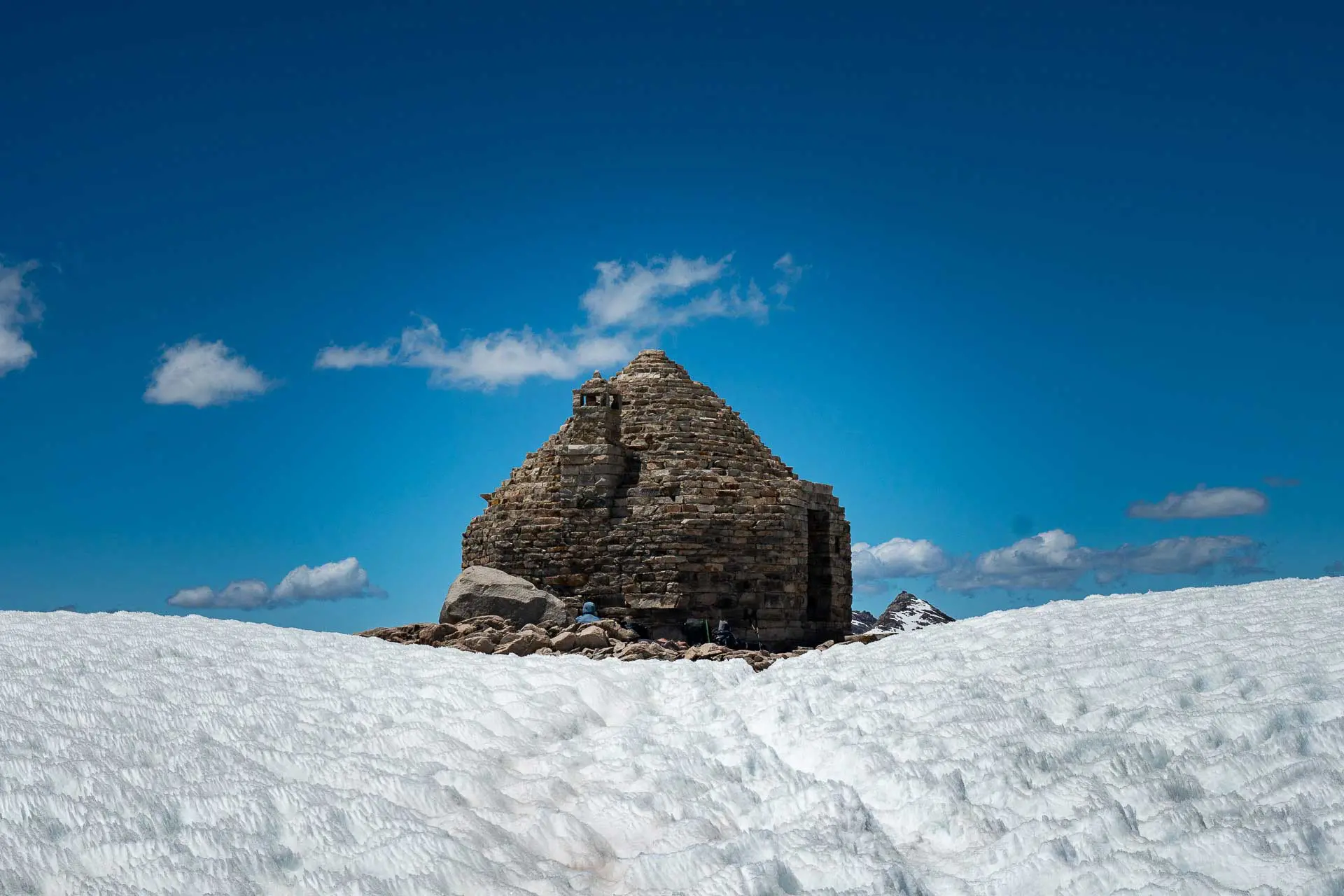
When you reach Long Valley there’s a nice flat section to greet you as you pass picnic benches and infrastructure. It’s like you’ve entered a new world. Stick to the trail and you’ll soon see the ranger station where you’ll have to go and register yourself (for free). This is also where you can refill on water.
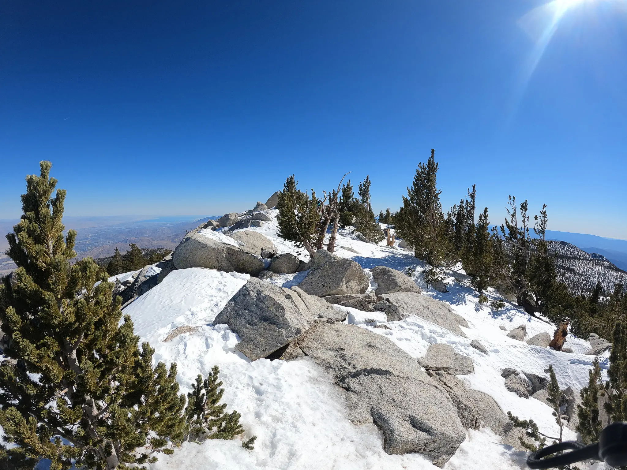
The hiking from here to the summit is much more straightforward than the Skyline Trail (which technically ends in Long Valley) you just hiked up. In snow-free conditions, you shouldn’t have any difficulty following the (now very nicely maintained) trails up to the summit. In the snow, it can be a bit more tricky, but because there’s (generally) so much foot traffic from the tramway that there will probably be some semblance of a path for you to follow.


Just be sure that if you are planning to take the tram down in the afternoon, you allow yourself enough time to make it back to the tram before the last car leaves for the bottom. The bathrooms at the ranger station don’t offer the greatest accommodation. Find the tramway schedule here.
Water Sources
Cactus to Clouds water sources are few in number and are located entirely within Mount San Jacinto State Park after reaching Long Valley. There is no water between the trailhead and Long Valley. This means that you’ll have to carry sufficient water for the first 9.1 mi / 14.7 km of the hike – which climbs nearly 8.400 ft / 2,560 m.
The only reliable, year-round water source on C2C is the taps in the bathrooms at the Long Valley Ranger Station. If you count the tramway (which has restaurants and a cafeteria), I suppose that’s also a reliable source of water (when it’s open – schedule here). Note there is a sign affixed above the bathroom faucets that reads, “be advised that the water here exceeds the Maximum Contaminant Level (MCL) for the disinfection by-product Haloacetic Acid (HAA5) and some people who drink water counting HAA5 in excess of the MCL over many years may have an increased risk of cancer”.
Outside winter conditions, there is also water available via a spigot at Round Valley Campground (although this can sometimes run dry). There are also seasonal water sources located along the trail between the Long Valley Ranger Station and the summit if you prefer collecting your water from the natures instead of a spigot. No matter where you get your water from, if you plan on drinking any water to be found on the hike, it should be filtered.


Cactus to Clouds to Cactus (C2C2C)
Cactus to Clouds to Cactus (C2C2C) is an alternate version of Cactus to Clouds where, as you may have already surmised, you hike up to the summit of San Jacinto and then back the way you came – all the way back to the Palm Springs Art Museum.
I’ll be doing a separate post on this, but essentially everything you need to know can be found in this post. You begin/end at the Palm Springs Art Museum, the total length (to the summit and back) is 27.6 mi / 44.4 km, and you should expect to start (and end) in the dark if you’re attempting to hike it in a day.
If you want to see more on C2C2C, you can check out my Instagram story of the hike.
Map
The following is an overview of Cactus to Clouds with landmarks. Note, this should be used as a guide and it is not necessarily 100% representative of what’s on the ground (i.e. you shouldn’t just be blindly trying to follow this track).
Conclusion
Cactus to Clouds is a unique and challenging hike. Where else can you hike from the desert floor and up to a (sometimes) snow-covered peak over such a relatively short distance? The answer is “probably somewhere, but that doesn’t make C2C and less of an adventure.
That said, this hike should not be underestimated. You can be met with both icy slopes and record-setting heat on C2C and the trail has claimed a number of lives over the years. There are multiple signs in the first couple miles of hiking warning of the dangers of the trail and if they make you nervous, they should.
I’m always looking to improve upon the information and resources provided in these guides so if you have any questions, suggestions, or updates, please leave a comment below or get in touch.
Resources
- Mount San Jacinto State Park (California Department of Parks)
- Palm Springs Aerial Tramway
- Palm Springs Aerial Tramway schedule
- San Jacinto Wilderness (Forest Service)
- Mount San Jacinto Pamphlet (pdf)
- Santa Rosa and San Jacinto Mountains National Monument (BLM)
- Sunline Bus Map
- Long Valley Live Webcam
- San Jacinto Trail Report (for current conditions on San Jacinto)
- Palm Springs Aerial Tramway weather (top station)
- Mount San Jacinto weather
- Palm Springs weather
- Santa Rosa and San Jacinto Mountains National Monument (overview map)
- Long Valley Ranger Station phone: +1 760 327-0222
Affiliate Disclosure: This page may contain affiliate links, which means I may receive small commissions for purchases made via these links at no additional cost to you. This helps to pay the bills and keep the site up and running. Thank you for your support!