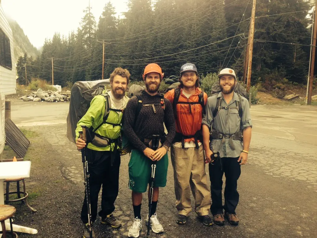
Best Section Hikes of the PCT: Washington
After Northern California and Oregon, both of which are found generally disappointing or unappealing by large swaths of Pacific Crest Trail hikers, we reach a contender for “favorite section of the PCT”: Washington (more specifically, the North Cascades).
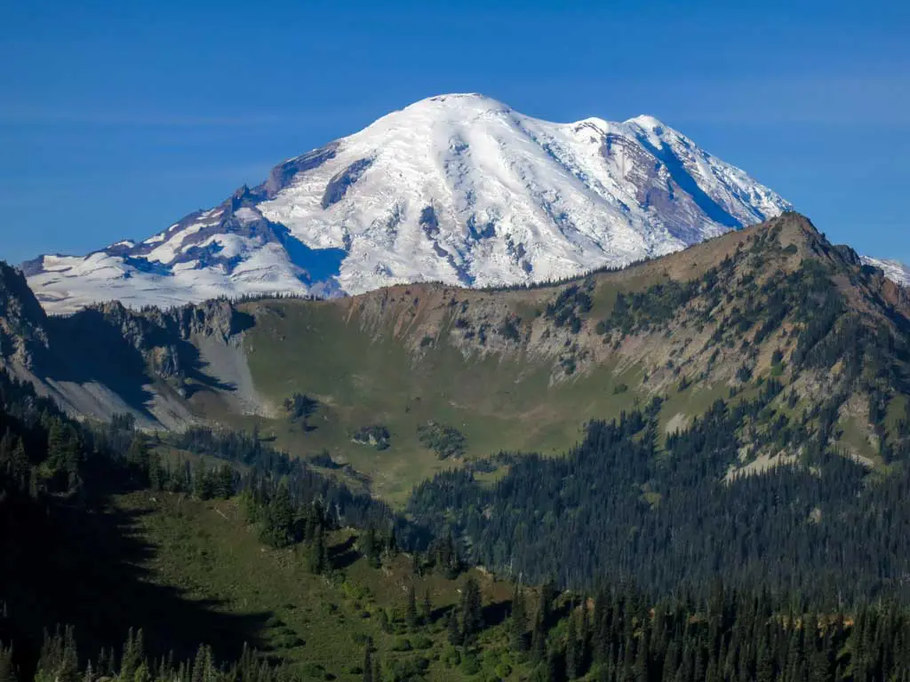
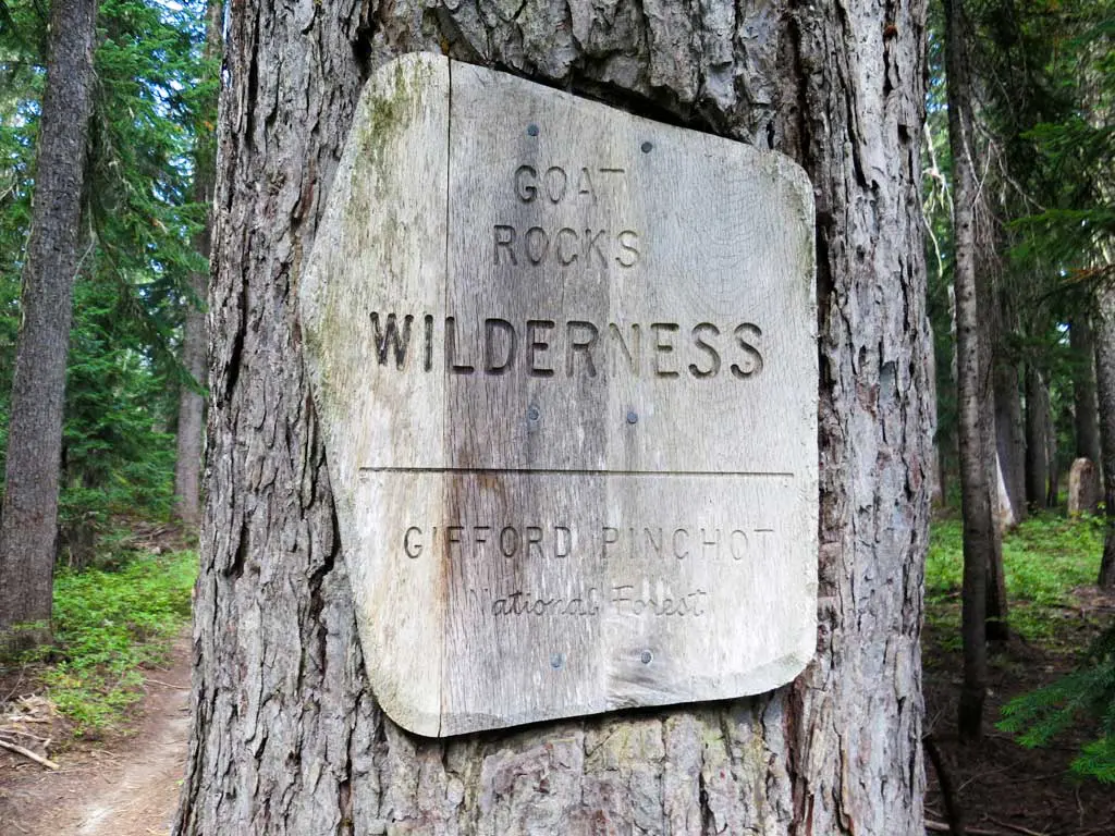
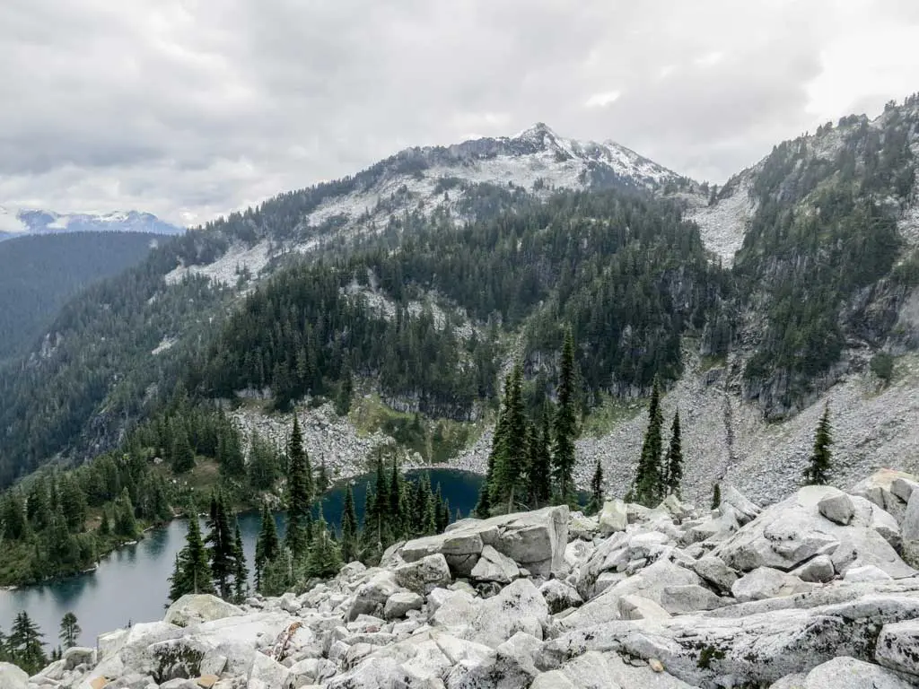
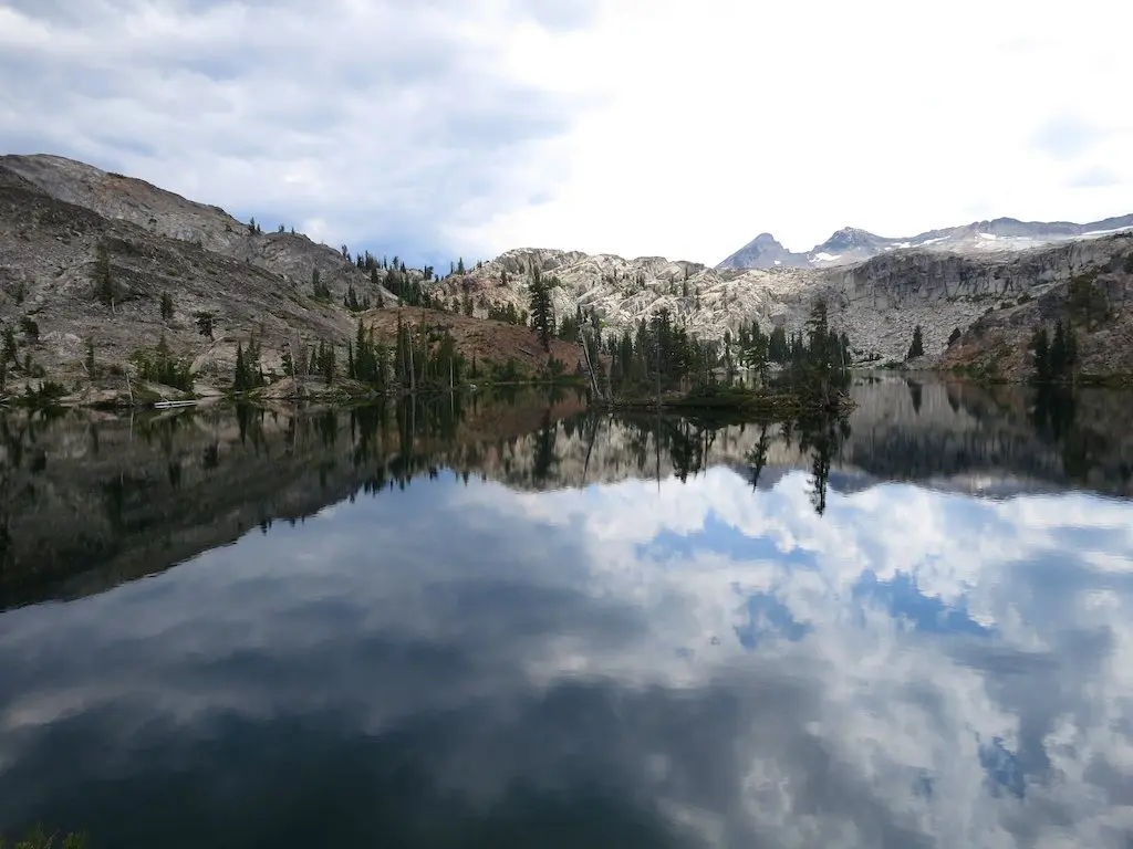
Although not as high as California’s Sierra, what Washington lacks in elevation (the state’s highest point being Lakeview Ridge at 7,126 ft / 2,172 m*), it makes up for with remote trails, spectacular mountainscapes, and deservedly glorified wilderness areas including the Goat Rocks Wilderness, Alpine Lakes Wilderness, Glacier Peak Wilderness, and North Cascades National Park (aka the Stephen Mather Wilderness).
*Some people say that Goat Crest in the Goat Rocks Wilderness may actually have the honor of “highest point on Washington’s PCT,” but the Pacific Crest Trail Association says Lakeview Ridge, so that’s what we’re going with here.
Washington Overview
The overwhelming majority of PCT thru-hikers travel northbound – making Washington the final obstacle in their quest for backcountry glory. However, this also means that many thru-hikers never get a chance to see Washington since not everyone who begins a thru-hike will be able to finish.
Because of this, you’ll generally hear much more about the Sierra than the trail’s northernmost state, making Washington a hidden gem on the PCT (for many hikers not from the Pacific Northwest).
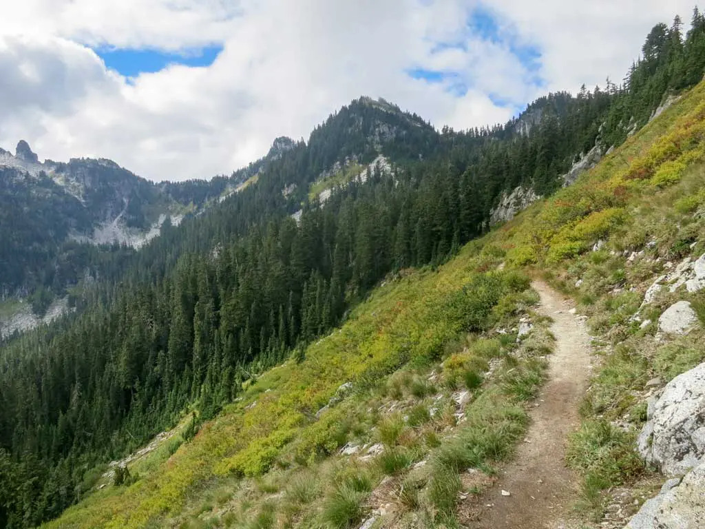
Be advised that the beauty awaiting hikers along Washington’s PCT comes at a price. The trail can be challenging, and it hates maintaining elevation; you will nearly always be climbing or descending (after which point you will almost certainly be doing more of the former).
The Washington PCT section hikes described below are by no means an exhaustive list of routes, but due to the remote nature of much of Washington’s PCT, access can be a pain in the ass if you’re not looking to use a major road crossing as your entry/exit point.
Note: I was conservative on the mileage for many of these hikes and typically did not assume more than 12 mi / 19 km per day. However, if you’re looking for more of a challenge, I’ve included extensions at the end of each section so that you can conquer as much of the PCT as possible. In the event you’re saying, “That’s not conservative!” I’ve also included some ways to shave miles for most of the hikes.
For planning and navigating all of the Pacific Crest Trail section hikes listed below, I encourage you to check out FarOut Guides. They make an excellent app with waypoints, GPS functionality (even without service), distances, side trails, and more.
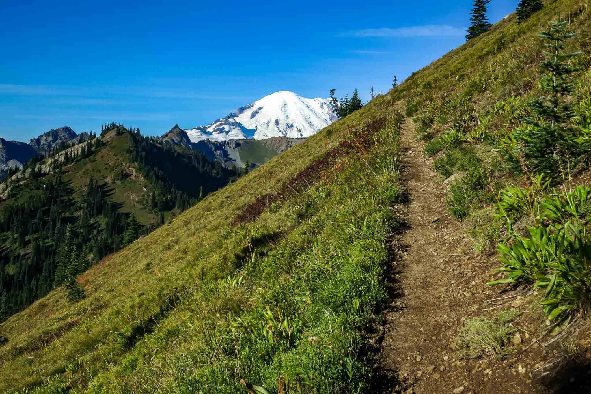
A Weekend: Goat Rocks Wilderness and the Knife’s Edge
Start: White Pass / Highway 12 (PCT 2292.4)
End: White Pass / Highway 12 (PCT 2292.4)
Length: 37.22 mi / 59.9 km
Elevation Gain: +9,113 ft / 2,778 m
Elevation Loss: -9,113 ft / 2,778 m
Note: Unfortunately, I do not have any decent photos of the Knife’s Edge since my own traverse took place in a furious rainstorm with gale-force winds attempting to hurl me off the spine and into the depths below. I hope that you choose to conquer this route in more fortuitous conditions.
This route is longer than the promised 12 mi / 19 km per day (assuming a two-day hike), but it traverses what is perhaps the most well-known piece of Washington PCT: the Knife’s Edge in Goat Rocks Wilderness (so maybe save it for a three-day weekend). If you’ve only got two days and this hike isn’t going to cut it, then check out the alternate weekend hike below.
The hike described here is an out-and-back hike beginning and ending at White Pass along Highway 12 (PCT 2,292.4 – 4,409 ft / 1,344 m). Trailhead parking is available.
Starting out, the trail winds up through a ski resort as you begin an almost 7 mi / 11.3 km uphill stretch from the highway. Upon reaching around 6,600 ft / 2,000 m, the trail takes a turn and begins a 1,500 ft / 457 m descent over 4.5 mi / 7.2 km. After a bit of vertical relief and a rare bit of level terrain, the trail swings back uphill for another 6 mi / 9.7 km climb towards Old Snowy and your goal: the Knife’s Edge.
When you reach the northern end of the Knife’s Edge, you can either follow the PCT or take the Old Snowy Alternate. This short alternate (less than 1 mi / 1.6 km) takes you over Old Snowy and provides even more stunning views of the surrounding mountains (you can make a small loop out of this, so you might as well take one on the way south and the other on your way back towards White Pass).
Once across the Knife’s Edge, you can either choose to camp at an exposed campsite (PCT 2,273.8 – 7,015 ft / 2,138 m) – the closest place past the Knife’s Edge with reasonable camping (and the turnaround point of this hike), or continue 1.7 mi / 2.7 km south to PCT 2,272.1 (6,148 ft / 1,874 m) for a better (and lower) campsite.
Extension
To add another 23.4 mi / 37.7 km to the out and back, then you can continue south 11.7 mi / 18.9 km on the PCT to the Walupt Lake Trail #101 junction (PCT 2262.1 – 4,964 ft / 1,513 m). From here, take the Walupt Lake Trail west for 3.8 mi / 6.1 km to the Walupt Lake Campground (or stop at the campsite just after the junction).
Variation
If you don’t like the idea of an out and back (and you have the necessary transportation or hitching prowess), you can instead hike from White Pass to Walupt Lake or vice versa (see extension above). This route creates a 34 mi / 54.7 km hike with around 6,990 ft / 2,131 m of elevation gain and 7,559 ft / 2,304 m of elevation loss. (Walupt Lake Forest Service website)
Alternate
If you’ve only got two days and 37.22 mi / 59.9 km seems like a bit more than you’re ready to conquer in that time frame, then allow me to suggest an alternate hike on Washington’s PCT: the Kendall Katwalk. This is part of my 4-5 day suggestion, but you can also do it as a short out and back instead of a part of the loop described below. Start from Snoqualmie Pass and head north on the PCT for about six miles to the Katwalk. You can then decide if you want to stop nearby or make the out and back longer by continuing north.
Four or Five Days: Goldmyer Hot Spring – Kendall Katwalk Loop
Start: Snoqualmie Pass (PCT 2390.7)
End: Snoqualmie Pass (PCT 2390.7)
Length: 61.1 mi / 98.3 km
Elevation Gain: +17,323 ft / 5,280 m (clockwise)
Elevation Loss: -15,384 ft / 4,689 m (clockwise)
This may be the best 4 to 5-day Pacific Crest Trail section hike I’ve found thus far.
This route follows the Goldmyer Hot Spring trail, a PCT alternate route, 26.6 mi / 42.8 km north from Snoqualmie Pass to the Dutch Miller Gap Trail #1362 PCT junction (PCT 2425.2 – 3,045 ft / 928 m). Then it picks up the PCT and heads 34.5 mi / 55.5 km south back to Snoqualmie.
What’s more? It’s jam-packed with elevation change, with an average of 535 ft of change per mile (101 m per kilometer).
Not only is this trail nearly a 100% loop (with only .2 mi / 320 m of overlapping trail), but it covers some incredible terrain and one of Washington’s most well-known PCT landmarks: the Kendall Katwalk (yes, it’s spelled with a ‘k’).
The trail described here follows the route clockwise, but there’s no reason you couldn’t also do it counterclockwise (anticlockwise for those of you living across the ocean).
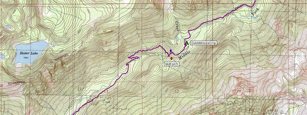
From Highway 90, follow the road 1.4 mi / 2.3 km up to the Snow Lake Trail near the Alpental Ski area. From here, the trail climbs steeply past Snow Lake before plunging down to meet the Snoqualmie River in the valley on the opposite side.
The Goldmyer Hot Spring Alternate is not named so without reason. Eleven miles (17.7 km) into the hike, hikers pass the Goldmyer Hot Springs (website) – a secluded hot spring in the middle of the mountains whose use is restricted to twenty people per day ($15 for day use and $20 to camp).
You are free to pass the hot springs without offering your patronage (as I did), but if you have the time, it’s probably worth checking out (and you should probably make a reservation). Be sure to allow yourself time to reach it before nightfall if you plan on paying a visit.
Which trail to follow in this area can be a bit tricky at points (do I cross the river or not!?), so be sure to have your map handy if you want to ensure a successful meeting with the PCT to complete the loop.
After passing through the Dutch Miller Gap, the trail passes Lake Ivanhoe and descends to meet the PCT at PCT 2425.2 (3,045 ft / 928 m). Head south (turn right) on the PCT and prepare for a 6 mi / 9.6 km climb before an equally long descent and then, as you should come to expect on the PCT, another 6 mi / 9.6 km climb.
Before getting back to Snoqualmie, you’ll have to navigate the Kendall Katwalk—a 150-yard/137-meter-long section of trail that traverses a 50-degree cliff with an 800-foot drop below. It was built in 1976 by blasting open the cliff with dynamite after marking out a path with paint-filled bottles dropped from a helicopter. The cost of the project? An incredible $25.2 million—or $24,000 per foot.
It is best to hit this section in the early morning to avoid crowds of day hikers. Also, be sure to check snow reports; if you want to avoid the stuff, it is typically best to wait until after the second week of July.
A Week: Snoqualmie Pass to Stevens Pass
Start: Snoqualmie Pass (PCT 2390.7)
End: Stevens Pass (PCT 2461.6)
Length: 70.9 mi / 114.1 km
Elevation Gain: +19,133 ft / 5,832 m
Elevation Loss: -18,068 ft / 5,507 m
This hike is a little under the promised 12 mi / 19 km per day average (an extension can be found further on if you’re worried about filling your week).
Why did I choose a shorter hike? Because the PCT in Washington doesn’t run through hugely developed areas, and since I’m attempting to make these hikes accessible (I’m imagining a hitchhiker), trailheads and trail crossings peppered along dirt forest roads buried deep in the mountains aren’t great starting and ending points.
The route I’ve chosen here begins at Snoqualmie Pass and heads north on a remote stretch of trail through the Alpine Lakes Wilderness, passing more than a dozen lakes before reaching Stevens Pass.
Leaving Snoqualmie, you’ll get to cross the PCT/Washington-famous Kendall Katwalk (described in detail in the “weekend hike” above) as you begin a 6 mi / 9.7 km climb into the Alpine Lakes Wilderness. The trail does a bit of up and down before a long descent down to the Waptus River (this is also where the PCT intersects the Goldmyer Hot Spring Alternate – for more on this, check out the 4 to 5-Day Hike above).
After passing the Waptus River and Waptus Lake, the trail climbs past Deer and Deep Lakes before coming to the Cathedral Pass Trail #1345 junction (PCT 2435.3 – 5,527 ft / 1,685 m). Now pay attention because 3.3 mi / 5.3 km north of this junction there is a potentially difficult ford of a large creek.
If you are hiking early in the season (especially after a high snow year), you may want to hop off the PCT at the junction and hike around the eastern side of Hyas Lake to bypass the crossing. This trail will meet you back up with the PCT at the Hyas Lake Trail junction (PCT 2440.3 – 4,469 ft / 1,362 m) near Deception Pass.
Continuing northward, the trail enters Snohomish County and passes by the entertainingly named Surprise Mountain and Surprise Lake (sorry for ruining the surprise).
The trail ends up bouncing around a series of small alpine lakes and then switchbacking down through a ski resort to where it meets Highway 2 at the base of the Stevens Pass ski area (where there is dining and a large parking lot).
Note: This section of the trail is remote. If you decide to bail at some point during your hike, you may have trouble doing so.
Variation
If you want to shave 7.9 mi / 12.7 km off this hike, then you can opt to take the Goldmyer Hot Spring Alternate, leaving (or coming into) Snoqualmie Pass.
Extension
North of Stevens Pass, the PCT passes through 107.8 mi / 173.4 km of Washington wilderness, so unless you’re looking to more than double the length of this hike (which, if you have the time, wouldn’t be a bad idea), your only option for an extension is to begin farther south. Where farther south? The area just south of Snoqualmie Pass has a large network of unpaved forest roads.
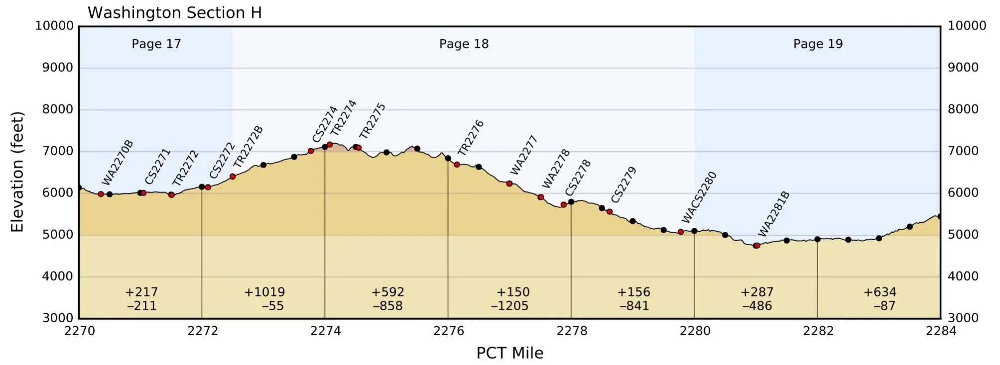
Two Weeks: Harts Pass to Stevens Pass
Start: Harts Pass (PCT 2,619)
End: Stevens Pass (PCT 2461.6)
Length: 157.4 mi / 253.3 km
Elevation Gain: +36,350 ft / 11,079 m
Elevation Loss: -38,370 ft / 11,695 m
Note: The hike described here requires a bit more in the logistics department than most of the others I’ve mentioned until now. However, it will take you through one of the most impressive sections of the PCT (and Washington’s). So basically, it’s worth the extra effort.
Harts Pass (6,188 ft / 1,886 m), the starting point for this hike, is just outside the town of Mazama and is the furthest north that the PCT can be accessed by road. It is reachable via an unpaved forest road and has a parking lot and campground – you probably want a vehicle with some clearance to make it up there.
From Harts Pass, head south on the PCT as the trail does a bit of rolling before beginning a 5 mi / 8 km descent past Glacier Pass.
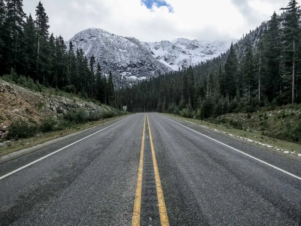
The trail continues up and down as it crosses Methow Pass, Granite Pass, and Cutthroat Pass before crossing Highway 20 and entering North Cascades National Park at PCT 2,585.2 (4,027 ft / 1,227 m).
Note: In North Cascades National Park (PCT 2569.1 – 2585.2), you are only permitted to camp in designated backcountry camps (each camp has a quota). You are required to obtain a free camping permit from the National Park.
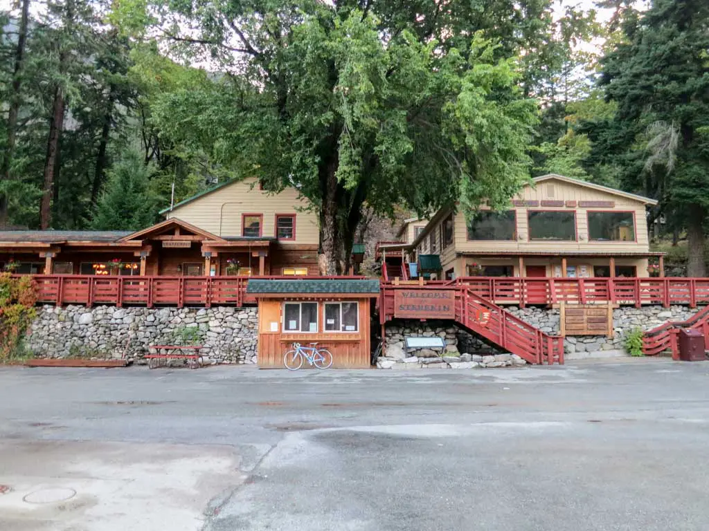
Almost 16 mi / 25.7 km after entering the North Cascades, the trail reaches the High Bridge Ranger Station (PCT 2,569.4 – 1,611 ft / 491 m). From here, you can take a shuttle 11 mi / 17.7 km to the small community of Stehekin ($7 one-way; see website for details).
Stehekin is your best resupply option (your only other option is Mazama—30 mi / 48.2 km into this hike). However, Stehekin’s resupply selection is rather limited (and quite expensive). So here’s where the logistics come into play. It wouldn’t be a bad idea to send your resupply to the Stehekin Post Office (+1 509-699-2015).
(Hiker Name)
c/o General Delivery
Post Office
Stehekin, WA 98852
This way, you have your resupply waiting, and you don’t have to waste time deciding how many $3 Snickers bars you want. If the idea of sending yourself a resupply package scares you, then check out my PCT Resupply posts (or just carry an ungodly amount of food in your backpack from the beginning).
Also, if you decide to bail on your hike, you can take a ferry from Stehekin across Lake Chelan back to (near) civilization (Lake Chelan website).
Make sure your Stehekin resupply is a good one because, for the next 107.8 mi / 173.4 km, you won’t have any chances to resupply or get off the trail (at least not without calling in air support).
South of the High Bridge, the trail does something it’s not particularly fond of: It levels out for a while, with less than 4,000 ft / 1,219 m of elevation change across more than 11 mi / 17.7 km.
However, after that, the ups and downs of Washington are in full force as you pass through the Glacier Peak and Henry M Jackson Wildernesses towards this hike’s southern terminus—Stevens Pass at Highway 2.
Variation
If getting to Harts Pass seems like it might be more trouble than it’s worth, then you can choose to knock 30.4 mi / 48.9 km off the hike and start at Highway 20 near the Rainy Pass Trailhead (parking available) at PCT 2588.9 (4,882 ft / 1,488 m).
Extension
If you want to extend this hike, you could either hike up to the Canadian border and tag the PCT’s northern terminus (which adds 62.2 mi / 100.1 km) or simply continue south from Stevens Pass to Snoqualmie Pass (see the week-long hike above).


Hey, I am attempting to get a Wonderland Walk up permit for August 31st – September 8th but if I cannot, what would you suggest for PCT (I would like to hike to take up all of those days at about 10-12 miles per day)…I would love to include Goat Rocks if possible!
Just take the ferry to Stehekin and hike south.
Looking at the goldmyer-Kendal 5 day loop with my dog. Research shows mostly dog friendly piece wise. Anyone know if that loop is dog friendly? Thanks!
I believe (leashed) dogs are allowed, but I would suggest getting in touch with the Snoqualmie Ranger District – North Bend Office – https://www.fs.usda.gov/detail/mbs/about-forest/offices/?cid=FSBDEV7_001660
I can’t find any info on permits for the section – GOLDMYER HOT SPRING – KENDALL KATWALK LOOP. Is it just walk-in permit on trailhead or is there anything else needed? Thanks.
I believe this is what you need: https://www.fs.usda.gov/r6
Thanks for a quick answer! I have annual interagency pass for my car, I meant something like a permit for the Enchantmens you need to register for ahead.
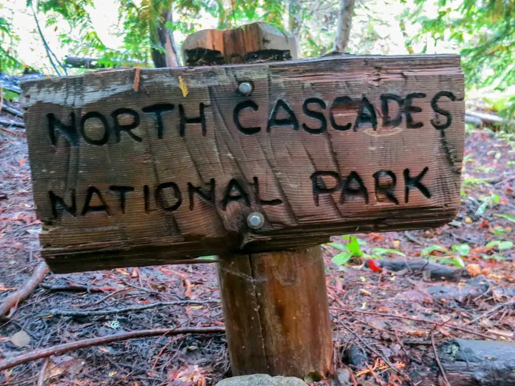
Essentially all of the North Cascades National Park is a wilderness area designated as the Stephen Mather Wilderness.
Good to know – updated!
What a fantastic resource–thank you! We are very interested in completing the GOLDMYER HOT SPRING – KENDALL KATWALK LOOP this summer. Do you have any advice for coordinating a drop off/pick up or for nearby camping locations for the night before starting the hike? Anything else you’d like to share?
Stealth camp.
Thanks for writing this! For the first two hikes in Washington, do you need any permits since it seems to be in National forest land? Also, do you still need to use bear canisters?
Permits? Depends where you are. For example, in the North Cascades National Park Service Complex you need a permit https://www.nps.gov/noca/planyourvisit/permits.htm
Bear canisters are not required along the PCT in Washington.
It is a remotely awesome area and awesomely remote. In 2015, water was few & far between between Canada and Hwy 20.
Wait, so it IS awesome?
But, of course it is.
Good overview. Thank you!
Happy to help.