Trans-Catalina Trail Backpacking Guide
The Trans-Catalina Trail runs the length of Catalina Island and is a popular backpacking trail just off the coast of Southern California. At around 38.5…

The Trans-Catalina Trail runs the length of Catalina Island and is a popular backpacking trail just off the coast of Southern California. At around 38.5…
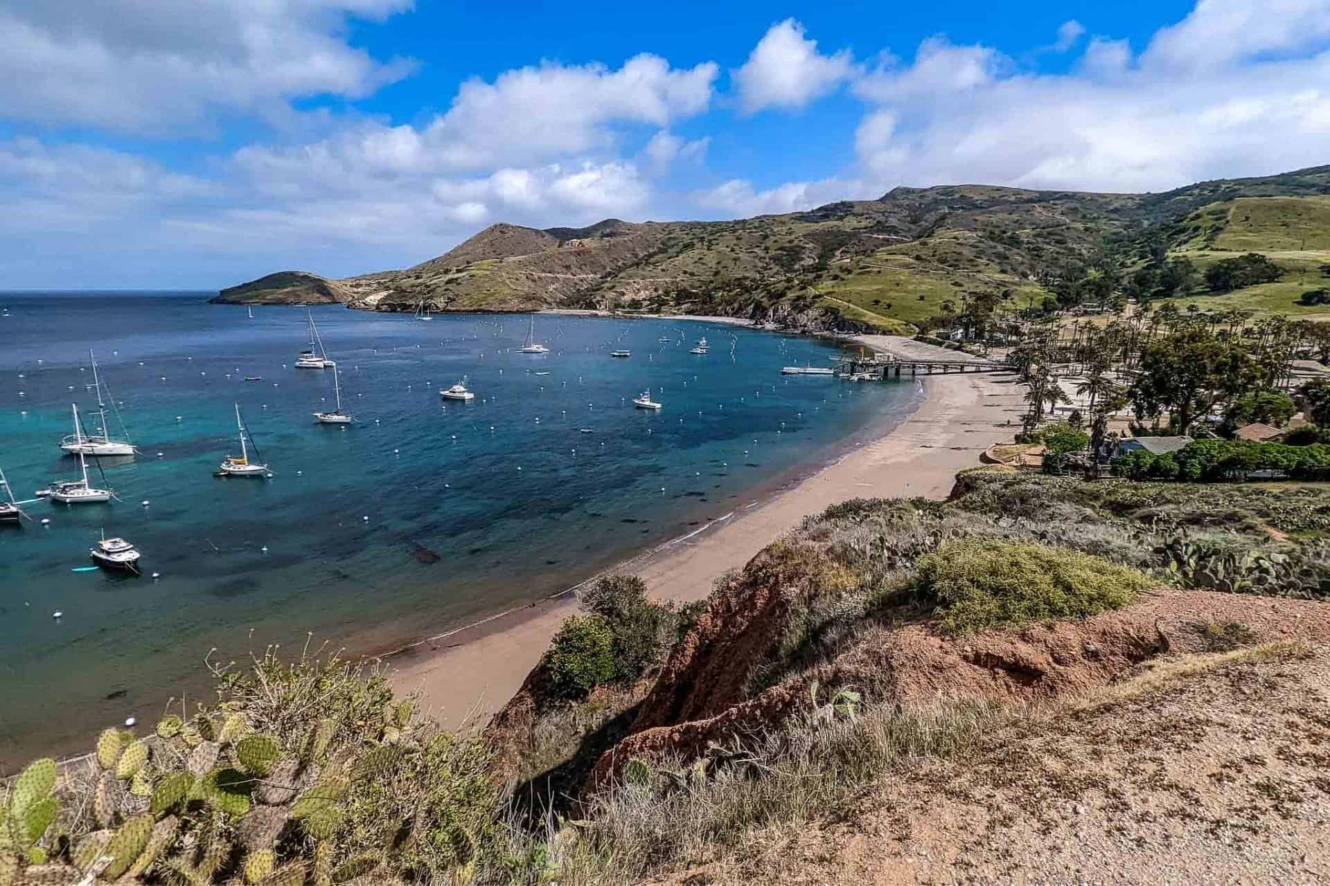
The Trans-Catalina Trail crosses Catalina Island and is a popular and accessible multi-day backpacking trip. One of the most challenging parts of backpacking the Trans-Catalina…

Section 6 of the Kings Canyon High Basin Route (KCHBR) begins at the Middle Fork King River near Simpson Meadow and ends at Road’s End…

Section 4 of the Kings Canyon High Basin Route (KCHBR) begins at the South Fork Kings River at the bottom of the Cartridge Pass Trail…

Section 3 of the Kings Canyon High Basin Route (KCHBR) begins at Junction Meadow and ends at the South Fork Kings River at the bottom…

Section 2 of the Kings Canyon High Basin Route (KCHBR) begins at Colby Pass Trail in Cloud Canyon and crosses Talus Pass, Thunder Ridge Pass,…

Section 1 of the Kings Canyon High Basin Route (KCHBR) begins at Twin Lakes Trailhead at Lodgepole in Sequoia National Park and ends where the…
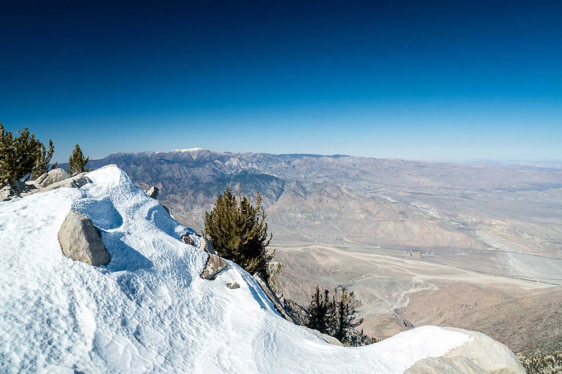
Cactus to Clouds (C2C) is an 18.78 mi / 30.23 km hike from the Palm Springs Art Museum at just 481 ft / 147 m…
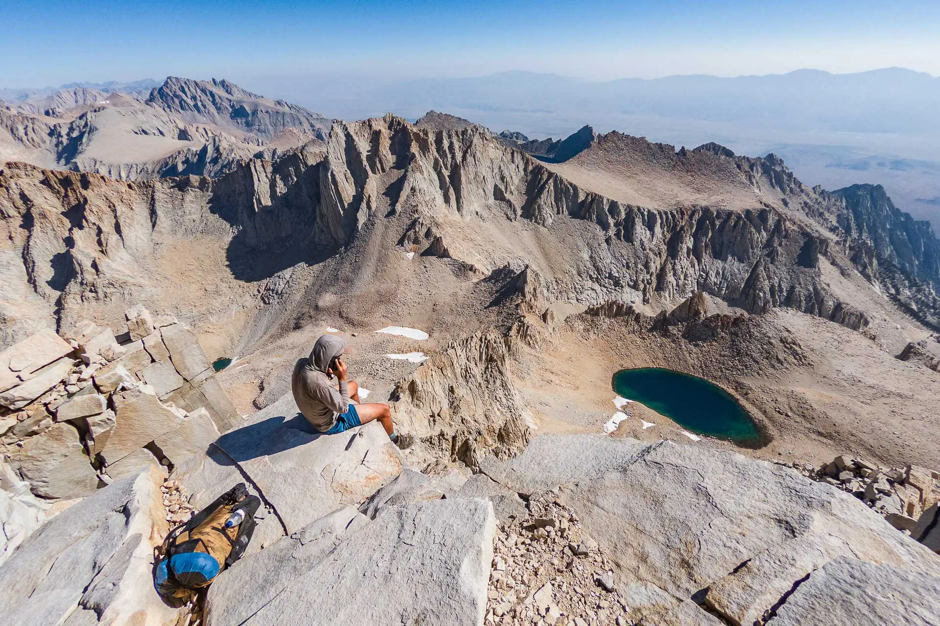
The Southern Sierra High Route (SoSHR) is a 100 mi / 160 km route through California’s Sierra Nevada that runs parallel to (and sometimes overlaps…
I’ve spent a lot of time in California’s Sierra Nevada Mountains – hiking through them twice on the Pacific Crest Trail (in both snow-free and…

The Lowest to Highest Route is a 135 mi / 217 km hike beginning at Badwater Basin in California’s Death Valley National Park and ending…

If you haven’t found a pussy to play with wherever you’re traveling to, then there’s good news: you still have more to discover. Here’s what you can expect.