Grand Canyon Rafting Winter Itinerary to Pearce Ferry
While planning my Grand Canyon rafting trip on the Colorado River, I found it difficult to predict how far we would make it each day, where we would camp each night, and how many layover days (i.e. days off from rafting) our group would be able to take.
I wasn’t trying to make a firm plan on exactly how things would go but because of the nature of the river and the size of our group (sixteen people), we couldn’t simply camp wherever we wanted to each night. From what I recall, there wasn’t an abundance of river itineraries for 29-day trips available, so I’m posting the overview from our trip to (hopefully) help future river users on the Colorado.

Overview
- Days/Nights: 29/28 (December 10 to January 7)
- Layover days: 5
- Rainy days: 5
- Average daily distance: 10.9 mi / 17.5 km (to Separation Canyon Camp not including layover days)
- Favorite camp: Pancho’s Kitchen
- Least favorite camp: President Harding Camp
Rigging Day
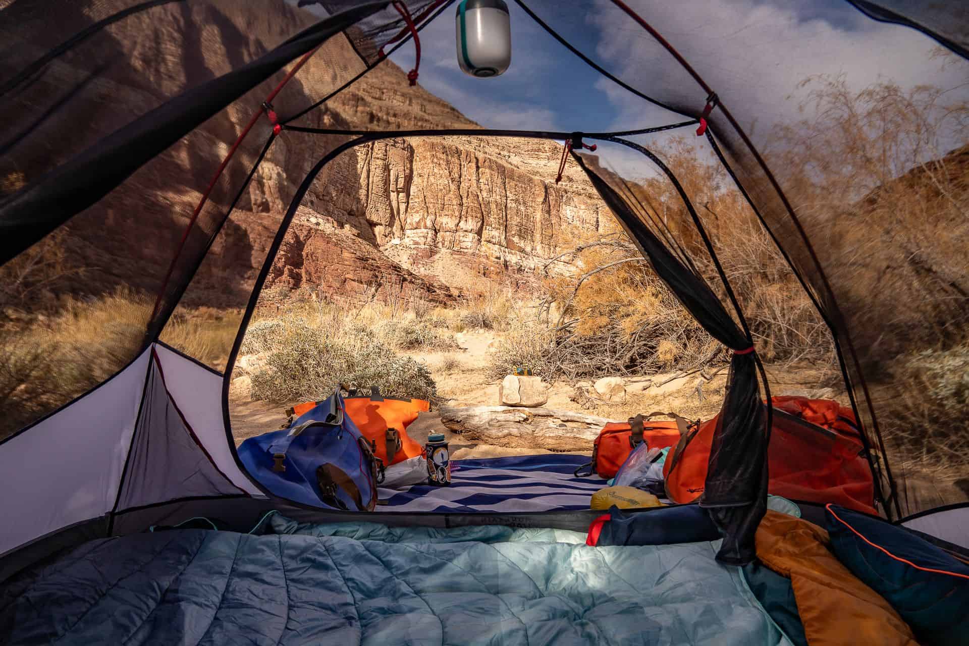
We arrive at Lee’s Ferry (as most groups do), one day before our launch. On this day, we rig our boats and then camp at one of the river-accessible campsites just a few hundred yards down from the launch ramp. This is the final vehicle-accessible boat ramp until Diamond Creek – on the other side of Grand Canyon National Park.
Notes: Toilets and the road still accessible via river campsites
Weather: Overcast during the day, rain in the early evening and overnight
Date: December 9

Day 1
Start: Lee’s Ferry (0.0) @ 11:20 AM
End: Soap Creek (11) @ 3:50 PM – large camp just above Soap Creek Rapid (5) on river right
River miles: 11 (17.7 km)
Notes: The ranger on duty came by in the morning to check our permit, verify our party members, and give a long speech on the river rules and regulations. If it’s cold, I suggest bundling up for this speech (and breaking out a chair if one is accessible).
River color: Blue
Weather: Mostly sunny
Date: December 10
Rapids
- Paria Riffle (1)
- Cathedral Wash (2)
- Badger Creek (5)
Points of Interest
- Navajo Bridges
- Ten-Mile Rock
Day 2
Start: Soap Creek (11) @ 11:07 AM
End: North Canyon (20.7) @ 2:43 PM – good-sized camp on river right just before the Roaring Twenties (a series of rapids between river miles 20 and 30.
River miles: 9.7 (15.6 km)
Notes: Hike up North Canyon from North Canyon Camp
River color: Blue
Weather: Mostly sunny
Date: December 11
Rapids
- Soap Creek Rapid (5)
- Brown’s Riffle (2)
- 13 Mile Riffle (3)
- 13.2 Mile Riffle (2)
- Sheer Wall Rapid (2)
- House Rock Rapid (7)
- Redneck Rapid (3)
Points of Interest
- Brown’s Inscription
- 1923 USGS Inscription
- Boulder Narrows
Day 3
Start: North Canyon (20.7) @ 10:16 AM
End: Shinumo Wash (29.4) @ 1:35 PM – large camp at the bottom of 29 Mile Rapid on river left
River miles: 8.7 (14 km)
Notes: Hike up Silver Grotto from camp at Shinumo Wash
River color: Blue
Weather: Sunny
Date: December 12
Rapids
- North Canyon Rapid (5)
- 21 Mile Rapid (5)
- 23 Mile Rapid (4)
- 23.5 Mile Rapid (4)
- 24 Mile (Georgie) Rapid (6)
- 24.5 Mile Rapid (6)
- 25 Mile (Hansbrough Richards) Rapid (6)
- Cave Springs Rapid (5)
- 27 Mile Rapid (5)
- 29 Mile Rapid (2)
Points of Interest
- Silver Grotto
Day 4
Start: Shinumo Wash (29.4) @ 9:55 AM
End: President Harding Camp (44) @ 5:05 PM – a medium-sized camp on river left just below President Harding Rapid
River miles: 14.6 (23.5 km)
Notes: We spent a long time today hanging out at Redwall Cavern. We had intended to camp at Buck Farm Camp, but another group (who specifically told us they would not be camping there) ended up camping there and prohibited us from stopping.
River color: Olive
Weather: Sunny
Date: December 13
Rapids
- Fence Fault Rapid (5)
- 36 Mile Rapid (4)
- President Harding Rapid (4)
Points of Interest
- Stanton’s Cave
- Vasey’s Paradise
- Redwall Cavern Dam Site
- Redwall Cavern
- Natural Bridge
- Marble Canyon Dam Site
Day 5
Start: President Harding Camp (44) @ 10:16 AM
End: Upper Nankoweap Camp (53.1) @ 12:46 PM – an exposed, medium-sized camp on river right near the bottom of Nankoweap Rapid
River miles: 9.1 (14.7 km)
Notes: Mostly flatwater all day. We were aiming to camp at Main Nankoweap Camp but it was already occupied by another party on a layover day. We had a sunny beach at our campsite ripe for swimming. After setting up camp, we hiked up to the Nankoweap Granaries.
River color: Olive
Weather: Partly cloudy followed by a raging windstorm at night (with a bit of rain)
Date: December 14
Rapids
- Nankoweap Rapid (3)
Points of Interest
- Nankoweap Granaries
Day 6: Layover Day 1
Today was our first layover day. We spent the day at Upper Nankoweap with some group members choosing to hike up Nankoweap Creek, some choosing to hang out in camp, and others opting to visit the granaries.
Weather: Sunny
Date: December 15
Points of Interest
- Nankoweap Granaries
Day 7
Start: Upper Nankoweap Camp (53.1) @ 10:28 AM
End: Lava Canyon Camp (65.9) @ 3:34 PM – medium-sized camp on river right with hiking up Lava Canyon
River miles: 12.8 (20.6 km)
Notes: Got out of rafts at the Little Colorado River to explore (highly recommended)
River color: Chocolate milk
Weather: Sunny
Date: December 16
Rapids
- Kwagunt Rapid (5)
- 60 Mile Rapid (4)
Points of Interest
- Little Colorado River
- Lava Canyon
Day 8
Start: Lava Canyon Camp (65.9) @ 10:19 AM
End: Upper Rattlesnake Camp (74.6) @ 1:59 PM – a medium-sized camp on river right
River miles: 8.7 (14 km)
Notes: We stopped at the Unkar Delta to check out the ruins. A group hiked up to the summit of the Tabernacle from Upper Rattlesnake Camp (there’s cell service at the top).
River color: Olive
Weather: Sunny
Date: December 17
Rapids
- Lava Canyon (Chuar) Rapid (4)
- Tanner Rapid (6)
- Basalt Rapid (6)
- Unkar Creek Rapid (6)
- 73.6 Mile Riffle (4)
Points of Interest
- Unkar Delta (Ancestral Puebloan structures)
- The Tabernacle (hike from Upper Rattlesnake Camp)
Day 9
Start: Upper Rattlesnake Camp (74.6) @ 9:55 AM
End: Lower Cremation Camp (87.7) @ 2:18 PM – a medium-sized camp on river left – the final camp above Phantom Ranch
River miles: 13.1 (21.1 km)
Notes: We did not have an exchange on our trip (i.e. trading out of participants), but we did have to hike to the South Rim which is why we camped so close to Phantom Ranch.
River color: Olive
Weather: Sunny
Date: December 18
Rapids
- Escalante Creek Rapid (4)
- Nevills Rapid (6)
- Hance Rapid (8)
- Sockdolager Rapid (7)
- Grapevine Rapid (7)
- 83 Mile Rapid (4)
- Zoroaster Rapid (5)
- 85 Mile Rapid (3)
Day 10
Start: Lower Cremation Camp (87.7) @ 7:30 AM
End: Across Pipe Creek Camp (89.3) @ 5:15 PM – a large camp on river right and the first below Phantom Ranch. We shared this camp with a solo boater who attempted to poop in our groover.
River miles: 1.6 (2.6 km)
Notes: Two rafts left at the break of dawn to park two boats at Boat Beach near Phantom Ranch. Three people hiked up the South Kaibab Trail to the South Rim to get more salt, propane, and a kettle from our outfitter; two people stayed with the boats and waited for the rest of the group.
River color: Olive
Weather: Sunny
Date: December 19
Rapids
- Bright Angel Rapid (3)
Points of Interest
- Boat Beach
- Kaibab Bridge
- Phantom Ranch
- Bright Angel Bridge
Day 11
Start: Across Pipe Creek Camp (89.3) @ 10:06 AM
End: Schist Camp (96.5) @ 3:27 PM – a medium-sized camp on river left
River miles: 7.2 (11.6 km)
Notes: Had a boat get stuck in an eddy in Horn Creek Rapid – scouted both Granite Rapid and Hermit Rapid.
River color: Blue
Weather: Sunny
Date: December 20
Rapids
- Pipe Creek Rapid (3)
- Horn Creek Rapid (8)
- Salt Creek Rapid (3)
- Granite Rapid (8)
- Hermit Rapid (8)
Day 12
Start: Schist Camp (96.5) @ 9:25 AM
End: Bass Camp (109) @ 1:30 PM – a large camp on river right
River miles: 12.5 (20.1 km)
Notes: We started early – our earliest start thus far – to hit Crystal Rapid in the morning when flows were more favorable. We spoke to another group regarding upcoming campsites.
River color: Blue
Weather: Overcast
Date: December 21
Rapids
- Boucher Rapid (4)
- Crystal Rapid (8)
- Tuna Creek Rapid (6)
- Lower Tuna (Willie’s Necktie) Rapid (4)
- Nixon Rock (3)
- Agate Rapid (3)
- Sapphire Rapid (6)
- Turquoise Rapid (3)
- Emerald Rapid (5)
- Ruby Rapid (5)
- 105.6 Mile Riffle (3)
- Serpentine Rapid (7)
- Bass Rapid (4)
Points of Interest
- The Gems – a series of rapids named for gemstones
- Parkins Inscription
Day 13
Start: Bass Camp (109) @ 9:30 AM
End: Fossil Camp (125.4) @ 3:45 PM – a large camp on river left
River miles: 16.4 (26.4 km)
Notes: We stopped at Elves Chasm for a long break. Highly recommended. Note: completely in shade in winter; we also stopped to hike up Blacktail Canyon.
River color: Blue
Weather: Mostly cloudy
Date: December 22
Rapids
- Shinumo Rapid (4)
- 109 Mile Rapid (2)
- 110 Mile Rapid (3)
- Hakatai Rapid (4)
- Walthenberg Rapid (6)
- 113 Mile Rock (2)
- 119 Mile Rapid (2)
- Blacktail Rapid (3)
- 122 Mile Rapid (4)
- Forster Rapid (5)
- 124.1 Mile Rapid (3)
- 125 Mile Rapid (3)
Points of Interest
- Shinumo Creek
- Elves Chasm
- Blacktail Canyon
Day 14
Start: Fossil Camp (125.4) @ 9:40 AM
End: Racetrack Camp (134.2) @ 2:51 PM – a medium-sized camp on river right; not the best camp but good access for the Tapeats Creek hike which we planned to do the following day
River miles: 8.8 (14.2 km)
Notes: We had two boats go left at Bedrock Rapid. One made it out unscathed and the other flipped. Everyone came out of the event unharmed and we didn’t lose any gear.
River color: Blue
Weather: Overcast
Date: December 23
Rapids
- Fossil Rapid (5)
- 126.4 Mile Rapid (3)
- 127 Mile Rapid (3)
- 128.4 Mile Rapid (3)
- 128 Mile Rapid (3)
- Specter Rapid (6)
- Bedrock Rapid (7)
- Deubendorff Rapid (7)
Points of Interest
- Randy’s Rock
- The Doll’s House

Day 15
Start: Racetrack Camp (134.2) @ 9:50 AM
End: Pancho’s Kitchen (137.6) @ 3:48 PM – a large camp on river left. My favorite camp of the entire trip.
River miles: 3.4 (5.5 km)
Notes: Five people rowed our five rafts from Racetrack to Deer Creek Falls on river right while the rest of the group hiked from Tapeats Creek to Thunder River to Deer Creek. The hikers were picked up at the end of their hike and we then floated to Pancho’s Kitchen.
River color: Blue
Weather: Rain in the morning, partly cloudy in the afternoon
Date: December 24
Rapids
- Tapeats Rapid (5)
- 135 Mile Rapid (3) / Helicopter Eddy
Points of Interest
- Tapeats Creek-Thunder River-Deer Creek Loop
- Thunder Spring
- Narrowest point on the river
- Christmas Tree Cave
- Deer Creek Falls
Day 16: Layover Day 2
Notes: Layover day on Christmas at Pancho’s Kitchen. The Football Field (a large, open, adjacent camp) was unoccupied and we spent much of the day playing games there.
Weather: Sunny
Date: December 25
Day 17
Start: Pancho’s Kitchen (137.6) @ 9:22 AM
End: Upset Hotel (150.7) @ 2:53 PM – a long/narrow camp on river left that requires hauling gear up to a flat area. We allowed another group to take Ledges Camp (where we initially wanted to camp), and think it was a good move (Ledges didn’t seem too awesome). Our group of 16 fit fine at Upset Hotel; the groove spot is unique.
River miles: 13.1 (21.1 km)
Notes: We stopped to explore Matkatamiba Canyon
River color: Olive
Weather: Mostly cloudy
Date: December 26
Rapids
- Doris Rapid (4)
- 138.5 Mile Rapid (3)
- Fishtail Rapid (4)
- 185 Mile Rapid (2)
- Kanab Rapid (3)
- Matkatamiba Rapid (2)
- Upset Rapid (8)
Points of Interest
- Matkatamiba Canyon
- Shorty Burton Pie-Pan Plaque
Day 18
Start: Upset Hotel (150.7) @ 9:23 AM
End: Tuckup Camp (165.1) @ 2:22 PM – a massive camp on river right large enough for at least three large groups to fit comfortably.
River miles: 14.4 (23.2 km)
Notes: We bypassed Havasu Canyon as the Havasupai Tribe had asked that river runners not enter at the time of our passing. There was another group at Tuckup when we arrived but we had no problem using a pull-in further down and maintaining a completely separate camp.
River color: Olive
Weather: Partly cloudy
Date: December 27
Rapids
- Sinyella Rapid (2)
- Havasu Rapid (3)
- 164 Mile Rapid (2)
Points of Interest
- Mount Sinyella view
- Havasu Canyon
- Trail to Beaver Falls
Day 19: Layover Day 3
Notes: We took a layover day at Tuckup Camp today in order to put some space between us and a group we had been leapfrogging with.
Weather: Mostly cloudy, with light rain in the evening
Date: December 28
Day 20
Start: Tuckup (165.1) @ 9:27 AM
End: Lower Cove Camp (174.8) @ 3:16 PM – a large camp and the final camp on river right before Lava Falls Rapid
River miles: 9.7 (15.6 km)
Notes: the river crosses the boundary of the Hualapai Indian Reservation at Mile 165.2. Visitation/access/camping to/on river left is strictly prohibited (except for scouting) without obtaining permission from the tribe ahead of time.
River color: Chocolate milk
Weather: Partly cloudy
Date: December 29
Rapids
- National Rapid (2)
- Fern Glen Rapid (2)
- Gateway Rapid (3)
Points of Interest
- Hualapai Boundary
- National Canyon
- Fern Glen Canyon
- Fern Glen Arch
- Stairway Canyon
- Mohawk Canyon (Hualapai permit required)
Day 21
Start: Lower Cove Camp (174.8) @ 9:26 AM
End: Upper 185 (185.9) @ 2:31 PM – a large camp on river right
River miles: 11.1 (17.9 km)
Notes: Lava Day – i.e. the day we ran Lava Falls Rapid. We stopped at Tequila Beach on river right immediately following Lower Lava Rapid.
River color: Chocolate milk
Weather: Overcast
Date: December 30
Rapids
- Lava Falls Rapid (9)
- Lower Lava Rapid (4)
- 185 Mile Rapid (2)
Points of Interest
- Red Slide
- First view of lava
- Vulcan’s Anvil
- Tequila Beach

Day 22
Start: Upper 185 (185.9) @ 9:27 AM
End: Parashant Camp (198.9) @ 1:12 PM – large camp on river right
River miles: 13 (20.9 km)
Notes: The guidebook said there would not be winter sun at the camp (and that it would instead be a short walk away) in January but we had plenty of winter sun (in January – the next day).
River color: Chocolate milk
Weather: Overcast
Date: December 31
Rapids
- Whitmore Rapid (3)
Points of Interest
- Whitmore Helipad
- Whitmore Trail and pictographs
- Hurricane Fault
- Book of Worms (hike from Parashant)
Day 23: Layover Day 4
Notes: We took our fourth layover day on New Year’s Day.
Weather: Sunny
Date: January 1
Points of Interest
- The Book of Worms
Day 24
Start: Parashant Camp (198.9) @ 9:32 AM
End: Middle 220 Mile Camp (220.1) @ 3:06 PM – a large camp on river right
River miles: 21.2 (34.1 km)
Notes: We had spoken to a group of kayakers who told us we could have Upper 220 Mile Camp (as we requested), but they had taken it when we arrived. Also, our longest day on the river thus far.
River color: Olive
Weather: Sunny
Date: January 2
Rapids
- 205 Mile (Kolb) Rapid (6)
- 209 Mile Rapid (5)
- Little Bastard Rapid (3)
- Three Springs Rapid (2)
- 217 Mile Rapid (5)
- Trail Canyon Riffle (2)
Points of Interest
- Spring Canyon
- Hurricane Fault (again)
- Pumpkin Spring (Hualapai permit required)
- Snyder tent campsite
- Three Spring Canyon (Hualapai permit required)
Day 25: Layover Day 5
Notes: We didn’t mean to take a layover day today but with where other groups were and with the limited availability of campsites ahead of us, it made sense to take a layover. It would have been nice to have used this layover day earlier in the trip, but it was also nice to have this as a buffer day in case something went wrong.
Weather: Sunny
Date: January 3
Day 26
Start: Middle 220 Mile Camp (220.1) @ 11:16 AM
End: Opposite Travertine Canyon (229.4) @ 2:14 PM
River miles: 9.3 (15 km)
River color: Chocolate milk
Weather: Sunny
Date: January 4
Rapids
- Granite Spring Rapid (2)
- 221.3 Mile Rapid (3)
- 224 Mile Rapid (3)
- Diamond Creek Rapid (4)
- 227.3 Mile Rapid (3)
- 228.2 Mile Rapid (3)
- Travertine Rapid (2)
Points of Interest
- Diamond Peak view
- Diamond Creek USGS cable car
- Diamond Creek Take-out/Put-in
- Travertine Canyon (Hualapai permit required)
Day 27
Start: Opposite Travertine Canyon (229.4)
End: Separation Canyon Camp (239.8)
River miles: 10.4 (16.7 km)
Notes: We stayed at Separation Canyon Camp this night and then for the entirety of the following day preparing for our night float. We saw a lot of other groups while we were here – probably more than the rest of the trip combined.
River color: Chocolate milk
Weather: Sunny
Date: January 5
Rapids
- 231 Mile Rapid (5)
- 232 Mile Rapid/Killer Fang Falls (6)
- 234 Mile Rapid (5)
- Bridge Canyon Rapid (4)
- Gneiss Canyon Rapid (5)
- 236.9 Mile Rapid (2)
- 237 Mile Rapid (2)
Points of Interest
- Bridge Canyon Damsite
- Historic cenotaph
Day 28-29
Start: Separation Canyon Camp (239.8)
End: Pearce Ferry (280.5)
River miles: 40.7 (65.5 km)
Notes: We began our night float just before sunset on our 28th night and floated all night and into the morning when we arrived at Pearce Ferry for our pick-up.
Weather: Sunny
Dates: January 6 to January 7
Rapids
- Separation Rapid (1)
- Lava Cliff Rapid (1)
Points of Interest
- Surprise Canyon
- Clay Tank Canyon
- Reference Point Creek
- Sandbar Alley
- Jackson Canyon
- Burnt Canyon
- Quartermaster Canyon
- Floating docks (pontoon boat and/or helicopter traffic possible here)
- Tincanebitts Canyon
- Dry Canyon
- Hualapai Grand Canyon Skywalk visible
- Bat Cave and aerial tramway towers
- Grand Canyon National Park boundary
- Columbine (Emery) Falls
- Rampart Cave