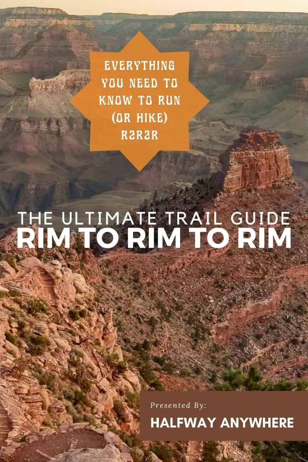
Rim to Rim to Rim in a Day Guide – Grand Canyon
Completing Grand Canyon’s Rim to Rim to Rim in a single day is a huge effort that should only be attempted by those familiar with the challenges of running/hiking in the canyon and with the proper fitness to complete the trail.
Many people undertake this as a multi-day effort. Here I’ll cover everything you need to know to undertake R2R2R as a single-day effort.
Although there are multiple routes down to the Colorado River from the rim on both the south and north sides of Grand Canyon National Park, the classic (and, due to infrastructure, the only reasonable) route is via the North Kaibab Trail to/from the North Rim and either the Bright Angel Trail or South Kaibab Trail to/from the South Rim.
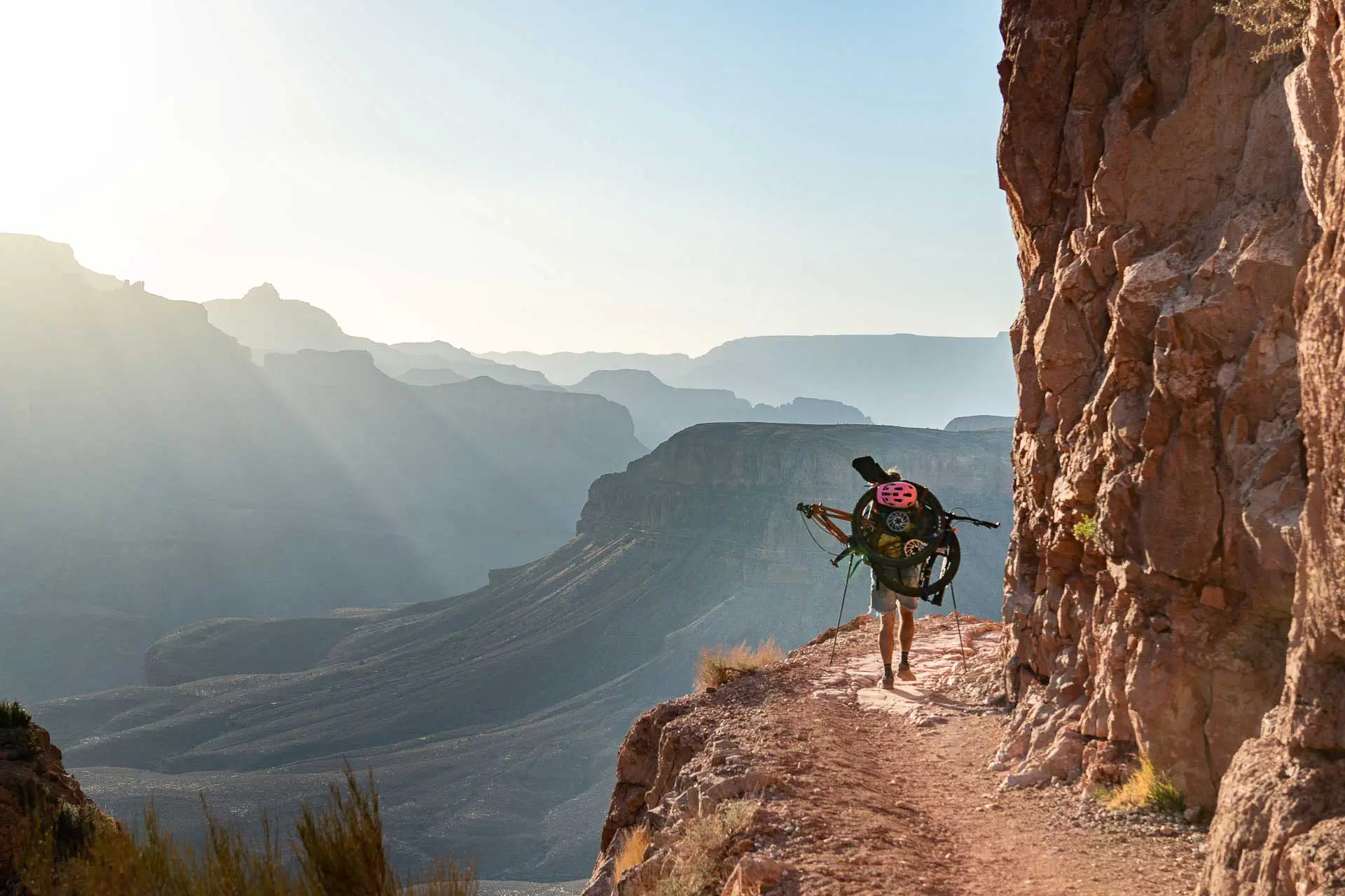
I completed (and will describe here) the route beginning at the South Rim’s South Kaibab Trailhead, ascending/descending the North Kaibab Trail, and then ending at Bright Angel Trailhead at the South Rim.
Rim to Rim to Rim Overview
- Location: Grand Canyon National Park (Arizona, USA)
- Length: 43.1 mi / 69.4 km (varies with trailhead selection)
- Type: Out-and-back
- Most Popular Months: March/April or October/November
- Max Group Size: 10
- Permit Required: No
- Dogs Allowed: No
- South Rim Trailheads: South Kaibab Trailhead (map) | Bright Angel Trailhead (map)
- North Rim Trailhead: North Kaibab Trailhead (map)
- Low Point: Silver Bridge / Black Bridge (Colorado River) 2,417 ft / 737 m (map)
- High Point: North Kaibab Trailhead 8,232 ft / 2,509 m (map)
- Elevation Gain: 12,030 ft / 3,667 m (varies slightly with trailhead selection)
- Elevation Loss: 12,390 ft / 3,776 m (varies slightly with trailhead selection)
- Difficulty (as a single-day effort): Extremely Strenuous

Things to Know
- You can begin and end the trail at either South Kaibab Trailhead (South Rim), Bright Angel Trailhead (South Rim), or North Kaibab Trailhead (North Rim). You can descend/ascend via either South Kaibab or Bright Angel on the South Rim (or mix and match).
- A permit is not required for Rim to Rim to Rim (so long as you are not camping)
- Phantom Ranch is just north of the Colorado River – where you’ll find cabins, a ranger station, potable water, restrooms, and a shop.
- The temperature at Phantom Ranch is significantly warmer than the temperature at the rim.
- The trail between the Colorado River and the North Rim (North Kaibab Trail) is nearly twice as long as the trails between the Colorado River and the South Rim.
- In winter, the North Rim is closed to vehicles; the road is closed at Jacob Lake – 42 mi / 68 km north of the North Rim.
- The North Rim is over 1,000 ft / 305 m higher than the South Rim.
- The Hikers’ Express Shuttle Bus departs the backcountry information center in the morning (where there’s parking) and stops at both Bright Angel Lodge and South Kaibab Trailhead but this is a morning bus only. If you’re doing Rim to Rim to Rim in a day with a personal vehicle, it’s best to utilize one of the parking lots closer to the rim (assuming a South Rim start/end).
- The (free) Village (Blue) Route Shuttle Bus to Bright Angel Trailhead does not run year-round. It runs between Memorial Day Weekend at the end of May and Labor Day Weekend at the start of September.
- Be sure to check Grand Canyon National Park’s Critical Backcountry Updates page
Getting to Grand Canyon National Park
Your only option for getting to Grand Canyon National Park is via car. There is no public transportation to Grand Canyon National Park.
There are a few options if you’re interested in a private tour from Las Vegas or Flagstaff, but most people arriving in Grand Canyon National Park will do so via a private vehicle. Also, it would be strange to pay for a private tour simply to get to the Grand Canyon, but don’t let me tell you what to do.
Car
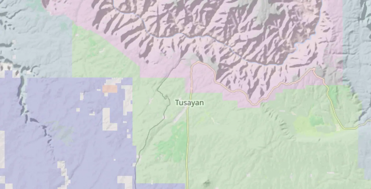
Tusayan, Arizona (map) is the closest town to Grand Canyon National Park. Tusayan has restaurants, a market, hotels, and a visitor center. It exists essentially as a result of its proximity to the park.
Flagstaff, Arizona (map) is the closest, largest city to Grand Canyon National Park. This is also where you will find the closest major airport. There is also a small private airport just south of the park where you can, presumably, fly via a small (and likely expensive) plane.
Williams, Arizona (map) is directly south of Grand Canyon National Park along Interstate 40. Williams is a large town with hotels, restaurants, and supermarkets. It’s possible to reach Williams from Flagstaff via train (the Amtrak).
NORTH RIM: Jacob Lake, Arizona (map) is the closest bit of civilization to the North Rim of the Grand Canyon. It’s officially an unincorporated community and besides a gas station, only has a campground and a motel – with a small shop and restaurant inside. It’s 42 mi / 68 km on a paved road from Jacob Lake to the North Rim, and the road is closed during the winter. There’s not much nearby, and you’ll have to go as far as Kanab, Utah, or Page, Arizona before you find a large town.
Hitchhiking
Hitchhiking is legal in Arizona. However, you must remain off the roadways (where cars are permitted to drive) and off the interstates. It’s not crazy to think that a hitchhiking trip from Flagstaff or Williams to the park would be possible.
Hitchhiking within Grand Canyon National Park is not permitted.

R2R2R Trailheads
There are three trailheads for Rim to Rim to Rim, two on the South Rim and one on the North Rim. You can start the trail from any of the trailheads. If you’re beginning/ending at the South Rim, you can opt to begin/end at the same trailhead or different trailheads.
If you’re beginning/ending at the North Rim, it makes the most sense to ascend/descend the same trail on the South Rim. Getting between trailheads on the South Rim adds 4.3 mi / 6.9 km of distance on a road along the (busy and mostly paved) South Rim. Yes, you could do this, but if you want to hit both South Rim trails, it’s best to begin/end at the South Rim.
South Kaibab Trailhead (South Rim)
South Kaibab Trailhead (map) is a popular starting/ending point for Rim to Rim to Rim. It’s 2.3 mi / 3.7 km east of the Grand Canyon Visitor Center. South Kaibab Trailhead is east of Bright Angel Trailhead (also on the South Rim).
From the Visitor Center Shuttle Bus Terminal (map), you can take the Eastbound Kaibab Rim Route (Orange) Route shuttle to the South Kaibab Trailhead. The shuttle is free.
The shuttle runs every 30 minutes from 4 am to 6:30 am and every 15 minutes from 6:30 am to 30 minutes after sunset (i.e. the last bus is 30 minutes after sunset).
From the Visitor Center, the South Kaibab Trailhead is the first stop.
Bright Angel Trailhead (South Rim)
Bright Angel Trailhead (map) is also a popular starting/ending point for Rim to Rim to Rim – and is more popular with day hikers than the shorter but steeper South Kaibab Trail (probably because there’s typically water available at Havasupai Gardens Campground).
Bright Angel Trailhead is 2.4 mi / 3.9 km west of the Grand Canyon Visitor Center and west of South Kaibab Trailhead (also on the South Rim).
From the Visitor Center Shuttle Bus Terminal (map), you can take the Village (Blue) Route Shuttle Bus to Bright Angel Trailhead. The shuttle is free.
This shuttle does not run year-round and generally begins at the end of May and runs through the start of September. When in service, it runs every 30 minutes from 4 a.m. to 6:30 a.m., every 10-15 minutes from 6:30 a.m. to 8:30 p.m., and every 30 minutes from 8:30 p.m. to 11 p.m. The last bus is at 10:30 p.m.
North Kaibab Trailhead (North Rim)
North Kaibab Trailhead (map) is the only North Rim trailhead option for Rim to Rim to Rim. There is no public transportation at the North Rim and the only way to reach the trailhead is via private transportation. This is why most people choose to start/end their hikes at the South Rim.
It’s worth noting North Kaibab Trailhead is 2.1 mi / 3.4 km from the North Rim Visitor Center (map), 1 mi / 1.6 km from the North Rim Backcountry Information Center (map) (where there’s water), and that the road to the North Rim (and therefore North Kaibab Trailhead) is closed during the winter.
Single-Day R2R2R Itinerary
The following covers how to complete Rim to Rim to Rim in a single day. There are a few ways to accomplish this since the South Rim has two trailheads, Bright Angel and South Kaibab. Here is the total distance covered with each trailhead combination.
- 40.7 mi / 65.5 km South Kaibab + North Kaibab + South Kaibab
- 43.1 mi / 69.4 km South Kaibab + North Kaibab + Bright Angel
- 45.4 mi / 73.1 km Bright Angel + North Kaibab + Bright Angel
The South Kaibab Trail is shorter and steeper than the Bright Angel Trail. That said, they’re both beautifully maintained trails. Descending and ascending South Kaibab Trail instead of Bright Angel Trail saves around 5 mi / 8 km.
I recommend starting at South Kaibab and ending at Bright Angel. That said, the R2R2R fastest known times (FKTs) typically start and end at South Kaibab Trailhead.
If you plan to hit both trails, I suggest leaving a car at the trailhead you plan to finish at and then finding a way to your starting point. This could be via a ride, walking, a shuttle bus, or some combination.
When I did R2R2R, I was alone with a single car. I parked at Bright Angel Trailhead and walked to the Visitor Center to catch the first shuttle to South Kaibab Trailhead. Why did I walk? Because it was 3:30 in the morning and there were no early-morning shuttles from Bright Angel to the Visitor Center because I did this in March (these shuttles typically start Memorial Day Weekend, in May). It was a good warm-up?
Where to Stay
Spending the night either before or after completing Rim to Rim to Rim in a day is an option that will make things logistically easier than arriving and leaving the Grand Canyon on the same day (e.g. if you were staying in Flagstaff).
Grand Canyon Village
If you would like the closest (and arguably most comfortable) lodging to the trailheads. There are six (privately owned) hotels within the park.
- Bright Angel Lodge (map)
- El Tovar Hotel (map)
- Kachina Lodge (map)
- Maswik Lodge (map)
- Thunderbird Lodge (map)
- Yavapai Lodge (map)
Four (Bright Angel, El Tovar, Kachina, Thunderbird) are near Bright Angel Trailhead, Maswik Lodge is near the backcountry information office (closer to Bright Angel Trailhead than South Kaibab but set further back from the Rim), and Yavapai Lodge is closer to the Grand Canyon Visitor Center. Yavapai Lodge also has an RV park.
For more on Grand Canyon lodging, check here.
Mather Campground (GCNP)
Mather Campground (map) is the only campground (within the park) in the proximity of Grand Canyon Village. It’s 1.5 mi / 2.4 km from Mather Campground to the Grand Canyon Visitor Center (where you can catch a shuttle).
For Mather Campground campsite reservations check here; campsites are between $18 and $30 per night. Toilets, trash cans, and potable water are available at Mather Campground.
There are also communal hiker/biker sites available at Mather Campground for $6. These are first come, first served and are only available to people traveling by foot or bicycle.
Kaibab National Forest
Dispersed camping is allowed in the Kaibab National Forest (map) so long it’s not expressly prohibited because of proximity to developed campgrounds or resource concerns.
I recommend heading down Forest Service Road 328 (map), past Apache Stables (where camping is prohibited). There are plenty of pullouts and you’ll likely see lots of other campers in the area.
More on Kaibab National Forest dispersed camping here.
Tusayan
The town of Tusayan (map) is 2 mi / 3.2 km south of the park entrance. Note that it’s 6.6 mi / 10.6 km from Tusayan to the Visitor Center.
Tusayan offers plenty of lodging options, restaurants (including a very expensive McDonald’s), and shops. There is also a seasonal (free) shuttle service operated by the Park from Tusayan to the Visitor Center – although this service will likely begin later in the day than most would like for an R2R2R attempt.
Flagstaff
The city of Flagstaff (map) is the largest/closest city to Grand Canyon National Park – it’s 80 mi / 130 km from the park.
This is also where the closest commercial airport is to the park. Flagstaff has everything you could want before or after a Rim to Rim to Rim attempt including outfitters, breweries, restaurants, lodging, and a hospital.
When to Attempt R2R2R
Rim to Rim to Rim can be done year-round. That said, the most popular time of year for R2R2R is spring and fall. Remember that the Colorado River is over 4,500 ft / 1,370 m lower than the South Rim and over 5,800 ft / 1,768 m lower than the North Rim (i.e. the North Rim is higher than the South Rim). Temperatures can (and do) vary significantly between the river and the rim; you can expect differences of around (or surpassing) 30°F / 7°C.
Spring: Spring (March) is when I completed R2R2R and is probably when I would do it again. That said, I did have to postpone one day because the morning I originally planned to start I woke up to 6 in / 15 cm of fresh snow blanketing my car and the South Rim. Average temperatures at the South Rim are around 51°F / 11°C in March and climb to 76°F / 25°C by the end of May. Just remember that even if it’s freezing at the rim in the morning, it may still be hot at the river at midday. It’s also worth noting that it has snowed at the Rim as late as June (although typically snowfall will have ended by April or May).
Summer: Is it possible to complete Rim to Rim to Rim in the summer? Sure. Is it advisable? No. Unless you are highly experienced in extreme temperatures and are deliberately attempting to subject your body to brutal conditions, there’s no reason to attempt R2R2R during the summer. A “nice day” at the Rim can still mean absurdly hot temperatures at the river. Summer temperatures at Phantom Ranch have reached 120°F / 49°C. Most of the rain the Grand Canyon receives falls in July and August; this is also when the risk of severe thunderstorms is highest.
Fall: Fall is essentially the opposite of spring at the Grand Canyon. Average highs at the South Rim hover around 76°F / 25°C in September and fall to 51°F / 11°C by mid-November. It can snow at the North Rim as early as September, but generally, snow won’t fall until later in the year. If I were to attempt R2R2R in the fall, I would probably do so in early November. That said, the transition from summer to winter can happen quickly and drastically making the fall a difficult time of year to predict.
Winter: It’s possible to complete Rim to Rim to Rim in the winter, but it will depend on when in winter you attempt it. Snow falls at both the South Rim and the North Rim, and trails – especially the North Kaibab Trail – can hold snow into spring. However, the South Rim trails can also hold ice and snow toward the Rim. The North Rim can be extremely cold in winter with temperatures having fallen to –22°F / –30°C. As with summer, unless you’re trying to make R2R2R difficult for yourself, it’s best to opt for a spring or fall attempt.
Here’s a look at average temperatures in the inner canyon.
| JAN | FEB | MAR | APR | MAY | JUN | JUL | AUG | SEP | OCT | NOV | DEC | |
|---|---|---|---|---|---|---|---|---|---|---|---|---|
| High (F) | 56 | 62 | 71 | 82 | 92 | 101 | 106 | 103 | 97 | 84 | 68 | 57 |
| Low (F) | 36 | 42 | 48 | 56 | 63 | 72 | 78 | 75 | 69 | 58 | 46 | 37 |
| High (C) | 13 | 17 | 22 | 28 | 33 | 38 | 31 | 39 | 36 | 29 | 20 | 14 |
| Low (C) | 2 | 6 | 9 | 13 | 17 | 22 | 26 | 24 | 21 | 14 | 8 | 2 |
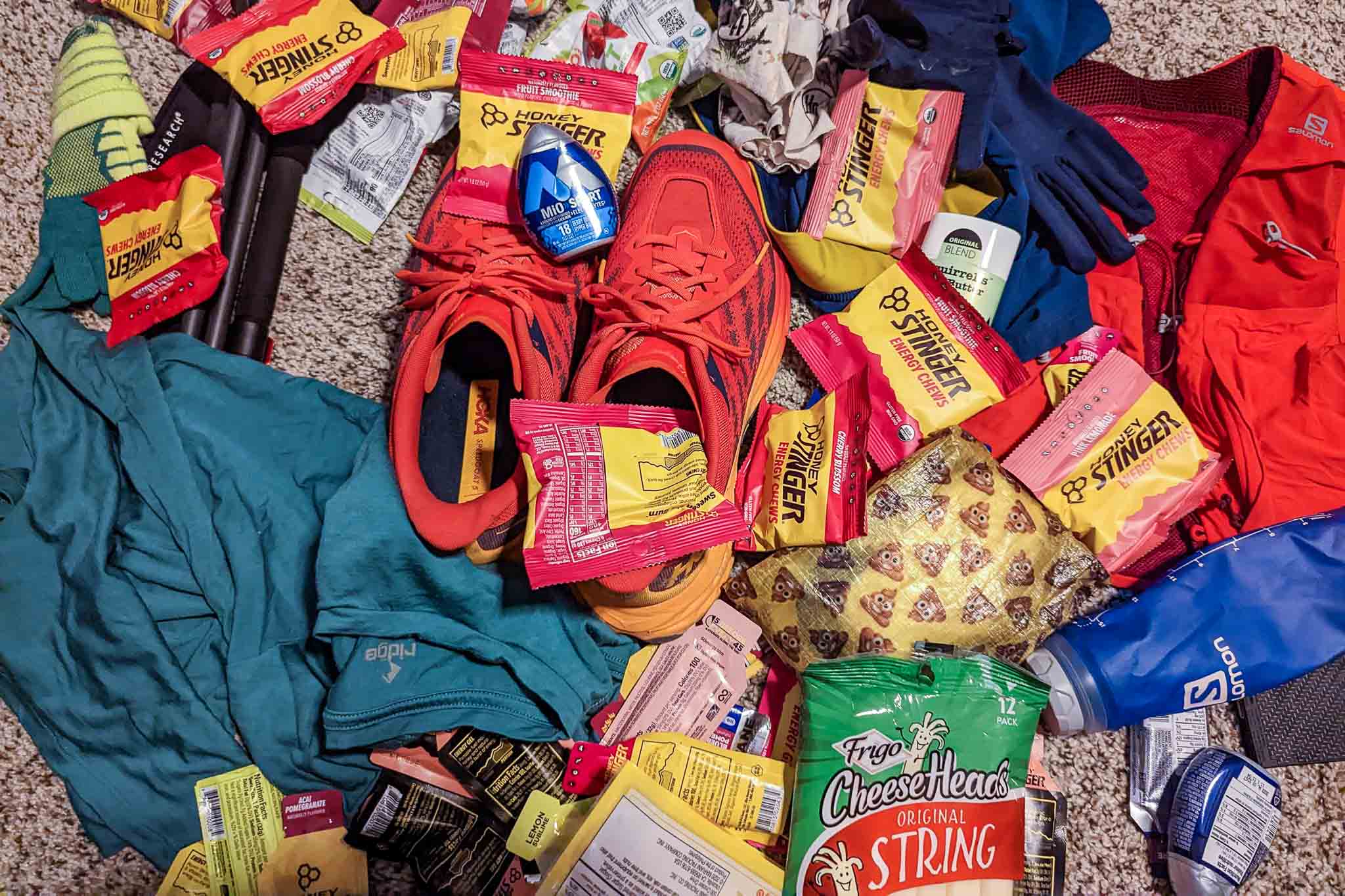
Gear & Packing List
If you’re going to complete Rim to Rim to Rim in a day, you’ll probably be going light (as you’ll most likely be running). Here’s a checklist to make sure you’ve got all you need to be successful.
Running Vest: If you’re attempting Rim to Rim to Rim in a day, you likely have a tried-and-true running vest. Do you need a running vest? I guess not. But you’ll likely want something to carry your water, filter, food, and other gear. Why make things more difficult than they have to be?
Trekking Poles If you’re a fan of using trekking poles when you run (or quickly hike), don’t forget them on R2R2R. There is 12,030 ft / 3,667 m of total elevation gain and an equal amount of less. The ups and downs are equally unrelenting – expect no undulation and very little flat.
Electrolytes: Bring electrolytes! Rim to Rim to Rim is exposed. There is very little shade to be found along the trail – unless it’s early in the morning, late in the afternoon, or you get lucky with the sun around Phantom Ranch – and the sun can be (and often is) intense. Make sure you’re bringing electrolytes to stay hydrated.
Water: There are few opportunities to fill up on water along R2R2R. I used a 1.5L hydration bladder (which I did not enjoy), but I would have preferred to carry two 500 ml soft flasks and an additional 500 ml bottle in my bag. Whatever you do, make sure you have enough capacity to remain hydrated between water sources.
Water Filter: I was told that the water from spigots along R2R2R is safe to drink, but if you want to play it safe, bring along something like a Platypus QuickDraw for filtering your water—just in case. Also, if there is no water on the North Kaibab Trail (which can happen), you can filter from Bright Angel Creek, which parallels the North Kaibab Trail until it begins climbing up Roaring Springs Canyon.
Traction: If you’re not on R2R2R in summer (again, summer is not the best idea) or in a summer-adjacent month, there’s a chance you’ll encounter ice and/or snow toward the South Rim, North Rim, or both (likelier the North Rim). Some foot traction may be a good thing to have. You wouldn’t want to nearly make it up to the North Rim and then have to turn around because of icy trail conditions.
Food and Fuel: I ate (and mostly eat while running) a mixture of CLIF BLOKS, Stroopwafels, bars, and candy. Whatever you bring, just make sure it’s something that won’t make you sick and that you bring enough of it. The last thing you want to do is bonk going back up to the South Rim (trust me, I’ve done it).
Satellite Messenger or PLB: There is cell reception at the North Rim and the South Rim, and there are other people out, but carrying a PLB is never a bad idea – particularly on an effort as big as this one. I generally carry a Garmin inReach Mini 2. It’s small, lightweight, and can save your life.
Sunscreen: Bring sunscreen. As stated above, the trail is very exposed. If you’re running on a clear day, you can expect to be in the sun for most of the trail.
For more recommendations on gear, check out my current gear list or gear reviews.

Route Description
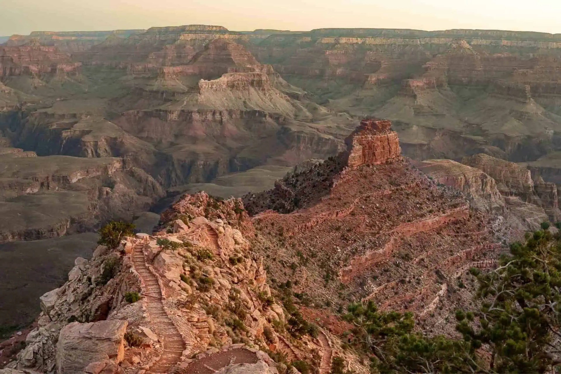
Whether you decide to take the Bright Angel Trail or the South Kaibab Trail, the Rim to Rim to Rim trail is remarkably well-maintained and easy to follow. The North Kaibab Trail is one of the most impressive trails I’ve ever been on.
That said, there are a couple of things you should keep in mind regardless of which trail(s) you choose. First, regardless of your starting point, you have a huge climb at the end of R2R2R. Also, the distance between the Colorado River and the North Rim is nearly twice as long as the distance between the Colorado River and the South Rim. You’ll probably make it down the Colorado River fairly quickly (assuming a South Rim start), but don’t allow yourself to be fooled – you are far from halfway at this point.
Bright Angel vs South Kaibab
You can choose whether to start or end your hike at Bright Angel Trailhead, South Kaibab Trailhead, or a mixture of both. As stated above, here’s a look at the difference in distances:
- 40.7 mi / 65.5 km South Kaibab + North Kaibab + South Kaibab
- 43.1 mi / 69.4 km South Kaibab + North Kaibab + Bright Angel
- 45.4 mi / 73.1 km Bright Angel + North Kaibab + Bright Angel
Reasons to take South Kaibab Trail
- Shorter than the Bright Angel Trail by 2.35 mi / 3.8 km (one-way)
- More scenic than the Bright Angel Trail – follows a ridgeline down instead of a canyon
- There’s a cool tunnel you go through immediately south of the Colorado River
- Less popular (and thus less crowded) than the Bright Angel Trail
- Less likely to hold snow and ice due to its exposure
Reasons to take Bright Angel Trail
- Offers more shade and shelter than the South Kaibab Trail
- There is a year-round water source, a natural water source, and two seasonal water sources; South Kaibab has no water
- Not as steep as the South Kaibab Trail
- More trailhead infrastructure and (arguably) easier access to the trailhead
- More toilets available on the trail
R2R2R Water Sources
Rim to Rim to Rim water sources are fairly straightforward. Water sources in the Grand Canyon can be divided into three categories: seasonal, year-round, and natural. Seasonal and year-round water sources refer to those provided by the park while natural water sources are perennial natural sources.
The longest stretches of trail without reliable, year-round water are the stretch from where the trail departs Bright Angel Creek and climbs to the North Kaibab Trailhead at the North Rim (10 mi / 16 km roundtrip) and the South Kaibab Trail (7 mi / 11.3 km one-way) between the Colorado River and South Kaibab Trailhead.
Seasonal water sources are generally available from May to October. Still, you should always check and confirm with the park as these water sources can be turned off at any time for a variety of reasons.
Year-round water sources (Havasupai Gardens Campground, Bright Angel Campground, North Rim Backcountry Information Center) are generally always available. However, as with seasonal sources, check and confirm with the park before beginning.
Natural water sources (which should be filtered) along Rim to Rim to Rim include the Colorado River, Bright Angel Creek, Garden Creek, Pipe Creek, and Roaring Springs.
Water Source Details
South Rim: It would be wise to arrive hydrated and with water to the start of Rim to Rim to Rim. However, if you need water at the south rim you can find spigots at Mather Campground (map). There is no water at South Kaibab Trailhead (but there is a privy). You can find water near Bright Angel Trailhead from the hotels and shops nearby.
Note: There are no water sources on the South Kaibab Trail between the trailhead and the Colorado River.
1.5 Mile Resthouse | Bright Angel Trail | Seasonal: Water is available seasonally (May to October) at 1.5 Mile Resthouse on the Bright Angel Trail (map).
3 Mile Resthouse | Bright Angel Trail | Seasonal: Water is available seasonally (May to October) at 3 Mile Resthouse on the Bright Angel Trail (map).
Havasupai Gardens | Bright Angel Trail | Year-round: Water is available year-round at Havasupai Gardens (map) on the Bright Angel Trail. There are also toilets here. Havasupai Gardens is 4.5 mi / 7.3 km from the South Rim.
Garden Creek / Pipe Creek | Bright Angel Trail | Natural: The Bright Angel Trail crosses and is adjacent to Garden Creek and Pipe Creek. Water can be collected and filtered from these sources.
Colorado River | All Trails | Natural: You can easily access the Colorado River on the north side to obtain and filter water. That said, there are two spigots just north of the river (Bright Angel / South Kaibab). Phantom Ranch and Bright Angel Campground are also just north of the river, which makes filtering from the river rather pointless (and the river will likely clog your filter if it’s sediment-filled).
Bright Angel Campground | All Trails | Year-round: Bright Angel Campground (map) is between the Colorado River and Phantom Ranch and has year-round water spigots and flushing toilets. Note that the campground is on the west side of Bright Angel Creek (Phantom Ranch is on the East Side). At the north end of the campground, there is a bridge to cross the creek back to Phantom Ranch and the North Kaibab Trail.
Phantom Ranch | All Trails | Year-round: Phantom Ranch (map) does not have spigots (you’re better off getting water from the nearby Bright Angel Campground), but it does have a canteen where you can purchase beverages and snacks from 8:00 a.m. to 4:00 p.m. Cash and cards are both accepted.
Bright Angel Creek | North Kaibab Trail | Natural: Bright Angel Creek flows into the Colorado River from Bright Angel Canyon and is what the North Kaibab Trail follows for around 8.7 mi / 14 km north of the Colorado River before starting up Roaring Springs Canyon. The trail runs parallel to and is often close enough to the creek for you to collect and filter water. Once you cross north of the bridge just south of Manzanita Rest Area, the creek will no longer be accessible.
Cottonwood Campground | North Kaibab Trail | Seasonal: Cottonwood Campground (map) is 6.8 mi / 11 km south of the North Rim and has water available from mid-May to mid-October. It also has an emergency phone and pit toilets.
Manzanita Rest Area | North Kaibab Trail | Seasonal: Manzanita Rest Area (map) is 5.4 mi / 8.7 km below the North Rim and has water available seasonally. That said, when I did Rim to Rim to Rim in early March, the water here was turned on. It’s always best to check with the Backcountry Information Office or rangers directly to confirm water source status.
Roaring Springs | North Kaibab Trail | Natural: Roaring Springs (map) is 4.7 mi / 7.6 km below the North Rim and requires a slight detour to reach (~0.25 mi / 400 m). It’s close enough to Bright Angel Creek that filling up at the creek would probably make more sense instead of detouring to the spring.
Supai Tunnel | North Kaibab Trail | Seasonal: Supai Tunnel (map) is 1.7 mi / 2.7 km below the North Rim. Water is available here seasonally, but this is one of the first sources to be turned off in the fall. There are also pit toilets; there is no emergency phone.
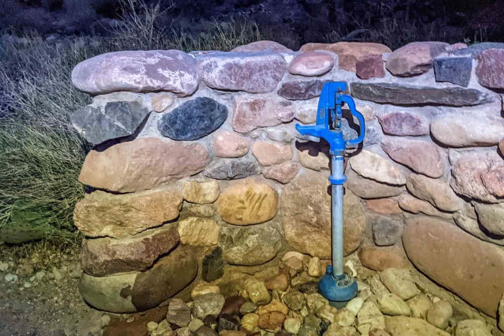
North Rim | North Kaibab Trail | Seasonal: At the North Kaibab Trailhead (map), seasonal water is available via a spigot. This water source is one of the first to be turned off in the fall, so be sure to check its status before relying on it. If there’s no water here and you need water, you can go instead to the North Rim Backcountry Information Center.
North Rim Backcountry Information Center | North Kaibab Trail | Year-round: The North Rim Backcountry Information Center (map) is 0.4 mi / 0.64 km from North Kaibab Trailhead via the Bridle Trail and a road. There is year-round water available here at a spigot outside the office.
Map
The following is an overview of Rim to Rim to Rim with landmarks. Note that this should be used as a guide, and it is not necessarily 100% representative of what’s on the ground (i.e., you shouldn’t just be blindly trying to follow this track).
I’ve included a few detours and tried to label all the noteworthy landmarks along the trail (e.g. water sources and toilets).
Conclusion
A single-day Rim to Rim to Rim run/hike/adventure provides a huge challenge (and a cool post-activity elevation profile). The entire trail is well-maintained, and the Grand Canyon is spectacular, but there are serious hurdles to deal with, including the drastic temperature differences between the river and the rim and ensuring you remain adequately hydrated.
The lack of water sources can provide additional challenges depending on the time of year, and once you’re in the canyon – you’re in the canyon. If you don’t manage to get yourself out to the rim, it means a helicopter ride. Be safe and know what you’re getting yourselves into, friends.
I’m always looking to improve upon the information and resources provided in these guides, so if you have any questions, suggestions, or updates, please leave a comment below or get in touch.
Resources
- Grand Canyon National Park (NPS)
- Kaibab Rim (Orange) Route Shuttle Bus to South Kaibab TH (NPS)
- Village (Blue) Route Shuttle Bus to Bright Angel TH (NPS)
- GCNP Shuttle Buses (NPS)
- Fastest Known Time R2R2R
- Grand Canyon National Park Lodging (NPS)
- Mather Campground Reservations (Recreation.gov)
- Parking Lot Information (NPS)
- Grand Canyon Historical Weather (NPS)
- Yavapai Point Webcam
- Critical Backcountry Updates (NPS)
- Bright Angel Trail description (NPS)
- South Kaibab Trail description (NPS)
- North Kaibab Trail description (NPS)
Affiliate Disclosure: This page may contain affiliate links, which means I may receive small commissions for purchases made via these links at no additional cost to you. This helps pay the bills and keep the site up and running. Thank you for your support!
Great write up, thank you. A small group of us, ultra runners, from Canada are attempting this next year and I am pushing for March. Your write up may have helped my vote for that time of year. Otherwise we will do April or May. The summer months sound terrible.
Summer will 100% be awful. Would not recommend.
I completed a single day R2R2R last July in 18 hours. I’m trying to find out if anyone else has ever done it in July, but I haven’t found any records of it. Is there any sort of digital logbook that you know of?
There is no logbook that I know of, but I would be shocked if nobody had done it in July already.
Thank you for this detailed information. I am considering R2R2R from the south in August. The goal is to complete it in 24 hours, hiking/running mostly in early morning and evening, resting during the middle of the day. Do you know of anyone that has attempted/completed during the middle of summer like this? Any specific advice?
I don’t personally know anyone who has done this (odds are someone has), but my honest advice is do not do this in the summer. Otherwise, carry a lot – a lot – of water and wear sunscreen.
Hey Sama. I did a single day R3 last July. I started at 7:00pm and it took me 18 hours. I went through about 17 liters of water and a full tube of Nuun Tablets (I wish I brought more). I’d recommend hiking as much as you can overnight, because the final climb in the heat of the day was brutal. Do not attempt this if you are not 100% aware of what your body can handle.
Great Details, Thanks a lot. I plan to do SK-NK-SK on May 12th, Hike not Run. Any suggestion on training. Thanks
Probably run uphill a lot would be best.
Wow, great recap! I’m looking forward to reading more of your posts!
For R2R2R, is there a link to your map with “noteworthy landmarks”? A couple friends and I plan to give it a go April 2023. Thanks!
Thank you for pointing this out! The map has been fixed and should now be displayed on the page. If you’re still having trouble seeing it, please let me know.
Hello Emily, I was planning the same, but unfortunately the North Rim is will be closed until June 2nd because of heavy snowfall and damages from rockfall and landslides.
“No hikers will be allowed to pass through this area under any circumstances.”
https://www.nps.gov/grca/learn/news/north-rim-to-reopen-june-2-for-2023-summer-season.htm