
Tour Divide Bikepacking Data and Stats
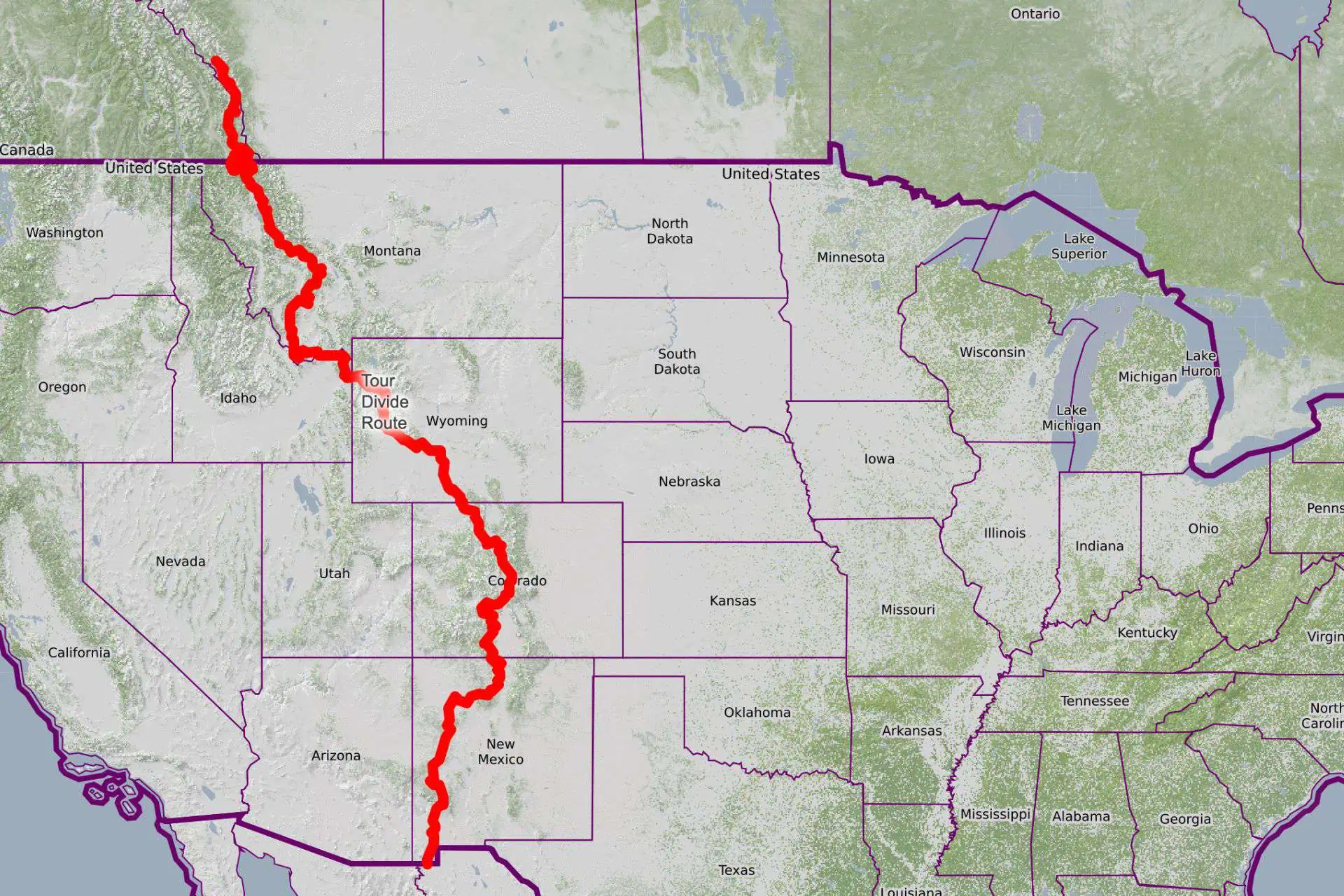
My race of the Tour Divide—a cross-country gravel bikepacking race from Banff in Canada to the US-Mexico border—generated a lot of data points: daily distance, elevation gain, moving time, and daily starting time, to name a few. Before beginning the ride, one of my biggest questions was: What will happen?
As I had never attempted anything like this, I was just interested in seeing how things would shake out more than anything.
I started the ride with a goal finish time of under 25 days, which I revised to under 20 days after the fourth day. Twenty-five days would still be awesome, but I was already ahead of 25-day pace and thought I could push myself to go sub-20. In the end, I finished with a time of 19 days, 17 hours, and 18 minutes.
It wasn’t easy to find data on the ride beforehand, and I hope the following breaks down my ride and will be helpful to future Divide racers. Granted, every year comes with its own challenges, but given that the route remains relatively the same and the start date is always around the same time of year, some variables will remain more or less consistent across races.

Notes on My Ride
Here are the notes to remember when reviewing the data from my Tour Divide ride. I’ve added more detailed notes for each day further down.
- Generally, I consider a day of riding to be from when I wake up in the morning until when I go to sleep – even if I ride past midnight and technically into the next day.
- The one exception to the above is my final push to the border. This ride spanned three days – finishing early in the morning on July 4. I’ve done my best to approximate the distance ridden for this final stretch in the data tables below.
- If you’re confused why there are 21 days in the tables below but my time was under 20 days, it’s because 1) I finished on the twentieth day (but under 20 days total), and 2) I finished earlier in the morning on Day 21 than I started on Day 1 (basically, it’s math).
For more on what the Tour Divide is, check out this post.
Totals
- Total Time: 19 days, 17 hours, 18 minutes
- Total Distance: 2710.45 mi / 4,262.05 km
- Total Elevation Gain: 174,561 ft / 53,206 m
- Total Moving Time: 12 days, 21 hours
Averages
- Average Daily Distance: 137.44 mi / 221.19 km
- Average Elevation Gain: 9,187 ft / 2,800 m
- Average Time per Day: 18:12:54
- Average Time Riding: 14:49:29
- Average Start Time: 6:21 AM
- Average Speed: 9.57 mph / 15.69 km/h
- Average Max Speed: 36.46 mph / 58.68 km/h
- Average Morning Temperature: 46°F / 7.8°C
Medians
- Median Daily Distance: 128.39 mi / 206.62 km
- Median Elevation Gain: 9,633 ft / 2,936 m
- Median Time per Day: 16:52:48
- Median Time Riding: 13:13:24
- Median Start Time: 6:15 AM
- Median Max Speed: 37 mph / 59.55 km/h
- Median Morning Temperature: 47°F / 8.33°C
Longest Stretches
- Longest Day of Riding: 316.35 mi / 509.12 km from the Toaster House in Pie Town, New Mexico, to the race’s finish line at the Antelope Wells Border Crossing at the New Mexico-Mexico border.
- Most Elevation Gain in a Day: 14,062 ft / 4287 m from the Toaster House in Pie Town, New Mexico, to the race’s finish line at the Antelope Wells Border Crossing at the New Mexico-Mexico border.
However, the above stretch was a final push to the end and required that I not sleep for the entire time. Since I know the above is a bit outside what could be considered a single day of riding, here are the same stats but only counting days where I slept some.
- Longest Day of Riding: 200.85 mi / 323.24 km with 8,734 ft / 2,662 m of elevation gain from the Strawberry Safety Shelter south of Union Pass to somewhere in the Great Divide Basin north of Warmsutter, Wyoming.
- Most Elevation Gain in a Day: 11,591 ft / 3,533 m on Day 7 from Butte, Montana, to just outside Lima, Montana. This was followed very closely by Day 9, where I had 11,581 ft / 3,530 m of climbing (just 10 ft / 3 m less) from Warm River Campground, just west of the Idaho-Wyoming border, to the Strawberry Safety Shelter located over Union Pass.

Data Table (Imperial)
| Day | Date | Miles | Elevation | Total Distance | Total Elevation | Moving Time | Elapsed Time | Average Speed | Max Speed |
|---|---|---|---|---|---|---|---|---|---|
| 1 | June 14 | 110.46 | 10,476 | 110.5 | 10,476 | 12:53:55 | 14:08:04 | 8.60 | 39.3 |
| 2 | June 15 | 128.39 | 8,753 | 238.9 | 19,229 | 13:13:24 | 16:41:57 | 9.70 | 28.5 |
| 3 | June 16 | 135.18 | 10,528 | 374.0 | 29,757 | 14:46:36 | 18:01:11 | 9.10 | 34.6 |
| 4 | June 17 | 113.04 | 4,800 | 487.1 | 34,557 | 10:35:37 | 11:58:19 | 10.70 | 31.3 |
| 5 | June 18 | 120.25 | 10,883 | 607.3 | 45,440 | 13:45:11 | 17:32:51 | 8.70 | 31.2 |
| 6 | June 19 | 118.12 | 11,276 | 725.4 | 56,716 | 12:47:30 | 15:44:48 | 9.20 | 34.2 |
| 7 | June 20 | 159.55 | 11,591 | 885.0 | 68,307 | 15:12:26 | 16:52:48 | 10.50 | 40.6 |
| 8 | June 21 | 152.41 | 4,324 | 1,037.4 | 72,631 | 12:57:20 | 15:54:29 | 11.80 | 37 |
| 9 | June 22 | 142.22 | 11,581 | 1,179.6 | 84,212 | 14:54:21 | 17:43:20 | 9.50 | 40.7 |
| 10 | June 23 | 200.85 | 8,734 | 1,380.5 | 92,946 | 17:03:38 | 19:26:39 | 11.80 | 37.9 |
| 11 | June 24 | 121.03 | 5,774 | 1,501.5 | 98,720 | 12:29:59 | 15:58:46 | 9.70 | 34.6 |
| 12 | June 25 | 105.02 | 8,363 | 1,606.5 | 107,083 | 12:19:18 | 16:52:37 | 8.50 | 37.5 |
| 13 | June 26 | 153.98 | 10,837 | 1,760.5 | 117,920 | 16:13:54 | 18:05:55 | 9.50 | 39.6 |
| 14 | June 27 | 109.61 | 7,667 | 1,870.1 | 125,587 | 11:29:39 | 16:55:46 | 9.50 | 36.1 |
| 15 | June 28 | 151.46 | 11,358 | 2,021.6 | 136,945 | 17:07:31 | 19:46:38 | 8.80 | 32.7 |
| 16 | June 29 | 104.12 | 8,491 | 2,125.7 | 145,436 | 12:46:45 | 16:37:04 | 8.10 | 37.5 |
| 17 | June 30 | 126.1 | 9,633 | 2,251.8 | 155,069 | 14:21:47 | 18:53:55 | 8.80 | 44.2 |
| 18 | July 1 | 142.31 | 5,430 | 2,394.1 | 160,499 | 13:11:57 | 16:33:43 | 10.80 | 36 |
| 19 | July 2 | 316.35 | 14,062 | 2,516.3 | 174,561 | 33:29:22 | 42:16:24 | 9.20 | 39.3 |
| 20 | July 3 | — | — | — | — | — | — | 9.20 | 39.3 |
| 21 | July 4 | — | — | 2,710.5 | 174,561 | — | — | 9.20 | 39.3 |
Town Data (Metric)
| Day | Date | Kilometers | Elevation | Total Distance | Total Elevation | Moving Time | Elapsed Time | Average Speed | Max Speed |
|---|---|---|---|---|---|---|---|---|---|
| 1 | June 14 | 177.73 | 3194 | 177.73 | 3194 | 12:53:55 | 14:08:04 | 13.84 | 63.23 |
| 2 | June 15 | 206.58 | 2669 | 384.31 | 5863 | 13:13:24 | 16:41:57 | 15.61 | 45.86 |
| 3 | June 16 | 217.50 | 3210 | 601.81 | 9073 | 14:46:36 | 18:01:11 | 14.64 | 55.67 |
| 4 | June 17 | 181.88 | 1464 | 783.70 | 10536 | 10:35:37 | 11:58:19 | 17.22 | 50.36 |
| 5 | June 18 | 193.48 | 3318 | 977.18 | 13855 | 13:45:11 | 17:32:51 | 14.00 | 50.20 |
| 6 | June 19 | 190.06 | 3438 | 1167.23 | 17293 | 12:47:30 | 15:44:48 | 14.80 | 55.03 |
| 7 | June 20 | 256.72 | 3534 | 1423.95 | 20827 | 15:12:26 | 16:52:48 | 16.89 | 65.33 |
| 8 | June 21 | 245.23 | 1318 | 1669.18 | 22145 | 12:57:20 | 15:54:29 | 18.99 | 59.53 |
| 9 | June 22 | 228.83 | 3531 | 1898.01 | 25676 | 14:54:21 | 17:43:20 | 15.29 | 65.49 |
| 10 | June 23 | 323.17 | 2663 | 2221.18 | 28339 | 17:03:38 | 19:26:39 | 18.99 | 60.98 |
| 11 | June 24 | 194.74 | 1760 | 2415.91 | 30099 | 12:29:59 | 15:58:46 | 15.61 | 55.67 |
| 12 | June 25 | 168.98 | 2550 | 2584.89 | 32649 | 12:19:18 | 16:52:37 | 13.68 | 60.34 |
| 13 | June 26 | 247.75 | 3304 | 2832.64 | 35953 | 16:13:54 | 18:05:55 | 15.29 | 63.72 |
| 14 | June 27 | 176.36 | 2338 | 3009.01 | 38291 | 11:29:39 | 16:55:46 | 15.29 | 58.08 |
| 15 | June 28 | 243.70 | 3463 | 3252.71 | 41754 | 17:07:31 | 19:46:38 | 14.16 | 52.61 |
| 16 | June 29 | 167.53 | 2589 | 3420.24 | 44343 | 12:46:45 | 16:37:04 | 13.03 | 60.34 |
| 17 | June 30 | 202.89 | 2937 | 3623.13 | 47280 | 14:21:47 | 18:53:55 | 14.16 | 71.12 |
| 18 | July 1 | 228.98 | 1656 | 3852.11 | 48936 | 13:11:57 | 16:33:43 | 17.38 | 57.92 |
| 19 | July 2 | 509.01 | 4287 | 4048.73 | 53223 | 33:29:22 | 42:16:24 | 14.80 | 63.23 |
| 20 | July 3 | — | — | — | — | — | — | 14.80 | 63.23 |
| 21 | July 4 | — | — | 4361.11 | 53223 | — | — | 14.80 | 63.23 |

Daily Observations
Here are some of the notes and issues from each day that may help to explain or offer context for some of the data.
- Day 1: I started later because riders begin the Tour Divide in waves. My wave was toward the end since I expected to finish in 25 days. This day also included Koko Claims – a notoriously long hike-a-bike section. I also had a pretty bad crash on Day 1.
- Day 2: I stopped in the town of Fernie, British Columbia, to get my bike fixed after my crash yesterday. There was lots of rain and snow.
- Day 3: Freezing rain in the morning, followed by snow, and today included “The Wall” – an incredibly steep (but relatively short) section of hike-a-bike. Pushed late to reach the town of Whitefish, Montana, to get a hotel room.
- Day 4: This is the day I revised my finish goal to under 20 days instead of under 25 days. This morning, I spent way too long at the hotel in Whitefish, Montana, doing laundry (a waste of time). I stopped at Holland Lake because of some fear-mongering regarding the snow on the next pass.
- Day 5: Snow in the morning. Passed Ovando, Montana, where I had lunch. I then pushed past Lincoln, Montana, to reach the Llama Farm (an awesome trail angel house). Rain in the afternoon and some evening hike-a-bike before the Llama Farm.
- Day 6: Stopped at a bicycle shop in Helena, Montana, to have some issues with the bike addressed. Made it to Butte, Montana, and stayed in a hotel. Some hike-a-bike in the afternoon after Helena.
- Day 7: Probably the nicest weather of the trip thus far. Hike-a-bike at Fleecer Ridge. Passed Wise River, Montana. Ended up at some random campsite after not quite reaching Lima, Montana. Cold at night. Longest day thus far.
- Day 8: Breakfast in Lima, Montana. Not a ton of elevation gain today. Crossed into Idaho. Passed Island Park, Idaho. Good day, weather-wise. Camped at Warm River Campground.
- Day 9: Crossed into Wyoming. Lots of pavement past Grand Teton National Park. Lots of climbing after this. Camped at the Strawberry Safety Shelter north of Pinedale, Wyoming.
- Day 10: Breakfast in Pinedale, Wyoming. Passed Atlantic City, Wyoming (terrible place) and entered the Great Divide Basin. Good day weather-wise. Pushed to make it to the halfway point (distance-wise).
- Day 11: I finished up the Basin and passed Warmsutter, Wyoming, in the morning. A thunderstorm hit and turned the road to peanut butter mud, which stopped me for a bit while I waited for the mud to dry. I passed Savery, Wyoming, and then crossed the border into Colorado. I slept at Brush Mountain Lodge (an amazing trail angel house).
- Day 12: Chunky uphill and downhill into Steamboat Springs, Colorado. Spent way too long getting my bike tuned up (fault of the shop). Thunderstorm leaving town.
- Day 13: Long morning into Silverthorne, Colorado. Rain starts in the early afternoon. Trying to make up for lost time yesterday. Pass Frisco, Colorado, and Breckenridge, Colorado. Singletrack section descending from Boreas Pass outside Breckenridge. Pass Como, Colorado (nothing here) and Hartsel, Colorado.
- Day 14: Misty morning into Salida, Colorado, where massive headwinds and a huge thunderstorm hits. Eat in Poncha Springs, Colorado, and ride to Marshall Pass in relatively good weather. Pass Sargents, Colorado, and then hit by another huge storm which forces an early camp.
- Day 15: Early start to make up for early camp yesterday. Two passes in the morning and a long ride into Del Norte, Colorado, but the weather is holding. Climb to Indiana Pass and then an annoying descent (with a climb up to Stunner Pass) past Platoro, Colorado, to Highway 17.
- Day 16: Road climb to La Manga Pass and then across the New Mexico border. Days distance hampered by a long section of the route that follows the Continental Divide Trail. This section was horrible. Technical, dangerous, and largely unrideable. Lots of hike-a-bike. Made it into Abiquiu, New Mexico, and stopped because of a huge storm that rolled in.
- Day 17: Thunderstorm in the morning. Lots of trouble keeping my chain from dropping with all the mud. Weather eventually clears for a chunky climb up to a pass. Pass Cuba, New Mexico and then have a long paved section where I get chased by dogs. Make it to the Chaco Trade Center where I hold up for a thunderstorm that puts all thunderstorms until now to shame.
- Day 18: Lengthy ride into Grants, New Mexico, in the morning. Thunderstorms all afternoon with a bit of mud, but still rideable. Make it to Pie Town, New Mexico where I sleep at the Toaster House. Apparently, the next section is terrible in the rain and so I choose to wait until the morning when conditions are (hopefully) better.
- Day 19+20: Leave Pie Town, New Mexico and the roads are okay. Thunderstorm hits and turns the road to peanut butter mud. Nearly stop but then push bike past it and am able to ride. Enter the Gila National Forest and push through the night past another section of Continental Divide Trail with a lot of singletrack climbing and a bit of hike-a-bike at the start. Descend into Silver City, New Mexico, and continue without sleep. Some bumpy roads south of Silver City. Pass Separ, New Mexico, and Hachita, New Mexico, before hitting the final Continental Divide Trail stretch. Get hit by a huge thunderstorm and have to take cover for a bit. Final CDT bit in the dark sucks a lot. Cacti, no real trail, sand, not great. Make it to the border.

Wrap Up
Given the number of variables associated with the Tour Divide – a (slightly) changing course, dynamic weather conditions, personal preparedness, mechanical issues, etc. – it’s challenging to define a typical Tour Divide experience.
If you’re planning to race the Tour Divide, hopefully, this helps to answer some of your questions, like, “How long did it take you to get from X to Y?” or “What was your average daily mileage?” It’s good to remember that all this data is based on just a single ride (mine) and that you may have had a much different experience than I did.
Is there any data I missed? Is there anything that would be helpful to include? Comment below and let me know; I’ll respond and add it here. Alternatively, if you raced the Tour Divide, share your data, and maybe we can get enough to put together some interesting comparisons.

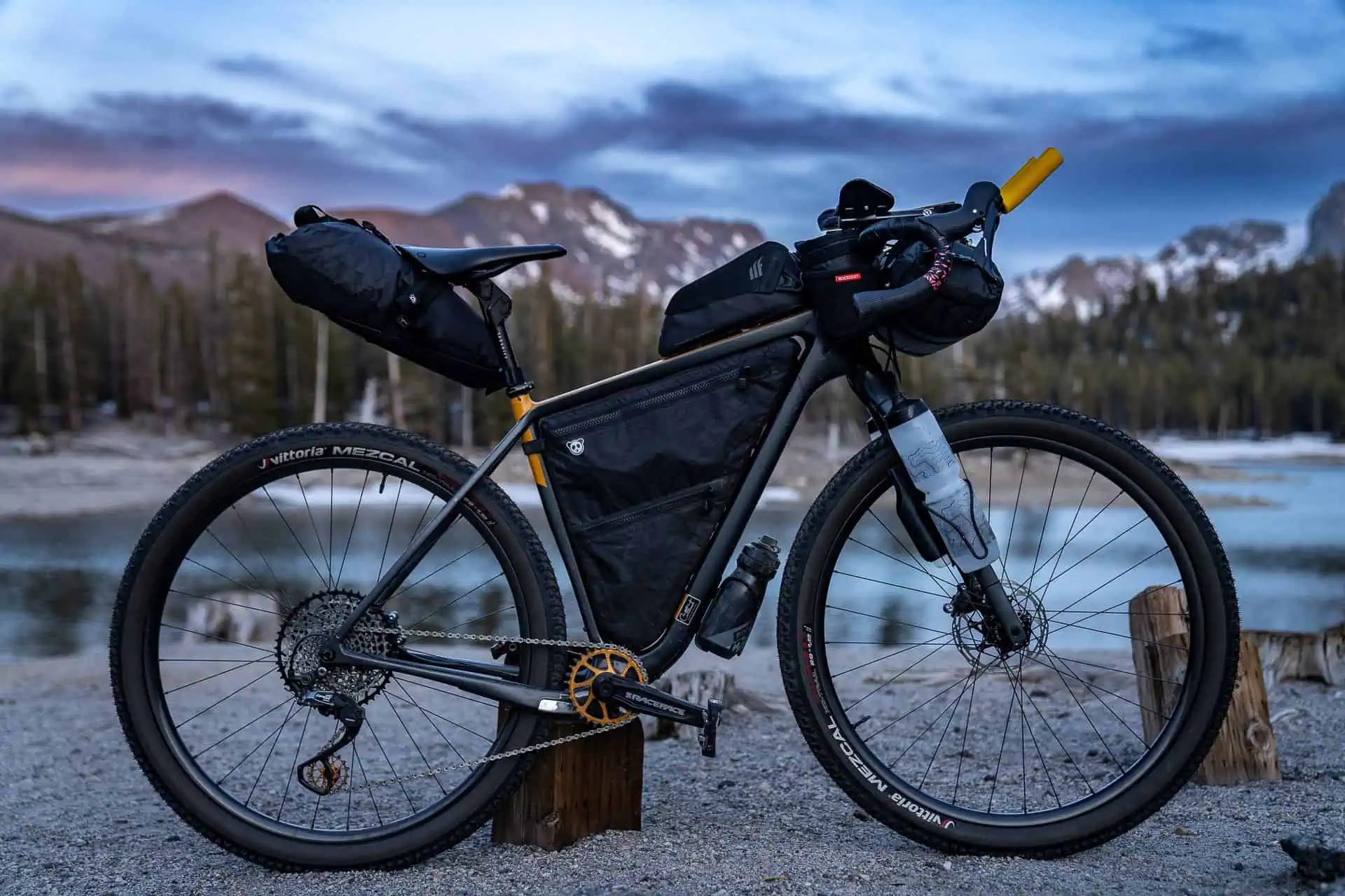
Hi, congrats on completing the tour and thanks for the stats. Curious to know whether you found the cutthroat the optimal bike for the route and if were you happy opting for a rigid fork?
I was happy with the Cutthroat. I would likely bring it if I did the TD again. Anything that was technical, I would have had to walk even if I had a suspension fork.
Hello! Love this as a resource for my 2025 bid.
I also am very curious about weather/temps, lows and highs throughout the day, or even hour by hour breakdown of layering for you. Did you only have that long sleeve shirt, down vest, and a rain jacket for riding the cold?
I can’t remember if I added them (but I’m about to/check) – I bought a base layer (top and bottom), arm warmers, and leg warmers in Fernie because it was SO COLD at the start.
The base layer I mostly slept in (until Colorado), but the arm and leg warmers were clutch. I wish I had them from the start.
It was a freakishly cold start in 2024, and we were under a winter storm warning for the first four days-ish.
If you had to guesstimate, what would the road breakdown look like? X% Paved roads, gravel roads and singletrack.
According to Ride with GPS and my own experience, it’s approximately 36% paved, 62% unpaved, and 2% singletrack.
Hi,
Nice article.
Did you record temprature stats like, min/max temp ? or riany days vs suny/cloudy
Tnx
I did not record temps and weather, but I could put this together with a combination of photos, notes, and historical weather data. What I can tell you is that the first four or five days were absolutely freezing; there was a winter storm warning in effect.