The Annapurna Circuit is one of Nepal’s best-known and most-traveled treks. That said, it can be difficult to know what to expect on the circuit if you’ve never been to Nepal before – especially when a lot of information out there is coming from trekking companies who simply want to sell you things.
I’ve put together a collection of photos to help convey what an Annapurna Circuit trek looks like. Despite my having some misgivings about the trek, it’s still a beautiful part of the world and an impressive mountain to (nearly) circumnavigate. If anything is missing from these photos that you would like to see included.
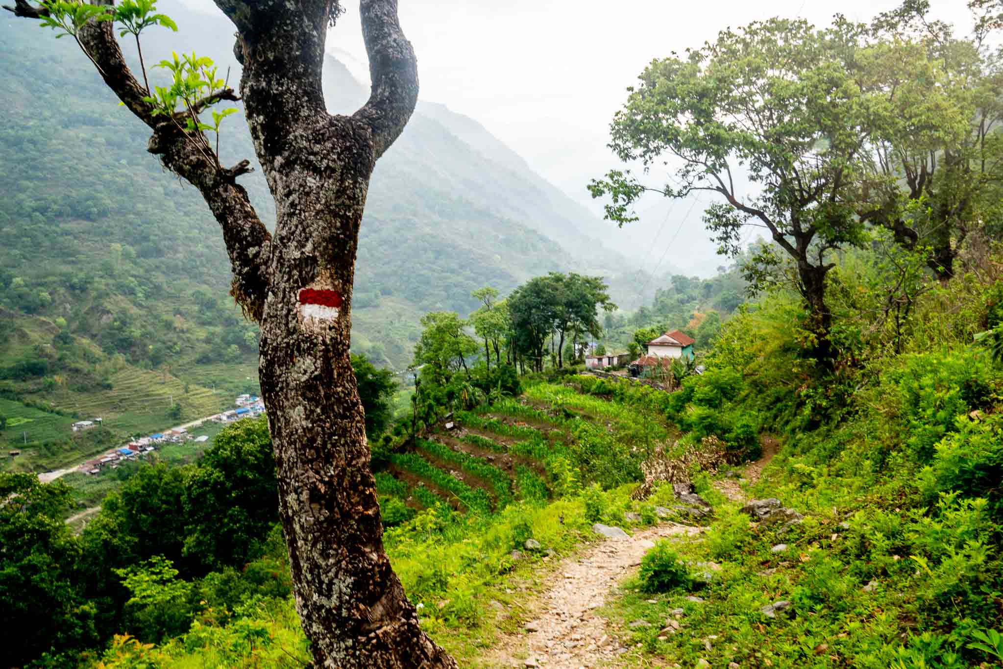
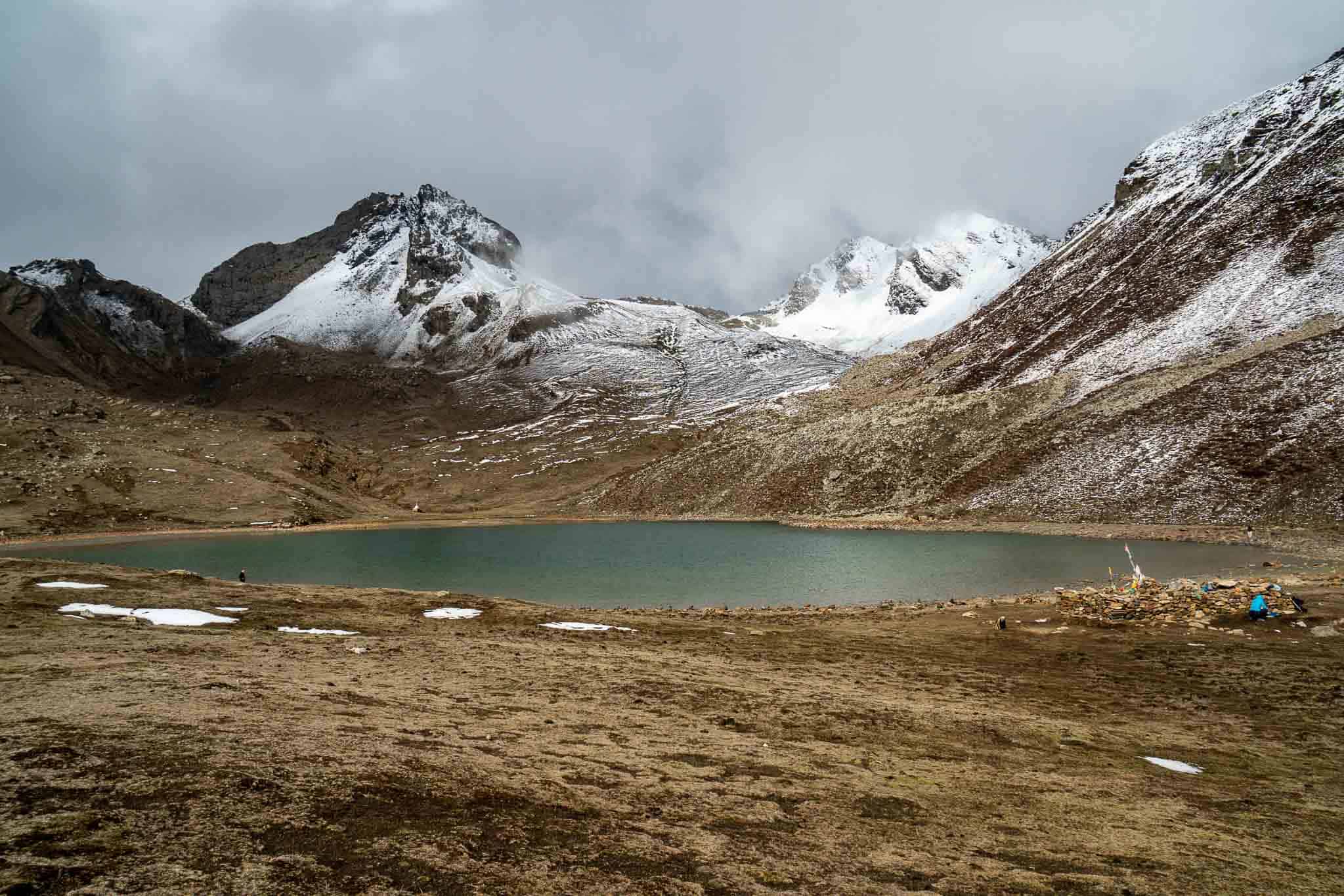
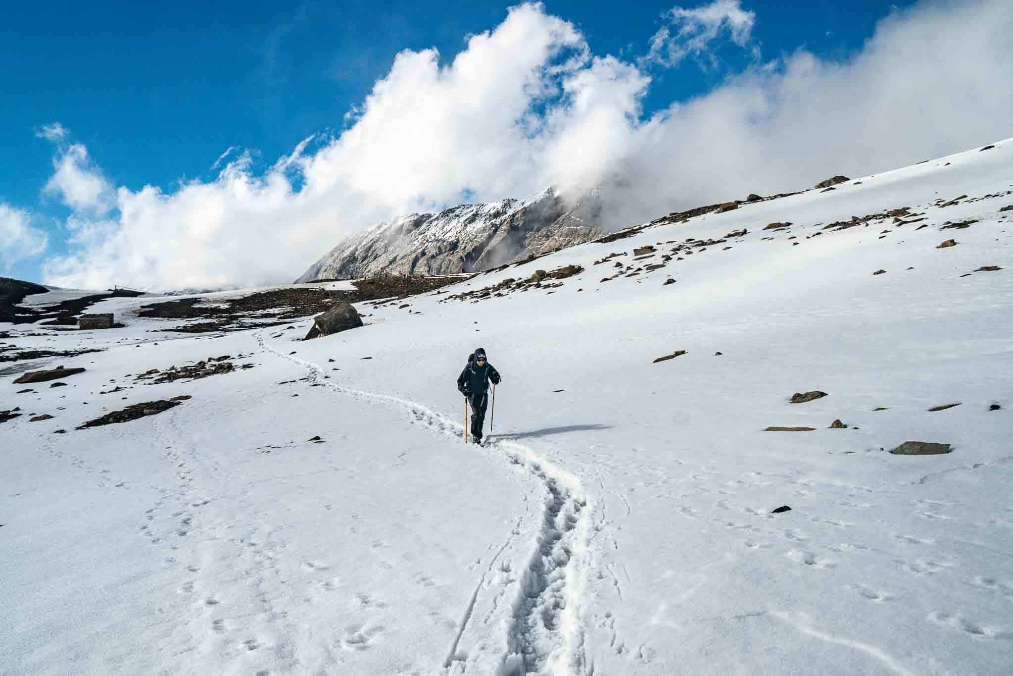
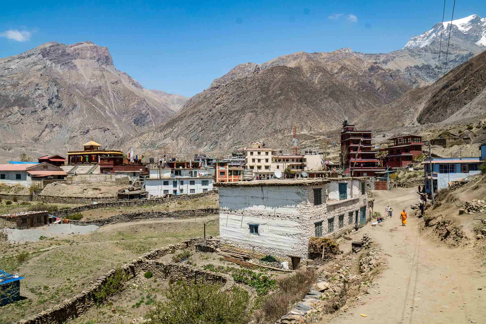
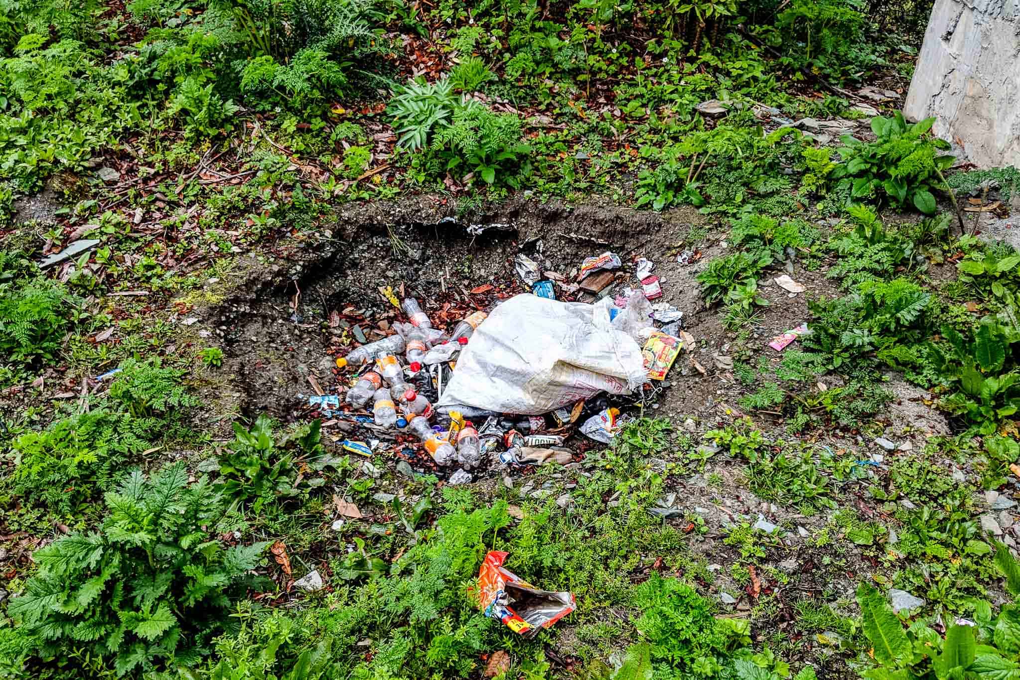
The but I took from Kathmandu to Besi ShaharWalking down the road – some serious infrastructureOne of the villages at a lower elevation on the east side of the Annapurna CircuitA red and white blaze marks the Annapurna Circuit’s routeA red and white blaze marks the Annapurna Circuit via the road; a blue and white blaze marks the Annapurna Circuit via the trail.Stinging nettle on the Annapurna Circuit – don’t touch it unless you want some unpleasant tingling sensations.You’ll be crossing the river quite a few times during the Annapurna Circuit.A look at the Annapurna Massif – the world’s tenth highest mountain.A cloudy morning on the Annapurna Circuit.The trail (or road) is easy to follow on the Annapurna Circuit.Looking back east on the Annapurna Circuit while hiking toward Manang.A nice break from being close to the road during the first half of the Annapurna Circuit.Looking back east along the Annapurna Circuit (while trekking west).Dramatic cliff bands end abruptly upon reaching the valley floor.The Annapurna Massif from Kicho Tal (Ice Lake)Kicho Tal (Ice Lake) – a worthwhile detour on the Annapurna CircuitInside a teahouse on the Annapurna CircuitLooking south across the valley from ManangLooking north at Manang from a spur trailLooking east from the north-facing slopes of the valley opposite Manang.Gangapurna Tal – located just south of Mamang – a side trek along the Annapurna CircuitThe inside of a shop on the Annapurna CircuitA station providing clean, filtered water to trekkers on the Annapurna CircuitLeaving the official Annapurna Circuit to being the Tilicho Lake side trekLooking west on the trail to Tilicho Base CampLooking back east along the trail to Tilicho Base CampLooking east, on the way up the trail from Tilicho Base Camp to Tilicho LakeTilicho Lake is still a worthwhile detour when it’s frozen (despite what the locals may tell you).The snow-covered trail leading to/from Tilicho LakeHeading back to the Annapurna Circuit from the Tilicho Lake side trekThe trail leading up to Thorong Phedi – the last stop before Thorong La, the high point of the Annapurna Circuit Sunrise on the Annapurna MassifPassing Base Camp (aka High Camp) on the way up to Thorung LaTrekkers coming up the trail toward Thorung LaThe final bit of trail before reaching Thorung LaThe shelter at the top of the pass, Thorung La, 5,416 m (17,769 ft)Looking west down the trail from Thorung LaMuktinath – a large village just west of Thorung LaThe trail from Muktinath to Lupra – an alternate routeA glimpse of Dhaulagiri – the world’s seventh highest peakCrossing a bridge on the way to LupraThe long, flat, dusty, and windy valley on the western half of the Annapurna CircuitYou can get a bus down from as far north as Muktinath on the western half of the trekThe intersection of the Annapurna Circuit and the (far more rugged) Dhaulagiri CircuitHotel Tanpopo in Marpha – one of the nicest guesthouses I found on the Annapurna CircuitA well-maintained trail at lower elevations on the western half of the Annapurna CircuitThe long, flat, slog south out of the valley continues (many people choose to fly back from Jomsom)Wild cannabis growing along the Annapurna CircuitThe infrastructure at lower elevations never ceases to impress.Humidity can be an issue at lower elevations the further away from winter you get in either direction.Annapurna Circuit lizard (if you have an ID, let me know)The country is quite green at lower elevations – much different than the alpine environments.Unfortunately, an all-too-common sight in Nepal’s mountains – pack out whatever you can.If you manage to make it to the western terminus in Nayapul before deciding to catch a jeep, bus, or plane, you’ll find yourself on a paved road.
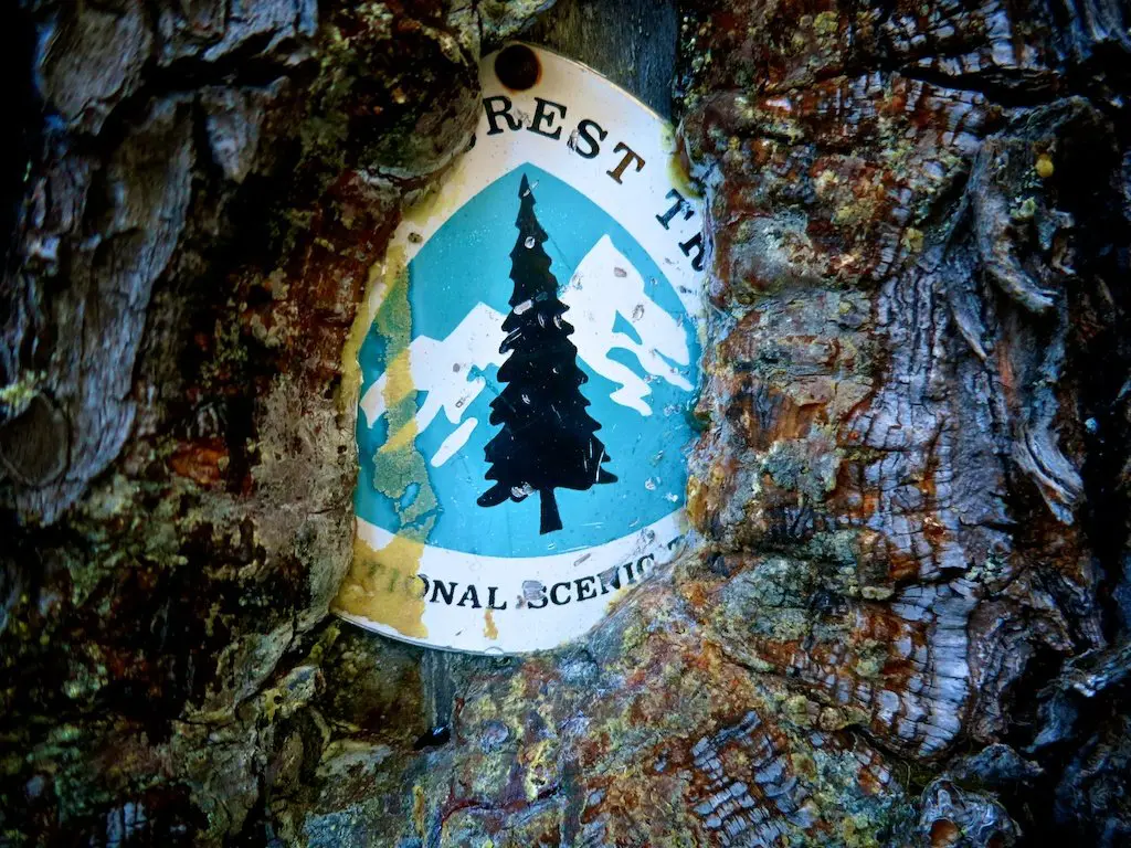
Colorado, the second state of the Continental Divide Trail (for northbound hikers), presents a set of new challenges for hikers leaving New Mexico. Hikers face…
NOTE: Since writing this post, I have returned from Everest Base Camp and answered all the questions I had here in the post Everest Base Camp Questions…
Not all excitement during an Everest Base Camp trek takes place during the day. No, sleeping outside in Namche Bazaar is a sure way to make you new friends.
Ever since I discovered that my phone could take panoramic photos (January 14, 2011, in case you were wondering), I have occasionally remembered this function…
2 Comments
such informative articles about Annapurna Circuit trek love to see more articles in future


such informative articles about Annapurna Circuit trek love to see more articles in future
They’re on the list!