
Continental Divide Trail in Photos: Colorado
Colorado, the second state of the Continental Divide Trail (for northbound hikers), presents a set of new challenges for hikers leaving New Mexico. Hikers face elevation, snow, thunderstorms, cold, moose, recreational cannabis, and increased prices once they cross the border into Colorado from New Mexico.
The Colorado Section of the CDT heads through the San Juan Mountains before heading north, at many points overlapping with the Colorado Trail, through Gunnison National Forest, past Mount Elbert (the highest peak in Colorado), over Grays Peak (the highest point on the CDT), through the Arapaho and Roosevelt National Forests, into Rocky Mountain National Park (the first national park heading northbound), into the Never Summer Wilderness, and then through the Medicine Bow-Routt National Forests and the Mount Zirkel Wilderness. I’m sure I’m missing a few forests or wilderness areas in there, but you get the picture – lots of nature.
If you are interested in a detailed account of my Continental Divide Trail hike through Colorado, check out these posts:
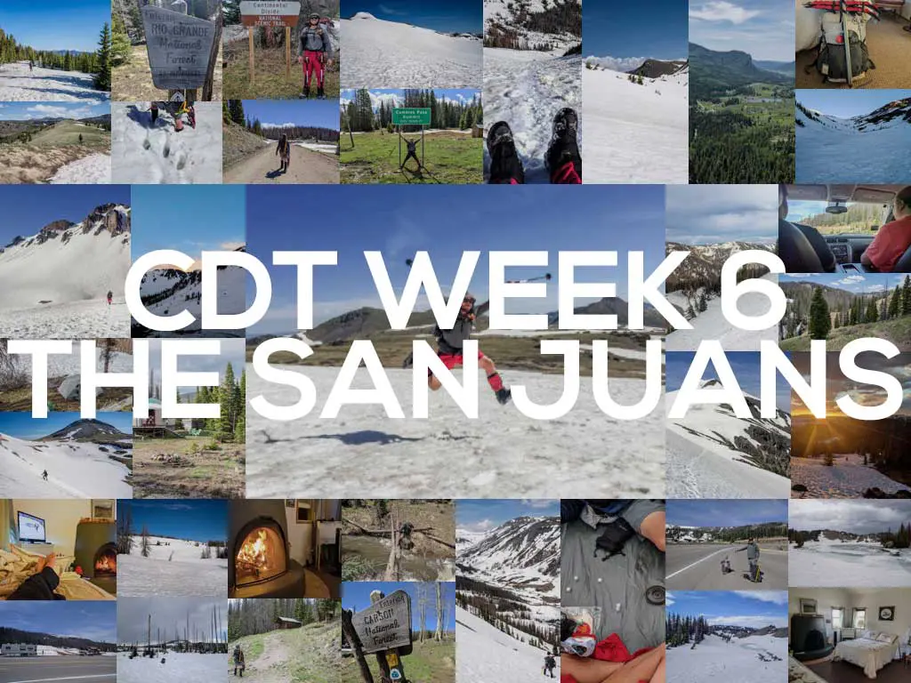
- CDT Week 6: The San Juans
- CDT Week 7: Big Decisions
- CDT Week 8: Three Is Company
- CDT Week 9: Moist Is Dead?
- CDT Week 10: Shortcuts to Town
- CDT Week 11: Farewell Moisture

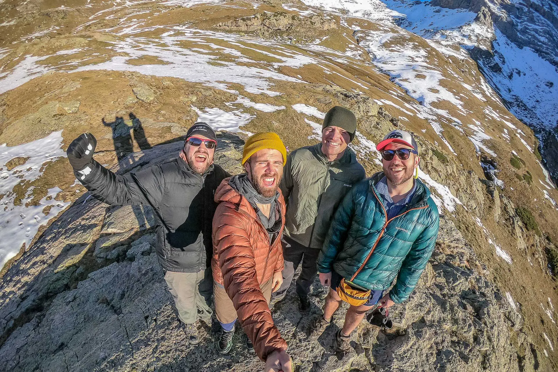
Welcome to Colorado! 
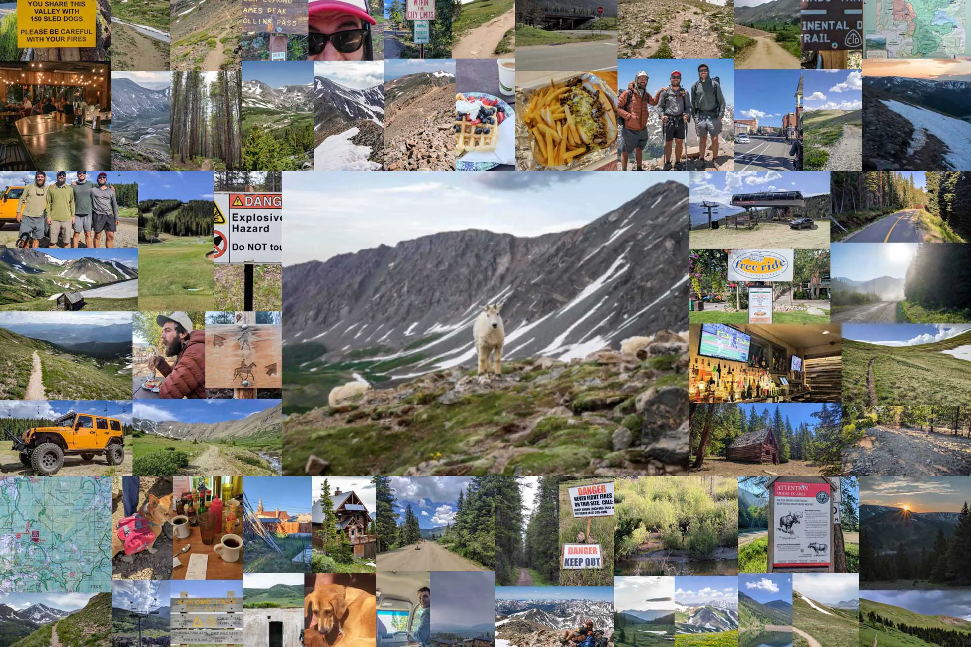
Heading down to Cumbres Pass near the New Mexico-Colorado border. The first pass in Colorado – Cumbres Pass Riding in the back of a pickup truck – probably a good way to get dead A mural in Chama, New Mexico, which is sort of the first Colorado resupply stop (heading northbound). I am sure everything will be fine… Deciding whether it would be better to stay high or drop into the valley below. Traversing in the snow – a common yet scary thing on the CDT. Looking forward to that dry trail ahead. Casually hanging out at Wolf Creek Pass. Postholing! Something you’ll get lots of practice doing on the CDT. Do yourself a favor and try to sleep on dry ground if possible; it’s a lot warmer than the snow. In the snow you can just make up where you want the trail to be! Glissading is quicker than hiking You’ll probably want an ice axe for the San Juan Mountains A yurt that sports the CDT logo but that does not welcome CDT hikers. To reach many of the towns along the CDT, hitchhiking is your only option. What’s more fun than hiking? Hiking in the snow. Staying high can keep you away from the snow (sometimes). Melting snow? Not as good as lakes when it comes to water sources. Walk through a freezing, flooded trail or through the brush? Probably the trail. Did you know that all sunsets are pink in Colorado? 
Finally, not everything is covered in snow. The clouds look nice until they all get together and decide to shoot lightning at you. Time to decide whether to make camp or press on. Falling trees are a legitimate danger on the trail, do not take these warnings lightly. Taking off your shoes during a break? Highly recommended. The snow is your friend, just accept it. Beautiful sunsets can do well to undue the horror of the day’s thunderstorms. After all the walking through snow, I promise to never complain about dry trail again. Traversing not in the snow? Safer (usually) than traversing in the snow. Heading down Lake Ann Pass. The north side of Lake Ann Pass can be sketchy. Nothing feels better than a well-defined trail. Mount Elbert – the highest point in Colorado There is some below tree line hiking in Colorado, too. Kokomo Pass – sadly, no beaches here. I hope you like having your feet wet, because they’ll be wet a lot on the CDT. Is there a storm coming? A question that you’ll ask frequently in Colorado. A cabin nestled deep in the Colorado backcountry. An abandoned structure near the trail. Walking jeep roads in Colorado. Heading up toward Grays Peak – the highest point on the CDT. Traversing to Grays Peak A mountain goat friend (not at all spooked by me) Duck friends! Stony Pass – where hikers can (try to) catch a ride to Silverton. Eating dinner after leaving town The high point of the Colorado Trail A second yurt in Colorado (this one you can go inside). Left symbol? Colorado Trail. Right symbol? CDT. Grand Lake, Colorado CLEAR A PATH! How many moose do you need for it to be a herd? Switchbacking up to the pass Just before a storm struck Dirt roads are your friends on the CDT Remember to take advantage of town offerings on the trail! The snow finally appears to have subsided in Northern Colorado. The CDT is the road and the road is the CDT


Questions about the Continental Divide Trail through Colorado? Leave a comment below and let me know!


Great pics – thanks for sharing these. Was there any part of the CDT that was completely unmarked where you had to make your own trail?
I don’t know that “make your own trail” would be the best description, but when I hiked, there were certainly sections where there was no obvious trail and you needed to navigate a bit.