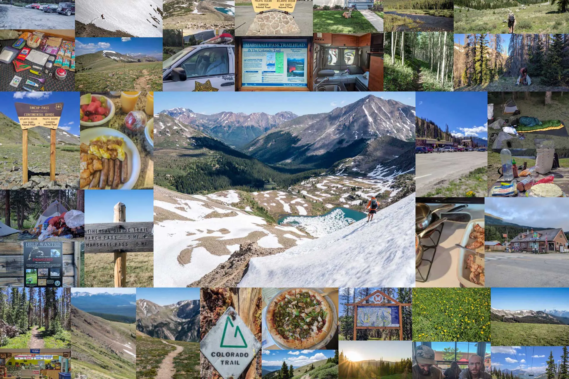
Continental Divide Trail Week 9: Moist Is Dead?
Week 9 on the Continental Divide Trail starts with me on my own, without Appa or Moist, before making it to one of the most-loved Colorado resupply stops, Salida. It’s so great I take a double zero here before hiking out, meeting back up with Appa and Moist, and making it to Twin Lakes, Colorado further up the trail.
Day 57: All Alone
The smart thing to do would be to start when the sun comes up (then again, the smart thing to do might have been to never begin the CDT in the first place). Instead, I let the sun wake me up (sunrise is around 6:00), and I leisurely pack up my things before starting to hike around seven.
One day, I will learn to set my alarm early and start hiking when the sun starts peeking over the horizon, but (unfortunately?) that day is not today (however, I do hear three hikers pass my tent this morning – maybe this will be my inspiration in days to come). Appa is up and ready before me and hikes out before I’m finished getting ready (he’s a much sexier hiker than I am). BAI APPA…
The trail today is again filled with dirt bike riders who very inconveniently make finding a place to poop quite the challenge. Is the spot that I believe to be completely secluded and safe from the peering eyes of the trail really as safe as I’ve imagined? Is a dirt bike about to come crashing out of the bushes from behind to end me in a most unspectacular fashion? Those are just risks you have to take on the CDT, I guess.
I need to start doing this first thing in the morning.


The weather appears to be cooperating, which is a relief since we will be above 10,000 ft / 3,048 m for the entire day today (‘we’ assuming I catch up to Appa – I’ve written Moist off as officially dead since it’s been more than 48 hours since I’ve seen him).
Signal at the top of a climb, eh? Any word from Moist? Nope. Yeah, definitely dead.
I don’t usually take many breaks when hiking alone and about halfway through the day I catch Appa at a water source (if you’re looking to catch hikers, water sources are good places to lurk). Apparently, this is the last water for the next 12 mi / 19.3 km. So now that the snow is gone we have to worry about water carries again (not that 12 mi / 19.3 km is super far, but it’s enough to note)? Lame.
I leave the water source before Appa (who very much enjoys his leisurely breaks on the trail) with three liters in my pack and one in my stomach.


The parade of dirt bikes continues for the rest of the afternoon. I feel like technically they should be yielding to me (as there are some very narrow sections of trail that we are meeting each other on), but practically it doesn’t make much sense (which means I’m constantly jumping out of the way either up or down the steep slopes on either side of the trail.
Another function of being near trailheads? Lots of day hikers (and still more Colorado Trail hikers). Seeing other hikers on the trail is exciting for a bit, but when everyone wants to stop and chat (and you’re trying to make miles), these pleasantries can seriously eat into your hiking time.
Speaking of eating into my hiking time, I need to sit down because what the fuck? I am feeling weird. I don’t know. Maybe it’s all the dirt bike exhaust? Maybe the altitude? We’ve been at elevation for a couple of weeks now so I don’t think that’s it. Whatever it is, I need to sit and calm myself for about ten minutes. Maybe I was on the brink of having a panic attack? Bad vibes, whatever it is. Probably ghosts.


By the time I’ve composed myself, Appa still hasn’t caught up. Appa knows that I’ll be pushing today so tomorrow will be as short of a day as possible (tomorrow we’ll make it to Monarch Pass and hitch into Salida), and I know that Appa won’t hike after dark without a very compelling reason to do so. Basically, I now have the power to decide whether I will be camping with Appa tonight.
Camping alone it is.
As the sun is setting I make it to a water source with three CDT hikers already camped, Bowleg, Quicksilver, and Spam. If Appa pushes this far, this is probably where he will stop (because of the water, not the company – the Appa is a solitary creature). I fill up and decide to push a bit farther to the Marshall Pass Trailhead where I find a man hanging out in his car with a girl and (what I assume are) their two dogs. They give me some weed when they find out I’m hiking the CDT, but they don’t have any soda. I could go for a soda. Maybe someone else will come along and I can trade the weed for a soda. Damn, I really want a soda. Who drives around in the mountains without a car full of soda?
Setting up my tent, fireworks are going off nearby. Great. One of the advantages of being camped near a trailhead. Dickheads (but maybe they have soda?).
I bury my head in my sleeping bag and try to rage sleep as best I can with a belly full of mac and cheese (but no soda).
Day 58: Monarch Pass (Arrive in Salida, CO)
Whether inspired by my thoughts yesterday morning or my wish to make it to town, I don’t know – but I am walking at 6:00 this morning and just narrowly beat the sunrise (HAH! Take that, sun).
The day starts with a 1,000 ft / 300 m climb (which is nice since I’m not walking in direct sunlight), and after making my way around a large snowbank that I am unable to scramble up and over, I am on my way to the road. The road which still looks oh so far away.


Fortunately, the rest of the way to the road is an easy walk down a windy and gently sloping road. Once I start to see day hikers without packs on, I know I’m nearly there – Monarch Pass.
Monarch Pass is at 11,312 ft / 3,448 m, and (apparently) sits along a popular cross-country cycling route as there are more bicyclists here than I’ve seen for the entirety of the CDT. There’s also a gondola and a surprising number of cars in the rather large parking lot. I guess this is a popular tourist spot too? Or at least a popular spot for people driving on Highway 90? Whatever. Maybe it’s just because today is Sunday. Most importantly, there is a gift shop with snacks, a small food counter (that is, a small counter with some food, not a counter for small food), and (most importantly) soda.
I get myself a soda for what I hope to be an easy hitch into Salida (there are lots of people here and approaching people to ask for rides usually proves more successful than simply hitchhiking – does that still count as hitchhiking if you’re just asking for rides? I would say ‘no’).
Two of my fellow CDT hikers, Chris and Spam, are lingering outside the shop waiting for a friend of Chris to come to pick them up (I guess they got started even earlier than I did today). I don’t feel like waiting (and I’m not sure if I’m invited), so I start my journey into town by asking an unsuspecting civilian nearby a very important question, “Which way to Salida?”


It’s about 22.5 mi / 36.2 km northeast from Monarch Pass to Salida. The smaller town of Poncha Springs is a bit closer at around 17.5 mi / 28.2 km, but Salida is really where you want to get to if you’re coming off the CDT (I’ve heard good things about this place).
Abandoning my brilliant idea of asking for rides (the parking lot is too big to effectively solicit everyone who might be leaving), I instead hang out on the road near where people are pulling out (and where thru traffic is speeding past). After ten minutes a guy in Sprinter Van (future home?) stops on his way out to ask me if I know where the Colorado Trail is. I thought that the Colorado Trail and the CDT were still overlapping, but I guess I missed a junction where the Colorado Trail split.
I tell him the truth, that I don’t know (note: this is a perfectly acceptable answer on the trail, friends – don’t make up answers or pretend to know things that you do not) and in return, he offers me a ride. Easy enough.
“Is it okay if we stop at Wal-Mart on the way into town?” he asks as we descend from the mountains. Wal-Mart is about 1 mi / 1.6 km outside of town. This may not sound like much if you’ve got a car, but if you’re on foot and need to buy a resupply plus food for town, that 2 mi / 3.2 km roundtrip journey is a pain in the ass (especially if you’re like me and do everything you can to minimize physical activity in town).
“I love you.”


My new friend drops me at a hostel in Salida’s downtown. However, the only person there is a guest (who irresponsibly allows me inside). I call the owner (person in charge?) and there’s no answer. Guess I’m not going to get clean before hitting the town.
Pizza and beer it is.
The Google points me in the direction of Moonlight Pizza where I find friendly staff accepting of my filthy state and a table with a power outlet (very important when deciding where to set up camp in town). I order a pizza, connect to the wifi, and begin replenishing my podcast and audiobook collection for the coming section.
A couple of hours later I get a call from Appa who has also made it to town, and while I’m on the phone, Quicksilver shows up at Moonlight Pizza (this place must have some sort of hiker beacon). Appa soon joins us and I decide against staying at the hostel since I expect to take two days off in Salida.
Splurging at the Comfort Inn it is.


Days 59 & 60: Salida Double Zero (Zero Days 7 & 8)
We’ve grown to like the Comfort Inn (a chain hotel in the US) on account of their wide range of movie channel offerings (as I don’t tend to move beyond the confines of my hotel room when in town) and their hot breakfast buffets (i.e. they have eggs, sausages, and sometimes waffles in addition to just cereal, fruit, bread, juice, and coffee) – coincidentally, one of the few things that will motivate me to get up out of bed when in town.
One of the other things that will motivate me to leave my accommodation in town? The kindness of strangers.
Chris, whom I saw at Monarch Pass yesterday, got in touch to let me know that we are invited to hang out and have dinner with two of his thru-hiker friends in Salida. Nobody knows what thru-hikers need like thru-hikers.


On morning 60 of our CDT thru-hike, Appa and I receive some good(?) news: Moist isn’t dead.
Nope, the third and final member of this expedition has returned to us (which is good because it means that this hotel room just got cheaper).
Tomorrow, it’s goodbye town and back to the trail. I wonder how long I would have to hang out in town before I would start missing the trail and need to go back. Two months? Definitely. Two days? Not even close.
Back to walk tomorrow (HAHA! Get it? Like back to work, except I said ‘walk’. Because they are both four letters and they both begin with a ‘w’ and end with a ‘k’? And I’m walking not working. So I say “Back to walk” instead of saying “Back to work” and then it’s funny. LAUGH, DAMN YOU).


Day 61: The Boreal Toad (Leave Salida, CO)
Hitching out of Salida isn’t tough (although it takes us two rides to get back to Monarch Pass) and after a short road walk south on Highway 50, it’s back on the T of CD. Appa and Moist quickly get ahead of me as I less hike and more leisurely stroll through the Monarch Mountain ski resort.
The weather is nice for the fifth day in a row which worries me. I’m sure it won’t be long before Zeus strikes fear into my heart again.


The climb up from the pass (because on the CDT, unlike the PCT, passes are generally low points, not high points – hence the whole Continental Divide thing) is one of the awesome ones where you descend a couple hundred feet (~60 m) for every five you gain (~150 m). The end is only 1,500 ft / 457 m higher than the start so this shouldn’t take too long (just in case, I’m kidding, it takes like 7 mi / 11.3 km to get to the high point).
Unlike the southern side of Monarch Pass, there aren’t any day hikers up here (probably because you have to walk down the highway to get to this trailhead). Instead, my company here is power lines, chairlifts, and signs marking the runs down the mountain.
I’m not sure if I’ve said this before, but New Mexico really does little to prepare your body for the climbing in Colorado. As soon as you feel fit at the end of New Mexico, the trail turns around and fucks you with elevation and real climbing (not whatever it is that’s happening in New Mexico).


We reach the day’s high point, 12,552 ft / 3,826 m, and the sun begins to slowly disappear as we begin a 2,000 ft / 610 m descent towards the Hancock Trailhead and parking lot. This parking lot is probably going to have people there since we’re still close to town. Instead of risking human interaction, we stop for the night at a water source 2 mi / 3.2 km before the parking lot.
It could be the two zero days in Salida, or it could be that I’m a wimp, but I’m exhausted after our relatively short hike (16.1 mi / 25.9 km) out of town.
Appa and Moist start up a campfire as I instead take an unintentional pre-dinner nap on top of my sleeping bag.
The days leaving town are the worst.


Day 62: Forest Roads
It’s our first morning on the trail together in nearly a week which means that my alarm clock has returned to the sound of Appa repeatedly hitting the ignition switch on his stove as he prepares his morning coffee.
I only recently began drinking coffee when I decided to let go of energy drinks, but I am not sure it does anything as far as keeping me awake. Years of energy drinks may have given me too high a tolerance for caffeine (I’m assuming that energy drinks/coffee work the same way as heroin as far as the tolerance thing goes). That said, I don’t drink coffee on the trail because I’m not someone who needs my coffee in the morning (in town, coffee is fair game).
On the trail, simply watching Appa drink coffee is enough to get me going in the morning (or at any time of day, really).


After an uneventful walk down to the parking lot before hitting Hancock Trailhead we head up a forest road for 1,500 ft / 457 m before hitting our first pass of the day. Today’s elevation profile is not one that you typically look forward to. After this first climb of 1,500 ft / 457 m, we have 1,500 ft / 457 m of downhill before – guess what – another 1,800 ft / 549 m of climbing.
However, before that second climb, we have the opportunity to take the Mirror Lake Alternate – a 22.6 mi / 36.4 km alternate route that is 0.5 mi / 805 m shorter than the official CDT. Shorter equals better, so it looks like we’re taking Mirror Lake (especially because it looks like there’s a bit toward the end of the alternate where we’ll be able to do a cut to save ourselves nearly 2 mi / 3.2 km of hiking.

We take the Mirror Lake Alternate, also known as the Collegiate West Low Route (which I am assuming means less climbing as well – one more point in favor of the alternate) and head up to Tincup Pass at 12,159 ft / 3,706 m (“less climbing” doesn’t necessarily translate to “no climbing”).
When we get to Mirror Lake, the trail is washed out and we need to wade through the water to make it to the picnic tables and parking area on the other side – much to the amusement of everyone who has driven to the lake today for some sun fun.
The bathrooms, tables, and grassy areas are taken full advantage of as we set up our base for lunch.


We make it to the cut we saw on the map earlier (at least the place where we believe a cut to be possible) and scramble down a hillside before realizing why the trail does an unnecessary-looking loop west – because there’s a river and that’s where the bridge is. But we’re already off the trail and we’re not about to go back.
At the edge of the river, which looks to be moving quickly enough to push someone over if they aren’t careful, there’s about a 3 ft / 1 m drop down to the water – water that is difficult to gauge the depth of. Eventually, we find a spot where we can safely lower ourselves down into the water and wade across. On the other side, it’s basically a marsh; but I guess getting our feet wet at the end of the day is preferable to doing it first thing in the morning.
Once back on the trail, we find Chris (a fellow CDT hiker), with his tent pitched in a nice flat, grassy spot where we decide to join (seeing as the next bit of trail is a 1,500 ft / 457 m climb). At 34.3 mi / 55.2 km, we’re just short of being able to say that we’ll definitely make it to Twin Lakes, Colorado tomorrow (a small town that’s actually on the CDT – unusual for Colorado).
But if we can find some sweet shortcuts like we did today, we might have a chance.


Day 63: Lake Ann & Hope Pass (Arrive in Twin Lakes, CO)
If we’re going to make it to Twin Lakes today, we’re going to have to earn it. In addition to the 34.3 mi / 55.2 km of trail between our camp and our next town, we also have two climbs of 1,500 ft / 457 m and then a third and final climb that’s nearly 2,500 ft / 762 m up to Hope Pass before dropping nearly 3,500 ft / 1,067 m down into Twin Lakes.
The climbing starts right away with a fairly epic climb up to Lake Anne Pass.
Appa, Chris, Moist, and I all hike out together as we’re confronted with huge switchbacks (as in long switchbacks) that gradually lead us up to the top of the pass. And what do we find at the top of the pass? A glorious cornice and an equally glorious view of the valley below where the trail is about to take us down.
However, before we can make it into the valley we need to cross a steep snowfield on the north side of Lake Anne Pass – I had thought we had made it past all the sketchy snow bits of the CDT.


When we hit the valley floor we immediately start running into day hikers. Apparently, there’s a forest road not too far ahead. A road? Does that mean a shortcut? Nope, not this time. Our most reasonable route out of this valley and to Twin Lakes is over the 12,533 ft / 3,820 m Hope Pass.
The valley is full of day hikers, trail crews, and scary unleashed dogs (statistically, the most dangerous animal you’ll encounter on a thru-hike). The hiking is easy and the trail junctions are all well-marked; it feels like we’re just around the bend from Twin Lakes and my ice cream, frozen burrito, and beer dinner. But then I remember that we still have one more big climb before the aforementioned salvation.
That said, as I always say, town is an incredibly effective motivator.


Down the other side of Hope Pass, there’s a huge and unnecessary-looking loop (as most loops look) the trail does around the twin lakes that this small Colorado community apparently gets its name from. We can’t tell exactly how much trail we’ll cut by taking this shortcut, but it looks to be close to 10 mi / 16 km. Worth it.
Crashing through the bushes, we break off from the trail and push north in the direction of the road. Knowing that we’ll hit it eventually makes dealing with the bog we encounter and subsequently slosh through more palatable (it wouldn’t be a complete day on the CDT without wet feet).

Fortunately, today is Friday which means the general store (aka the only store in Twin Lakes) is open until eight – we arrive at 18:30 (they would have been closed had we arrived yesterday and our little hiker hearts would have been smashed to pieces).
Sitting outside at a table in front of the store, we are joined by a southbound Colorado Trail hiker from New Zealand and eventually two more northbound CDT hikers. When it starts to get dark we head to the other side of the street to a large grassy area with, oddly enough, a large wooden floor (presumably for dancing) and a white tent set up over it. The store employees (who were very friendly) told us there’s going to be a wedding here tomorrow.
Maybe we should take a zero here and crash it.


Week 9 Totals
- Day 57 (June 24): 35 mi / 56.33 km
- Day 58 (June 25): 10.8 mi / 17.38 km (Arrive Salida, CO)
- Day 59 (June 26): Zero Day 7 (Salida, CO)
- Day 60 (June 27): Zero Day 8 (Salida, CO)
- Day 61 (June 28): 16.1 mi / 25.9 km (Leave Salida, CO)
- Day 62 (June 29): 32.8 mi / 52.8 km
- Day 63 (June 30): 34.3 mi / 55.2 km (Arrive Twin Lakes, CO)
CDT Week 9 Total: 129 mi / 207.6 km
CDT Journals
- Day 1: The Middle of Nowhere
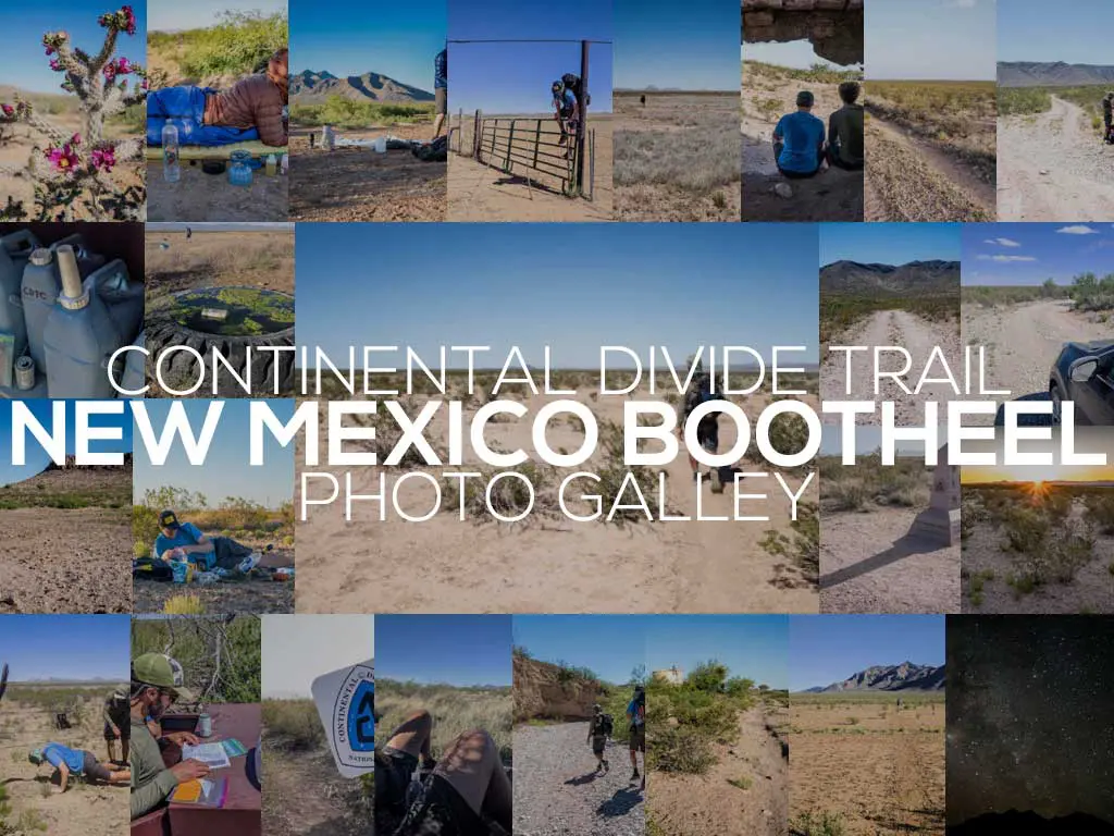
- Week 1: The Bootheel
- Week 2: The Gila
- Week 3: We Got A Dog
- Week 4: One Month In
- Week 5: Don’t Die
- Week 6: The San Juans
- Week 7: Big Decisions
- Week 8: Three Is Company
- Week 9: Moist Is Dead?
- Week 10: Shortcuts to Town
- Week 11: Farewell Moisture
- Week 12: Wyoming!
- Week 13: The Winds
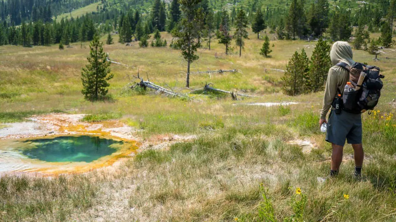
- Week 14: Yellowstone
- Week 15: The Final State(s)
- Week 16: MURKAH
- Week 17: You Think You Know Montana?
- Week 18: The Gang’s All Here
- Week 19: Fires!
- Week 20: Canada
Affiliate Disclosure: This page may contain affiliate links, which means I may receive small commissions for purchases made via these links at no additional cost to you. This helps pay the bills and keep the site up and running. Thank you for your support!


Woooo, glad to finally read more about this. Thanks for posting!
Finishing these is a monkey I need off my back.