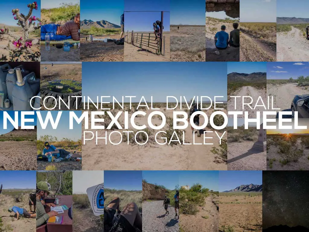
Continental Divide Trail In Photos: New Mexico Bootheel
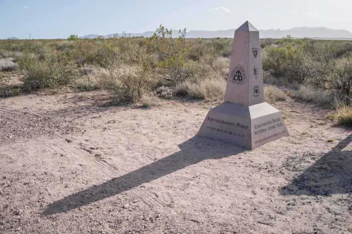
Despite the Continental Divide Trail (CDT) having numerous starting (or ending, if you’re one of those weird southbound hikers) points, many people (myself included) consider Crazy Cook Monument to be the “official” southern terminus (probably because there’s a monument there with the CDT logo and an inscription that says “Southernmost Point”).
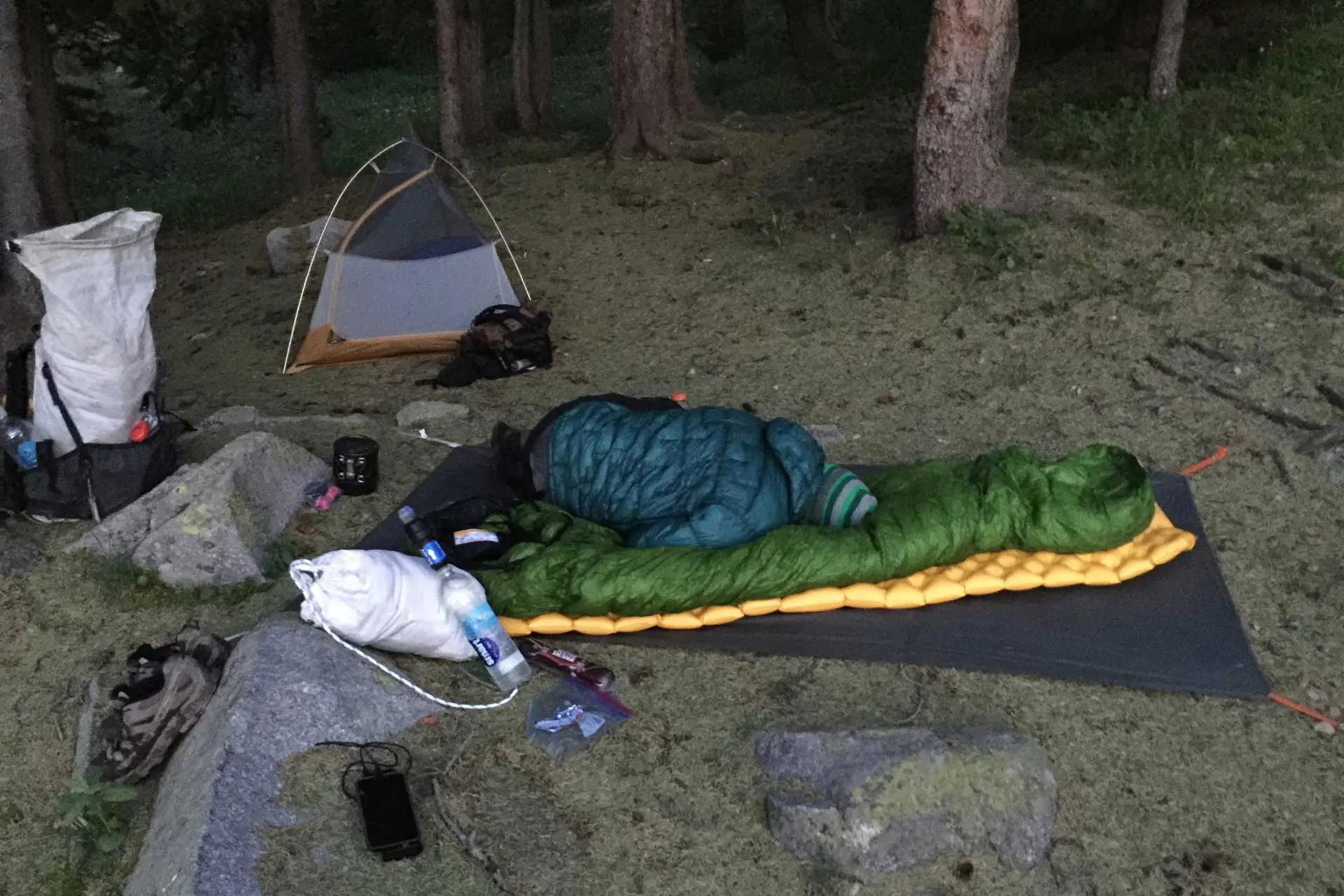
The Bootheel (that is, the southwestern corner of New Mexico defined by a straight, north-south border with Mexico on its eastern side) is 50 mi by 30 mi (80 km by 61 km) and occupies an area of 1,500 mi² / 3,900 km². There are very few water sources in the Bootheel and most hikers have water cached at five different locations along the trail. It’s truly the desert.
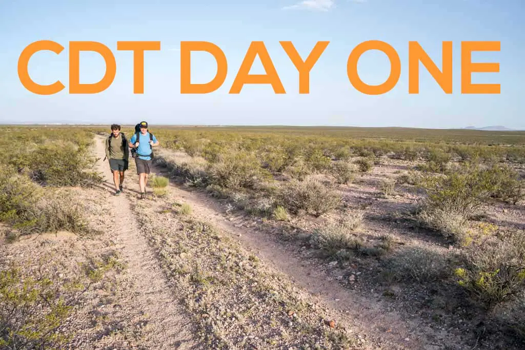
Eight-five miles (137 km) of trail lies between the southern terminus at the US-Mexico border and the town of Lordsburg, New Mexico; it’s an excellent introduction (or a lame end) to a Continental Divide Trail thru-hike.


If you’re more interested in reading about the New Mexico Bootheel (and want more pictures, then check out the following posts:


Flash floods, poisonous wildlife, wildfires, high crime rate and other problems killed my dream of retiring to southwestern NM; likewise to Tucson and vicinity. And I’m too scared of flying to make visits from NY and back. So all I have are shared experiences like yours. NM has such a vast variety of terrain, temperate zones, vegetation and mountain ranges. And so wonderfully free of the “wetness” that’s all through NY, never could get used to it. If only NY were at least as big as NM maybe the mountains would look similar and they and the rivers and lakes further apart. Lots of photos here showing much of what I love about NM. But for some reason this was a big favorite.
https://www.halfwayanywhere.com/wp-content/uploads/2018/05/CDT-New-Mexico-Bootheel-Gallery-Moist-Over-Fence.jpg Thanks for having me along.
Thanks for coming along, Greg. It’s funny to see with all that nothingness how a simple fence or gate can get in the way.
Mac, just a few questions about your (our) NM hiking event: Were you in any way driven to make this trek out of curiosity for the vegetation and smells you might encounter? Various types of trees, cacti, sagebrush, range grass, et al? And did their smells sort of excite you and made the trip more enjoyable?
And since you just happen to be exploring within the same counties in NM where I had hoped to build my retirement dream home-within the vicinity of Silver City and Deming-how exactly did retiring for the evening in your sleeping bag protect you from snakes, black widows, Gila monsters, red ants and other poisonous nocturnal wildlife? How did you cover your face and head enough to still breathe and not be all stiff like a sardine in a can?
Do you two guys live year round in NM? And within Luna or Grant counties? If yes, have had run into these wildlife threats around your homes or friends homes? I know the state gives instructions to homeowners for installing snake fencing and other precautions, but have you had many close encounters with snakes, scorpions, black widows when you least expected it?
Btw, did you feel that 5.8 quake in 2014? The USGS said Lordsburg was the epicenter but then revised the location to some place nearby in AZ. The last quake that hit NY was in 2011. That also was a 5.8; epicenter was VA. I remember that day I was in my office at my job talking to someone and suddenly it was like the entire floor was on rollers.
It lasted only about 2 seconds if that long.
USGS show no sinkhole risks for the region.
https://www.usgs.gov/special-topic/water-science-school/science/sinkholes?qt-science_center_objects=0#
Any experiences with sinkholes in Luna or Grant?
Excuse my ranting but it’s a rare thing to chat with those who can put aside the niceties of modern living-and even risk snake bites (!!)-long enough to enjoy what we probably love most about the Land of Enchantment.
Were you in any way driven to make this trek out of curiosity for the vegetation and smells you might encounter? None
I had zero problems with insects and reptiles. I don’t know of a single person who had issues with them.
Do you two guys live year round in NM? And within Luna or Grant counties? I have never lived in New Mexico.
Btw, did you feel that 5.8 quake in 2014? No, I don’t live in New Mexico.
Any experiences with sinkholes in Luna or Grant? None
When I think about what those nights might have been
like there I always hear this version of “Jack Straw”.
I hope you like these.
https://www.youtube.com/watch?v=9NqggeXq6ms
https://www.youtube.com/watch?v=Cm_IQtLIe4E
And thanks again for sharing your hike.
Not a bad soundtrack – thanks for coming along!