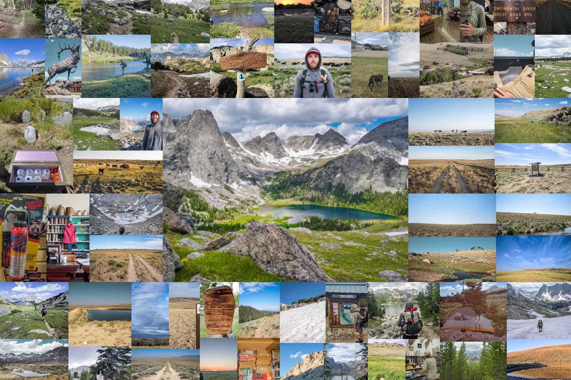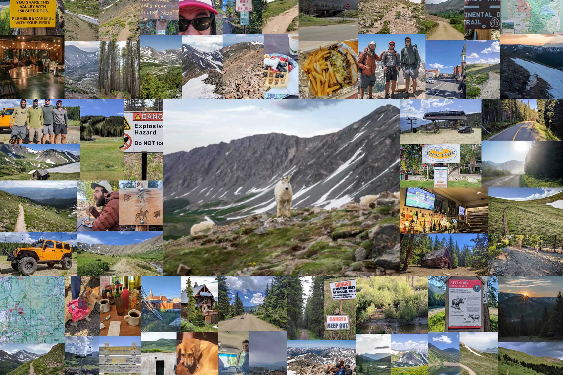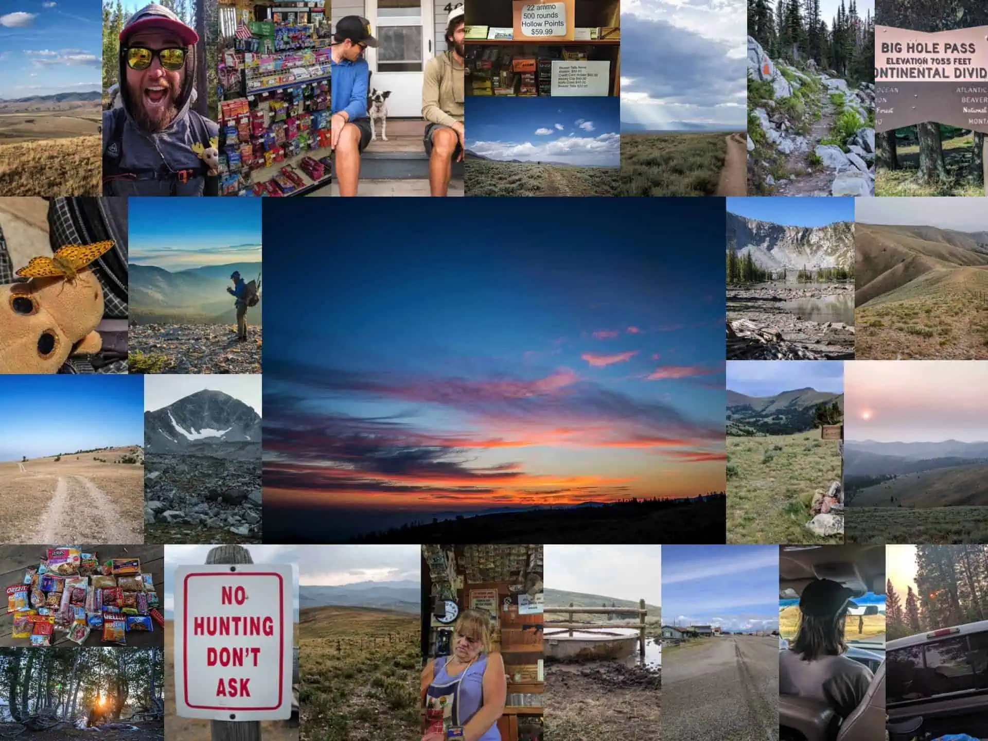
Continental Divide Trail Week 16: MURKAH
Week 16 on the Continental Divide Trail takes us deeper into Montana as we (again) lose Moist and hits the trail town of Leadore, Idaho (where I need to replace my lost sunglasses). We end Week 16 just south of our next resupply in Darby, Montana.
CDT Day 106: Moist Is Dead
We’re up early and walking before six in the morning. Pre-sunrise hikes are always the best – I need to do this more.
The trail is easy enough to follow in the dark, but the constant undulation proves frustrating. This could easily be one of the worst sections of the trail thus far. And by worst I mean my least favorite, the trail itself is acceptable, I suppose. Idaho-Montana border, you leave much to be desired.
After a couple of hours of hiking, I stop to wait for Appa and Moist. It’s snack time.

It starts raining and I take shelter under a tree, hoping the now-expected thunderstorm fails to materialize. Appa shows up and reports that he has yet to see Moist. We suppose that Moist is possibly (most likely) dead.
We hang out for a bit, waiting for him to show up. Nothing. We spot someone on the ridge coming toward us, but we can tell by the gait that it’s not our Moisture. The Moist has a distinct walk that can be spotted from miles away.
When the unknown hiker reaches us, we ask if he’s seen anyone else (specifically, Moist). He hasn’t. We figure Moist will catch up to us if he’s still breathing.
Appa and I continue hiking.

The rest of the day passes quickly, and despite regular stops to fill up on water and eat snacks, there’s still no sign of Moist.
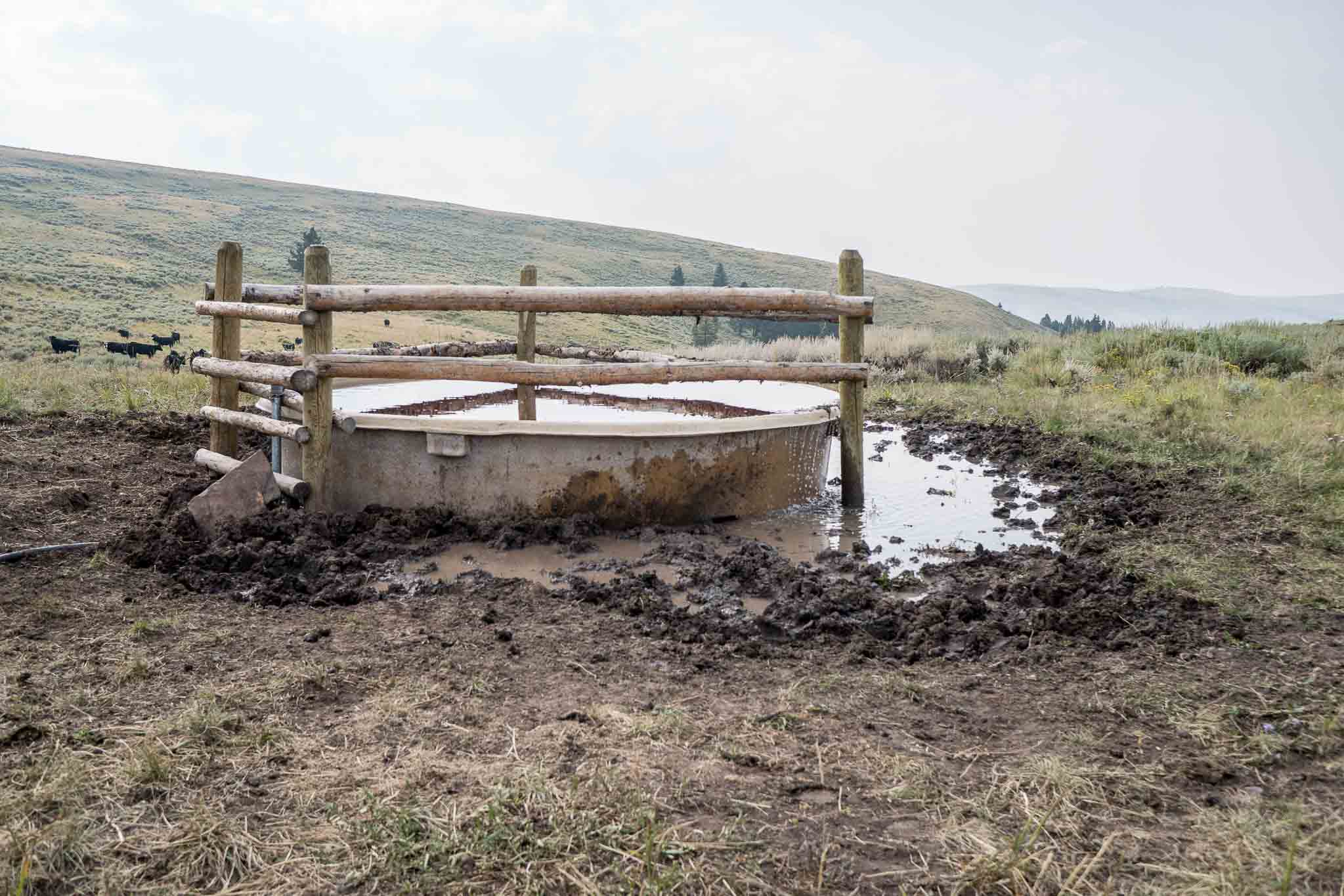
We reach a saddle with a cow trough (i.e. a pretty good water source) and decide that the nearly 40 mi / 64 km we put between ourselves and camp last night is sufficient.
After pitching our tents and making dinner there’s still no sign of Moist. Guess he really is dead.
CDT Day 107: Farewell, Sunglasses
It’s another early morning but we’re starting the day following a dirt road which makes for easy walking.
We didn’t expect Moist to materialize during the night last night and he failed to do so. Appa gets ahead of me (it’s always good to keep track of who is ahead and who is behind you – this can get tricky when pooping), and we continue the endless undulation we began yesterday along the Idaho-Montana border.
I see Appa stopped talking to a group of four southbound hikers but I’m too far away to justify making the trip over to them. Plus, it’s starting to rain and it looks like a storm is on its way in.
Reaching the shelter of some trees, I stop to wait for Appa.


Our next town stop is Leadore, Idaho. We’re supposed to hitchhike there from Bannock Pass, but since it’s such a small town (under 100 people live there) we don’t like our chances of hitchhiking and we don’t know if we’ll have cell reception at the pass to call for a ride.
Reaching the next pass on the CDT, we examine our maps. It looks like if we drop down directly west from here we’ll be able to follow dirt roads all the way into Leadore and it should be about the same distance as if we simply stayed on the trail.
We leave the official CDT and hope that the path we’ve picked out on the map doesn’t cross any private land or have any insurmountable obstacles waiting for us.
Now there’s zero chance we’ll see Moist again (at least not today).

One of the things you should be conscious of when hiking the CDT is the precise relationship between you and the people you’re hiking with/around.
Sure, it may seem like we’re abandoning Moist, but we know that he’s a big boy who can take care of himself. We also know he’s not going to be upset with us when we eventually find him again (that is if he’s still alive).
If Appa and Moist were ahead of me and I was dragging ass or decided to stop and swim all day at a lake or whatever the case may be, I wouldn’t expect them to stop hiking and I certainly wouldn’t expect them to turn around and come looking for me.
Appa and I continue on our newly found alternate and keep a close eye on the stream we’re following down into the valley below. Since we’re no longer on the official CDT, we no longer know where our next reliable water source will be so we want to make sure we fill up here before leaving it behind.

Looking at the maps, Appa and I begin to disagree on which way we should go.
We get water, as planned, and then end up going separate ways. Sometimes it’s better to just go off on your own than to argue about which way is “better” and get upset. And speaking of getting upset, it’s not until I’ve been hiking another hour that I realize I’ve forgotten my sunglasses back at the water source.
Would it make sense, financially, for me to hike back and get my sunglasses? Absolutely. That said, having to backtrack on a thru-hike is an awful thing to have to do.
Guess I’m buying new sunglasses in Leadore.
CDT Day 108: The Worst Trail Town (Arrive Leadore, ID)
Camped alone, I’m woken up constantly during the night by the howls of coyotes and intermittent rain. When it’s finally light outside, I pack up my wet tent and continue north to the next trail town, Leadore, Idaho.
I don’t know much about this place other than it’s incredibly small – one of the smallest towns on the CDT (maybe just a bit bigger – but more compact – than Pie Town). The town has just over 100 residents (according to the most recent census) and sits at an elevation of 5,971 ft / 1,820 m.
Walking into town I immediately spot two familiar faces, Mr. Appa and Mr. Moist; I guess he’s not dead.

Despite the town being small, there is a hiker-friendly business here, the Leadore Inn.
They allow hikers to camp on their property and offer rides to and from the nearest access to the official CDT, Bannock Pass. There’s also a golf cart at the inn which CDT hikers are allowed to use to drive to the two other spots in town where a hiker would find his or herself in need of going – the restaurant and the general store.
Appa, Moist, and I head to the inn where we find some familiar faces (JPEG, Quicksilver, and Treeman), as well as a few new CDT hiker faces.

After laying out our tents to dry, we make our way to the town’s one restaurant – which appears to share a wall with/be a part of the town’s one bar – where we get the largest breakfasts on the menu and drink coffee until we’ve all taken our turn in the bathroom.
After breakfast, we head across the street to the general store where we replenish our food stocks for the next section of the trail.
The general store has maybe slightly more on offer than you would expect to find at a gas station. It’s by no measure a great resupply, but it certainly gets the job done. Looks like there will be a lot of candy and cookies in the next section – at least they have cheese and tortillas.

We head back to the Leadore Inn to set up our now-dry tents and laze around the porch. I suppose we could easily hike out, but then we wouldn’t be reaping the rewards of having made it to town (not that this town has much on offer).
Before calling it a day, we make one more trip to the other end of town to the restaurant-attached bar. Inside, we find one of the most unfriendly bartenders I’ve ever had the misfortune of interacting with. The walls are covered with signs and slogans reminding anyone reading how much the proprietors of this establishment love guns as well as tacky bumper stickers mostly about shooting people and sex.
To top it off, there’s an effigy of a lynched Barack Obama.
Worst trail town.
But I did manage to find and purchase a new pair of sunglasses at the general store. I guess the Leadore isn’t all bad?

CDT Day 109: Summer Sunsets (Leave Leadore, ID)
Today’s a great example of why we should leave town when we have the chance.
Instead of waking up and getting back on the trail early (which never happens), we end up hanging out around the Inn all morning, and then, when it’s time to go, new hikers show up which of course means we need to stay and chat with them for a bit. And then maybe we should get a beer with them. And then maybe more ice cream and another burrito from the store. And then why not just stay another night in town?
We manage to do most of this but ultimately end up being able to pack our resupplies and get a ride up to Bannock Pass.

Now wait a second, I bet you’re wondering what happened to Moist three days ago when he never caught up to me and Appa. I’ll tell you.
It turns out that Moist started feeling not too well and instead of making it to our campsite (which he got very close to), he instead turned down a dirt road he found on the map and managed to get a hitch back to Lima (where he had just rejoined us on the trail).
He then got a hitch to Leadore where he waited for us to show up.
Moist already missed the entirety of Wyoming (and has hiked the CDT once before), so missing this section of trail doesn’t bother him much. Just like Appa and I missing the section of trail from where we turned off the CDT to take our alternate into Leadore and Bannock Pass doesn’t bother us much.

Because the word “pass” on the Continental Divide Trail can indicate a low point in addition to a high point (lately all the passes have been lows), we are climbing up from the road once we’re dropped off.
Climbing after resupplying is quite common (since I guess towns aren’t typically on mountain tops), and going uphill with the heaviest pack you’ll carry for the entire section (because you haven’t eaten any of your food yet), makes getting back on the trail just that much more pleasant.
It’s after 6 PM by the time Appa, Moist, JPEG, and I are dropped off and hiking. Before long, the sun is already setting and the coyotes are once again howling.
Looks like the gang’s back together again.

CDT Day 110: Hiking Is Boring
In case you’ve made it this far into my Continental Divide Trail saga and haven’t noticed yet – a lot of thru-hiking is boring. Sure, there are glorious places to visit and exciting things to see, but the vast majority of my time out here is spent simply walking and listening to podcasts, audiobooks, or music.
Some people will tell you that you should be “listening to nature” while you’re out hiking, but after nearly four months on the trail, I think I’ve listened to enough nature.
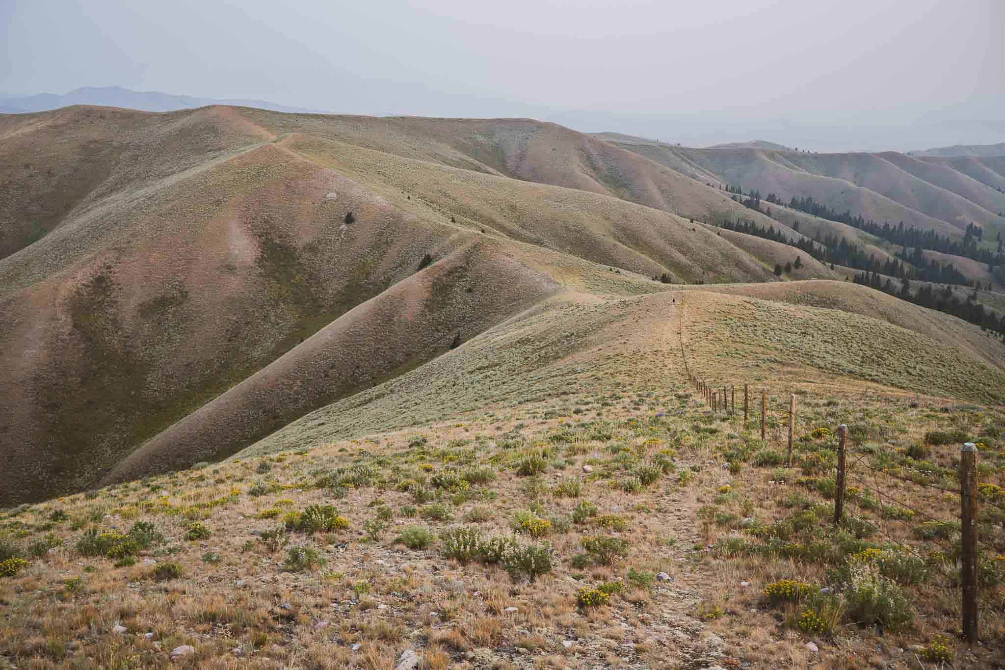
This section of the CDT is particularly uninteresting as the trail traces the Idaho-Montana Border. It feels a bit like the Northern California Section of the Pacific Crest Trail. Yes, it’s beautiful, but next to what we’ve seen (and what we expect to see), it’s just sort of meh and uninspiring.

The Idaho-Montana Border is also a great place to come if you would like to learn to appreciate PUDs – also known as “pointless ups and downs”.
We follow the trail as it goes up 500 ft / 152 m, down 500 ft / 152 m, up 1,000 ft / 305 m, down 1,000 ft / 305 m, up 2,000 ft / 610 m, down 2,000 ft / 610 m, up 1,000 ft / 305 m, down 1,000 ft / 305 m – I hope you get the picture.
JPEG and I pull ahead of Appa and Moist and the two of us end up pushing harder than expected. By the time we decide to “camp at the next water source”, we’ve already put over 35 mi / 56 km behind us.
We set up camp just before sunset and wonder if we’ll be seeing Appa and Moist tonight (or tomorrow, for that matter).
They’re no-shows to the cowboy party.

CDT Day 111: Blazes
JPEG and I get an early start without catching sight of Appa or Moist. Unless we take it easy today, we probably won’t see them until the next town (Darby) because I doubt they’re going to push to catch up with us (they love each other).
The terrain today begins to get a bit more interesting as we escape some of the grassy, rolling hills and find ourselves spending time above 8,000 ft / 2,438 m – even above 9,000 ft / 2,743 m at times.

The CDT has had a lot of different blazes up until this point – or at least I think.
One of the interesting things about being out on a long trail like the CDT (opposed to something like the Appalachian Trail) is that there’s no instruction manual. There’s nothing that says, “you should follow these marks”. Yes, there are official CDT markers at times, but then at other times, there are markings that look like the letter ‘i’.
And now I’m seeing these blazes that look like someone painted a bunch of inverted orange exclamation points on the rocks. Am I supposed to follow them? Honestly, I don’t know, but I do.
And things work out.

CDT Day 112: Big Hole Pass
We wake up eager to get moving. If we put in a huge day today, we’ll be in town tomorrow and we’re over this section of trail – uninspiring.
We’ve long discounted the idea of Appa and Moist catching up to us; we’ll see them in the next town.
One of the nice parts of today is the abundance of water sources. Yes, the New Mexico Bootheel may be far behind us, but that doesn’t mean there aren’t still dry sections of the trail. The Idaho-Montana Border has been hit or miss as far as water sources are concerned.

We put our heads down and hike and before five in the afternoon, we’ve already put in over 30 mi / 48.3 km.
The typical exit for this section of trail is Chief Joseph Pass – around 15 mi / 24 km ahead of us. But It’s only 10 mi / 16 km down to the road from Big Hole Pass, it looks like. It also looks like there might be a restaurant down on the road.
So what do we do? We detour from the trail and move as quickly as we can down the mountain and to the main road below. We tell ourselves that we can make it to food if we really push.

After almost two hours of hiking, a truck appears out of seemingly nowhere. We resist the urge to stick out our thumbs, but then the driver pulls over to ask us if we’re all good. We tell him we’re great, but will be a lot better when we make it to food. He asks us if we want a lift. How can we say no? We jump in the bed of the truck.
We make it to the restaurant, Broken Arrow, which turns out to be a Mexican restaurant – a delicious Mexican restaurant with amazing staff.
Now our problem is where to camp. Fortunately, there’s really nothing around here and so after a brief walk up the road towards town (town here being Darby, Montana).
Tomorrow we’ll wake up early and hitch into town with the expectation of getting back on the trail at Chief Joseph Pass. Will we be missing approximately 10 mi / 16 km of the trail? Yes. Will it be worth it to have had this delicious meal? Absolutely.

Week 16 Totals
- Day 106 (August 12): 38 mi / 61.16 km
- Day 107 (August 13): 39.2 mi / 63.09 km
- Day 108 (August 14): 13.3 mi / 21.4 km (Arrive Leadore, MT)
- Day 109 (August 15): 6 mi / 9.7 km (Leave Leadore, MT)
- Day 110 (August 16): 35.4 mi / 56.97 km
- Day 111 (August 17): 31.2 mi / 51.7 km
- Day 112 (August 18): 28.9 mi / 46.5 km
CDT Week 16 Total: 192 mi / 309 km
CDT Journals
- Day 1: The Middle of Nowhere
- Week 1: The Bootheel
- Week 2: The Gila
- Week 3: We Got A Dog
- Week 4: One Month In
- Week 5: Don’t Die
- Week 6: The San Juans
- Week 7: Big Decisions
- Week 8: Three Is Company
- Week 9: Moist Is Dead?
- Week 10: Shortcuts to Town
- Week 11: Farewell Moisture
- Week 12: Wyoming!
- Week 13: The Winds
- Week 14: Yellowstone
- Week 15: The Final State(s)
- Week 16: MURKAH
- Week 17: Fires!
- Week 18: Canada
Affiliate Disclosure: This page may contain affiliate links, which means I may receive small commissions for purchases made via these links at no additional cost to you. This helps to pay the bills and keep the site up and running. Thank you for your support!

![The Continental Divide Trail in Four Minutes [VIDEO]](https://www.halfwayanywhere.com/wp-content/uploads/2018/01/CDT-YouTube-Featured.jpg)