Continental Divide Trail In Photos: The Gila
Northbound thru-hikers of the Continental Divide Trail have a very important decision to make when they reach CDT Mile 173.1 (or for anyone who chooses to do the Columbus Alternate, where you begin the CDT from the town of Columbus, New Mexico instead of at Crazy Cook Monument south of Lordsburg, CDT Mile 192.7) – whether or not they are going to take the Gila Alternate.
This CDT alternate takes hikers up the guts of the Gila National Forest and through what is arguably some of the best scenery in New Mexico. Over the course of my CDT thru-hike I only met one hiker who took the official CDT through the Black Range instead of the Gila Alternate (what a sucker). The Gila Alternate is also 73.6 mi / 118.45 km shorter than the official CDT. Yes, it’s both more beautiful and shorter; there’s no downside.
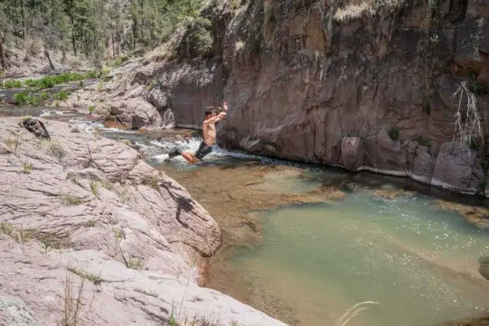
Hiking through the Gila is a huge departure from the Bootheel and is almost dreamlike – spectacular canyon walls rising around you in every direction, delicious water to drink and to swim in everywhere you look, and it’s the only place in the world where you can still find living Camahueto (the closest living relative of the now-extinct horse-like creature commonly referred to as a ‘unicorn’).
Yes, the Gila is magical.