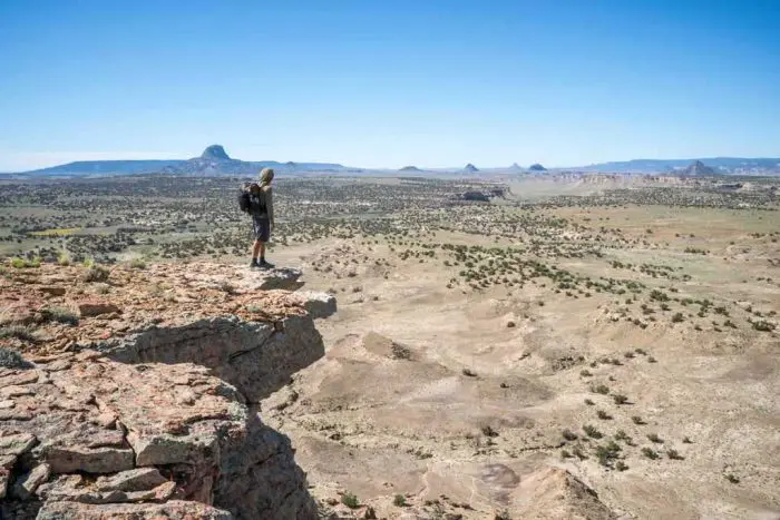
The southernmost 809 mi / 1,302 km of the Continental Divide Trail (CDT) covers the stats of New Mexico. New Mexico can (somewhat accurately) be described as the “desert section” of the trail, and the entire New Mexico CDT is above 4,000 ft / 1,220 m, and more than 75% is above 6,000 ft / 1,830 m (with the high point appropriately found near the New Mexico/Colorado border).
Notable sections of New Mexico? The Bootheel, the Gila National Forest (which is actually an alternate route), the San Pedro Parks Wilderness, the Ignacio Chavez Special Management Area, El Malpais National Monument, and the Chama River Canyon Wilderness.
The photos below are in chronological/geographical order from south to north, and if you’re really into photos of New Mexico you can check out the following posts as well:
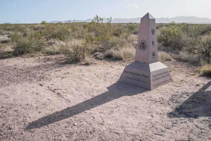
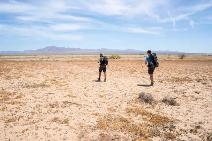
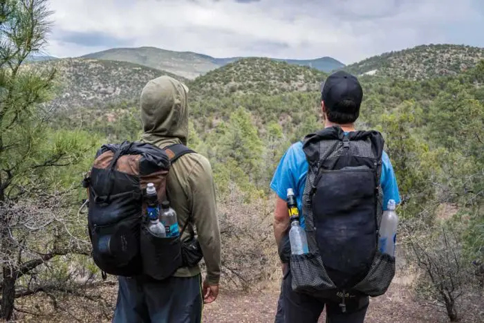
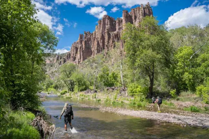
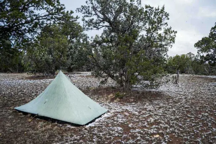
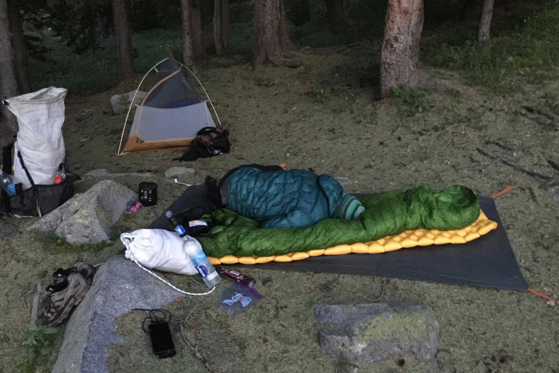
Crazy Cook Monument in the late afternoon. The mornings are best for photos with the monument.A picture of three dudes who no longer exist at the southernmost point of the Continental Divide Trail.Taking the first break of the trail in a random and crippled structure.The first (and hopefully not the last) sunset of the trail.The stars in the New Mexico Bootheel are spectacular. May you be have the fortune of many moonless nights.Just walk as straight as you can and hope that you don’t step on any snakes.The trail in New Mexico is whatever you make it.It wouldn’t be growing anything if it wasn’t full of vitamins.Dirt roads very commonly constitute the the Continental Divide Trail in New Mexico. Whether these roads remain the trail in the future, who know? If you’re reading this in the future, then do us all a favor and let us know in the comments.Don’t worry, eventually the trail stops being an endless haul across a never-ending desert.If you hike the Continental Divide Trail and you opt not to take the Gila River Alternate, I would love to hear your (probably completely inadequate reason) why.Jumping off things and swimming – two excellent activities you can engage in while on the Gila River Alternate that aren’t hiking.The trail crosses the Gila River literally hundreds (I’m going to say hundrest) of times.The highlight of the state right here.Camping in the Gila is more like what most people think of as camping and less what camping is usually like on a thru-hike.When you decide you’ll camp at the next water source but then it’s crowded there so you decide to keep walking and end up hiking until after sunset.Gila Cliff Dwellings National Monument in the Gila Wilderness.I wonder if this all turns green at some point during the year. If it does, it’s probably beautiful.The beginning of a long waterless stretch of trail.The trail is the road and the road is the trail.This was shortly before we almost hiked directly into a forest fire. You see?! There are benefits to being in the desert where there’s nothing to burn.If you can tame a wild horse in New Mexico, you’re legally allowed to ride it the rest of the way to Canada.Reserve, New Mexico – now serving bar food.That time we adopted a dog for the section between Reserve and Pie Town.Stubing the dog ended up being an excellent hiking companion.“You had great weather” people say when they look through all my photos. No, I just don’t like taking my camera out when it’s raining or snowing. In this photo it is in fact snowing.The sun, a road, and some deserty looking stuff – everything you can look forward to finding in New Mexico.The summit of Mount Taylor – a worthy CDT alternate route.Things you do a lot on the Continental Divide Trail in New Mexico: walk on roads.I call it, “Tree”.Perhaps the greenest place on the entire New Mexico CDT.New Mexico isn’t all desert.But let’s be real, a lot of it is desert.Sleeping in the dirt to ward off the rain.When the dry sandy desert gives way to more rocky desert.The kind of view that photos (at least my photos) really can’t do justice.The dirt gets a bit more red as you get closer to Ghost Ranch (probably all of that blood in the soil).And a lot of it is proper desert, like the desert from the Old West.The hills north of Ghost Ranch (a strange/interesting place on one of the many New Mexico CDT alternates).if you carry your water bottle in your hand, it doesn’t count toward your pack weight.New Mexico was the only place on the trail where we got snowed on (and yes, it happened more than once).A look at what to expect a lot more of once we hit Colorado in a couple of days.A rare DOUBLE CDT marker; very happy that it’s here because the trail is still hiding under the snow.Approaching the New Mexico/Colorado border we are greeted by the snow gods.The rare “actual trail” that we found in Northern New Mexico.
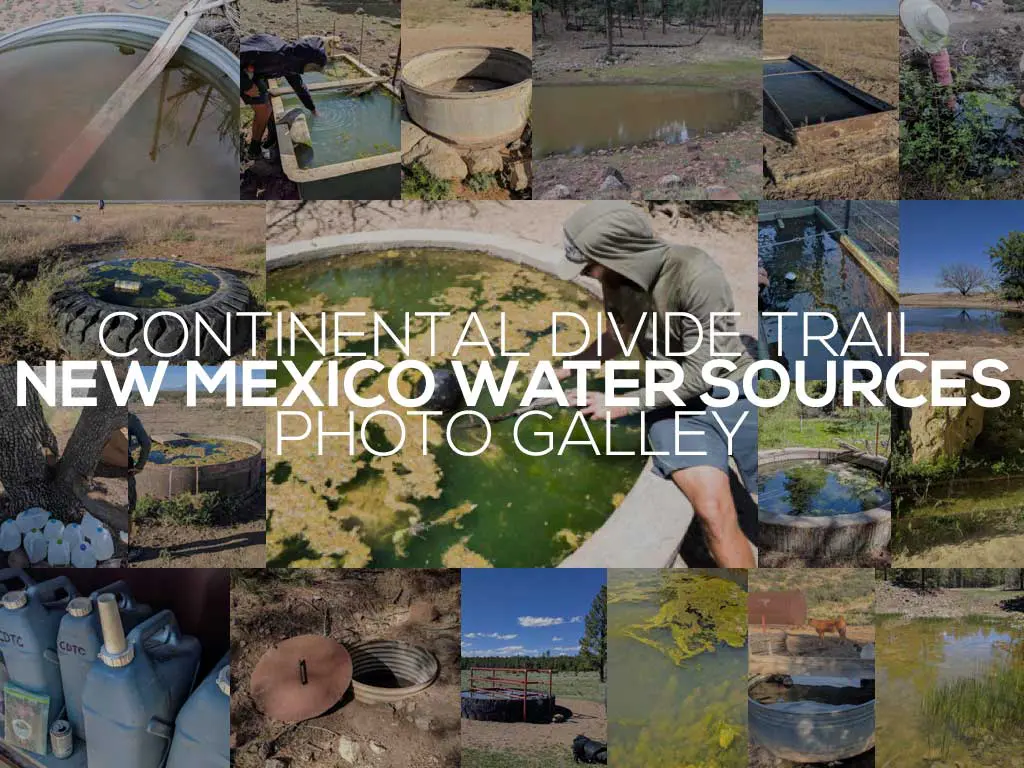
The water sources Continental Divide Trail hikers drink from in New Mexico are often less-than-ideal, and hikers are often filling their water bottles from water sources that cows are either drinking from or pooping in. Something to filter out the sediment (poop) is a must.
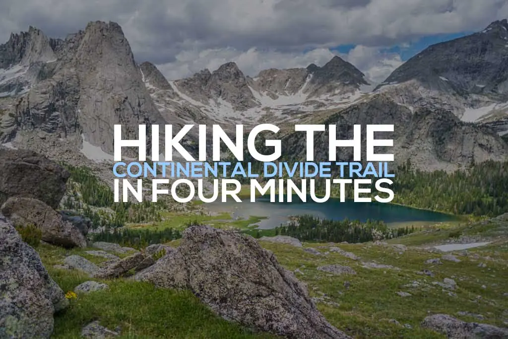
The Continental Divide Trail is a 3,100 mi / 5,000 km trail that crosses the United States from Mexico to Canada via the states of New Mexico, Colorado, Wyoming, Idaho, and Montana. Thru-hikers will take an average of five months to complete the trail – here’s the entire thing in just four minutes.
Colorado, the second state of the Continental Divide Trail (for northbound hikers), presents a set of new challenges for hikers leaving New Mexico. Hikers face…
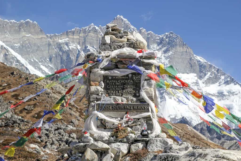
After twelve days in the Himalayas and many thousands of units of elevation change, I have successfully returned to the civilized world (read about the…


Awesome photos and commentary. Thanks!
A very underrated state!
Hey, Did you adopt that dog at Fur and Feather Animal Assistance?
We gave the dog to Fur and Feather Animal Assistance. Read about it here in Week 3: https://www.halfwayanywhere.com/trails/continental-divide-trail/cdt-week-3/