
2018: What The Hell Did I Do?
Congratulations! It’s the third week of 2019 (goes fast, huh?) and we’re all still here. I wonder if we’ll be able to say the same thing after our next solar revolution. But does that mean that the sun is doing the revolution or that we’re doing the revolution? I hope the latter; maybe it’s just ambiguous. You know what I mean.
Yes, last year was exciting. We had not one, but two, total lunar eclipses, the world’s last male northern white rhinoceros died, Swaziland changed its name to the Kingdom of Eswatini, the Supreme Court of India decriminalized homosexuality, Canada legalized the sale and use of recreational cannabis, and the world’s longest sea-crossing bridge opened connecting Hong Kong and Macau (now go crush that trivia night).
I began the year in Southern Hemisphere for the second year in a row – this time on the South Island of New Zealand – and ended it in Japan (a place that’s slowly becoming a second home – immigration has begun to look wearily at my passport and all it’s Japan stickers. Yes, they use stickers not stamps when you enter on a tourist visa; no, the stickers do not have cute anime-style mascots on them – yet).
Generally there’s a single big hike or event that defines the year for me, but for 2018 there are two: the nearly 100 days I spent in Nepal and my traverse of the Japanese Alps.
But I’ll start where I normally do, with a look at my (and your) favorite posts of the year.
- A total of 52 posts were published on Halfway Anywhere this year (I’m ashamed of this number and hope to double it in 2019).
- I divulged the secret origins of Halfway Anywhere and how I’ve managed to maintain my life of homelessness until now (it’s not as glamorous as you think it is).
- The sixth annual Pacific Crest Trail Thru-hiker Survey was published (and this year I plan on doing some comparison posts).
- The third annual PCT Survey Gear Guide was published (this took far too long to write).
- I continued my (now incredibly delayed) trip report on the Continental Divide Trail – read it here (Appa, I promise, I’m working on the rest).
- I sat down for an interview with Jotaro Yoshida, the founder of Japan’s LOCUS GEAR (which makes gear that is equal parts sexy and expensive).
- You all had the rare opportunity to hear what I sound like after I sat down to record a podcast with a stranger in Kathmandu (one day I’ll get around to making videos and speaking directly to you all).
- I completed my Continental Divide Trail video (which I believe to be objectively better than my PCT video).
- We talked more about proper procedure for pooping in the woods (seriously, practice proper pooping procedure, people).

So where did I go this year?
I spent a lot of the year revisiting places I’ve been but doing the things I’ve been wanting to do since first visiting said places. I began in New Zealand (where I still have a lot to do), before making a brief stop in Australia to say hello to some friends and be disappointed by Mountain Laurel Designs before heading back to Nepal.
After spending nearly 100 days in Nepal (and yes, there’s still more I want (need?) to go back and do, namely, the Great Himalaya Trail), I flew to Malaysia (my first time there) for a quick visit before returning to Japan where I spent two months visiting as many hot springs as I could before hiking across the Japanese Alps from the Sea of Japan to the Pacific Ocean with two incredible Kiwis whom I met in Nepal (and somehow convinced abandon their plans to come hike with me in Japan).
Then, it was back to the States for a wedding followed by some fall wandering around the Sierra Nevada Mountains (my favorite time to be there). Next up was Europe, where I got my first taste of England’s Lake District and then spent some time bouncing around visiting old (and new) friends living scattered across the somewhat unionized continent.
I closed out the year with a quick trip up the Camino Português (Portuguese Camino) from Porto to Santiago de Compostela before touching down back in Sunrise Land (that means Japan) just in time for New Year’s.
In case you’re not keen on all the above text, here’s a more succinct breakdown of where I got to in 2018:
COUNTRIES
- Austria
- Czech Republic
- Denmark
- England
- France
- Germany
- Japan
- Malaysia
- Nepal
- New Zealand
- Poland
- Portugal
- Spain
- Sweden
- United States
- Wales
US STATES
- California
- New York
JAPANESE PREFECTURES
NOTABLE EVENTS & ADVENTURES
- Reached my highest elevation ever at the top of Nepal’s Imja Tse (Island Peak) at 20,305 ft / 6,189 m.
- Hiked in the route to the Everest Region from the traditional starting point of Jiri (instead of flying into Lukla).
- Thanks to my dear friend Mr. Michael Chang, I got the chance to take my first a ride in a helicopter – and in the Himalaya of all places.
- I celebrated Holi (you may know it as “that Hindu festival with all the colors) in Kathmandu, Nepal (highly recommended, but oh so dirty).
- I got to see (and spend some time in) England’s Lake District (or, as I learned, simply “The Lakes”) – will definitely be going back.
- I built myself a new backpack with Tom Gale of Atom Packs.
- Not knowing what to do with my 17 days in Portugal, I decided to walk the Camino Português (Portuguese Camino) from Porto, Portugal to Santiago de Compostella in Spain.
- Went paragliding for the second time, but this time in Pokhara, Nepal. Honestly, I got a bit motion sick and don’t know if I’ll be doing it again (I do, however, still need to jump out of a plane).

But who cares about where I was. What about the places I walked around and/or up? From what I can remember, I could have been found at/along the following at some point during the year.
TRAILS, HIKES, AND STINTS IN THE MOUNTAINS
- New Zealand
- Ball Pass Route, Aoraki/Mount Cook National Park
- Cascade Saddle Route, Mount Aspiring National Park
- Dart Track, Mount Aspiring National Park
- Earnslaw Burn, Otago
- Mueller Hut Route, Aoraki/Mount Cook National Park
- Mount Taranaki Summit Track, Egmont National Park
- Tararua Southern Crossing, Tararua Forest Park
- Tararua Section of Te Araroa, Tararua Forest Park
- Nepal
- Annapurna Circuit, Annapurna Conservation Area
- Island Peak Trek, Sagarmatha National Park
- Manaslu Circuit, Manaslu Conservation Area
- Mardi Himal Trek, Annapurna Conservation Area
- California (New Passes)
- New Army Pass
- Crabtree Pass
- Portugal/Spain
- Camino de Santiago (Portuguese Way) / Camino Português
JAPANESE PEAKS SUMMITED
This is a list of all the peak crossed (from north to south – more or less) during my traverse of the Japanese Alps this summer. For more on this hike, check out these posts.
- 入道山 – Nyudoyama (1,470 ft / 448 m)
- 尻高山 – Shiritakayama (2,221 ft / 677 m)
- 坂田峠 – Sakatatoge (1,903 ft / 580 m)
- 白鳥山 – Shiratoriyama (4,222 ft / 1,286.8 m)
- 下駒ヶ岳 – Shimokomagatake (4,072 ft / 1,241 m)
- 菊石山 – Kikuishiyama (3,969 ft / 1,209.7 m)
- 黄蓮山 – Orenyama (4,462 ft / 1,360 m)
- 犬ヶ岳 – Inugatake (5,225 ft / 1,592.5 m)
- サワガニ山 – Sawaganiyama (5,290 ft / 1,612.3 m)
- 黒岩山 – Kuroiwayama (5,327 ft / 1,623.6 m)
- 長栂山 – Nagatsugayama (7,438 ft / 2,267 m)
- 朝日岳 – Asahidake (7,047 ft / 2,147.9 m)
- 雪倉岳 – Yukikuradake (8,566 ft / 2,610.9 m)
- 三国境 – Mikunisakai (9,026 ft / 2,751 m)
- 白馬岳 – Shiroumadake (9,620 ft / 2,932.3 m)
- 丸山 – Maruyama (9,081 ft / 2,768 m)
- 杓子岳 – Shakushidake (9,226 ft / 2,812 m)
- 鑓ヶ岳 – Yarigatake (9,525 ft / 2,903.2 m)
- 天狗の頭 – Tengu Peak (9,226 ft / 2,812 m)
- 唐松岳 – Karamatsudake (8,845 ft / 2,695.9 m)
- 大黒岳 – Daikokudake (7,851 ft / 2,393 m)
- 白岳 – Shiradake (8,337 ft / 2,541 m)
- 五龍岳 – Goryudake (9,232 ft / 2,814 m)
- 鹿島槍ヶ岳北峰 – Kashimayarigatake (North Peak) (9,324 ft / 2,842 m)
- 鹿島槍ヶ岳 – Kashimayarigatake (9,479 ft / 2,889.2 m)
- 布引山 – Nunobikiyama (8,802 ft / 2,683 m)
- 爺ヶ岳北峰 – Jiigatake (North Peak) (8,632 ft / 2,631 m)
- 爺ヶ岳 – Jiigatake (8,760 ft / 2,669.9 m)
- 爺ヶ岳南峰 – Jiigatake (South Peak) (8,727 ft / 2,660 m)
- 岩小屋沢岳 – Iwagoyazawadake (8,630 ft / 2,630.5 m)
- 新越乗越 – Shinkoshinokkoshi (8,077 ft / 2,462 m)
- 鳴沢岳 – Narusawadake (8,665 ft / 2,641 m)
- 赤沢岳 – Akazawadake (8,786 ft / 2,678 m)
- スバリ岳 – Subaridake (9,029 ft / 2,752 m)
- 針ノ木岳 – Harinokidake (9,254 ft / 2,820.7 m)
- 針ノ木峠 – Harinokitoge (8,320 ft / 2,536 m)
- 立山(雄山) – Tateyama (Oyama) – 9,852 ft / 3,003 m)
- 龍王岳 – Ryuodake (9,423 ft / 2,872 m)
- 鬼岳 Onidake (9,022 ft / 2,750 m)
- 獅子岳 – Shishidake (8,904 ft / 2,714 m)
- ザラ峠 – Zaratoge (7,703 ft / 2,348 m)
- 鳶山 – Tonbiyama (8,583 ft / 2,616 m)
- 越中沢岳 – Echuzawadake (8,503 ft / 2,591.6 m)
- スゴの頭 – Sugonoatama(?) – 7,976 ft / 2,431 m)
- 間山 – Mayama (8,482 ft / 2,585.4 m)
- 北薬師岳 – Yakushidake (North Peak) – 9,514 ft / 2,900 m)
- 薬師岳 – Yakushidake (9,600 ft / 2,926 m)
- 薬師峠 – Yakushitoge (7,526 ft / 2,294 m)
- 太郎山 – Taroyama (7,785 ft / 2,373 m)
- 北ノ俣岳 – Kitanomatadake (8,733 ft / 2,661.9 m)
- 赤木岳 – Akagidake (8,602 ft / 2,622 m)
- 中俣乗越 – Nakamatanokkoshi (8,038 ft / 2,450 m)
- 黒部五郎岳 – Kurobegorodake (9,645 ft / 2,939.7 m)
- 三俣蓮華岳 – Mitsumatarengedake (9,322 ft / 2,841.4 m)
- 丸山 – Maruyama (9,364 ft / 2,854 m)
- 双六岳 – Sugorokudake (9,385 ft / 2,860.4 m)
- 樅沢岳 – Momisawadake (9,039 ft / 2,755 m)
- 硫黄乗越 – Ionokkoshi (8,399 ft / 2,560 m)
- 千丈乗越 – Senjo Junction (8,957 ft / 2,730 m)
- 槍ヶ岳 – Yarigatake (10,433 ft / 3,180 m)
- 飛騨乗越 – Hidanokkoshi (10,105 ft / 3,080 m)
- 大喰岳 – Obamidake (10,180 ft / 3,103 m)
- 中岳 – Nakadake (10,118 ft / 3,084 m)
- 南岳 – Minamidake (9,950 ft / 3,032.9 m)
- 大キレット – Daikeretto – 9,016 ft / 2,748 m)
- 北穂高岳 – Kita-Hotakadake (10,190 ft / 3,106 m)
- 涸沢岳 – Karasawadake (10,203 ft / 3,110 m)
- 穂高岳 – Oku-Hotakadake (10,466 ft / 3,190 m)
- ジャンダルム – Gendarme (10,377 ft / 3,163 m)
- 天狗ノ頭 – Tengunoatama (9,544 ft / 2,909 m)
- 間ノ岳 – Ainodake (9,537 ft / 2,907 m)
- 西穂高岳 – Nishihotakadake (9,543 ft / 2,908.8 m)
- 西穂高岳 独標 – Nishihodoppyo – 8,862 ft / 2,701 m)
- 西穂 山荘 – Nishiomaruyama (8,045 ft / 2,452 m)
- 割谷山 – Waritaniyama (7,297 ft / 2,224.2 m)
- 新中尾峠 – Shinnakaotoge (7,021 ft / 2,140 m)
- 中尾峠 – Nakatoge (7,021 ft / 2,140 m)
- 焼岳 – Yakedake (8,056 ft / 2,455.5 m)
- 硫黄岳 – Iodake (8,379 ft / 2,554 m)
- 大黒岳 – Daikokudake (9,094 ft / 2,772 m)
- 富士見岳 – Fujimidake (9,242 ft / 2,817 m)
- 蚕玉岳 – Kodamadake (9,760 ft / 2,975 m)
- 剣ヶ峰 – Kengamine (9,927 ft / 3,025.7 m)
- 継子岳 – Mamakodake (9,380 ft / 2,859 m)
- 御嶽四の池 – Hidachojo – 9,226 ft / 2,812 m)
- 摩利支天山 – Marishitenyama (9,710 ft / 2,959.5 m)
- 赤林山 – Akabayashiyama (7,145 ft / 2,177.9 m)
- 駒ケ岳 – Kisokomagatake (9,698 ft / 2,956 m)
- 中岳 – Nakadake (9,596 ft / 2,925 m)
- 宝剣岳 – Hokendake (9,616 ft / 2,931 m)
- 檜尾岳 – Hinokiodake (8,950 ft / 2,728 m)
- 熊沢岳 – Kumazawadake (9,114 ft / 2,778 m)
- 東川岳 – Higashikawadake (8,763 ft / 2,671 m)
- 木曽殿越 – Kisodonokoshi (8,038 ft / 2,450 m)
- 空木岳 – Utsugidake (9,396 ft / 2,864 m)
- 北沢峠 – Kitazawatoge (6,680 ft / 2,036 m)
- 仙水峠 – Sensuitoge (7,428 ft / 2,264 m)
- 駒津峰 – Komatsumine (9,029 ft / 2,752 m)
- 駒ヶ岳 – Kaikomagatake (9,729 ft / 2,965.5 m)
- 双児山 – Futagodake (8,691 ft / 2,649 m)
- 仙丈ヶ岳 – Senjogatake (9,950 ft / 3,032.9 m)
- 大仙丈ヶ岳 – Osenjogatake (9,760 ft / 2,975 m)
- 伊那荒倉岳 – Inaarakuradake (8,264 ft / 2,519 m)
- 横川岳 – Yokokawadake (8,130 ft / 2,478 m)
- 野呂川越 – Norokawagoe (7,579 ft / 2,310 m)
- 三峰岳 – Mibudake (9,839 ft / 2,999 m)
- 間ノ岳 – Ainodake (10,464 ft / 3,189.5 m)
- 中白根山 – Nakashiranesan (10,023 ft / 3,055 m)
- 北岳 – Kitadake (10,476 ft / 3,193 m)
- 井川越 – Ikawagoe (8,809 ft / 2,685 m)
- 安倍荒倉岳 – Abearakuradake (8,835 ft / 2,693 m)
- 新蛇抜山 – Shinjanukeyama (8,750 ft / 2,667 m)
- 北荒川岳 – Kita-Arakawadake (8,852 ft / 2,698 m)
- 塩見岳 – Shiomidake (9,998 ft / 3,047.4 m)
- 本谷山 – Hontaniyama (8,721 ft / 2,658.3 m)
- 三伏山 – Sanpukuyama (8,579 ft / 2,615 m)
- 三伏峠 – Sanpukutoge (8,553 ft / 2,607 m)
- 烏帽子岳 – Eboshidake (8,944 ft / 2,726 m)
- 前小河内岳 – Maekogochidake (9,134 ft / 2,784 m)
- 小河内岳 – Kogochidake (9,193 ft / 2,802 m)
- 大日影山 – Ohikageyama (8,442 ft / 2,573 m)
- 板屋岳 – Itayadake (8,681 ft / 2,646 m)
- 前岳 – Maedake (10,066 ft / 3,068 m)
- 中岳 – Nakadake (10,117 ft / 3,083.7 m)
- 東岳 – Higashidake (10,305 ft / 3,141 m)
- 小赤石岳 – Koakaishidake (10,108 ft / 3,081 m)
- 赤石岳 – Akaishidake (10,238 ft / 3,120.5 m)
- 大沢岳 – Osawadake (9,251 ft / 2,819.8 m)
- 中盛丸山 – Nakamorimaruyama (9,209 ft / 2,807 m)
- 小兎岳 – Kousagidake (8,983 ft / 2,738 m)
- 兎岳 – Usagidake (9,245 ft / 2,818 m)
- 前聖岳 – Maehijiridake (9,885 ft / 3,013 m)
- 小聖岳 – Kohijiridake (8,734 ft / 2,662 m)
- 南岳 – Minamidake (8,865 ft / 2,702 m)
- 上河内岳 – Kamikochidake (9,198 ft / 2,803.4 m)
- 富士山 – Fujisan (12,395 ft / 3,778 m)
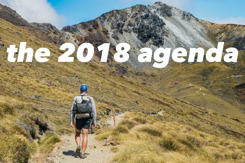
So what’s on the agenda for 2019? That’s what I’m trying to figure out right now from my temporary accommodation in Japan (just outside Nagoya – give me a shout if you’re in the area). Next week I’ll try to fill you (aka myself) in on what the hell I’m thinking about doing with myself for the next year for the final episode of the two thousand and tens (I don’t know if I can get behind that terminology).
And if you’re reading this (and especially if you’ve read everything that preceded this final bit of text), then THANK YOU. Knowing that (or, I guess I don’t really know, but I guess imagining that) you’re out there somewhere, sitting on your phone in the bathroom and digesting this article, is what keeps me writing. Your comments, messages, and emails motivate me to continue pursuing whatever it is I’m after in the world (despite being entirely unsure what this is). So THANK YOU!
Make good decisions, friends.
Love,
Mac


Thank YOU for sharing! I managed to go to EBC/Kalapattar independently from ur sharing :)
Awesome to hear! That’s exactly the kind of information I hope to be able to put out.
I’m amazed by all you continue to do and try! I feel like I’m entering into a “stability-focused” phase, i.e. one job, one relationship, live in one place… but whenever I read your posts I want to ditch it all and get back on the road. So, thanks for confusing the situation? Ha, seriously, it’s great to hear what you’re up to and to remember that as humans we have so many more options than we initially assume. Keep it up in 2019!
Thank you, Anna! (And you should totally do it – ditch it all and hit the road!)
I read until the end. You called it- sitting in the bathroom waiting for my hair to dry (its knee length, i takes a while!)
I love reading your posts. I literally laugh out loud frequently at times.
Your cdt video is my favorite part of the internet. I’m glad you finished it. Not only for the amazing views, but introducing me to the song paper tigers. I love it, and because of your video i associate it with mountains when i hear it.
I guess I’m just fangirling now. But what I’m trying to say is i think you are pretty great and I’m trying to follow your example and live through adventures. Keep it up!
Thanks, Rikki! Great to hear you’re a Paper Tigers fan. Javier Dunn (the artist) is actually a friend of mine – he’s got a ton of awesome stuff!