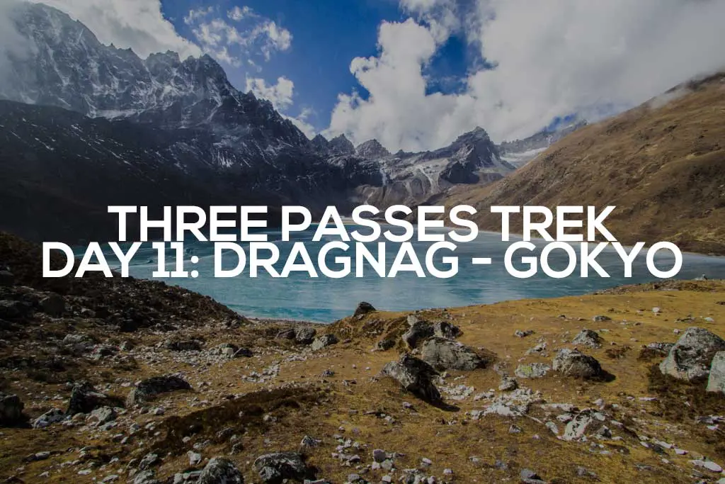
Three Passes Trek Day 11: Dragnag to Gokyo
I wake up and head to the common area for breakfast, where I find the lodge-keep asleep behind the bar. It’s already eight o’clock, late for the Himalayas, and whilst standing and deliberating whether I’m going to rouse the sleeping sherpa, he gets up on his own.
A few groggy moments later, he’s back to his cheery and helpful self. “Good morning, Sir! Yes, you will want some breakfast. I remember your order last night. Cheese sandwich, no problem, Sir.”
I tell him to take his time and sit by a frosty window. He quickly fills the large stove in the middle of the room (aka the central heating) with dried yak dung (there’s no wood up here) before heading into the kitchen.
Let’s hope he’s washing his hands.
Peter and his girlfriend (my Czech friends) join me just before my cheese sandwich emerges from the kitchen with their breakfasts. Mine’s a grilled cheese. I don’t know what I was expecting, but it’s delicious.

It’s easy hiking this morning as we head north along the eastern side of the Ngozumba Glacier looking for where the trail crosses it and heads to Gokyo.
Gokyo isn’t far (just a couple of miles), but past it is the third and final pass of the trek, Renjo La. I could make it over today if I wanted to, but I’m ahead of schedule and yesterday was a huge day. I’m thinking I’ll make it go Gokyo and just chill the rest of the day.

That is, if I make it to Gokyo.
The “glacier crossings” were a part of the trail that everyone warned me about prior to this trek. “Be careful of those sketchy glacier crossings,” people were fond of saying.
The question, of course, is whether these people know what they were talking about. Had they done this trek before? Probably not. Regardless, I now have this idea in my head that glaciers are huge and perilous obstacles. Despite not having any problems crossing the Khumbu Glacier after Kongma La, I’m still a tad concerned about making it across this one.
As the trail becomes less obvious, we hike toward a flag on the rim of the glacier, hoping it indicates where the trail begins its crossing. At the flag, we find no obvious trail. I retrace our steps to make sure we haven’t missed anything. The amount of effort this scouting mission takes would not normally be significant, but at nearly 16,000 ft / 4,800 m, any bit of walking (especially extra walking) taxes the hell out of me.
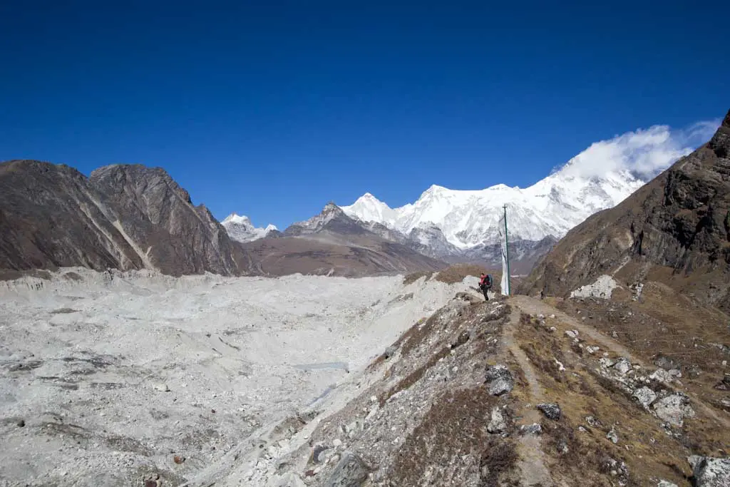
I find a faint trail and we follow it north as it parallels the rim. Slowly and gradually, we descend to the glacier.
The trail does a lot of up and down, westward across the glacier. In the distance, I can see the trail leading up Gokyo Ri (a 17,585 / 5,360 m peak just west of Gokyo). I still can’t see the village, but I know it’s at the base of this mountain (a mountain that looks more like a hill next to all the enormous peaks surrounding it).
If I decide not to cross Renjo La today and instead stop at Gokyo (and it’s looking like I will), then I may head up Gokyo Ri after lunch.


A couple of times we get disoriented and need to find our bearings. Overall, the navigation isn’t difficult and it seems like any of the trails crisscrossing the glacier will eventually get us to the other side (or just dead-end into a crevasse).
Before long we’ve reached the other side and after a short climb up to the western rim, we are back on solid ground.
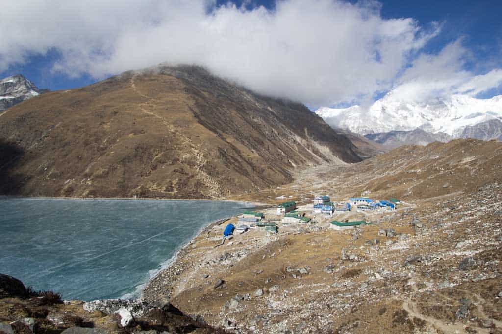
From here we get our first look at Gokyo. Next to the small village is Gokyo Tsho, a now-frozen lake, and just beyond the village is Gokyo Ri (a side trip that’s looking less inviting by the minute due to the slowly descending cloud cover).


The wind picks up and the temperature drops rapidly as we approach the small village. I’m fairly certain that my ears are going to freeze and fall off.
I head for the Namaste Lodge in the center of the village and without talking to any staff, grab a seat next to the stove in the middle of the common area. Also around the stove (and now staring at me) are two brothers from Switzerland and a couple from Germany.
Eventually, the lodge owner (I never know if the person is an owner, employee, resident, or all three, so I’m just going to refer to this woman as the owner) emerges from hiding and tells me and my Czech friends that she does not have space for us. However, when she sees that we don’t have guides or porters, she tells us that there is in fact space (great news considering I am not willingly moving from my seat).
I order a “cheese and potato spring roll” that ends up being a delicious calzone and do my best to make friends with the other hikers staying here tonight.
Outside, the clouds continue to gather and within an hour of my arrival, it’s snowing. For the first time this trip, there’s weather. Hopefully, this doesn’t turn into a full-blown blizzard and close the pass tomorrow (because there’s now zero chance of me going over today).
Everyone orders dal bhat for dinner (free refills!), and we enjoy our meals as we watch the owner, along with the guides and porters, remove the stove in the middle of the room and replace it with a larger one they got from I have no idea where.


As the sun sets, I desperately try to convince someone heading east to buy my microspikes. No takers. Defeated (and still out $15), I head up to my room and get into bed (aka my sleeping bag).
Trying to sleep, I can clearly hear the person next door moving around. It sounds like they are literally in my room. A quick investigation reveals that this entire upstairs was a single room at some point. Now, the individual rooms are separated by just thin sheets of plywood (it would be a stretch to call them “walla”).
Tomorrow morning, breakfast is at 6:30 (I wanted mine at six, but everyone else voted for 6:30, so I was overruled), so I hope this person doesn’t snore. Sometimes, I think it would just be best if I slept outside.
- Start: Dragnag (15,420 ft / 4,700 m)
- End: Gokyo (15,715 ft / 4,790 m)
- Distance: 2.75 mi / 4.43 km
- Sleeping elevation change: +295 ft / 90 m
- Day’s elevation change: +627 ft / 191 m
- Total time: ~3:44:41
THREE PASSES TREK DAY: 1 | 2 | 3 | 4 | 5 | 6 | 7 | 8 | 9 | 10 | 11 | 12 | 13
NOTE: I forgot to turn on my GPS at the beginning of the day so the track mapped below begins slightly northwest of Dragnag (my starting point). Also, I have no guarantee that this route is correct, nor that it can be accurately relied upon for navigation. It should serve only as a general guideline for what the trail is expected to look like.
Hi Mac! Thanks for this insightful post. I do enjoy reading your blog and hope I’ll get a chance to trek in Himalayas after I’m done with Europe ;)
Definitely find the time, it’s worth it!
Always amazed, wen i see the scale of the Himalay,s and how awsome it looks..
Hi, I enjoy reading your post. I covered almost all.
I am planning EBC + 3passes coming November-December.
It will start from Jiri-Bandhar (another one week before Namche).
For me the weather and condition of trek at the period of year is the information to catch.
Your post is dated by posting, and not show actual time it happened.
If it is not too much trouble, please put the actual date.
Yoonki
p.s. what is the GPS you used? or App. ?
thanks
This trek took place in the winter (from the end of December to the beginning of January).
The app I used to record my GPS track has been discontinued, but it was My Tracks by Google.