
Three Passes Trek Day 10: Cho La (Dzongla to Dragnag)
Cho La Pass, today’s objective, has been built up in my mind as a dangerous and monstrous obstacle that should only be attempted in the best conditions and under proper supervision. Thankfully, I wake up to another day of clear skies because I will be doing this pass on my own (and with my trail running shoes that everyone continues to insist are incapable of getting me through this hike).
I wake up at 6:00, and by 6:30, I’m packed and eating breakfast – a massive portion of vegetable fried rice (some of which goes into a plastic bag to be eaten on the trail today).
As has been the case for much of this trek, although technically I am doing the Three Passes alone, I set out from the lodge accompanied by three other hikers heading over Cho La today (Mr. Tim and the Czech couple I met last night). It’s comforting to know that someone will be out there to hear me scream should things go awry.
Out of Dzongla, the trail heads northwest across a relatively flat area out towards a spot on my map labeled “Crampons recommended”. Hopefully, the $15 microspikes I bought last night from the Italian hiker who had just come over Cho La from the other direction will prove sufficient for a successful day.
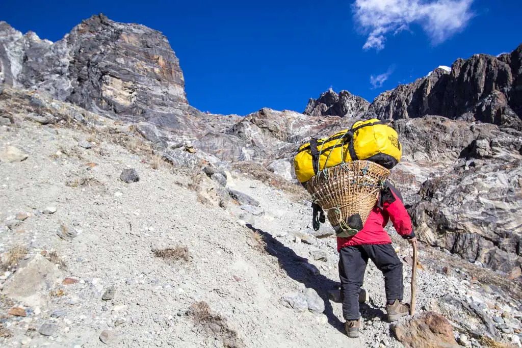
Despite the relatively easy terrain, I’m still struggling with the altitude and am swiftly passed by a porter hauling up far more gear than I would ever be comfortable carrying. I’ve said it before, but it bears repeating – these guys are superhuman.
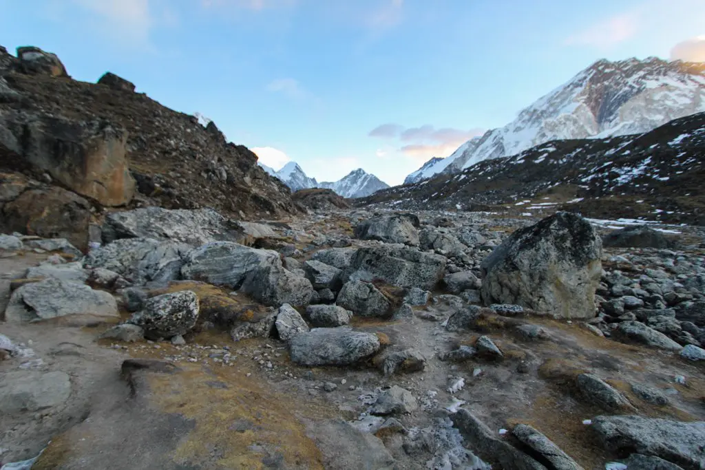
After crossing a small stream, the trail climbs steeply up a boulder-filled chute toward the glacier below Cho La. So far, the trail has yet to be any different than everything I’ve come across in the past nine days of hiking. Also, something to note: I still can’t see the pass (don’t make the mistake of claiming to be able to see Cho La from Dzongla – you can’t).

At the top of the rocky chute, I discover that I will not be escaping today without crossing snow (the first of the trip). In front of me, the leading edge of a glacier (that it appears I will eventually have to cross) creates a near-vertical wall of ice rising probably 50 ft / 15 m or more from the valley floor. It’s pretty neato.
I follow old footprints as I slowly make my way up the southern side of the narrowing valley – doing my best to stay off the glacier. The trail is partially covered with snow, but since it’s early morning, what I really mean is that it’s covered with ice. Despite having microspikes, I want to see how far I can make it without putting them on (possibly a very stupid idea, but I’ll blame it on the altitude).
I’ve now reached the point on the map where I’m warned, “Danger of Crevasses. Glacier Crossing Stay on Left Side”. Coincidentally, this is also the point where I’ve run out of shoulder and will need to transition onto the glacier (where I will be religiously keeping to the left).


Once on the glacier, all traces of a trail have disappeared. To complicate things, it turns out the glacier is incredibly slippery (it’s like this thing’s made of ice). I take a moment to gather myself and decide it’s best to equip my microspikes. Suddenly, walking is noticeably easier.
I’ve taken to aiming for (what I think is) the pass without venturing too far out onto the middle of the glacier. My Czech friends are following behind me, so I know that I at least know I look like what I’m doing.
However, as I am now getting closer to the pass I am also becoming less certain about which way to go. There’s a large gap between the east side of the pass (the direction I’m approaching from) and the glacier. To the left, there’s a steep scree field. To the right, it looks like there may be a way to get down into the gap, but that would involve crossing the glacier and according to my trusty map, I’m supposed to be keeping left.


I’m not trying to go down (no matter how little), so I choose left. Across the steep and (what turns out to be an) incredibly sketchy scree field we go. I’m so smart.
Not far down from where I’m now attempting to scramble across, there is what’s probably a 30 ft / 10 m drop straight down to the ice. It appears to be very important that I not fall. I consider taking my microspikes off but decide to keep them on; whether this is a good idea, I do not know.
What I decide needs to go are my trekking poles. I’m in no position to take my pack off since I’m now practically climbing, so I retract my poles and stick them vertically between my back and backpack, sticking up behind my head like a flagpole. What I fail to consider when doing this is that I’ve just used my poles to effectively take away my ability to tilt my head back.
Realizing that I can no longer look up (a useful thing to be able to do when climbing), panic boils up inside me as I kick loose rocks and listen to them crash down to the ice far below. For a moment, I legitimately feel that I am in danger of becoming “that idiot,” and it takes all that I have to calm down and try to proceed rationally.
My mind made up that I’m not going to kill myself, I slowly and carefully inch myself toward the pass and past the scree field.

Once on solid ground (sworn to never again store my poles in this manner) I climb the small gap between myself and Cho La. I can now clearly see the route that I should have taken, and I can see my Czech friends safely making it across the bottom of the gap. Next time, I’ll go that way.
The wind has picked up and I need to get out my warmer jacket to endure the chill. As I’m about to head down, a woman arrives with her guide having just come up the west side (aka the other side). We try our luck at conversation, but the wind won’t allow it. After briefly employing them as my photographers, it’s time to descend.
The west side of Cho La is (thankfully) free of snow and ice. Instead of a glacier, it features an awesomely steep moraine. The trail here isn’t obvious, but I can see the trail further down in the valley, so navigation (at least in this weather) isn’t difficult. That being said, the map here does report “Possibility of Rocks Falling” (I would say accurate) indicates a “Difficulty Icy Crossing” at the stream I’ll need to cross further down (which I imagine accurate early in the morning or after a heavy snowfall).

Unfortunately, today’s uphill battle has yet to be won.
When I make it to the valley floor, the trail turns west aiming for a flag atop another small but, at this point in the day, challenging rise before it begins its long and seemingly endless descent to Dragnag. After making it over, I give up on following “the trail” and instead stick to whichever side of the stream appears more hospitable (according to the map, the trail stays north after the initial crossing).
Dragnag, on the eastern side of the Ngozumba Glacier just south of Gokyo (on the western side), eventually comes into view and replaces all my thoughts of “this will never end” with “I love you small village whose name I’m unsure how to pronounce”. My original thought was that I would make it all the way to Gokyo today, but in my current state, the extra effort required by another (longer) glacier crossing will most certainly kill me.


I head to the first open lodge I see, the Kongma La Lodge, and decide I’m too tired for my usual perusing of the entire village before deciding where to stay (it also looks like this may be the only place open).
The guy in charge of the lodge is young and he’s being helped by two small children, probably no older than twelve, to care for the place. He welcomes me with a cup of some complimentary hot orange drink (tasty) and allows me to use his personal internet card to get my data fix (the lodges sell prepaid cards to a satellite internet network and this lodge is out of cards to sell).

The Czech couple and I are the only guests tonight, and after a hearty dinner of macaroni and cheese with a side of momos, it’s time for bed.
I don’t know that I’ll be trying to go over Renjo La, the final pass, tomorrow and so it might be just a short day to Gokyo. Once there, I have the option of going up to the summit of Gokyo Ri or hiking north to check out the world’s highest freshwater lake system (which are most definitely frozen), but it will be a game-time decision.
We’ll see how I’m feeling in the morning (I’ve ordered a cheese sandwich for breakfast so chances are I’ll be ready for anything).
- Start: Dzongla (15,846 ft / 4,830 m)
- End: Dragnag (15,420 ft / 4,700 m)
- Distance: 5.8 mi / 9.38 km
- Sleeping elevation change: -426 ft / 130 m
- Day’s elevation change: +2,832 ft / 863 m
- Total time: 8:22:35
Three Passes Trek Day: 1 | 2 | 3 | 4 | 5 | 6 | 7 | 8 | 9 | 10 | 11 | 12 | 13
Note: I have no guarantee that this route is correct nor that it can be accurately relied upon for navigation. It should serve only as a general guideline for what the trail is expected to look like. Also, Dzongla is sometimes spelled Zongla or Zonglha (because the Sherpa language is unwritten).
Location of high altitude cat noted for planning purposes. My wife is not up for trekking with me, but being able to send photos of cats will help.
They never hurt.
I almost didn’t read this one because your earlier, briefer description of Chong La made it sound like business as usual. But this hike certainly had its moments (panic, wondering if you’d live, etc.). You’ve got an understated but honest way of putting things I really like. I continue to hope there’s a book in your future.
I continue to hope for the same thing.