Guide to Hiking Corcovado in Rio de Janeiro
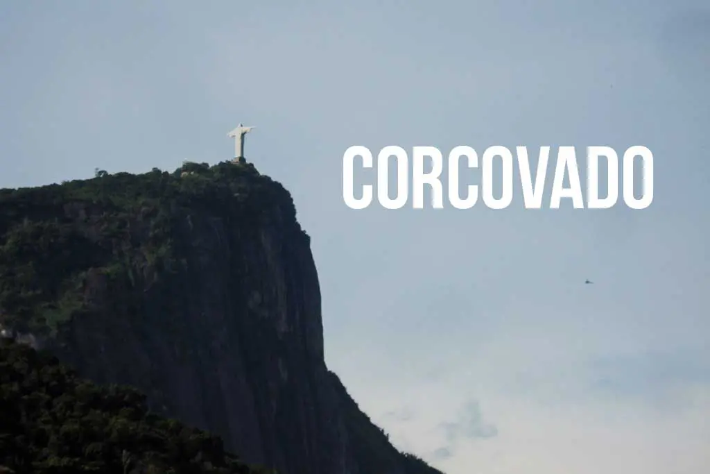
Corcovado, also known as “the mountain that Giant Stone Jesus lives on,” is a 2,329-foot (710-m) granite peak in the Tijuca Forest and a centerpiece of Rio de Janeiro.
To ensure we’re all on the same page, Corcovado is the peak’s name, and Cristo Redentor is the name of the Jesus statue. Also, Corcovado is not to be confused with the nearby Pão de Açúcar (Sugarloaf Mountain) – the one with the cable car (aka where Roger Moore fights Jaws in Moonraker).
The hike up Corcovado is an excellent alternative to taking the train or a van to the summit, and you’ll gain discounted entry into the monument at the top (worth a visit).
- Location: Parque Lage, Rio de Janeiro
- Summit elevation: 2,329 ft / 710 m
- Elevation change: 2,283 ft / 696 m
- Round-trip distance from trailhead: 2.73 mi / 4.4 km
- Round-trip time from trailhead*: 4 hours
- Difficulty: Moderate-Strenuous
- Water on trail: Yes
*Note: The round-trip time listed above is based on my experience. Please remember that your time may vary.

Getting to Corcovado
- Accessible via public transportation: Yes
- Trailhead parking: No
- Trailhead coordinates: -22.959150, -43.209690
- Summit coordinates: -22.951990, -43.210463
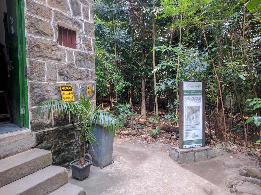
The Corcovado trailhead is in Parque Lage in Jardim Botânico (the neighborhood, not the location Jardim Botânico aka Botanical Gardens).
You can easily get to Parque Lage by car or bus (or just on foot, depending on your level of commitment). The park is open from 8:00 until 17:00 (18:00 during daylight savings). When you enter the park, head to the northeast corner to find the trailhead (aka walk as straight and as right as you can).
The official trailhead is marked below, but there is another access point (the old trailhead) above the small lake with a waterfall (you need to go up the stairs on the left and then cross the rocks to your right).
Not sure what I’m talking about? Yeah, best to just start at the official trailhead.

The Trail
The trail up Corcovado begins by gradually slowly switchbacking northwest (since Corcovado’s south face is a sheer cliff face).
Following the trail is easy, and you should have no problem finding your way – always follow the most obvious route, and you’ll be fine. Keep an eye out for marmosets (little monkeys) and capuchins (slightly larger monkeys) as you climb (but don’t you dare feed them).


Eventually, you’ll cross a creek and climb up a small rock wall before continuing. This is a good place to take a break, as there is only one more place that offers ample space for breaking activities (aka staying out of the way).
Continuing up the trail, you will soon come to the ridge with a bench overlooking the forest to the north.
From here forward, the trail gets increasingly steeper, so if you skipped break time at the river, then this is your last solid opportunity for a while to suck some wind.


Now begins the most challenging and steepest section of the trail as you climb the spine of Corcovado.
In some areas, you will have to use your hands to help yourself up the steep steps cut into the mountainside. Further up, you will reach a sloping rock that must be climbed to continue. Thankfully, the park people have drilled a rebar ladder to make the climb more accessible.
If it has rained during the past day or two, this section (and the section immediately after) may be hazardous – use caution (because I don’t want you to hurt yourself).


As you finish the steepest bit of climbing, you will reach the tracks for the bondinho (aka the lazy person way up the mountain).
Look both ways, cross directly over the tracks, and continue your hike with the last bit of trail as you approach the road above.
The road?
Yes, unfortunately, the last bit of this hike is a road walk up the base of the Jesus monument. This is also the most dangerous section of the hike because tour vans come flying around the turns in both directions.
Stick to the outside edge of the road and follow it until you see signs for the monument.


The Summit
When you reach the sign directing you to the monument, you have arrived. Take a seat and consider your options.
Said options are:
- Continue up the road to where the vans drop off their passengers (you cannot enter the monument this way).
- Turn around and hike down the way you came (or follow the road down; this will bring you to Cosme Velho.
- Climb the stairs, say hello to the park employees, and buy a ticket to enter the monument (CASH ONLY).
The entry price is R$26 (high season, weekends, and holidays), R$13 (low season weekdays), or R$0 (under 11 / over 60).
If you buy a ticket to enter, you also get yourself access to the lazy train should you not want to hike back down. The train will deposit you in Cosme Velho. A train ride down from the top will run you R$24.50.


You won’t get much of a view unless you enter the monument, so if it’s a nice day, then it’s worth the price.
From the top (on a clear day), you can see Pão de Açúcar, Pedra da Gávea, Pedra Bonita, Pico da Tijuca, Lagoa Rodrigo de Freitas, Copacabana and Ipanema beaches, Maracanã, basically the entirety of Rio’s Zona Sul and Zona Norte, and across the water to Niterói and beyond.
Basically, you can see everything (except Barra).


However, since Parque Lage opens at 8:00 and since the first train up to the monument is also at 8:00, you will likely arrive at the top to find a crowd (so a hike up will not give you the best opportunities for photos with Senhor Jesus).
Despite the crowds, it might still be worth the entry to get a cold refreshment (or to use the facilities—yeah, those facilities).

Map of Corcovado
My GPS recorded the following route up Corcovado.
I have no guarantee that this route is correct, nor that it can be accurately relied upon for navigation. It should serve only as a general guideline for what the trail is expected to look like.
Conclusion
If you’re up for a more challenging hike and/or interested in visiting the Giant Stone Jesus, then Corcovado is the hike for you.
The only downside is that you need to pay upon reaching the summit if you want to see any of the views a hike like this would normally reward you with (and that you will most definitely not be alone up there).
Do you have any questions about hiking Corcovado? Would you like to see another post about another one of Brazil’s hikes? Do you have a suggestion to improve this information?
Leave a comment and let me know!


Thank you for your great description of the hike. We made this in November. I am sixty and walk regularly on flat ground but am not a hiker. I definately found it to be strenuous. Took us about 2 hours. The only thing I wanted to add was that they wanted our passport numbers at the guard house. I had a pcture of my passport on my phone and that worked.
I did this hike in August 2018 alone and really scared my friend who lives in Rio. There have been multiple attacks on tourists hiking this trail and it should not be done alone.
At the beginning of the hike there is a small office to sign in with the park rangers and it specifically asks for an emergency contact because this trail has been known to have attacks.
Please include a strong warning at the top of this article as safety is a known issue.
It looks like there have indeed been an increase of incidents on this trail in the past couple years – warning included. Thank you for your thoughtful and curse-free comment :)
Thanks a lot for bring back memories of the time I did the hike. I did it while in Rio for the soccer World Cup in 2014. The only people I saw on the track were armed police – probably keeping the track safe for tourists. When I got to the sloping rock I was faced with a dilemma. I am no spring chicken, am not an experienced hiker and had boat shoes on. So the idea of clambering up the rock was not something I wanted to do – the chain was there but not the footholds. However, I had found the climb up to that point reasonably challenging and did not relish the prospect of tackling the same terrain going down hill, particularly as it seems as I looked back that there was a sheer drop. So I went for the lesser of two evils and I managed to scale the rock and complete the hike. I had a real sense of achievement when I got to the top. Unfortunately there was no scenery due to the low lying clouds.