
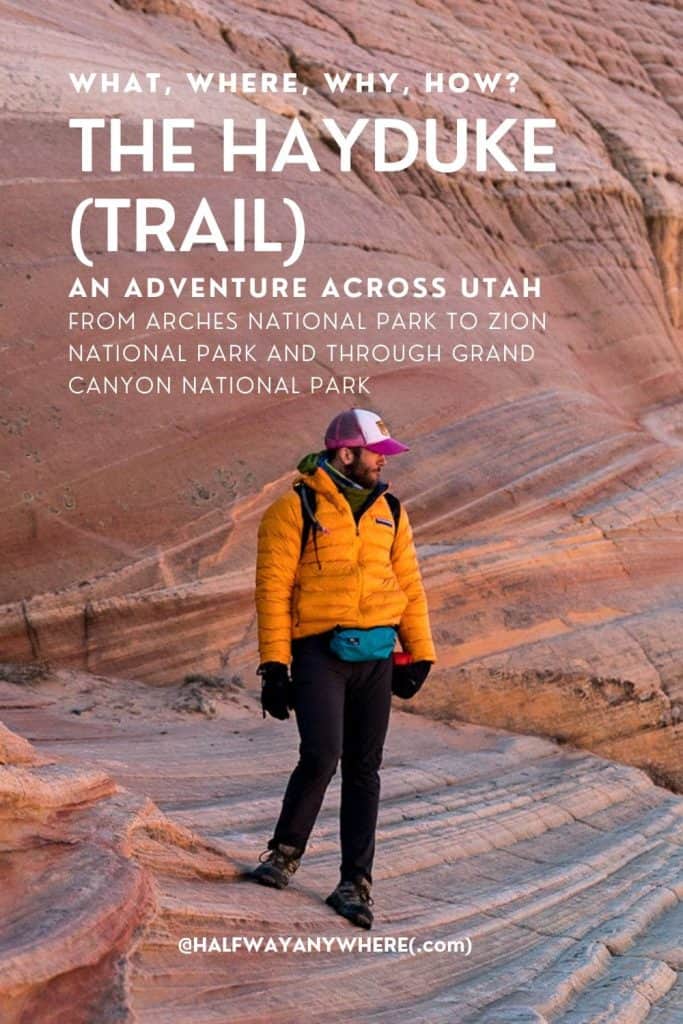
The Hayduke (Trail): What, Where, Why, and How?
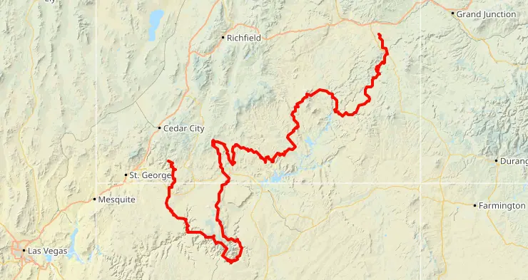
The Hayduke Trail is an 800(ish) mile (~1,300 km) route with its eastern terminus in Arches National Park and its western terminus in Zion National Park. The majority of the trail – or more accurately, the route – is within Utah, but there is a section that dips into Arizona and traverses Grand Canyon National Park as well.
As noted above, the Hayduke is more accurately described as a route and not a trail; this is why I hesitate to call it the Hayduke Trail and will instead continue to call it simply the Hayduke.
That said, the pioneers of the route, Joe Mitchell and Mike Coronella titled their guide, The Hayduke Trail: A Guide to the Backcountry Hiking on the Colorado Plateau. But calling it a trail can give the wrong impression to those unfamiliar, so I’ll continue to call it the Hayduke and omit “trail” – at least until someone convincingly tells me to do otherwise.
Since beginning my Hayduke research, it’s become apparent that this undertaking requires a bit more forethought than simply showing up at a trailhead with a backpack.
Seasonality
Just like many of the world’s long-distance trails, the Hayduke can’t be hiked year-round – at least most people wouldn’t want to hike it year-round.
Spring and fall are the optimal seasons for hiking the Hayduke.
Summer temperatures in the Utah desert can be brutal – easily exceeding 100°F / 38°C for days at a time. Meanwhile, winter can bring frigid temperatures and deep snow to higher elevations making travel equally miserable.
There are pros and cons to both spring and fall hikes. The former can mean more abundant water sources and more stable weather as you’re still well outside monsoon season; the latter can mean not having to worry about residual snowpack (and that’s about it).
I’m opting for a spring departure as it appears to be the optimal season for the Hayduke.

Water
Arguably the greatest concern of the Hayduke is water.
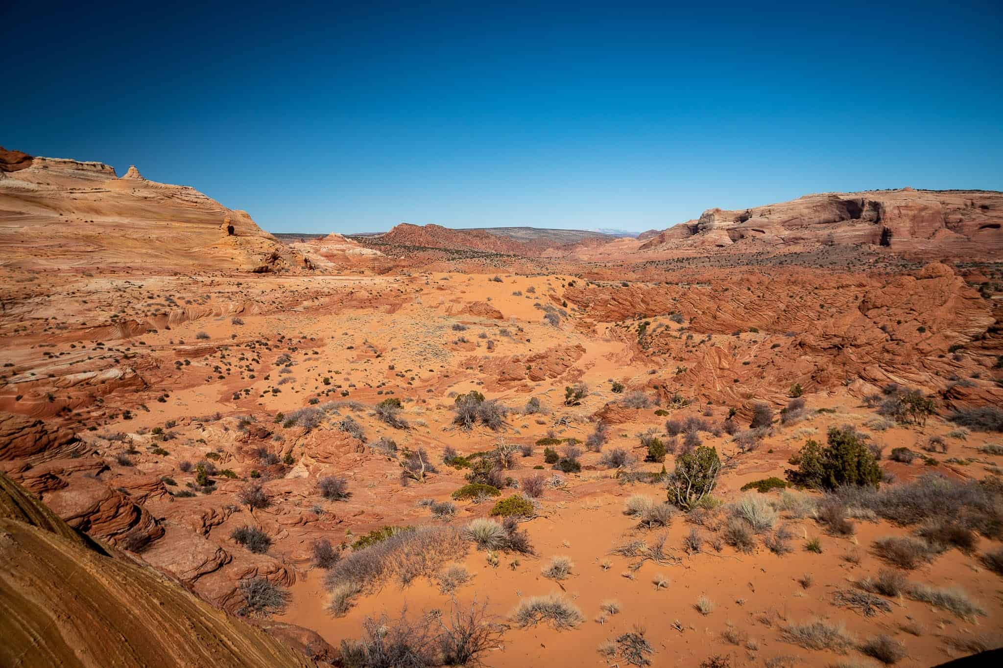
The Hayduke offers a lot to hikers across the deserts of Utah and Arizona, but the one thing that’s in near-constant short supply is water. Yes, there are certain sections of the Hayduke that are exceptions to this, but for much of the trail, water poses a major hurdle for hikers.
Making things worse, a large number of Hayduke water sources are tainted in one way or another. This could mean that the water is alkaline (a problem if you have kidney issues – otherwise a potential cause for dry and itchy skin or an upset stomach), the water has cows pooping in it (a common issue with desert water sources in the American Southwest), or the water is polluted and completely undrinkable due to agricultural runoff or even uranium (lots of mining in the desert).
All of this and more means hikers will oftentimes need to carry huge amounts of water over distances of thirty miles (48 km) or more. Because of this, some hikers choose to cache water beforehand.
I’ve chosen not to cache any water; time will tell whether I regret this decision.

Resupply
A major consideration of any long-distance trail, route, excursion, trek, path, jaunt, or whatever through the backcountry? What does resupply look like? That is, how are you going to restock your food and/or supplies over the course of your journey?
As is the case with water, some Hayduke hikers (Haydukers?) choose to cache resupplies ahead of time. However, the additional logistical considerations – including transport to/from caches pre/post hike, proper disposal of waste, additional permits, as well as the risk that something (or someone) moves, messes with, or otherwise disturbs your caches – make caching resupplies more trouble than it’s worth.
At least that’s how I see things pre-hike.
Longer food carries, hitches into town, and the potential for having to ration food seem like reasonable risks that “me now” can sign “me later” up for without too much room for regret. Just like the water carries, time will tell. There are ample opportunities to reach population centers (or at least sparse population outcrops) via roads and highways along the Hayduke, but infrequent vehicular traffic may mean waiting longer to catch a ride.

Route Finding
As noted above, the Hayduke is not an officially designated trail. There are no official markings, no official designation, no defined trail, and no official trail organization.
Parts of the route follow established trails, other parts follow jeep roads, some small sections follow paved roads, and others still follow none of the above. In many sections, Haydukers need to follow their maps as they travel cross-country across the desert, into and out of canyons, and along sometimes (but hopefully not) overgrown plateaus or riverbanks.
It’s for this reason, as noted above, I am hesitant to call the route the Hayduke Trail instead of simply the Hayduke. To do so may suggest to some that the Hayduke is more established or better marked than is the reality.
Another consequence of the need for route finding on the Hayduke? Hikers won’t be able to knock out as many miles per day as they might be able to on an established route. Scrambling up and down canyons through boulders, talus, and slippery slabs isn’t quite as conducive to high-mile days as is a well-packed trail through the forest.
Permits
Passing through some of the country’s most stunning scenery comes at the cost of needing to secure permits for much of the trail.
Approximately 25% of the Hayduke is within the boundaries of a national park. These parks include Arches National Park, Canyonlands National Park, Capitol Reef National Park, Bryce Canyon National Park, Grand Canyon National Park, and Zion National Park. For those paying attention, that’s all of Utah’s National Parks and a third of Arizona’s (which has three total, but it sounds fancier to say a third instead of just “one”).
Permits are required for overnight stays in national parks and because there is no “Hayduke Trail permit”, each of these permits needs to be secured individually. This can complicate logistics as these parks are spread out across the Hayduke – making predicting the dates permits will be needed difficult.
This can mean waits at ranger stations (or, more likely, on hold), having to push miles to get outside park boundaries, or having to take unexpected days off if permits can’t be secured for the desired date(s).

Alternates
Because the Hayduke isn’t an established trail, a number of alternates have sprung up around the route. In fact, if you look at a map of the original Hayduke alongside all the alternates, it almost looks like a spider web across Southern Utah.
So many alternates exist that you could conceivably put together a hike of the Hayduke that ends up being more alternate than the original trail.
The Hayduke also takes many long switchbacks across the desert which means hikers can, at multiple points, cut off huge sections of the trail. For example, you can hike a short 11 mi / 18 km (down a well-defined trail) and skip the entirety of Grand Canyon National Park.
This is why it’s difficult to define exactly how long the Hayduke is; it’s likely quite rare that any two individuals or groups end up hiking the exact same route.
This is all further complicated by the fact that there’s currently no trail into Zion National Park via the East Rim. Massive rockfalls in 2018 and 2019 closed the trail leading to/from the East Rim – officially(/unofficially) part of the Hayduke. This means hikers must currently choose between hitchhiking through Zion’s tunnel (no pedestrian traffic allowed), getting permits and equipment for a top-down hike of the Narrows, bringing a rope to follow a technical route into the park, going around the park to the south/west, or simply ending (or starting) their hikes short of the “official” terminus.
Gatekeeping
An issue I’ve noticed while researching and planning for the Hayduke is the seemingly large amount of gatekeeping around the trail.
Although many well-intentioned trip reports and resources exist, there’s perhaps an equal number of pseudo-resources serving little purpose beyond informing the world that a particular person hiked the Hayduke.
Many of these hikers flaunt their willful withholding of trail beta as an exercise in protecting the Hayduke, protecting inexperienced hikers, or protecting cryptobiotic soil. But all of these reasons are simply a cover for these hikers’ misguided attempts to protect something much more fragile – their superiority complexes.
No, nobody wants to “ruin the Hayduke”. Nobody wants inexperienced hikers to get themselves into dangerous situations in the backcountry. And nobody wants to destroy cryptobiotic soil. But the Hayduke is a thing. People are going to hike (or attempt to hike) this thing. And people are going to do so with or without gatekept beta (that, let’s be honest, is probably garbage anyway).
The best thing we can do for the Hayduke, its users, and the lands it passes through, is to make sure Haydukers are well-educated and fully informed regarding the route and the best practices surrounding the lands it passes through.

Wrap Up
The Hayduke (Trail) has been on my list for a long time now and I’m excited to finally be attempting it.
I’ve spent a lot of time hiking both cross-country and in the desert since taking my first steps on the Pacific Crest Trail nearly ten years ago. The hiking, route finding, water carries, and resupply don’t worry me too much (although I’m sure some resupplies will be less-than-optimal).
What worries me most about the Hayduke is getting caught in a freak flash flood while in a slot canyon as a result of a storm that’s potentially hundreds of miles away (yes, this is a thing that can happen). That, or getting pulled from my sleeping bag in the middle of the night by a drunk and disgruntled rancher angry at me for existing.
Permits will be an annoyance, I’m sure, but with flexibility built into my schedule and a willingness to push miles to camp legally when required, this an issue I feel can be reasonably overcome.
Overall, I’m excited. However, I am typically most excited during the planning phase. Dread sets in during the “getting to the trailhead” phase but typically subsides following my first twenty-four hours in the backcountry.
Hayduke thus far? 10/10, would plan again. Let’s hope I can say the same for the hiking part.
Affiliate Disclosure: This page may contain affiliate links, which means I may receive small commissions for purchases made via these links at no additional cost to you. This helps pay the bills and keep the site up and running. Thank you for your support!


Yep, should be a fun “trail”. I’ve been planning the route all winter, so many alts to choose from. I’ve got an excellent Gpx set if you’d like a copy (annotated routes/waypoints of Li, Barth and others). I start 3/14, maybe I’ll see you out there.
I’m planning to start probably a week or so later; always a chance we’ll cross paths! Would love to see what you’ve put together and hear which alternates you’re (at this point) committed to and why – I’ve been hard at work on my own GPX I’m happy to share as well. Shoot me an email: [email protected]
Very much looking forward to this one. Good luck!
Thank you!
As someone whose life circumstances prevent me from thru-hiking, I vicariously enjoy a number of thru-hiker blogs, yours first and foremost, Mac. I’ve also read about the Hayduke once or twice before and just how challenging it is. But I’ve yet to read any firsthand accounts about someone actually hiking it. I wish you safe travels, enjoy it, and I’m looking forward to reading all about it.
I’m anticipating doing an article on each section (there are 14 in total). Hopefully, each will be equal parts educational and entertaining.
“If you see a pictograph (painted/drawn) or petroglyph (carved/pecked) never don’t touch it.”
never don’t touch? That looks like a typo.
Anyway, the route looks cool, good luck!
You are correct – typo, indeed; it’s been updated!