Guide to Hiking Mount Rishiri (利尻山) in Japan
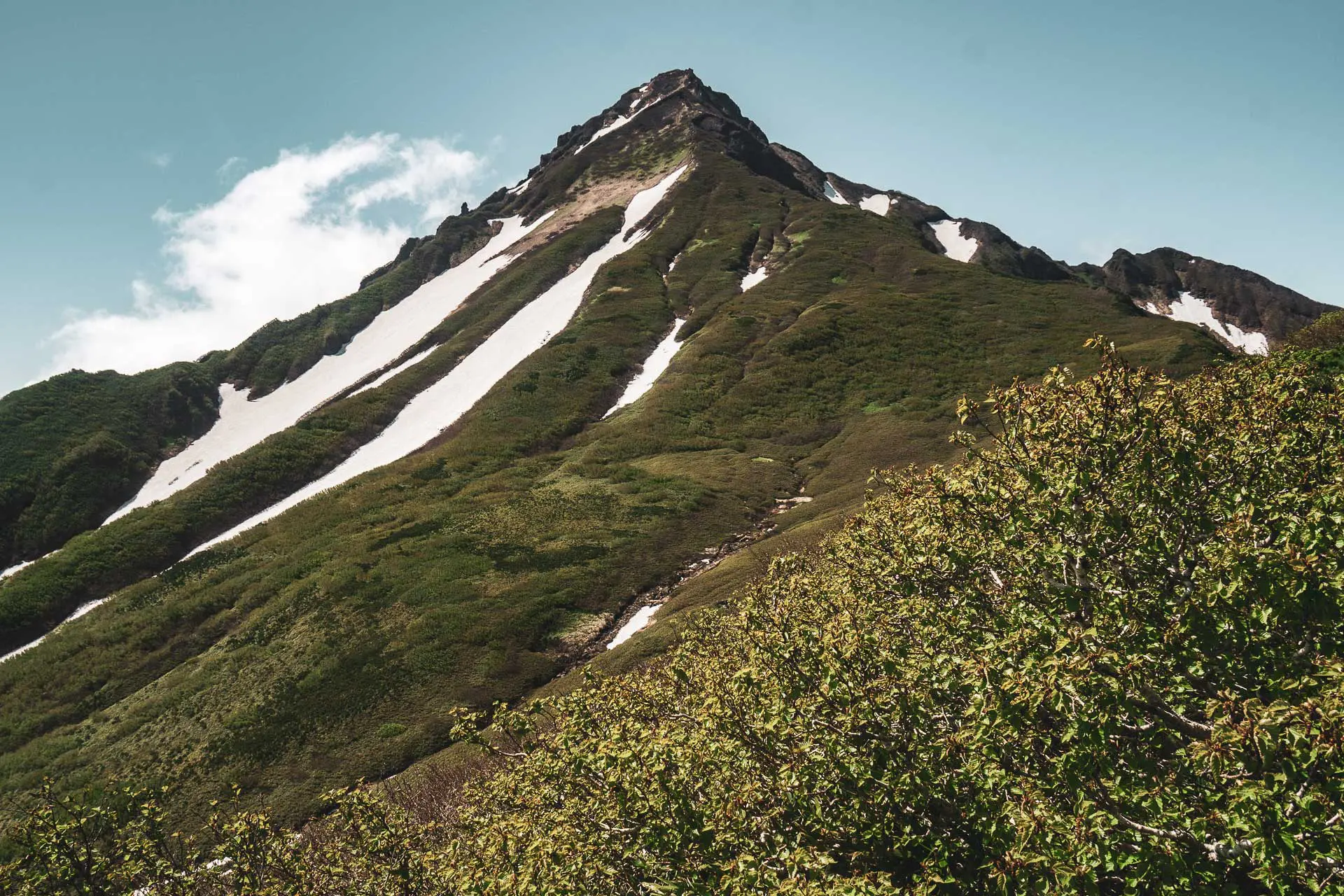
Mount Rishiri (利尻山, Rishiri-zan) is a 5,646 ft / 1,721 m stratovolcano on Rishiri Island (利尻島) off the northwest coast of Hokkaido (北海道). The entirety of Rishiri Island is essentially Mount Rishiri and the peak is near the island’s center.
It is one of Japan’s hyaku-meizan, but it is not very easy to get to because of its remote location (that is to say, it takes a long time to get to). You’ll need to take the train to the country’s northernmost train station (unless you’re driving) and then take a ferry to Rishiri Island if you’re looking to climb Mount Rishiri.
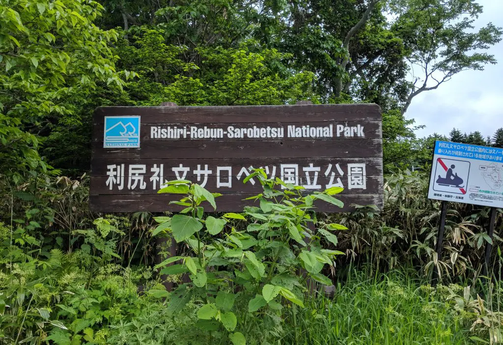
There are two trailheads – one on the northern side of the mountain (Oshidomari Hiking Trail, 鴛泊登山道) and one on the western side of the island (Kutsugata Hiking Trail, 沓形登山道). The Himenuma Ponyama Nature Trail (姫沼ポン山深勝路) is an adjoining trail on the northern side that starts a little east of the Oshidomari Trail (from a different trailhead) before joining it at Rishiri Hokuroku Campsite.
Mount Rishiri Basics
- Name: Mount Rishiri
- Japanese name: 利尻山 (Rishiri-zan)
- Location: Rishiri Island, Hokkaido (利尻島北海道)
- Summit elevation: 5,646 ft / 1,721 m
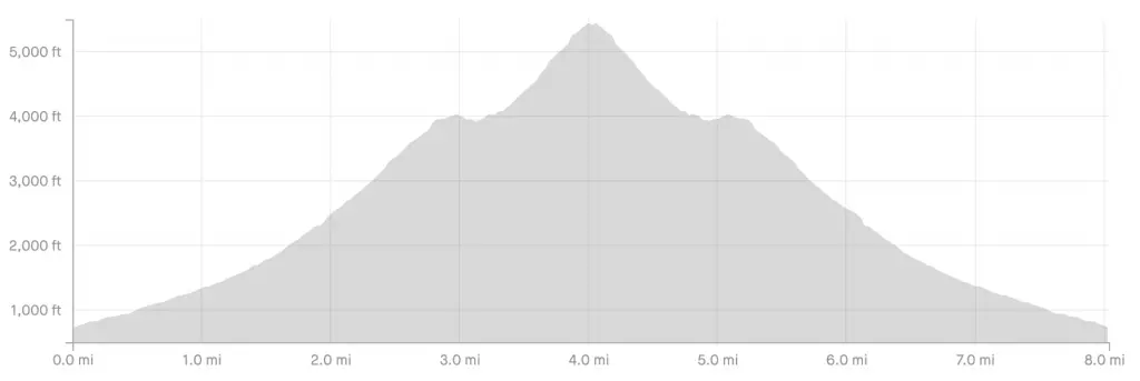
- Roundtrip distance*: 8.03 mi / 12.92 km
- Elevation Change*: ~4,910 ft / 1,497 m
- Trailheads: 3
- Difficulty: Moderate
- Water on trail: Yes**
- Trailhead facilities: Parking, bathroom, camping
- Nihon Hyaku-meizan: Yes
*Via the Oshidomari Hiking Trail (鴛泊登山道)
**Only via the Oshidomari Hiking Trail (鴛泊登山道) or Ponyama Nature Trail (姫沼ポン山深勝路)
Getting to Mount Rishiri
At the northern tip of the country, getting to Mount Rishiri is a bit of a mission. Step one for getting to Mount Rishiri is to get to Rishiri Island (利尻島). The island is accessible via ferry from Wakkanai (稚内) – home to the northernmost train station in Japan, Wakkanai Station (稚内駅).
- Accessible via public transportation: Yes
- Trailhead parking: Yes
- Trailhead coordinates:
Rishiri Hokuroku Campsite (利尻北麓野営場) 45.222323, 141.212633
Mikaeridal Picnic Area (利尻山見返台公園) 45.182671, 141.192551 - Summit coordinates: 45.180566, 141.241123
Train
Step one for getting to Mount Rishiri is getting to Wakkanai Station (稚内駅). The train ride takes five hours from Sapporo (札幌市), the closest major city and costs ¥11,090 (~$105 US) one way (if you’re going to Japan and haven’t already checked out getting a Japan Rail Pass, I would look into getting one). Once you get to Wakkanai Station it’s a quick 10-minute walk to the Heartland Ferry (ハートランドフェリー) at Wakkanai Port (稚内支店).
Car
Driving to Mount Rishiri is possible, but you’re probably better off leaving your car on the mainland if you decide to drive up to Wakkanai. The quickest route from Sapporo to Wakkanai takes about five hours and covers just over 200 mi / 322 km. If you want to take a car on the ferry to Rishiri Island, it’s over $100 US each way (the longer your car, the more expensive). There are plenty of cabs available on Rishiri Island if you don’t feel like walking to the trailhead. I’m not sure what longer-term parking looks like in Wakkanai, but I’m sure it won’t be too difficult to find somewhere to park your car for a night or two.
Bus
It is possible to reach Wakkanai by bus from Sapporo’s Odori Bus Center (大通BC). There are six departures a day with an overnight option as well. Find details here (Japanese only but Google translatable to English). A one-way ticket is ¥6,200 (~$58 US) and a roundtrip ticket is ¥11,300 (~$105 US). The bus takes approximately six hours.
Rishiri Island Ferry Terminal
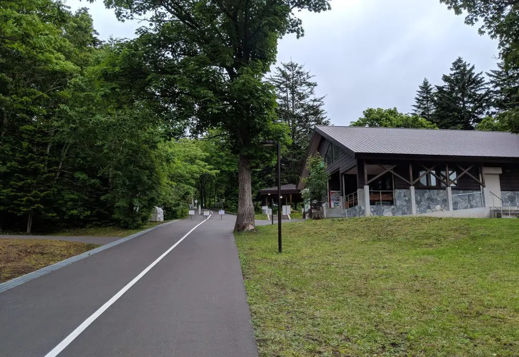
Once you reach the Rishiri Island Ferry Terminal (assuming you didn’t bring a car), you can either take a taxi or walk to the Oshidomari Trailhead (鴛泊登山道) at Rishiri Hokuroku Campground (利尻北麓野営場). It’s 2.3 mi / 3.7 km from the ferry terminal to the campground/trailhead. I walked and it wasn’t bad.
The Kutsugata Trailhead is further – 11.1 mi / 17.9 km – since you need to go around the western side of the island to reach it. You can take a bus from the ferry terminal in Oshidomari to Kutsugata (沓形) which takes around 30 minutes and costs ¥750 (~$7 US). From Kutsugata, you begin your hike up the mountain by walking the 3.5 mi / 5.7 km road leading up to the trailhead.
Oshidomari Hiking Trail Parking
Kutsugata Hiking Trail Parking
Notes on Mount Rishiri
- Mount Rishiri is on Rishiri Island off the northern coast of Hokkaido and is accessible only via the Heartland Ferry from the Wakkanai Port.
- There are two trailheads for Mount Rishiri, one in Oshidomari (鴛泊) and one in Kutsugata (沓形). The Oshidomari trailhead is closer to the ferry terminal on Rishiri Island.
- Each of the two trails up Mount Rishiri has an emergency shelter – overnight stays in these shelters are not permitted.
- There are additional small wooden shelters on the way up each of the trails – these are meant to provide privacy should you need to poop in a portable toilet/wag bag (which you’re expected to bring with you up the mountain).
- Kanro Spring (甘露泉水) is located just past Rishiri Hokuroku Campground. This is the only natural water source on the mountain (except for any melting snow that might be around), so make sure to fill up here and bring all the water you’ll need with you.
- Rishiri Fuji Onsen (利尻富士温泉) is located just north of Rishiri Hokuroku Campground stopping here for a post-hike dip is highly encouraged.

Mount Rishiri Trail
Oshidomari Hiking Trail (鴛泊登山道)
- Distance: 8.03 mi / 12.92 km
- Elevation gain: 4,910 ft / 1,497 m
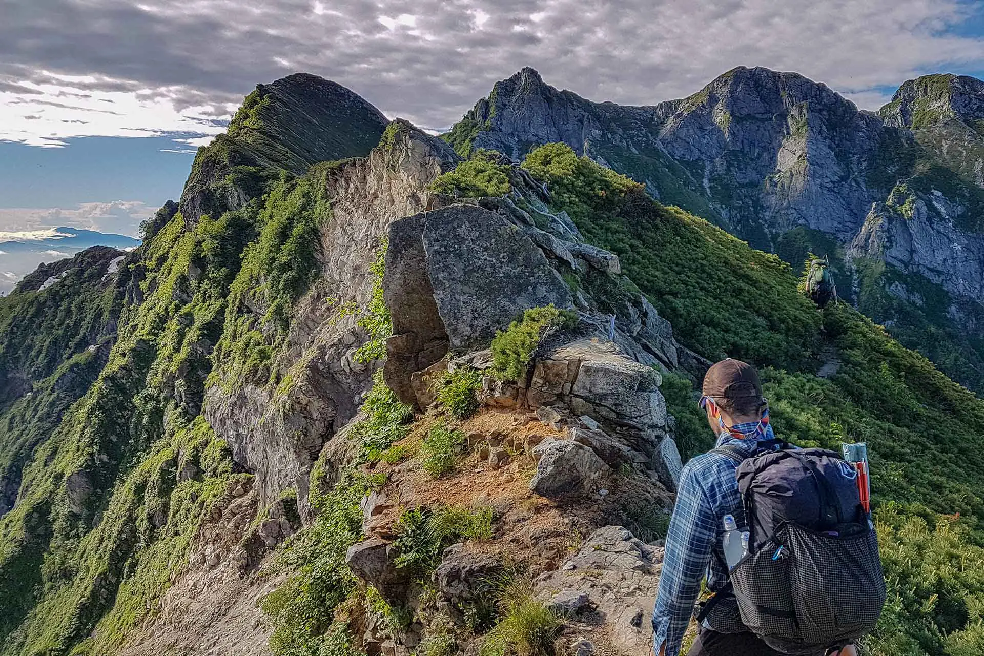
This is the more popular route up Mount Rishiri since it is closer to the ferry terminal (walking distance) and better maintained than (although still is fairly rough). This is also the route that I hiked and the one I will describe here.
A word to the wise – take a poop and fill up on water before leaving the campground (there is no reliable water anywhere on the trail and you are expected to poop in a portable toilet – which you need to bring – should you wish to fire off a missile on the mountain).
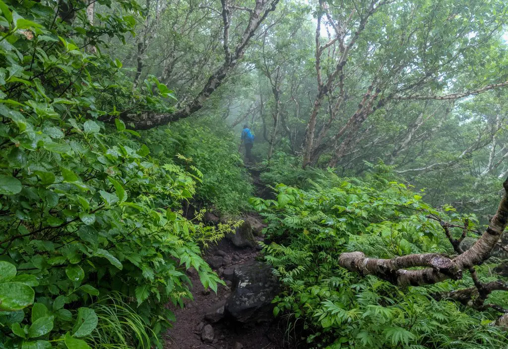
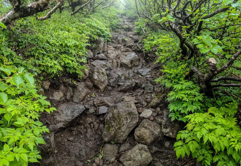
The first 1 mi / 1.6 km climbs gradually through the trees on a rocky and root-filled trail. When you pass the 1 mi / 1.6 km mark, the trail gets steeper as you climb over 1,100 ft / 335 m in the next 1 mi / 1.6 km. The second half of the climb (~2 mi / 3.2 km) is far steeper than the first half as you climb the final 3,000 ft over 2 mi / 3.2 km.
Just after leaving Rishiri Hokuroku Campsite, you’ll hit the 3rd Station. I don’t know what it is with mountains in Japan (I should probably know this, but I don’t), but many of them have these “stations” as you climb up them. The “station” might be just a post in the ground telling you that it’s a station or it might be a full-fledged restaurant (plenty of this on Mount Fuji). Climbing Mount Rishiri via the Oshidomari Hiking Trail, you’ll encounter the following stations:
- 3rd Station (Kanrosen Spring)
- 6th Station (Viewpoint) – 2,493 ft / 760 m
- 6.5th(?) Station (Privacy box for making poops) –
- 8th Station (Mount Chokan-yama) – 3,996 ft / 1,218 m
- 9th Station (Privacy box for making poops) – 4,626 ft / 1,410 m
The emergency shelter (where there’s also a poop-making box) is located between the 8th and 9th stations. Again, just think of these “stations” as landmarks (usually there’s a sign, and most of the time there’s at least a bench or something).

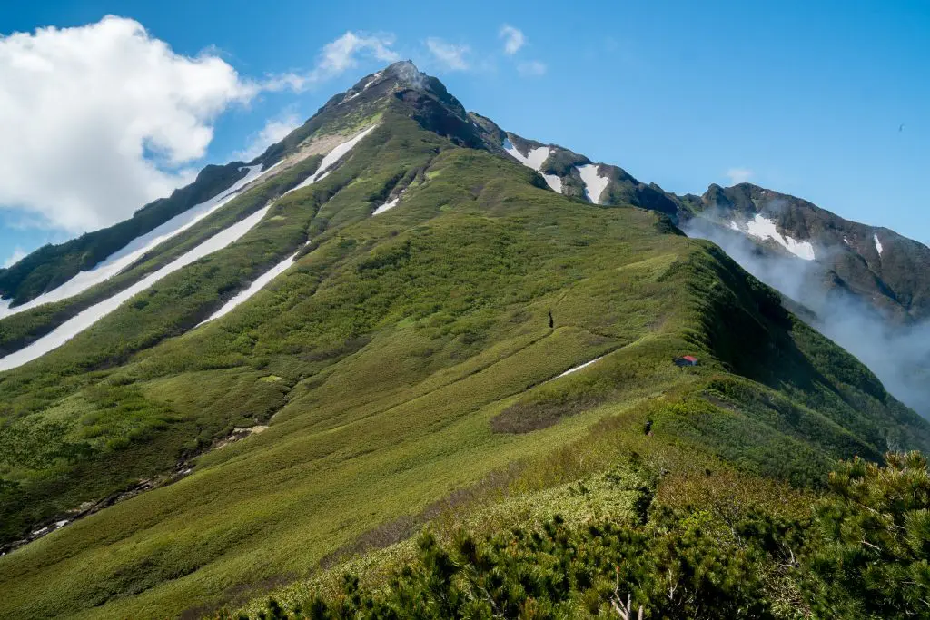
When you reach the 6th Station (2,493 ft / 760 m) you get your first good views of the summit as you break above the tree line. There are some steps built into the trail but be prepared for a lot of loose dirt and rocks on your way up to the summit. If you don’t already have a pair of trail running gaiters, this may be the time to invest.
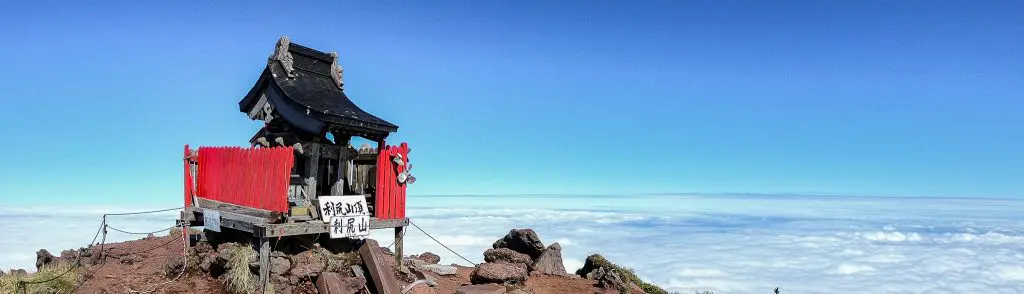
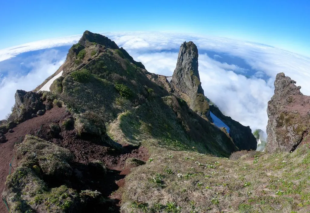
Mount Rishiri Summit
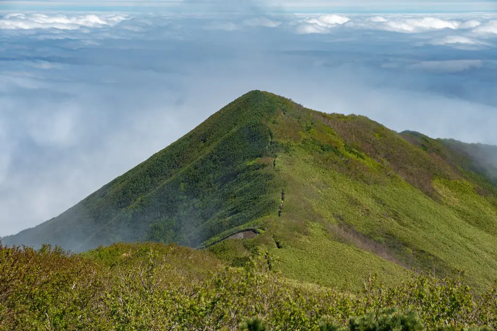
At the summit of Mount Rishiri, there’s a shrine (typical of Japanese mountains) and a small sitting area where you can (hopefully) take in the view. I climbed through fog most of the morning, afraid I wouldn’t have any views, but eventually, I broke through the clouds and was very happy for having continued to push up the mountain.
There’s a bench with enough room for maybe a dozen people to comfortably hang out at the summit. From here, you can either descend via either trail. Next time I am hoping to head down the Kutsugata Hiking Trail (沓形登山道).

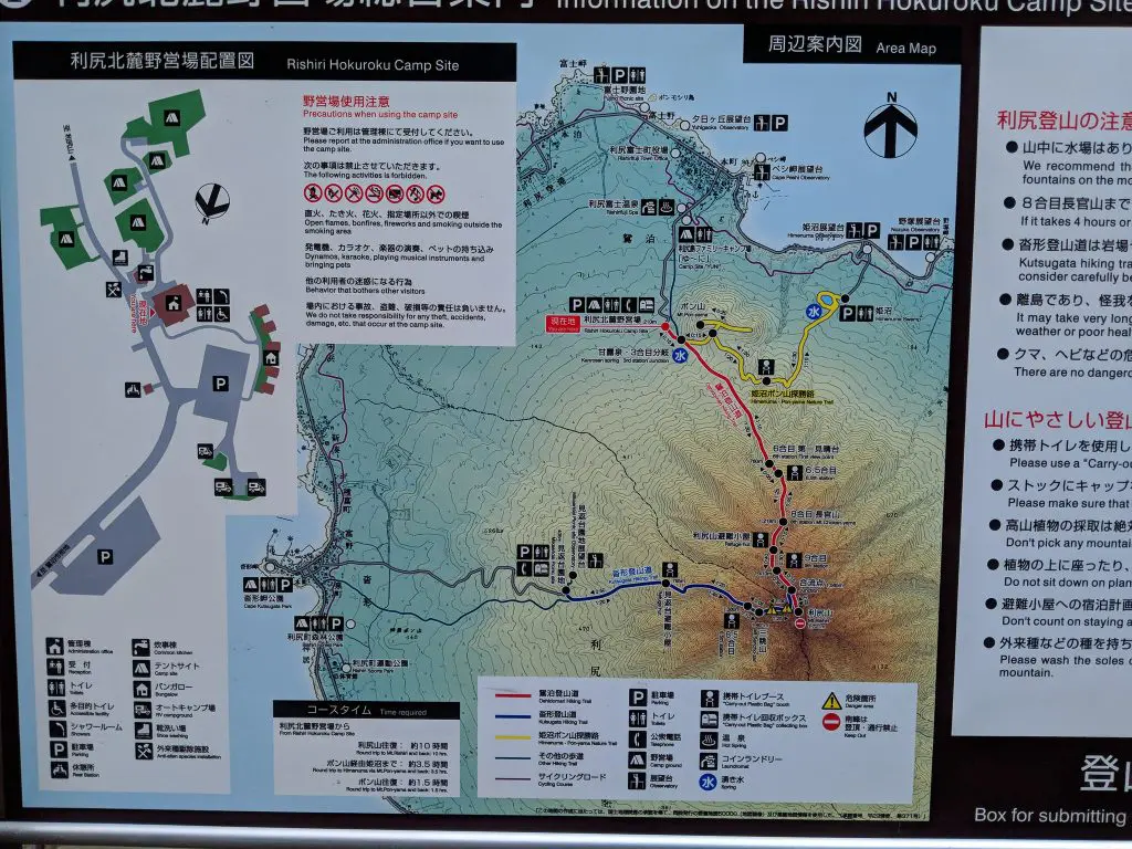
Mount Rishiri Map
The following map shows the hike up to the summit of Mount Rishiri via the Oshidomari Hiking Trail (沓形コー ス) beginning at the Rishiri Hokuroku Campsite (利尻北麓野営場).
Wrap Up
So is Mount Rishiri worth all the effort it takes to get to the northernmost point in Japan? Probably. (Note that the northernmost point in Japan is actually Cape Sōya – 宗谷岬, Sōya-misaki – just north of Wakkanai).
That said, my answer is only yes if you have a JR Pass and some time to kill – and if you’re already planning on spending some time in Hokkaido. Mount Rishiri is definitely not worth being the one hike you do for the entirety of your time in Japan – unless maybe you’re spending all that time in Hokkaido (but there is a lot in Hokkaido I have yet to explore).
Overall? Excellent experience – would hike again.
Have questions about hiking Mount Rishiri? Want another post about another one of Japan’s mountains? Have a suggestion to improve this information? Leave a comment and let me know!
Mount Rishiri Resources
- Heartland Ferry Website (timetables and reservations)
- Mount Rishiri Live Image (updated every thirty minutes)
- Wakkanai City Website
- Sapporo to Wakkanai Bus
- Rishiri Tourism Website (Japanese)
- Rebun Island (an island next to Rishiri Island that can be visited via ferry)
- Mount Rishiri weather


thank you for the good report
assuming we wish to go ascend one way and descend the other, which way do you recommend?
I ascended/descended via the same trail so, unfortunately, I don’t think I can offer a great opinion on that.
Hi. Did you see Sakhalin island (Russia) from the summit?
Thanks the detailed post. My plan is to go in July. You just never said anything about the ferry to the island. That’s the only thing left uncovered. Do you have any information to share, please? Hours, ticket, return? I don’t want to get shucked on the tiny island after the hike!
I mention the ferry multiple times and include a link to it in the Resources section, here it is: http://www.heartlandferry.jp/english/
Since ferry schedules, fares, etc. change with frequency, I did not publish these on the site. That said, they’re all available (in English) at the above link. Have fun!