
Hiking Mount Tsurugi (剱岳) in Japan
Mount Tsurugi (剱岳, Tsurugidake) is one of the many prize peaks of the Kita Alps (北アルプス), and is also one of Japan’s 100 Famous Mountains.
The trailhead described here is a bit remote and if you don’t have your own transportation, then you’re out of luck unless you want to take an expensive taxi ride (¥8,000).
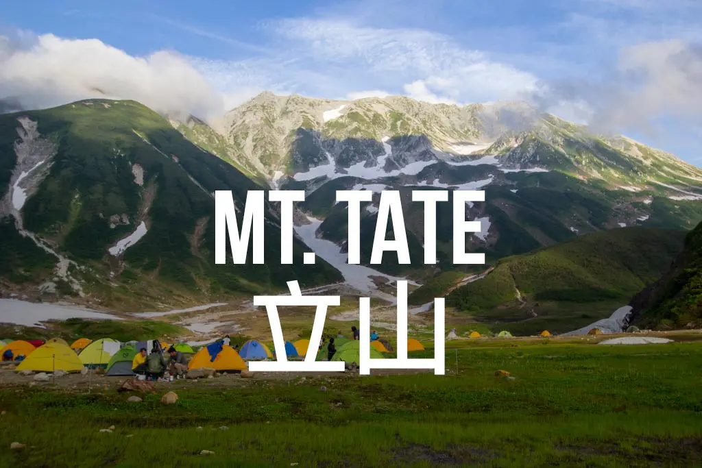
That being said, there are other routes to reach Tsurugidake. The most popular of these starts at Murodō Station (室堂駅) just below Tateyama (立山); you can hike to here or take the Tateyama Kurobe Alpine Route (立山黒部アルペンルート) to Murodō (English website). This route is the most popular; however, it requires more than one day to complete.
Tsurugidake Facts
- Name: Tsurugidake (Mount Tsurugi)
- Japanese name: 剱岳
- Location: Tateyama, Toyama (富山県立山町)
- Summit elevation: 9,839 ft / 2,999 m
- Elevation change: 7,283 ft / 2,220 m
- Round-trip distance from trailhead: 10.6 mi / 17 km
- Round-trip time from trailhead*: 10:55 moving time / 12:02 total time
- Difficulty: Strenuous
- Water on trail: No
- Trailhead facilities: Parking, bathroom, campground, lodge
- Nihon Hyaku-meizan: Yes
*Note: The round-trip time listed above is based on my own experience. Please remember that your time may vary greatly.
Getting to Tsurugidake
- Region: Kita Alps (北アルプス)
- Accessible via public transportation: No
- Trailhead parking: Yes
- Trailhead coordinates: 36.646709, 137.557387
- Summit coordinates: 36.623305, 137.617071
BY CAR: You can find the trailhead for Tsurugidake at Banbajima (馬場島荘) – at the end of a long and winding valley road. In addition to the Banbajima Inn, there is a free parking area, a bathroom, and a large grass field (in case you want to come the night before and camp).
BY TRAIN: You need to get yourself over to the Toyama Local Main Line (富山地方鉄道本線) and take a local train to Kamiichi Station (上市). Then you’ll need to take a taxi (~45 minutes) that will run you somewhere close to ¥8,000.
Alternatively, if you opt to hike up via Tateyama instead of taking the route described here, you can take a train to Tateyama Station (立山駅) and either hike up from there or take the cable car and bus portion of the Tateyama Kurobe Alpine Route to Murodō.
The Hike

The start of the hike lies through the small grass field next to the Banbajima parking lot. Fill up on water because there’s none on the trail unless you want to buy expensive bottles from Hayatsukigoya (早月小屋); the lodge is about two-thirds of the way up (open July 1 through mid-October; website here, Japanese only).
Mentally prepare for hours of uphill hiking, as the trail heads straight up the mountain and doesn’t let up for pretty much the entirety of the hike (you are climbing a mountain, after all).
There’s a pair of benches about 90 minutes into the hike at an elevation of 6,562 ft / 2,000 m – now you’ve only got 656 ft / 200 m to go until reaching the next good place to rest at, Hayatsukigoya (3.35 mi / 5.4 km from the trailhead at an elevation of 7,218 ft / 2,200 m).


From the hut (which costs ¥6,000 (~$60 US) to stay at (not including meals), it’s another 2,600 ft / 800 m to the summit.
The hiking from here forward is a lot more enjoyable since you’re mostly above the treeline and now (hopefully) have spectacular views of the Kita Alps and beyond.
Once reaching about 9,186 ft / 2,800 m, you’ll climb over rocks (and chains) the entire way to the summit. There’s nothing too technical and it doesn’t require that you bring any special equipment, but there’s a bit of climbing with your hands to be done. Rest assured that you will be given plenty of opportunities to fall off the mountain and plummet to your death.

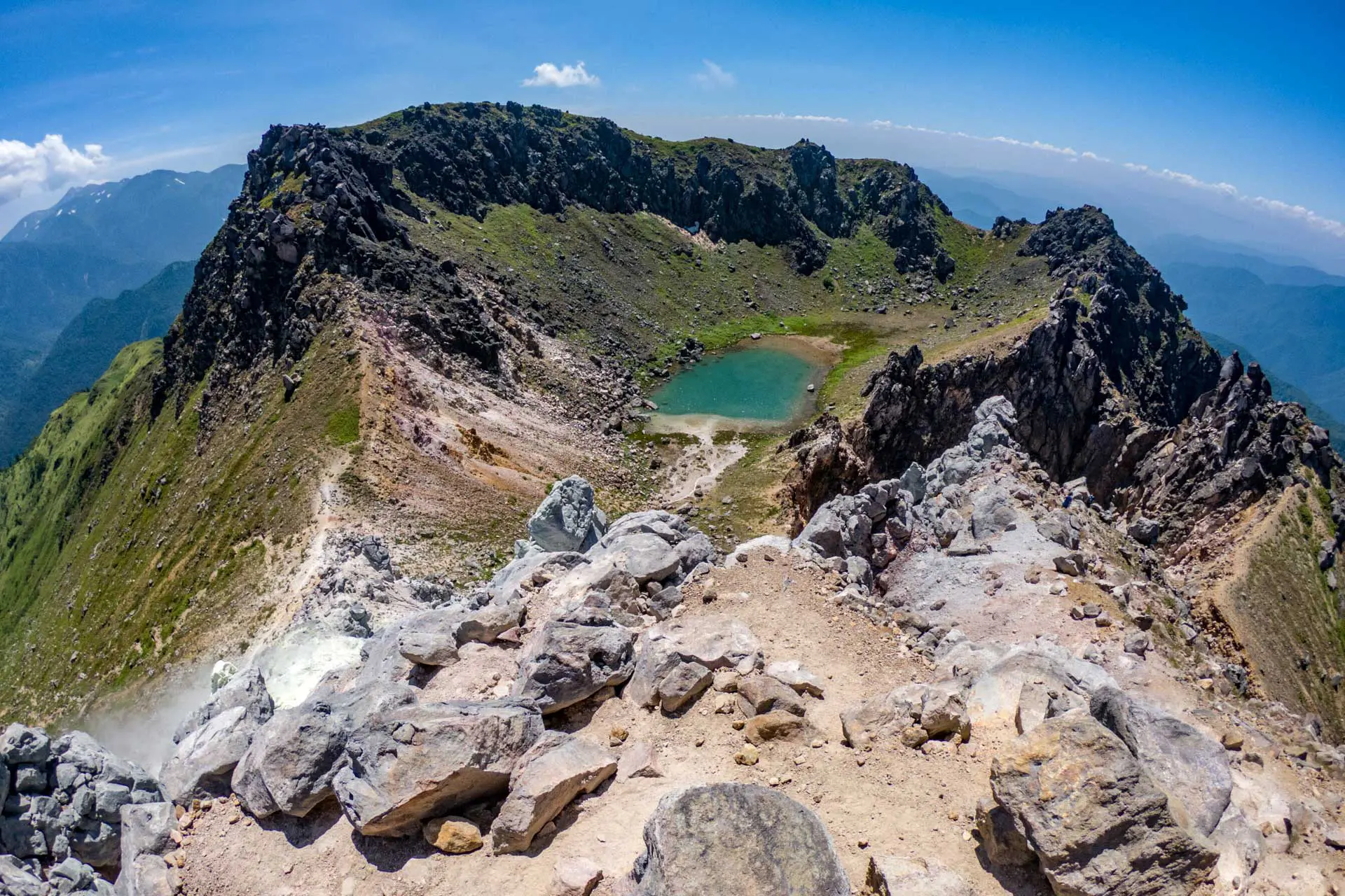
The Summit
The rocky summit of Tsurugidake is home to a small shrine and space for maybe a dozen hikers.
If you’ve followed the route described here, don’t be surprised if you see a lot more people on the summit than you’ve seen all day – most of them will have climbed from Tsurugisawa Goya (剣沢小屋) via the Tateyama Kurobe Alpine Route.
On a clear day you’ll have great views over to Hakusan (白山), Tateyama (立山), and the Kita Alps extending south – if you’re lucky, you can spy Mount Fuji (富士山) as well.

From here, you have a few options: 1) Descend via the way you came and back down to Banbajima, 2) Head north towards Mount Ikenodaira (池平山) and Mount Sennin (仙人山) to Keyakidaira (欅平) on the Kurobekyō-tetsudō line (黒部峡谷鉄道), or 3) Traverse south towards Murodō Station and Tateyama.
I opted for option three (which I would highly suggest if you’ve managed to get a ride to Banbajima) and was able to make it to the Murodō campground before nightfall (there’s another campground a couple of hours before reaching this one, and the Kenzanso Lodge a couple of hours after leaving the summit of Tsurugi).
If you traverse to Tateyama, you can hike (or take the Alpine Route) down to Tateyama Station (立山駅) and catch a train from there.

Map of Tsurugidake
The following was the route my GPS recorded on my hike up Tsurugidake (it also includes the traverse over to the Murodō campground).
I have no guarantee that this route is correct, nor that it can be accurately relied upon for backcountry navigation. It should serve only as a general guideline for what the trail is expected to look like.
I have also included my hike’s elevation profile below (although it is incomplete due to some GPS troubles).

Conclusion
If you happen upon a mountain enthusiast during your time in Japan, then chances are Tsurugidake will be high on their list of revered peaks.
Whether you’re making the huge climb up from Banbajima, heading in from the north, or traversing over from Tateyama, the 9,839 ft / 2,999 m summit of Tsurugidake is one of the most coveted prizes of Japan’s Kita Alps (and is relatively unspoiled when compared to some of the surrounding peaks).
Have any questions about Tsurugidake? Want another post about another one of Japan’s mountains? Have a suggestion to improve this information?
Leave a comment and let me know!

hi, i’m foreigner and has no car in japan, like to do tsurugi in winter month Jan start from murodo station and end at Tsurugidakeseishonenryokomura Camping Ground, or another way round. from many sources in the internet say that the cable car/bus from tateyama station would be closed during winter time. do you think can get hitchride to murodo on luck? is it many people climbing in winter month Jan? what others option during that time?
Hi,
Great page!
Do u have a way to assess the time and effort to make a circular track from the camping ground in murodo via mt. Tate and via mt. Tsurugi and then back to the camping ground?
You won’t be able to do a perfect loop because the trail to Mount Tsurugi does not loop back to Mount Tate. As far as the time and effort, it could probably be done in a single day (a long day), and it would definitely be demanding.
Here’s a picture of a map I found (sorry, names are in Japanese, but Mount Tate is labeled 2861 m and Mount Tsurugi is labeled 2999). https://uploads.disquscdn.com/images/906a883d549d08ca9e9fb787138136bd64f60f2d40386faf94a8cd2559dd0979.png
if im in shikoku in late march, its not possible to do ishizuchi?
can you recommend any other mountain possible and worth hiking on the island?
Unfortunately, I have not done any hiking on Shikoku yet and don’t know the area well enough to be able to make any solid recommendations :(
I realize I am probably too late to help you but maybe anyone with a similar situation or if you decide to hike this winter. I live on Shikoku and I would recommend hiking Mount Tsurugi and/or Mount Miune. Tsurugi is more well known, popular and has more permanent paths and such. Miune on the other hand is on the same level as Tsurugi but is less traveled and more for those who wish to have a bit more isolation when hiking. I would recommend both hikes as it is a lot of fun. Spring time is great because you get a lot of the mountain flowers and vegetables (山菜).
Is climbing Mt Tsurugi and doing the traverse to Murodo station possible to do in the beginning of May? A friend and I are looking for some multi day treks to do in the beginning of May but it seems like most long treks say June-August are best.
May is probably too early (especially for the traverse) unless you’re an experienced winter mountaineer (because it wouldn’t be hiking at that point). Really July-September/October is the best as far as no snow goes.