
Guthook Guides (Atlas Guides) PCT App Review
If you are going to hike the Pacific Crest Trail and want a serious app dedicated to the PCT, then Guthook’s Guide is exactly what you’re looking for. The Guthook/Atlas Guides Team went to extraordinary lengths to not only create an excellent app tracing the entirety of the Pacific Crest Trail, but also to document thousands of waypoints, from campsites to post offices, all complete with locations, descriptions, and sometimes even photos.
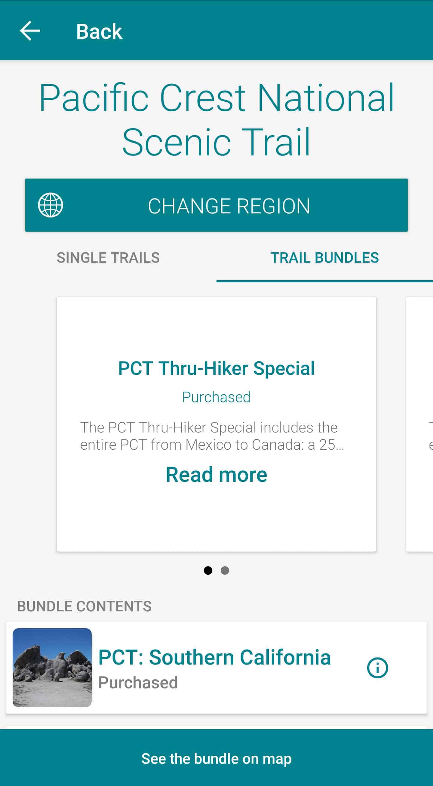
Guthook’s Guide (available for Android and iOS) is split into five parts, one for each section of the trail (Desert, Sierra, NorCal, Oregon, and Washington). Each section costs $7.99 (that’s $39.95 US if you can’t math). They can be purchased individually (i.e. if you only want Sierra and Washington) or as a bundle for $29.99 (if you’re thru-hiking, this is what you want to do). The Guthook Guides app is distributed by Atlas Guides, so don’t get confused if/when you start to see both of these names.
Despite the price, Guthook’s Guide is far superior to any guidebook you probably wasted your money on before hiking the PCT. Also, when you consider it’s something you will use (probably) every day for what could be as long as five months, it helps justify the price.
Basics
- Name: Guthook Guides: Hike & Bike Offline
- Publisher: AtlasGuides
- Available For: Android and iOS
- Offline Maps: Yes
- GPS Tracking: Yes
- Cell Service Needed: No
- Elevation Profile: Yes
- Waypoint Photos: Yes
- Price Per Section: $7.99
- Bundle Price: $29.99
- Water sources (including reliability of each water source)
- Resupply locations/post offices
- Tenting sites/camping sites
- Trail junctions
- Parking areas along the trail
- Picnic areas, campgrounds, ranger stations
- Roads, railroad tracks, power lines, fences, gates
- Natural landmarks (e.g. mountain passes)
- Privies/restrooms
- Restaurants, stores, libraries, lodging
- Views
The Good
The Maps
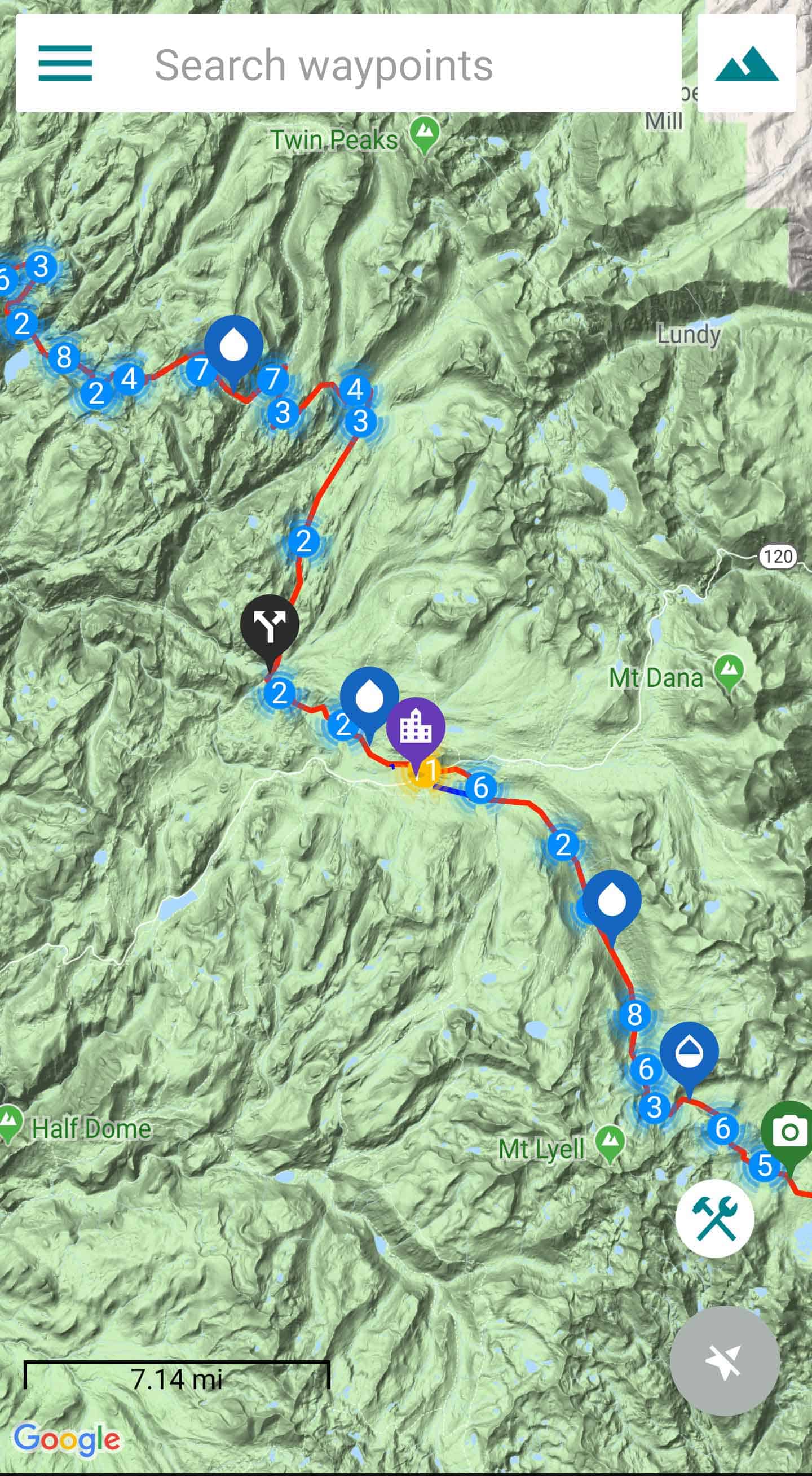
Atlas Guides offers the option to use seven different map types. Three of these maps, OpenCycleMap Topo Maps (meters), USGS Topo Maps (feet), and USGS Offline Satellite, are available for download and use offline. The four other maps, Google Street, Google Satellite, Google Terrain (limited zoom), and Google Hybrid, are only available online. The line denoting the trail (and alternate trails) as well as the waypoint markers are visible on all maps.
The Waypoints
Guthook Guides: Hike & Bike Offline includes hundreds (thousands) of waypoints, including actual photographs of many waypoints, meaning you’ll no longer have to wonder if you’ve actually found the campsite or water source that the map is referring to. The app lists junctions, state/international borders, wilderness boundaries, road crossings, trail changes, water sources (streams, creeks, rivers, lakes, springs, big tires filled with rainwater, etc.), campgrounds, trailheads, passes, summits, cattleguards, cairns, trail markers, parking areas, towns, post offices, hotels, restaurants, outfitters, libraries, grocery stores, information centers, liquor stores, RV parks, and more. It’s an impressive collection of trail data.


The Detailedness
Not only does the app include hundreds of waypoints, but it also includes descriptions of each. Does that creek have a name? It’s in the app. Is this campground first-come, first-served? It’s in the app. Are there toilets in this parking area? It’s in the app. What time does this pizza place close? It’s in the app. For each waypoint, you can (generally) find:
- A photo of the waypoint
- CDT mile number
- Miles until the next waypoint
- Elevation
- Details about the waypoint.
- Next water information (south and northbound)
- Next campsite information (south and northbound)
- Comments from other hikers using the app
- Any notes you may have left yourself about the waypoint.
From each waypoint’s detail screen, there are also options to show the waypoint on both the map and the elevation profile (a very useful feature).
The Search
Guthook Guides: Hike & Bike Offline features an excellent search function that provides instant results based on what you enter. It searches both waypoint names and descriptions so if you type “XXX Pass” you may get XXX Pass and XXX Trailhead as results. It’s very easy (and quick) to scroll through and see your results – 10/10, would search again.
The Demo
Not sure about paying for something that you’ll use every day and might save your life? That’s alright, Atlas Guides understands your apprehension. They have been kind enough to include a free demo of his app for the first 85.5 mi / 137.6 km of the CDT (assuming a northbound hike, sorry southbounders, no demo for you) from the US/Mexico border to Lordsburg or Deming (you only get 57.7 mi / 92.9 km for free if you’re starting at Columbus for some reason). The demo is a fully featured version of the app that will give you the chance to see how you like it before deciding that yes, you should definitely get it.


The Okay
THE DOWNLOADING | This is not anything wrong with the app itself, but rather a problem hikers may run into when deciding to use Guthook Guides. After downloading the app, you will need a stable internet connection to download the maps and photos for offline use. If become lost and decide you all of a sudden want to download and use Guthook, then chances are you’re out of luck. You might also be out of luck if you decide you want to download it in a trail town with little or no internet connection or cell service. Plan ahead, friends.
THE TRAIL REGISTER | Guthook Guides also include an interesting social aspect. Each waypoint offers users the ability to add comments. Ideally, this function is used by hikers to inform on the status of water sources, warn about trail hazards, or bring up unforeseen issues. However, it could be (and often is) abused by asshole hikers or uninformed hikers to spread misinformation or simply garbage comments. However, the PCT community is a relatively awesome group of people who would never engage in any of that undesirable behavior (except maybe on the Facebook page – that place is toxic).


The Bad
THE COST | Yes, it’s true that this app costs money. It’s also true that it comes in five parts – one for each section of the trail. And yes, it’s true that each part is $7.99 US, making the entire package almost $40 US. But as we learned above, you can buy all the sections as a package for $29.99. If you’re serious about hiking the PCT and you want an app to help you do so (and when you’re lost in the snow, you will), then you can’t do any better than Guthook’s PCT Guide. For something that you’re going to be using every day, it’s well worth the price.
THE ANDROID/iOS DIVIDE | This is not something that you would particularly notice, but the Android and iOS versions are slightly different – this is most apparent when looking at the elevation profile. There is also a feature in the iOS version that allows you to record a custom route you walk (i.e. you’re recording that sweet shortcut you found and want to know how long it is and/or share it with your friends). Why is this not allowed on Android? I do not know.
THE SAFETY NET| The final point I have about Guthook isn’t about the app itself but about the fact that this is not a foolproof guide to hiking the trail. Yes, having Guthook on the PCT will make you feel powerful. It will make you feel found. It will make you stupid. Don’t forget that this is an app. It’s not always going to be perfect and it’s not always going to be 100% reliable. You phone may die, another app you have may cause Guthook to glitch, your GPS might stop working, you may drop your phone in a river. Be prepared for the worst and know that simply downloading this app will not guarantee you safe passage on the PCT. That is all.


Conclusion
In case you skimmed this article or you’re just really dense, I love Guthook.
When I hiked the PCT, Guthook was the app to have. It almost becomes a baseline point of reference when discussing places and routes on the PCT. When your friends back home ask you, “But how do you know how many miles you hike each day?” you can just point them to Guthook. If you can get over the price (which honestly, you should), then this is probably the best app for hiking the Pacific Crest Trail. Again, if you’re unsure, you can always try out the demo from the US/Mexico border to Mt. Laguna.


I’m definitely purchasing the PCT maps from the guthook app when I start the PCT. BUT I’m wondering… will all of the maps/waypoints/etc be updated if I buy the maps now, 2 years before I start my thru hike?
A lot of the way points don’t change – a road/river/junction aren’t going anywhere. There are comments in the app so that you can check on the status of water sources etc. if other people have been choosing to share information (however, be wary of comments and don’t trust 100% in all of them).
I found Guthook’s to a be an invaluable resource. I did carry paper maps the entire way, did not once look at them. Halfmile’s app was useful for bypass/alternate info, the one area where Guthook’s was lacking. Oh, and Guthook’s now sells the maps as a bundle for $25.
I have an update for this review coming soon. Why? Because you’re right, Guthook is awesome.
can you really rely on a map run by batteries? love the idea,, you should make a hard copy too .. cuz the maps out there aren’t no good
Like I said at the end – reliance on technology can be dangerous in the backcountry. Paper maps (and knowing how to read them) are always a good idea.
Oh F, screenshot #7 shows June Lake !!! Oblivion and home. I love it. I’m SOLD.
Happy to help!