Mapping All 2,600 PCT Miles
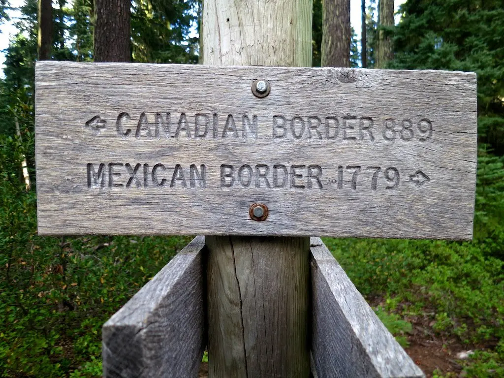
Those unfamiliar with the Pacific Crest Trail tend to assume that it follows the coast, but sadly, it fails to come within eye-shot of the ocean.
Looking at a giant zoomed-out map of the Pacific Crest Trail aids in impressing people with its length and demonstrating its true proximity to the ocean. However, people have enthusiastically (and hypothetically) suggested that they meet me along the trail, and referring them to said map proves useless in aiding their hiking pipe-dreams.
Thankfully (in the absence of readily available, detailed paper maps), we have invented this thing called the Internet to assist us in such desperate times of need.
The following is a rough approximation of the entire Pacific Crest Trail. Again, the waypoints are approximate, but if you zoom in, you will find that the trail is actually on the map and labeled accordingly.
Now, if you are thinking, “Hey! That’s not too far from where I am”, and you want to abandon your everyday routine and spend some time out in the shower-less wilderness, then let me know, and perhaps you can join me for a section of the trail.
After all, when it comes time to do battle with the bears, I would feel a lot more comfortable with some backup (aka an alternative victim for said bears).