Three Passes Trek Map (and GPS Track)
Nepal’s Three Passes Trek is one of my favorite hikes, and if you’re thinking about a trip to Everest Base Camp, I strongly urge you to look at doing the Three Passes Trek instead; you can do Everest Base Camp as a detour and it will take just one extra day. If you’re already thinking about doing the Three Passes Trek, even better, you’re in the right place.
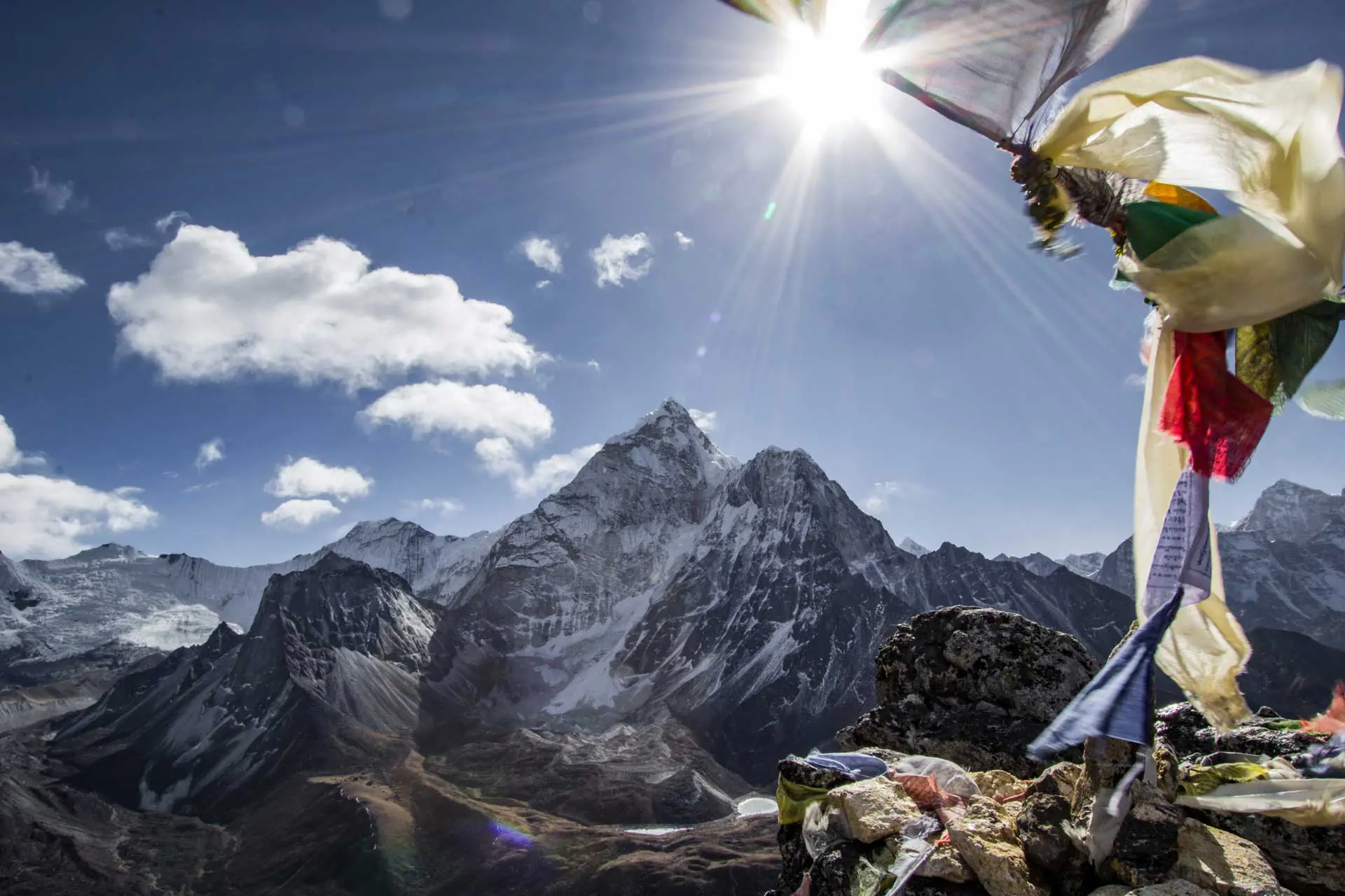
Before I set off to hike the Three Passes (Kongma La, Cho La, and Renjo La) I wanted to look at what the track looked like to get an idea of the distances between villages, the terrain, and really just because looking at maps is fun (maps are cool, right? Okay, good, just needed to confirm).
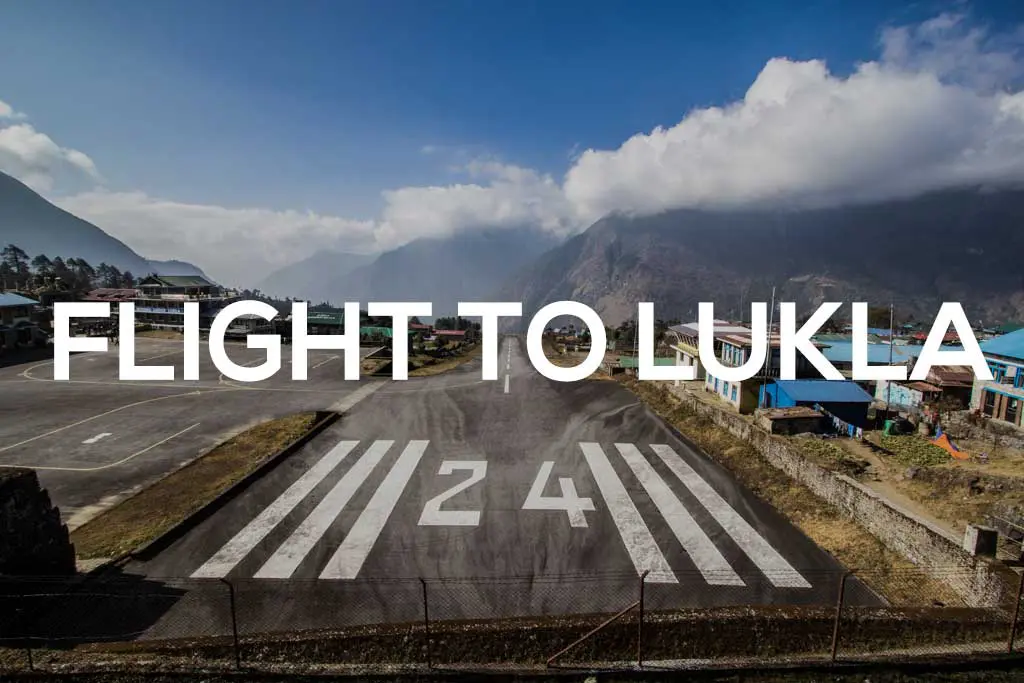
Here I outline my trip around the Three Passes Trek from Lukla (that is, I flew in and out of Lukla – yes, that scary mountain airport – when I did this trek). You can also hike in from Jiri (or Shivalaya) or Salleri (or Phaplu) – I will be covering the trek in from Jiri in a future post. Below the outline, you can find a map of my route.
Feel free to export this map if you would like to use it with your GPS or hiking application. However, know that this map should not be used for navigation purposes. It should be a tool (or simply something entertaining) for your trip and not a guide.
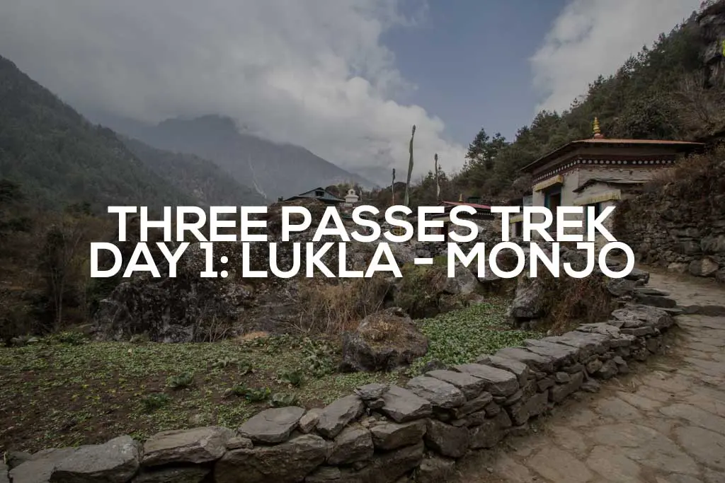
Day 1: Lukla to Monjo
- Distance: 7.8 mi / 12.63 km
- Elevation Gain: 2,985 ft / 910 m
- Max Elevation: 9,339 ft / 2,847 m
- Min Elevation: 8,077 ft / 2,462 m
Day 2: Monjo to Namche Bazaar
- Distance: 2.6 mi / 4.13 km
- Elevation Gain: 2,471 ft / 753 m
- Max Elevation: 11,096 ft / 3,382 m
- Min Elevation: 8,953 ft / 2,729 m
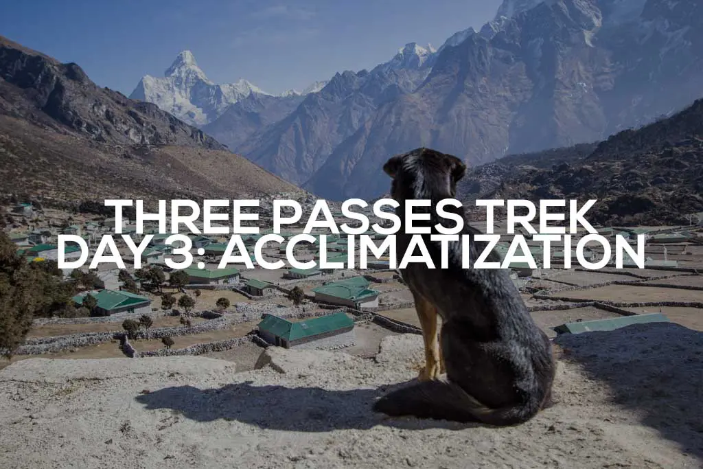
Day 3: Namche Bazaar Acclimatization Day
Most people hike up to Hotel Everest View, but I recommend hiking up to Hillary Viewpoint above Khunde and looping back to Namche via Khumjung.
Day 4: Namche Bazaar to Pangboche
- Distance: 9.4 mi / 15.12 km
- Elevation Gain: 4,194 ft / 1,278 m
- Max Elevation: 12,892 ft / 3,929 m
- Min Elevation: 10,714 ft / 3,266 m
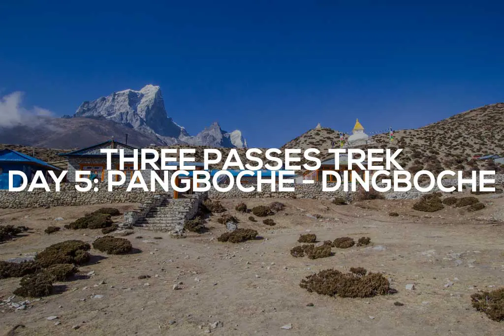
Day 5: Pangboche to Dingboche
- Distance: 4.3 mi / 6.96 km
- Elevation Gain: 2,024 ft / 617 m
- Max Elevation: 14,047 ft / 4,282 m
- Min Elevation: 12,875 ft / 3,924 m
Day 6: Dingboche Acclimatization Day
Most people hike up to a viewpoint on the way up to Nangkartshang Peak. Alternatively, you can also hike up to some lakes to the southeast or even up Chukhung Ri to the north.
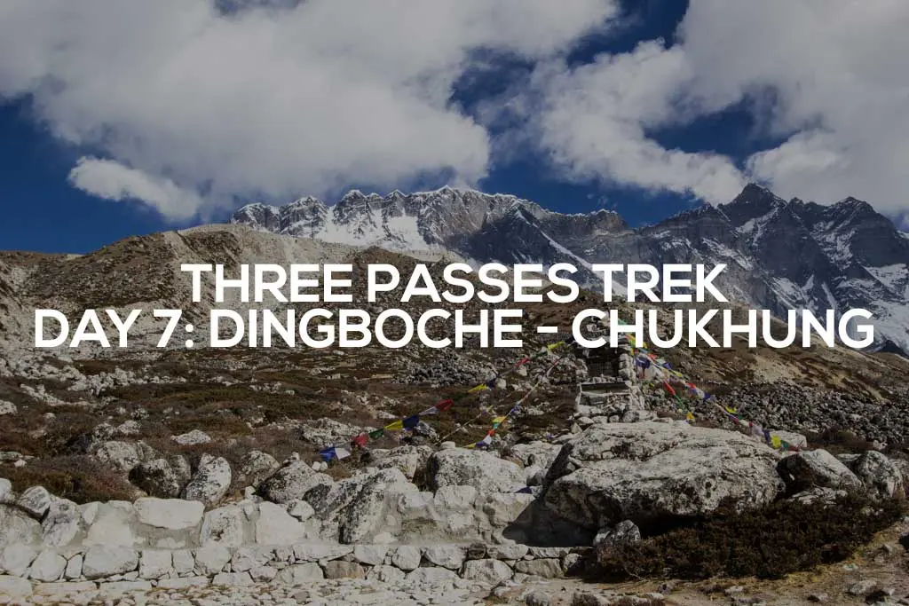
Day 7: Dingboche to Chukhung
- Distance: 3.1 mi / 5.03 km
- Elevation Gain: 1,593 ft / 486 m
- Max Elevation: 15,419 ft / 4,700 m
- Min Elevation: 13,950 ft / 4,252 m
Day 8: Chukhung to Lobuche (Kongma La)
- Distance: 6.6 mi / 10.61 km
- Elevation Gain: 2,024 ft / 617 m
- Max Elevation: 17,966 ft / 5,476 m
- Min Elevation: 15,275 ft / 4,656 m
Day 9: Lobuche to Dzongla
- Distance: 4.1 mi / 6.6 km
- Elevation Gain: 1,153 ft / 351 m
- Max Elevation: 16,029 ft / 4,886 m
- Min Elevation: 15,369 ft / 4,684 m
Day 10: Dzongla to Dragnag (Cho La)
- Distance: 5.8 mi / 9.38 km
- Elevation Gain: 2,832 ft / 863 m
- Max Elevation: 17,467 ft / 5,324 m
- Min Elevation: 15,224 ft / 4,640 m
Day 11: Dragnag to Gokyo
- Distance: 1.9 mi / 3.08 km*
- Elevation Gain: 626 ft / 191 m
- Max Elevation: 15,654 ft / 4,771 m
- Min Elevation: 15,316 ft / 4,668 m
Day 12: Gokyo to Thame (Renjo La)
- Distance: 13.7 mi / 22.01 km
- Elevation Gain: 3,215 ft / 980 m
- Max Elevation: 17,591 ft / 5,362 m
- Min Elevation: 12,314 ft / 3,753 m
Day 13: Thame to Lukla
- Distance: 7.6 mi / 12.23 km
- Elevation Gain: 1,309 ft / 399 m
- Max Elevation: 12,337 ft / 3,760 m
- Min Elevation: 8,223 ft / 2,507 m
*I missed recording the first bit of trail on Day 11 (so sorry, friends, but I think you’ll survive). Here’s a picture of the view from Khunde to make it up to you. Yes, that’s a mountain dog.

Three Passes Trek Map
Here are a map and GPS track of the Three Passes Trek. I’ve tried to mark the major points of interest and villages here, but if you have any suggestions for something I may have missed, please leave a comment and let me know.

Hi did do a post on the trek in from Jiri if so can you provide a link please cheers Alistair
I have not yet done one.
Hi Mac – These articles are so useful – thank you!!
I am planning a trek in March or October(ish) 2026 and have been tossing around lots of options. I’m currently looking at Three Passes but perhaps with some variations, including perhaps Pokalde Peak (aka Dolma Ri), which is reached from Chhukung. Two questions:
1. This will just be my lack of comprehension, but you note that the western sides of the passes are much steeper than the eastern and mention somewhere that you felt for anyone travelling the other direction. Wouldn’t it make the anti-clockwise route harder (which everything says it’s not), as you are going from east to west, so up the slope? What bit of logic am I missing here? Is it that sometimes downhill can be harder (though presumably altitude makes everything uphill harder)?
2. One option I thought of might be (going anti-clockwise) to skip Renjo La and instead head from Gokyo down south of Thanak through Machhermo and Dole to Phortse. Something different and perhaps a bit shorter. Do you know anything about this route?
Cheers and thanks again – Matthew from Melbourne (Australia; max altitude 2,228 metres)
Hi Matthew!
Going counterclockwise would mean steeper climbs up the western sides of the passes. Not necessarily harder, but different. Counterclockwise would be preferred if you enjoy a more gradual downhill and a steeper uphill.
Unfortuantely, I don’t know anything about that route firsthand, but I know it is well-traveled since many people hike from Namche to Gokyo Lakes as an alternative to Everest Base Camp. I don’t think you should have any trouble navigating up this valley. The more western valley used to access Renjo La from the west is less traveled as far as I know.
Hope that helps!
Amazing article – also the related ones!
“Fuck Everest Base Camp, fuck the Annapurna Circuit, fuck the Manaslu Circuit, and fuck Poon Hill. Three Passes Trek from Jiri. This is what you need to do.”
Wondering if you can share GPX – KML is not working for me….
Manaslu is a good one if you don’t mind taking a guide along (and EBC is an excellent Three Passes Trek detour).
Send me an email about the GPX.
https://www.halfwayanywhere.com/contact/
Amazing article, thank you.
Happy to help!
Thanks Mac,
Exellent write-up, best I found about 3 passes.
I’m planning doing the trek later this year, question is what would be the best two weeks time in Sept, Oct or Nov that I would have mostly dry weather as well as avoid the most crowd?
From what I read on the web, Sept could be too wet, Oct will be too crowded and Nov too cold?
Thanks
Hard to say as that’s basically peak season. Earlier will likely be wetter as you suspect. I would opt for later, personally. I did this in December/January. Yes, it was cold, but there were fewer crowds.
Thanks Mac,
I’m intended to the trek almost exactly the route as you did, are there teahouses along the trail you would recommend?
Thanks
Honestly, I’m sure too much has changed for me to be able to recommend specific tea houses. I always look for ones with good vibes when you walk in and owners/workers who acknowledge you and are friendly. Don’t be afraid to walk out of one and look for another.
Hi Mac,
A very helpful site thanks.
I’m looking at treking in March 2025. Considering doing a shorter trek, clockwise, from Namche, over Renjo La and then down the next valley South back to Namche. Do you know if this is viable?
Thanks, Andy
I don’t see why that wouldn’t be possible.
I am looking to do the 3 pass loop this Spring. I am an ultra trail runner and live in the mountains of Colorado and often go to 14K. Is it ok to do much longer days and do the circuit faster with my experience and fitness?
It all depends on how well your body adjusts to the elevation. Some people are certainly more capable of pushing bigger days than others. Listening to your body is the best way to gauge what you can safely do.
Going from Namche to Panboche far exceeds safe altitue ascent recommendations! Experts recommend no more than 300-500m per day. But your Day 4 is well above this.
Many will suffer altude illness, potentially serious.
Personally, I have spent a lot of time around this elevation and know that my body does not have an issue with it. As you pointed out, this is not the case for everyone.
I am not suggesting that this be what people do for their hikes; I am simply sharing what I did and what worked for me.
Hey Mac! Awesome post. I’m an experienced trekker but only with low-altitude treks. The few treks at altitude, I was pretty sensitive to it. I was wondering if you recommend the Manaslu Circuit in lieu of the Three Passes for someone with my experience level? Or, is it fine to just spend a few more acclimatization days?
As far as acclimatization they’re about the same, I would think. Except that for Manaslu you are only up high(er) once instead of multiple times. Also, Manaslu requires that you have a guide which is a big difference. Without knowing you it’s hard to say. I would just suggest budgeting extra days to acclimatize no matter which you decide to go with.
Manaslu’s Larkya La is much snowier and more subject to weather closures. Quite common to have turn back. Lodges up high (esp Dharmsala and Bhimtang, either side of the pass, are not open in Winter.
Hello! Thank you very much for all the information! im planning to do the 3 high passes with my girlfriend on middle of november, would you recommend it? also do you know a website which i can download the GPX files for my garmin! thank you in advance!
I would recommend it but I would caution you if either of you doesn’t have experience with altitude. You should be able to grab my GPX from the embedded Google Map. That said, it should NOT be used for navigation.
Hi Mac, I am planning my third trek(first one was in 2018 (Kilimanjaro Northern Circuit) 10 days – did without any difficulties except bit of headache on the summit day – and second Annapurna Base Camp in April/May 2019 without any difficulties – 9 days), EBC with Cho La & Gokyo! I was planning to do it in October-November 2020 but due to ongoing pandemic I am forced to postpone to April/May 2021. The trek start and end at Salleri so as to spend more days in the mountain before reaching Namche Bazar. I will be doing it with a Guide & Porter as I wish to take my own time, not to rush or to have a fixed itinerary but to complete it within 27 days with one day each acclimatization in Namche & Dighboche minimum. My only issue walking over snow/ice and I don’t feel comfortable – of course, I will be carrying microspikes with me). After reading a lot of articles I am bit confused to do the trek in April/May OR in October/November as the weather in the Mountain is unpredictable! However I will be looking for your advise on whether to do it in April/May OR October/November. I am already 61 years old too late to start my trekking passion and still the bucket list if too long, I do not want to miss another season as we have already lost one year! Your piece of advise will help me to take the final decision.
Personally, I would hike in April (or earlier, if possible). If you want more stable weather (but are fine with more crowds) go in October/November.
Thank you Mr. Mac for your kind reply. It seems 2021 is also not possible! Now I have changed my mind, I will be doing 3 pass trek w/EBC starting from Salleri. After Three Pass, if everything goes as planned I will be attempting GHT mix High/Low Route (avoiding Makalu-Everest high pass) instead Taplejung to Jiri low route. I am planning the trek to start October and to finish in April (2023)- taking my own time, spending time in places I like. Your piece of advise matter a lot.
Best of luck! Sounds like an awesome trip!
Hi mark. Thanks for your itinerary. We are planning to do the three passes in November this year. I see you’ve done it in 13 days. Was this doable? We also want to do EBC in 1 day and we’ve got exactly 14 days.
Thanks for your advise!
That’s cutting it close – I would recommend building in more time (especially if you’re flying in/out of Lukla). That said, it’s possible if you are fit and acclimatized. Best of luck!
Hello! Great itinerary!
I am hiking the Three Passes trek counterclockwise, starting April 18, 2020. I really do not want to go with a guide and I have trekked a lot. I am only a bit nervous about the section between Lobuche and Gokyo. Seems like there will be plenty of trekkers doing this in mid-late April, so I’m not too worried. I am not the best at route finding.
1. How serious can route finding be on that section, given all the annual shifts in the glacier?
2. Also- given the traffic to EBC do you think I will have problems getting a room at any of the Teahouses on the way to EBC- like in Gorak Shep?
Thanks for any advice on these 2 things.
Benedict- Eugene, OR.
1. Route finding on this section was incredibly straightforward to me and is not something I would worry about having to do again.
2. I would just suggest doing a big day from Lobuche if you’re worried about getting a room at Gorak Shep (worst case they have you sleep in the dining room with the guides, I would think) – that said, Gorak Shep isn’t a great place to stay anyway.
hello Mark. i completed the 3 passes ( plus the island peak ) in november. i prefered hiking clockwise going through thame and lungden. one advantage is that you have no one. it is not like going to EBC where you have tons of hikers.
come one day to Europe , tons of hike to do.
PS: i will be section hiking the PCT in 2020 ( sierras, washington) and read all your posts
Not like EBC at all – a far better hike in my opinion (and with the option to detour to EBC!). Best of luck on the best parts of the PCT!
Not sure if this comment will get back to Keith or not… If so, Keith did you hike with a guide? I am quite comfortable trekking the 3 passes without a guide, but would also like to climb Island Peak and for that would like a guide. It doesn’t seem like it will be easy to find someone willing to only guide for the summit, rather than the full circuit. Curious how you went about it.
Hi, Brenna! I have since done Island Peak with a guide whom I met in Dingboche (also where I rented equipment for climbing) – it is possible. Don’t let companies (especially those in Kathmandu) tell you that it’s not.
Hola! I’m Doni from Indonesia. I have plan go to Three Passes and EBC soon. Can I download this maps(GPX Version)?
Hola, Doni from Indonesia! If you view the map in a separate window – http://bit.ly/2EedHpx – you can download a KML version of the map.