North or South – Which Way to Hike the Pacific Crest Trail
Should I hike north to Canada or south to Mexico?
The great NOBO/SOBO dilemma (that’s northbound/southbound for anyone who does not understand acronyms or realize the blue words are links). A simple yet important question that all thru-hikers must ask themselves.
An estimated 90% of thru-hikers choose to go northbound according to the Pacific Crest Trail Association and based on my personal experience on the trail, I can confirm this. For this past year, I would put the number around 95% or more – I only (remember) meeting maybe ten southbound hikers.
Both northbound and southbound Pacific Crest Trail thru-hikes have their advantages and disadvantages (but both directions have bears). Which direction will you hike? The following information may help you in your decision.
The PCT Southbound
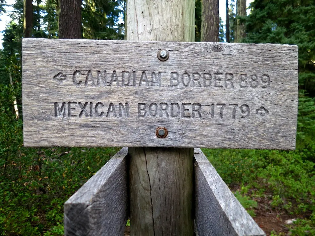
The road less traveled by – south from Canada to Mexico.
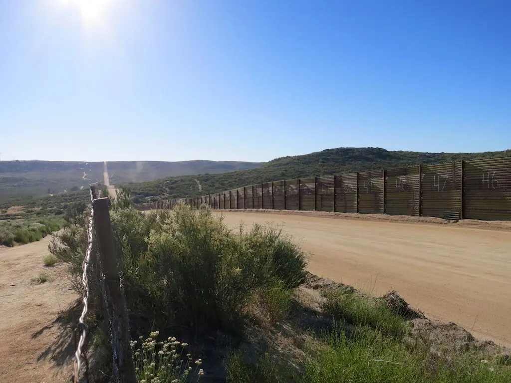
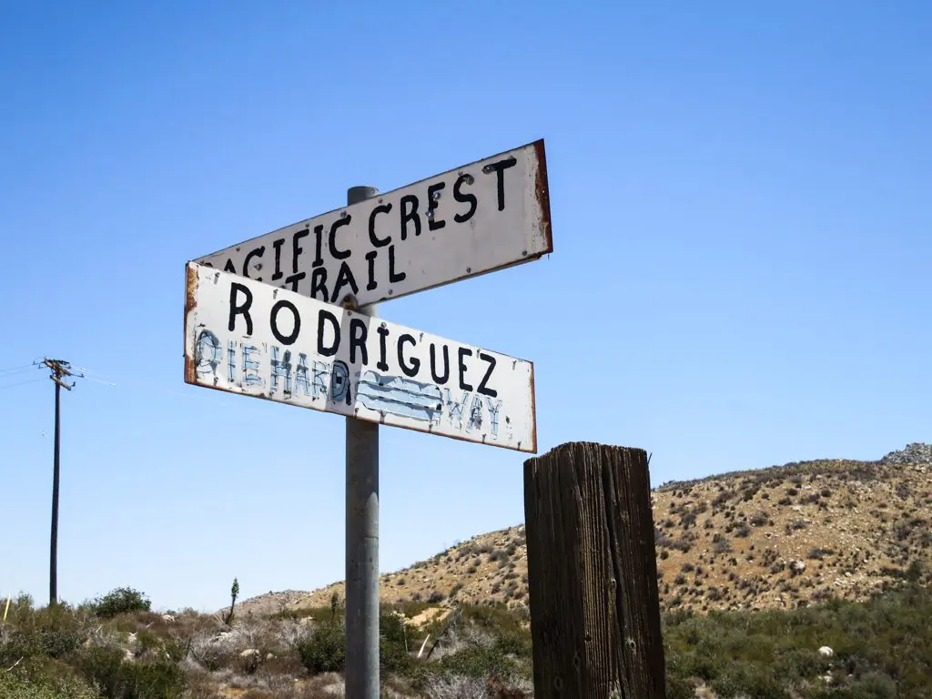
You walk from a clear-cut line of trees at the Canadian border straight into an embarrassing and hideous fence at the Mexican border.
Southbound hikers see the PCT in a way most of us will never experience. They cross snowy passes in Washington, deal with NOBO hikers in Oregon, beat early snowstorms through the Sierra, and then brave 700 miles of California desert to reach their journey’s end.
PROS OF SOBO HIKING
- You will have plenty of time to be alone since only a handful of other hikers will be hiking south with you (although for many this may be a con).
- The desert will be far cooler by the time you reach it, and triple-digit temperatures should not be an issue.
- The southern terminus is accessible by car and is far closer to civilization than the northern terminus.
- You get to feel special for being not only a PCT thru-hiker but a SOBO PCT thru-hiker.
CONS OF SOBO HIKING
- Late snowfalls in Washington and Oregon can make the window for successfully completing a SOBO thru-hike quite small (typically 4.5 months instead of 6.5 months for NOBO hikers).
- It is technically illegal to enter the USA from Canada via the PCT (but there is nobody waiting at the border, so really, who cares?). To legally hike SOBO, you must get dropped off at Harts Pass (the border’s closest road access), hike 20 miles north to the border, and then begin your journey south.
- You will have to stop and chat with every single NOBO hiker that you pass (this will be fun at first, but it will become increasingly terrible and end up cutting your daily mileage).
- Most PCT guidebooks and maps are written for NOBO hikers, SOBO hikers will have to read them backward.
- The trail is marked better for NOBO hikers (when it is marked) so navigation is more difficult.
- Water caches in the desert will be (even) less reliable for SOBO hikers since many are not maintained into the fall or winter months.
- If you are unprepared physically, Washington’s terrain can easily force you off-trail.
- The summer solstice and a later start date mean that SOBO hikers have fewer hours of daylight than NOBO hikers to complete the PCT (and nighttime in the wilderness is frightening).
The time frame for a SOBO thru-hike: Begin mid-June or early July. Make it to Kennedy Meadows by late September or early October. Finish up at the Mexican border in early to mid-November.

The PCT Northbound
PROS OF NOBO HIKING
- Get the desert over with, and have only the glory of Washington to look forward to.
- Since most people hike north, you will have a number of friends with you along the trail (and plenty of replacements should your initial choices not work out).
- The desert terrain is easier to cross than Washington’s mountains, and so for anyone who did not do much physical preparation, the transition into the hiking life will be easier.
- Hikers are fond of leaving helpful messages, arrows, or trail magic out for one another (thank you to whoever wrote all the notes warning of hornet nests in Washington), and hiking NOBO ensures that plenty of assistance will be left by hikers (assuming you aren’t at the front of the pack).

CONS OF NOBO HIKING
- Starting in late April (when most hikers start) means that the desert will be crowded.
- The desert can (and will) be hot during April, May, and June (the months NOBO hikers will be crossing said desert).
- Entering the Sierra too early can mean flooding bodies of moving water and high snow levels.
- You need to beat the winter snows to Washington and the Canadian border.
- You will encounter all the southbound John Muir Trail hikers in the Sierra (and once your superiority complex kicks in, this will be a con, trust me).
The time frame for a NOBO thru-hike: Begin in late April or early May. Hit Kennedy Meadows (Sierra) around June 20, and then make it to the Canadian border by mid to late September.

If I (when I) hike the Pacific Crest Trail again, I will most certainly do so northbound.
I am sure that hiking south is an equally incredible experience, but one of the best parts of the trail (for me, at least) was getting to know my fellow hikers.
It is hard to say that one way is “harder” than another, but I think that facing the challenges of Washington early on, and dealing with the water situation in the desert, put SOBO hikers at a disadvantage in terms of “easiness”.
Happy hiking!


QUESTION – I posted a longer version of this on the anti-NOBO article, but wanted to throw it out here as well. I’m thinking of starting near mid-point around late May, heading to northern terminus, flipping back to mid point around early to mid-Aug, and doing the rest of the trail SOBO. Kind of a PCT version of the AT Harper’s Ferry flip-flop. Anyone heard of others doing this? Wondering if this would be possible? Experiences to tell or major issues I may encounter?
Don’t see why this wouldn’t be possible, but haven’t heard specifics of people doing this.
Great info, thank you! Let’s just stop using “Sierras” for Sierra. :)
Younger me was wrong in so many ways – thank you for pointing this out.
informative….but your blogs come off a bit condescending
Sorry?
They really don’t :)
I’ve decided to hike SOBO. Any tips/idea on when is good to start? My goal is just to make it back to school by 9/1 haha!
I cannot say from personal experience, but the results from SOBO hikers in my 2015 survey might help: https://www.halfwayanywhere.com/trails/pacific-crest-trail/pacific-crest-trail-hiker-survey-2015/
A typo: “Southbound hikers see the PCT in a way most of us will ever experience”. Cheers.
Thanks for pointing this out! Fixed.
can i ‘drive’ this thing !?
(:
The 5 Freeway does a pretty good job of this :)