Best Section Hikes of the PCT: The Sierra
The Sierra is widely regarded as the “best” section of the Pacific Crest Trail (although Washington is usually a close second).
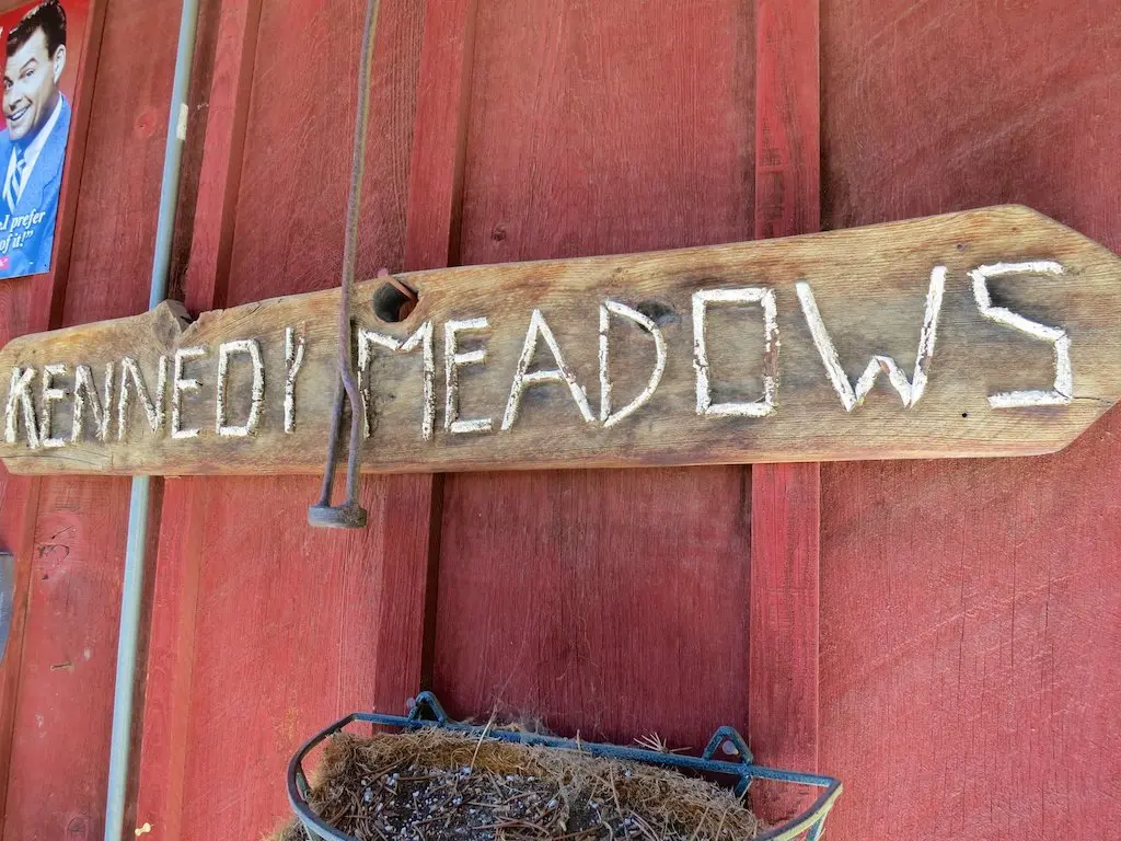
If you’re looking to hike only a small portion of the PCT, then practically any section of the Sierra would make an incredible section hike (except maybe for the section immediately after Kennedy Meadows – not much to see except a burn and some cows).
Some things to keep in mind whilst hiking in the Sierra:
- Bear canisters are required on the majority of the Pacific Crest Trail between Lone Pine and Bridgeport.
- Fires are generally not permitted at altitudes above 10,000 ft / 3,048 m (always make sure to check current conditions and restrictions on fires).
- Afternoon thunderstorms mean higher elevations, and passes are best conquered in the morning.

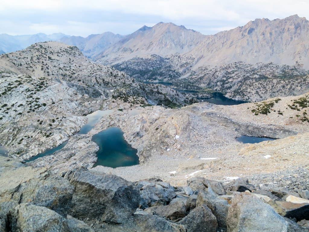
Sierra Nevada Overview
The Sierra is not the most accessible place, and so there aren’t many places you can simply pop on and off the PCT.
A lot of access to the trail is done via detouring over passes that are not on the Pacific Crest Trail. I tried to make the start and end of all the hikes described here in relatively accessible places, but know that you may be taking a long drive down a dirt mountain road to get to some of these trailheads.
The PCT in the Sierra has plenty of spectacular and incredible hikes. The ones listed here are a few countless suggestions for shorter-than-thru-hike backpacking trips.
Again, carrying a bear canister is required by law (and rangers do give tickets) in most of the Sierra.
Note: I was conservative on the mileage for many of these hikes and typically did not assume more than 12 mi / 19 km per day. However, if you’re looking for more of a challenge, I’ve included extensions at the end of each section so that you can conquer as much of the PCT as possible. In the event you’re saying, “That’s not conservative!” I’ve also included some ways to shave miles for most of the hikes.
For planning and navigating all of the Pacific Crest Trail section hikes listed below, I encourage you to check out FarOut Guides. They make an excellent app with waypoints, GPS functionality (even without service), distances, side trails, and more.
A Weekend: Rae Lakes
Start: Onion Valley Trailhead (9,196 ft / 2,803 m)
End: Onion Valley Trailhead
Length: 25.6 mi / 41.2 km
Elevation Gain: +7,729 ft / 2,356 m
Elevation Loss: – 7,729 ft / 2,356 m
This trail begins at the Onion Valley Trailhead, 13 mi / 21 km west of the town of Independence on Highway 395.
Follow the trail 4.8 mi / 7.7 km from the parking lot up to Kearsarge Pass (11,771 ft / 3,588 m). When descending the western side of the pass, stay to the right at each of the two junctions to meet the PCT at PCT mile 789.1 (10774 ft / 3,284 m), 2.8 mi / 4.5 km past Kearsarge.
However, if you want to change up the scenery a bit on the way back, you can take a left at the first junction to pass Bullfrog Lake. Once you reach the PCT, you will only have an extra .6 mi / 1 km to walk.
When you reach the PCT, head north and over Glen Pass (PCT 791.1 – 11,947 ft / 3,650 m) before descending to Rae Lakes. There are three lakes here: Upper, Middle, and Lower. Middle and Lower Rae Lakes have nice campsites as well as a ranger station between them.
I suggest arriving here as early as you can because you’ll want to enjoy some lakeside activities before the sun goes down.
Note: An alternative route, the official “Rae Lakes Loop,” begins on the Western Side of the Sierra at Roads End in Kings Canyon National Park. This version of the route is around 40 mi / 65 km.
Four of Five Days: Tuolumne Meadows to Devils Postpile Loop
Start: Tuolumne Meadows (PCT 942.5 – 8,590 ft / 2,618 m)
End: Tuolumne Meadows
Length: 50.1 mi / 80.6 km
Elevation Gain: +11,065 ft / 3,373 m (clockwise)
Elevation Loss: -9,625 ft / 2,934 m

This hike begins at Tuolumne Meadows in Yosemite National Park. From Tuolumne, head .3 mi / .48 km north to meet the Pacific Crest Trail and then head south.
The trail passes through Lyell Canyon, over Donohue Pass (PCT 929.5 – 11,073 ft / 3,375 m), and then over Island Pass (PCT 924.6 – 10,227 ft / 3,117 m) towards Thousand Island Lake (PCT 922.9 – 9,841 ft / 3,000 m).
When you reach Thousand Island Lake, you will begin the loop portion of the trail. You can take either the PCT or the John Muir Trail (JMT) south to where they meet again near Devils Postpile (PCT 909 7,681 ft / 2,341 m). The route described here follows a clockwise loop; if you head counterclockwise, taking JMT south, you will save yourself 1,570 ft / 478 m of climbing).

When you reach the southern PCT/JMT intersection, continue along the PCT south for another 1.8 mi / 2.9 km until you come to the Devils Postpile Trail (PCT 907.2 – 7,486 ft / 2,282 m). Take this trail north 1.6 mi / 2.6 km through Devils Postpile until you reach the PCT/JMT junction again.
This time take the JMT and head north back towards Yosemite. Yes, this trail requires that you cross both Donohue and Island Pass twice; and no, it isn’t a true loop. If it really bothers you that much then you can start at Red’s Meadow (near Devils Postpile) and hike up to Thousand Island Lake and back. Otherwise, enjoy Tuolumne and your trip in the Sierra.
Extension
If you want to make this a longer hike, you can try starting at the Happy Isles Trailhead in Yosemite (the northern terminus of the JMT) and ending at Tuolumne. Hiking up to Tuolumne gives you an additional 22.5 mi / 36.2 km of Yosemite to explore and takes you past some of the park’s best-known sights.
Alternative
If you don’t like the sound of this hike, you can opt for another trek, starting from Tuolumne Meadows but heading north on the PCT instead of south.
Hike 30.2 mi / 48.6 km up to the Benson Lake Trail at PCT 972.7 (7,601 ft / 2,317 m) and hike .4 mi / 650 m SW to Benson Lake. This is a great place to hang out, camp, and enjoy yourself. When you’re finished, head back the way you came to Yosemite, or continue north towards Sonora Pass (PCT 1016.9) and Highway 108 to complete the section.
A Week: Bishop Pass to Mammoth Lakes
Start: South Lake Picnic Area, 37.169876, -118.566128 (9,788 ft / 2,983 m)
End: Red’s Meadow Store (.3 mi / .5 km N of PCT 906.7 – 7,779 ft / 2,371 m)
Length: 87.8 mi / 141.3 km
Elevation Gain: +16,305 ft / 4,970 m
Elevation Loss: -18,418 ft / 5,614 m

This route begins at the South Lake Picnic Area at the end of S Lake Rd in Bishop – east of the Pacific Crest Trail.
From here, follow the trail 5.3 mi / 8.5 km past Long and Saddlerock Lakes over Bishop Pass (11,973 ft / 3,649 m), and then back down another 6.5 mi / 10.5 km to meet the PCT at PCT mile 831 (8,751 ft / 2,667 m).
Once you meet the PCT, head north to begin your climb up and over Muir Pass (PCT 838.6 – 11,973 ft / 3,649 m), home to the iconic Muir Hut (and a bunch of marmots). Descending from Muir Pass, the trail passes a series of stunning alpine lakes, including Wanda Lake and Evolution Lake.
After 19.9 mi / 32 km of hiking northbound on the PCT from the Bishop Pass junction, you’ll have to cross Evolution Creek (PCT 850.9 – 9,201 ft / 2,804 m). You will get wet completing this crossing. In high snow years, this crossing can be dangerous, so if you’re worried, before reaching the creek (at PCT 850.1) you can take an alternate route to safely get across.

Another 6.2 mi / 10 km later, you’ll be at the junction for Muir Trail Ranch (PCT 857.7, 7,758 ft / 2,365 m). If you need to bail or have some sort of emergency, Muir Trail Ranch can be reached via a 1.5 mi / 2.4 km trail off the PCT. Continuing north, the trail heads over Selden Pass (10,910 ft / 3,325 m), and farther north, the PCT crosses Bear Creek—which can also be a difficult ford (PCT 869.1).
Not long after Bear Creek, you’ll pass the Bear Creek Trail junction (PCT 872.4 – 8,944 ft / 2,726 m), which can take you to Lake Edison and Vermilion Valley Resort (VRR). Further up the PCT, and you’ll pass the Lake Edison Ferry Trail junction (PCT 878.8 – 7,899 ft / 2,408 m), bringing you to a ferry that can take you to VVR. If you have more time and are thinking about heading to VVR for whatever reason, you can learn more about how to get there from the PCT here.
Past Lake Edison, the trail climbs over Silver Pass (PCT 884.9 – 10,748 ft / 3,276 m) before finally making its way up to Red’s Meadow (.3 mi / .5 km NE of PCT 906.7). If you have the time, Devils Postpile is only a short hike away from Red’s and is worth checking out, even if you aren’t continuing towards Yosemite.
From Red’s, you can either have some very nice person pick you up, hitchhike, or a shuttle into Mammoth Lakes.

Extension
If you want to extend this hike by another 35.8 mi / 57.6 km, you can continue to Tuolumne Meadows in Yosemite. This trail will take you past Thousand Island Lake, over Island Pass (10,227 ft / 3,117 m), over Donohue Pass (11,073 ft / 3,375 m), and then through Lyell Canyon before arriving in Yosemite and Tuolumne Meadows.
If you want to add even more miles, you can tack on an additional 22.5 mi / 36.2 km by hiking from Tuolumne down the John Muir Trail (JMT) to the Happy Isles Trailhead (the JMT’s northern terminus) in Yosemite Valley. This trail will take you past the Mist Trail, Vernal Falls, and a trail for Clouds Rest (which I suggest you check out if you have the time). This route isn’t part of the PCT (part of the JMT), but it’s a great way to extend the hike nonetheless.
Short Version
You can bail and get off-trail at Vermilion Valley Resort to shorten this hike by about 30 mi / 48 km. However, I don’t know how easy getting a ride from VVR to Fresno (the closest city) would be if you don’t have someone willing to pick you up.
Alternative
Start yourself off at Tuolumne Meadows and hike northbound instead.
You will encounter far fewer hikers than you would south of Yosemite, and you’ll still get some incredible scenery. The trail stays lower than it here than it does further south – so take what you will from that.
Make sure to stop and hang out (or camp) at Benson Lake (.4 mi / .6 km SW of PCT 972.7). You’re welcome.
Two Weeks: Horseshoe Meadow to Mammoth Lakes
Start: Horseshoe Meadow (1.7 mi / 2.7 km N of PCT 744.5 – 9,960 ft / 3,036 m)
End: Red’s Meadow Store (.3 mi / .5 km N of PCT 906.7 – 7,779 ft / 2,371 m)
Length: 164 mi / 264 km
Elevation Gain: +30,931 ft / 9,428 m
Elevation Loss: -33,616 ft / 10,246 m

This hike includes everything described in the hike above (except for the climb up to the Pacific Crest Trail from Bishop Pass), but it begins (or ends) 86.5 mi / 139 km south at Horseshoe Meadow.
You will need to resupply yourself at some point during this hike (unless you’re carrying a beastly amount of food, moving very quickly, or very good at convincing others to hand over their supplies).
This can be done via hiking over Kearsarge Pass to Independence at PCT 788.9 (15.2 mi / 24.4 km detour with 22 mi / 35.4 km hitch), hiking over Bishop Pass to Bishop at PCT 831 (11.8 mi / 19 km detour with 22.1 mi / 35.6 km hitch), at Muir Trail Ranch at PCT 857.7 (1.6 mi / 2.6 km NW of PCT – NOTE: they have very strict resupply requirements), or at Vermilion Valley Resort (more information on VVR resupply here).
Yes, the resupply in this section can be a hassle, but it’s worth it because it is one of the best sections of the Sierra and of the entire PCT.

This hike will take you over most of the major Sierra passes along the PCT, including Forester Pass – the highest point on the trail at 13,120 ft / 3,999 m (PCT 779.5).
If you make it to Mammoth, you will also cross Glen Pass (11,947 ft / 3,641 m), Pinchot Pass (12,139 ft / 3,700 m), Mather Pass (12,096 ft / 3,687 m), Muir Pass (11,973 ft / 3,649 m), Selden Pass (10,910 ft / 3,325 m), and Silver Pass (10,748 ft / 3,276 m).
Short Version
Maybe with the resupply, this hike will not give you the time you want to stop and just be a bum in the Sierra. That’s alright, you’ve got options to shave about 25 mi / 40 km by either: 1) starting this hike by crossing Kearsarge Pass and heading north from PCT 788.3, or 2) ending the hike at VVR.
Alternate Start
If you get a permit to climb Mt. Whitney, you could also begin (or end) this hike at Whitney Portal. You will meet the PCT 22.5 mi / 36 km up from Horseshoe Meadow, but the trek over from Whitney Portal will add another 14.6 mi / 23.5 km and a lot of elevation change to the hike (add 3.8 mi / 6.1 km if summiting).
Extension
Are you thinking about crushing miles in the Sierra? Do you have more days? You could just complete the entirety of the section and head all the way to Tuolumne Meadows in Yosemite—another 35.8 mi / 57.6 km past Red’s Meadow.
If you’re thinking about doing this, then you might as well just hike the John Muir Trail because that’s almost where you’re at in terms of distance at this point.