Hiking Yarigatake (槍ヶ岳) in Japan
Yarigatake (槍ヶ岳) is perhaps one of the most recognizable peaks in Japan. Located in the center of the Kita Alps, it’s a must for anyone serious about peak bagging in the Land of the Rising Sun.
It can be accessed via numerous trailheads and is possible to conquer in a day (a very tough day). I recommend spending a night in the mountains and/or pairing Yarigatake up with a nearby peak (like Okuhotakadake).
Yarigatake Facts
- Name: Yarigatake (Mount Yari)
- Japanese name: 槍ヶ岳
- Location: Kita Alps (北アルプス)
- Summit elevation: 10,433 ft / 3,180 m
- Elevation change: 6,991 ft / 2,131 m
- Round-trip distance from trailhead: 17.6 mi / 28.4 km
- Round-trip time from trailhead*: 12 hours
- Difficulty: Strenuous
- Water on trail: Yes
- Trailhead facilities: Parking, bathroom, lodge, drinks, food
- Nihon Hyaku-meizan: Yes
*NOTE: The round-trip time listed above is based on my own experience. Please remember that your time may vary greatly.
Getting to Yarigatake
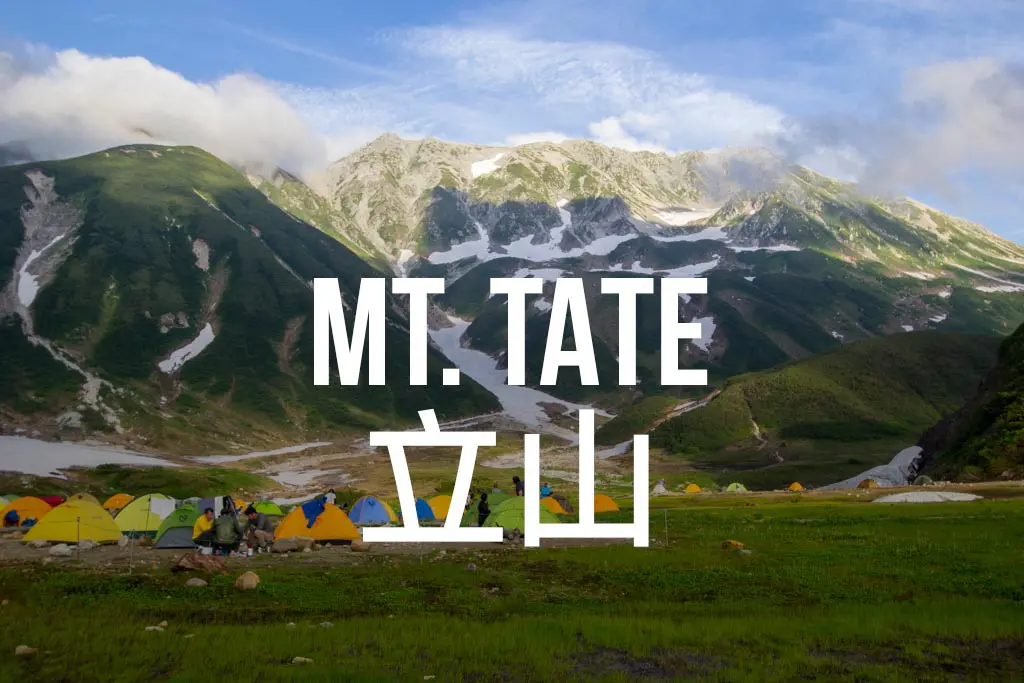
NOTE: There are multiple trailheads for reaching Yarigatake (including from Kamikochi (上高地), where private cars are prohibited). The trailhead/route described here begins at Shinhotaka Onsen (新穂高温泉). A map of the Kita Alps peaks and huts can be found here.
- Accessible via public transportation: Yes
- Trailhead parking: Yes
- Trailhead coordinates: 36.286281, 137.575869
- Summit coordinates: 36.342027, 137.647704
BY CAR: Via car, the base of Yarigatake can be easily reached. There is a free parking lot for hikers at the Ryokan Shinhotaka Okuhida (map). From here you will need to walk up the road, past the entrance to the ropeway, and then past the parking lot at the top of the hill to officially begin the hike (signage and maps provided at the lodge).
BY TRAIN: Sorry, no train station near the trailhead.
BY BUS: Get yourself to Takayama Station (高山駅) in Gifu (it’s a train station). From there, take the bus bound for Shinhotaka Onsen (新穂高温泉) to the last stop. It takes about an hour and a half, and the first bus departs Takayama Station at 7:00.
If you’re farther north, you can also take a bus from Matsumoto Station (松本駅) in Nagano.

The Hike
The hike begins following a forest road before entering the trees only to emerge on the road once more for an even longer stretch of road walking.
You’ll pass the turnoff for the route of Okuhotakadake and not long after you’ll reach a spring and a concrete dam (like structure) that you’ll cross before beginning what could actually be considered the start of the hike.
The trail climbs gradually as it follows a river north through the valley. After 5 mi / 8 km you will reach Yaridaira Goya (槍平小屋) where there is a campground and (seasonal) lodging available. There aren’t many great places to take a break on your way up so feel free to take advantage.
Yaridaira Goya is actually at the intersection of four trails, one leading away in each direction, and you can reach Yarigatake via any of the three. The easiest (and the one described here) is one you’re already on and is the most obvious of the three trails (it goes north).


The most difficult is the climb up to the east which will take you up to the ridgeline and across three additional summits on the way to Yarigatake. The trail to the west takes hikers up to another (lower) ridgeline and approaches the summit from the northern ridge above the valley.
Continuing north along the valley floor, the trail is incredibly steep. However, it’s uphill nearly the entire way, with the steepest sections still waiting further ahead.
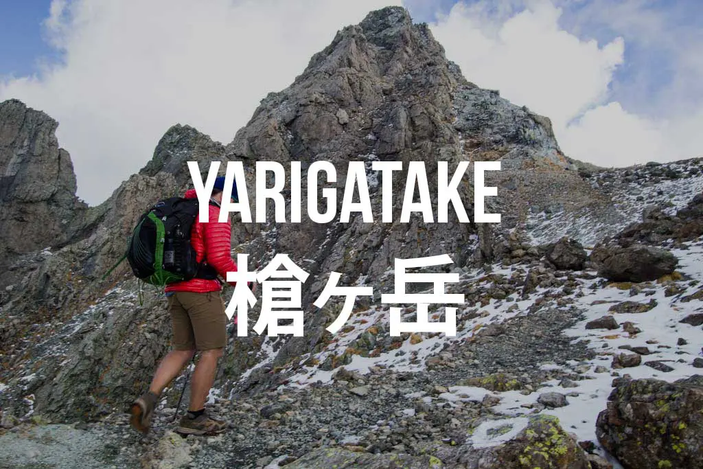
Continuing up the valley as it slowly winds east, your destination comes into view. Yari means “spear” in Japanese and it’s easy to see how this peak got its name (you might also see this peak referred to as Mount Yari, but I stick with the Japanese names for consistency’s sake).
You will pass one more junction as you make your final approach up the valley, offering you the opportunity to climb (now north) and make your approach to the summit from the western ridge. This route is a bit more scenic than the climb up the valley, but both will get you to the summit in around the same time.


The Summit
Before reaching the summit of Yarigatake, you will find Yarisanso (槍ヶ岳山荘) – the surprisingly large lodge occupying the prime real estate just below the summit. On the ridge just south of the lodge, there is an exposed campground where you can pay ¥1,000 to pitch your tent if the exorbitant lodge prices aren’t to your liking.
Although it may look like there’s no easy way to the summit, the final 100 m are not too terribly difficult to conquer (I did it in a typhoon). Your biggest obstacle may be other hikers as bottlenecks are a real threat to you making it up and down to the summit in a reasonable amount of time (I took about 50 minutes, including my brief stop on top).
The route to the top is well marked (with separate up and down routes in some tight spots) and there are, as always, a lot of chains and ladders. If you manage to make it up on a clear day, the unobstructed views from the summit are some of the best in the Kita Alps.


Once you return to the lodge, you can either head back the way you came, head south along the ridge past Obamidake, Nakadake, and Minamidake before turning west at the Minamidake Hut (南岳小屋) and descending to the Yaridaira Hut (槍平小屋) (the last one you passed on the way up from Shinhotaka), or continue south past the Minamidake Hut and through the Daikiretto (大キレット) over to Kitahotakadake and Okuhotakadake.
You could also head down to Kamikochi, or west across the ridgeline towards Momisawadake. It’s really a great location for exploring the rest of the Kita Alps.
Yarigatake Map
My GPS recorded the following route up Yarigatake.
I have no guarantee that this route is correct, nor that it can be accurately relied upon for backcountry navigation. It should serve only as a general guideline for what the trail is expected to look like.

Conclusion
For me, simply seeing a picture of Yarigatake was enough to convince me to climb it.
Although it would be a serious ass-kicking day hike, it wouldn’t be impossible if you got an early start. Camping below the summit is entirely feasible (but not free), so there’s no reason you can’t turn this into a relaxed weekend trip (just look out for the crowds).
Have any questions about Yarigatake? Want another post about one of Japan’s mountains? Have a suggestion to improve this information?
Leave a comment and let me know!
Resources
Yarigatake group (English language site)
Live webcam of Yarigatake summit
Yarigatake summit weather forecast
Kamikochi website


Hi there!
I am planning to visit Kamikochi in the first week of Nov. I would have around 2 or 3 nights here and I really would like to do hikes and stay in huts. I am an experienced hiker and Mt Yari – Mt Okuhotakadake is currently on the top of my list. Can i just confirm that it is a great period to hike these mountains and the huts are open for stay? And also, what mountains would you recommend if i will be in Kamikochi area for around 4 days?
Thanks!
The huts might be closed that late in the year, I would check with them directly. It’s possible you’ll have very cold temperatures and possibly even snow in November.
Hey! This is a VERY helpful blog. Thank you! I am planning to visit Kamikochi in April when it opens and I have some questions about the hiking and snow/ conditions. Is it possible to complete the main hikes around Kamikochi at this time? I really would like to do a 3-4 day hike and stay in huts. I am an experienced hiker with very good fitness levels. I haven’t see n any blogs from anyone that has visited at this time of year and i’m curious as to whether the snow will make Mt Yarigatake too dangerous/ impossible? I am also considering the Mt Hotaka hike or panoramic hike, has anyone done these?
When you say “at this time” do you mean March? Yari will be a mountaineering peak in winter conditions, not a trekking peak.
I’ll be there April 17th (when the park opens), it appears that most of the mountain huts don’t open until late April so it looks like only day walks will be possible. Do you know any other regions for good hiking/ saying in huts/ farm stays? Thanks
Most of the mountain huts will open later in the season. I would look at areas in Kyushu, since there is less snow there and it will be warmer earlier.
Hello, I enjoyed reading your desciptions. I’ve climbed Yari 3 times already, but never from Shinhotaka Onsen. I’m now planning my next for this August. Hour many hours did you take from Shinhotaka to Yari? Thanks.
I believe (the first time I did) this hike took around five hours one-way.
Hello!
I would like to hike, but not climb (and by climbing I mean using ropes, carabiners and the like) for 3 days in Kamikochi, starting and ending in Matsumoto. Could you suggest an itinerary that includes shelter (huts ?) and meals ? I will be traveling light and won’t have a tent or cooking equipment. What kind of weather should I expect by the end of September ?
Thanks in advance!!
This really depends on how many miles you’re planning on hiking each day and what kind of terrain you’re comfortable with. End of September should be nice, but a lot of the huts may be closed already.
Hi! What would you recommend for a 2-day hike in Japan for an intermediate-experienced person? I’ve climbed European mountains many times, but never been to Japan :) Thank you!
This would be an excellent hike. If you want to make this longer, you could head to Okuhotakadake via the Daikeretto. That would be a challenging two-day loop.
Hei, what is your opinion about taking this hike in April? Thank you!
There will be a lot of snow in April which will probably turn this into a rather technical hike. I would not attempt it without a lot of experience hiking in these conditions.
Hi Mac, thanks for the info above! We’re planning to do the hike in october. Would you say it’s feasable to do the hike starting from Kamikochi to the foot of the summit in a day, stay the night and go back in terms of available number of hours?
Plus, we’d like to camp in a tent but don’t know if we can store our luggage at the base of the mountain or where to rent a tent. Do you have any ideas?
That would be a long hike, but it would definitely be possible in a day (but would also depend on whether or not the snow season had started early).
I don’t know about storing luggage at the base of the mountain, and I don’t know where you could rent a tent – but good luck!
You could try looking for the nearest luggage storage using Bounce App. If not too far away – store luggage and just bring what you need for the hike.
Hi Mac – I really enjoyed reading your Japan hiking journals! I was wondering if you’ve also done Mt Cho and Mt Jonen. I’m planning a 2-3 days hike. Starting from Kamichochi, looks like option 1 is get to Mt Yari; option 2 is Cho and then go on to Jonen? I’d say I’m average speed hiker, but have done the Inca Trail and Grand Canyon Rim to Rim hike before.
I have not done either one of those peaks, unfortunately. I have yet to hike in from Kamikochi.
Thank you for all the information about hiking in Japan, I enjoyed them very much.
I am planning to hike from Mount Tsubakuro to Mt. Yarigadake. Starting point is from Nakaboonsen Yubara Hot Spring. I am wondering if you could share your experience on the below, thanks
1. I am not planning to stay in the huts and decided on relying on camping, is it a must to camp near the huts camping ground or I could find a private spot and camp for a night?
2. Is it possible to resupply water and food in the huts along the trial?
3. As I am traveling from Mount Tsubakuro to Mt. Yarigadake, is there another trails or route you would suggest so that I can go back to Nakaboonsen Yubara Hot Spring using a new trail instead of go back the way I came from?
Looking forward to hearing from ya….and enjoy your CDT. Thanks!!
Hey Andy! You can find camping that’s not close to the huts, but it’s generally not allowed and the terrain makes it difficult to find good camping. That being said, stealth camping is not impossible.
You can buy some snacks and order meals (to be eaten in the lodge) at the huts, but as far as a full resupply goes, it might be difficult (and expensive). Water is generally available at the huts.
I don’t have my Kita Alps map with me right now so I can’t recommend any specific routes right now, but there are lots of trails in the area so I am sure it will be easy to figure something out.
Enjoy yourself out there!
Hi Mac!
Thanks so much for your kind reply! I definitely will go and check it out next year and will report back if I find anything new. Enjoy yourself and stay safe!!
Hi there, I’m having fun reading these posts. This area was my “garden” in the early ’90s. Tsubakuro to Yari is a good route, but as an alternative there is none. You would be returning with the same trail.
Nice post. I plan to go here this summer. Did you do the Daikiretto? I’d like to climb up Yari and cross over Daikiretto to Okuhotaka, but not sure if it’s too difficult or not.
I did not do the Daikiretto but I came to the northern edge of it (it was raining the day I planned on doing it). It looks awesome! I would definitely do it if I had the chance.