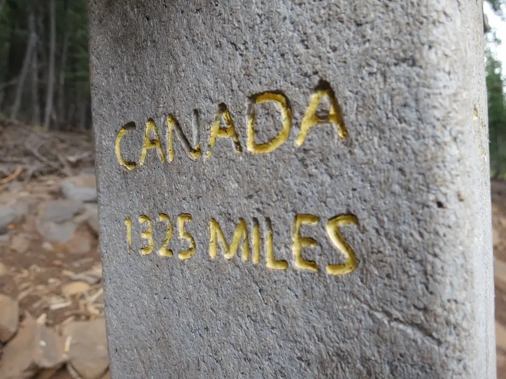
Best Section Hikes of the PCT: The Desert
Many of you have written to ask, “I have *insert amount of time*, what section of the Pacific Crest Trail should I hike?
This is not an easy question to answer. It depends on who you are, what you’re physically capable of, what you want to see, what time of the year it is, and what you’re looking to get out of the experience. I’ve broken these posts up by PCT section (Desert, Sierra, Northern California, Oregon, and Washington) and amount of time (a weekend, four or five days, a week, two weeks, and a month).
A lot of people would probably respond to someone asking, “What’s the best PCT section hike?” either “THE SIERRA!” or “WASHINGTON!” but I’ve opted to attempt a more useful answer. For this reason, my “Best PCT Section Hikes” series will upset a lot of people who don’t agree with my choices. However, everything here is simply my opinion. Obviously, there isn’t a single answer to the question, “I have two weeks; what section of the PCT should I hike?”.
Hopefully, this will provide a rough outline/guide for people to narrow down and choose where to head out and hit the PCT.
Now, let’s get started with Part 1: The Desert.

Desert Overview
The desert is widely regarded as one of the most disliked portions of the trail. An unfair characterization.
There are some amazing places to see and sections to hike in Southern California. Most people have a bad time in the desert because they are (usually) fresh, just starting out their hike, and not prepared for the journey they’re about to take their body on (or the blisters). This is a combination of scorching heat, unreliable water sources, rattlesnakes, poodle-dog bush, and long/heavy water carries.
Best to just find out for yourself.
Note: I was conservative on the mileage for many of these hikes and typically did not assume more than 12 mi / 19 km per day. However, if you’re looking for more of a challenge, I’ve included extensions at the end of each section so that you can conquer as much of the PCT as possible.
A Weekend: Idyllwild and San Jacinto
Start: Deer Springs Trailhead (Idyllwild, CA)
End: Humber Park (Idyllwild, CA)
Length: 20.3 mi / 32.6 km
Elevation Gain: +6,491 ft / 1,978 m (clockwise)
Elevation Loss: -5,468 ft / 1,667 m (clockwise)

I chose this hike for three reasons: 1) because it lets you see a lot in just two days, 2) because it is in the mountains and less reminiscent of an arid desert wasteland, and 3) because it’s a loop.
This hike is a loop, so you can head out in any direction, but I will describe the clockwise route here (since it accomplishes the majority of the climbing during the first day).
Start at the Deer Springs Trailhead (5,609 ft / 1,710 m) in Idyllwild and hike up 4 mi / 6.4 km to meet the PCT at Strawberry Junction (PCT 183.4 – 8,069 ft / 2,460 m). From here, hike north along the PCT until reaching the trail to San Jacinto Peak (PCT 185.7 – 8,937 ft / 2,724 m) via Little Round Valley.
From here, you’ll leave the PCT and climb 1,896 ft / 578 m over 2.9 mi / 4.7 km to the summit of San Jacinto, the second tallest peak in Southern California at 10,834 ft / 3,302 m (the tallest being San Gorgonio, 11,503 ft / 3,506 m).

Descend from the summit and continue clockwise until you reach the Wellman Divide Junction (PCT 181.2 – 8,965 ft / 2,733 m) and rejoin the PCT. Continue south to Saddle Junction (PCT 179.4 – 8,139 ft / 2,481 m) and take the trail to Tahquitz Meadow.
This trail heads south for 1.5 mi / 2.4 km until meeting back up with the PCT (PCT 177.2 – 8,151 ft / 2,484 m).
Continue west for .7 mi / 1.1 km to the Tahquitz Peak Trail (PCT 178 – 8,616 ft / 2,626 m) and head 230 ft / 70 m over .4 mi / 640 m up to tag Tahquitz Peak. Head back to the PCT and continue north back to Saddle Junction (PCT 179.4 – 8,139 ft / 2,481 m).
This time head down the Devil’s Slide Trail and drop 2,413 ft / 735 m over 2.6 mi/ 4.2 km to reach Humber Park. You’re now back in Idyllwild, but from here, the start of the hike described here (at the Deer Springs Trailhead) is actually a 3.1 mi / 5 km away. Keep this in mind if bringing your own transportation and parking somewhere in the town (or arranging a pickup).
Note: If you want to camp within San Jacinto State Park, a $5 permit is required.
Extension
A great extension adding 22.7 mi / 36.5 mi to this hike would be to hike back to Spitler Peak trail junction (PCT 168.6) after reaching Tahquitz Creek (PCT 177.2) and then hike back to Idyllwild via the Herkey Creek Campground. Unfortunately, this portion of the trail is still closed because of a 2013 fire.
Four or Five Days: Mount Laguna to Warner Springs
Start: Mount Laguna (PCT 41.5 – 5,942 ft / 1,811 m)
End: Warner Springs (PCT 109.5 – 3,114 ft / 949 m)
Length: 68 mi / 109.4 km
Elevation Gain: +8,938 ft / 2,724 m
Elevation Loss: -11,866 ft / 3,617 m
This section of the trail begins at Mount Laguna (PCT 41.5 – 5,942 ft / 1,811 m), which has a small store, post office, and outfitter who will happily take money from novice PCT hikers (note: this outfitter no longer exists). It then continues to Warner Springs (PCT 109.5 – 3,114 ft / 949 m), the end of the section.
Hiking north from Mount Laguna, you’ll be greeted with some incredible views of the Anza-Borrego Desert and the trail ahead of you. After the Rodriguez Spur fire tank (PCT 68.4 – 3,667 ft / 1,118 m), you may not find water for another 32.7 mi / 52.6 km.
However, if you’re not ready for a huge water carry, once you descend to the (PCT) famous Scissors Crossing (PCT 77 – 2,276 ft / 694 m), you can reach the Stagecoach Trails RV Park 4 mi / 6.4 km SE on Highway S2 or the town of Julian 12 mi / 19.3 km west on Highway 78 (you should probably hitchhike).

Ensuring that you’ve got adequate water, make the climb up from Scissors Crossing and begin the very exciting series of pipe gate crossings as you wind your way up onto the ridgeline. For the next 24 mi / 38.6 km, there is limited camping due to the terrain, so if you’re traveling in a group or have a large shelter, then you may want to take this into consideration when scouting out a home for the night (aka take what you can get).
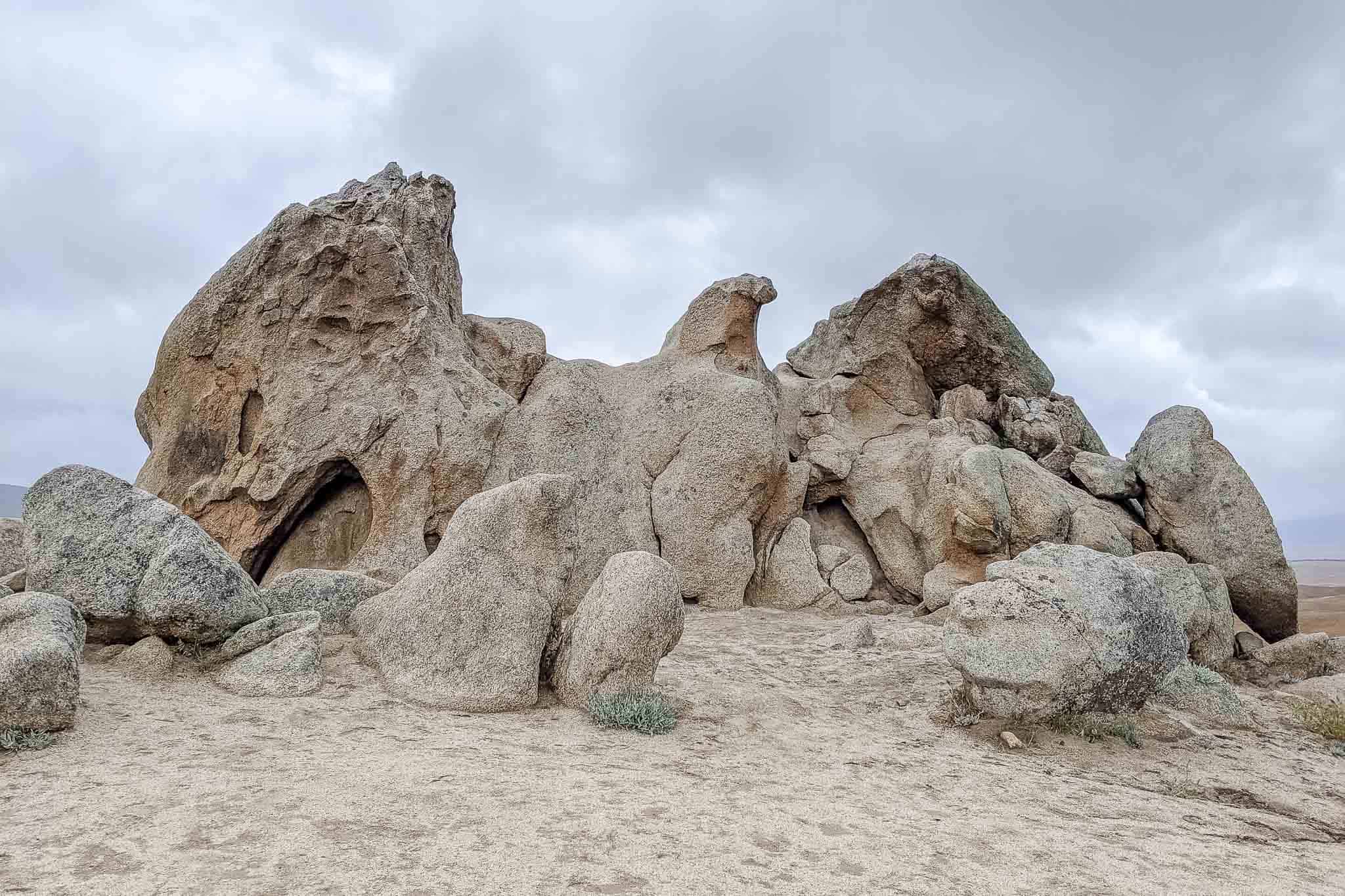
When you reach the Barrel Spring area (PCT 101.1 – 3,455 ft / 1,053 m), be sure to watch for poison oak. Also, do not accidentally pass Eagle Rock without stopping to marvel at the awesomely eagle-esque boulder formation (PCT 106.2 – 3,537 ft / 1,078 m).
Note: If you plan on not making it very far on your first day, remember that “remote camping” is not allowed in the Laguna Mountain Recreation Area (PCT 41.2 – 52.7).
Extension
Want to tack on another 41.5 mi / 66.8 km to the hike? Just move your starting point south to the PCT’s southern terminus at the US/Mexico border in Campo, California.
A Week: Cabazon to Big Bear + San Gorgonio
Start: Highway 10 near Cabazon (PCT 209.5 – 1,355 ft / 413 m)
End: Big Bear City (Cougar Crest Trailhead)
Length: 90.8 mi / 146.1 km
Elevation Gain: +17,889 ft / 5,452 m
Elevation Loss: -12,473 ft / 3,801 m

This hike takes you through the first half of this section along the PCT. It begins near the city of Cabazon, summits Southern California’s tallest mountain, San Gorgonio (11,503 ft / 3,506 m), and continues north until Big Bear City (via the 1.2 mi / 1.9 km Cougar Crest Trail at PCT 277.7).
Note: San Gorgonio isn’t actually along the PCT, it’s a 21.4 mi / 34.4 km round-trip detour from the trail at PCT mile 240, but it turns this hike into a 90.8 mi / 146.1 km trek that can be realistically accomplished in a week (and it bags you a peak).
From Cabazon (PCT 209.5 – 1,355 ft / 413 m), you climb up to around 3,200 ft / 975 m before entering the San Gorgonio Wilderness (PCT 215.7). You’ll get a taste of the desert’s infamous wind farms and pass the lovely Whitewater Preserve (PCT 218.6 – 2,312 ft / 705 m), which can be reached via a .6 mi / 965 m spur trail (and is a great place to break or camp).
The trail continues through the California desert. After crossing Mission Creek (PCT 226.2 – 3,128 ft / 953 m), it begins a 4,844 ft / 1,476 m, 14 mi / 22.5 km climb up to Mission Creek Trail Camp (PCT 239.9 – 7,921 ft / 2,414 m), where you’ll take the Fish Creek trail up to the summit of San Gorgonio.
Once you summit San Gorgonio, head back to the PCT and continue north. Back on the PCT make sure you fill up on water, the next water you encounter after passing Mission Creek Trail Camp may not be for 16.3 mi /26.2 km at Arrastre Trail Camp (PCT 256.2 – 7,605 ft / 2,318 m).
Continuing alone, if you hear growling tigers or roaring bears, don’t worry, you’re not hallucinating or about to be brutally torn to pieces, it’s just a bunch of animals at PCT mile 250.3 (8,148 ft / 2,483 m) that have been imprisoned for use in film and television (it’s a sad place, pass quickly to avoid depression).
After passing Arrastre Creek (PCT 257.9 – 7,045 ft / 2,147 m), the trail flattens out for about 10 mi / 16 km (not to say that it’s flat, but instead that there are no big climbs or descents) as you approach the Highway 18 (PCT 266.1 – 6,759 ft / 2,060 m). If you’ve taken more time than planned to reach here, this can be an exit point from the trail.

If you’re good on time, continue up into the mountains until reaching the Cougar Crest trail junction (PCT 277.7 – 7,674 ft / 2,339 m). There, keep left to head down the 1.2 mi / 1.9 km trail into Big Bear City to complete the hike.
Extension
For those of you looking for something a bit longer, you can add 49.8 mi / 80.1 km by continuing north past Big Bear City to Cleghorn Picnic Area at Silverwood Lake (PCT 328.7 – 3,392 ft / 1,033 m) neat Highway 138.
And if you’re really pushing, then tack on another 13.3 mi / 21.4 km to Highway 15 (PCT 342 – 2,995 ft / 913 m) to finish up the entirety of the section.
Two Weeks: Agua Dulce to Walker Pass
Start: Agua Dulce (PCT 454.5 – 2,669 ft / 814 m)
End: Walker Pass (PCT 652 – 5,271 ft / 1,606 m)
Length: 197.5 mi / 317.8 km
Elevation Gain: +35,994 ft / 10,971 m
Elevation Loss: -33,246 / 10,133 m

If you’re looking to do two entire weeks in the desert, then you might as well go all out and hike what’s probably the most disliked portion of the trail.
A lot of hikers would probably suggest you spend your two weeks elsewhere on the trail, but if you want to experience the desert and be able to relate to PCT thru-hikers lamenting about their time spent in Southern California, then there are no better sections.

This section begins at Agua Dulce (PCT 454.5 – 2,669 ft / 814 m) and ends along Highway 58 at Tehachapi Pass (PCT 566.5 – 3,821 ft / 1,165 m). From here, you can hitch west to Tehachapi or east to Mojave to resupply (although hitching to one of these towns is more easily accomplished from Tehachapi Willow Springs Road (PCT 558.5 – 4,153 ft / 1,266 m) since Highway 58 is a proper highway).
This section of the trail will take you down perhaps the longest, flattest, and straightest section of the PCT. It will also take you across the San Andreas Fault, past the California Aqueduct, into burn areas, through some serious wind farms, and down some long waterless stretches (the longest of which, if you don’t stop in Mojave or Tehachapi, is 21.5 mi / 34.6 km). It’s basically everything people think of when they imagine “the desert” section of the PCT.

The section begins with a 2,500 ft / 762 m climb up from Highway 58 (PCT 566.5 – 4,153 ft / 1,266 m) and then continues through what may be the driest section of the PCT (be ready to carry a lot of water).
Luckily, this section doesn’t have any huge climbs (the largest of which will be your climb up from Highway 58), so hopefully, you will not run out of water and die alone in the desert (please don’t die).
What this section does have is an 18.8 mi / 30.3 km waterless stretch after Golden Oaks Spring (PCT 583.3 – 5,495 ft / 1,675 m), an 11.1 mi / 17.9 km waterless stretch after Landers Camp (.2 mi / 300 m north of PCT 608.9 – 6,240 ft / 1,901 m) and a 32 mi / 51.4 km waterless stretch from Willow Spring (1.6 mi / 2.6 km north of PCT 620 – 4,547 ft / 1,386) until Walker Pass at the end of the section (and there’s not even guaranteed water at the campground there).
No wonder this section is arguably the most hated section of the PCT.

Shorter Route
If 197.5 mi / 317.8 km is just out of your reach for this amount of time, then you can opt to end the hike at Kelso Valley Road (PCT 615.9 – 4,947 ft / 1,508 m) to shave 36.1 mi / 58.1 km off the hike (the nearest town to this point is Lake Isabella which is 33.6 mi / 51.4 mi away.
There are also many points within this section where the PCT can be easily accessed (aka places to start a bit farther north to shave off some mileage).


Looking at the loop from Idyllwild around President’s Day. Any idea if there would still be a lot of snow on this route at that time? May not summit the peaks depending on weather that time of year.
It really depends on the year. I’ve been there in February with barely any snow and I’ve been there in April covered in snow.